Category:August 2008 in Lincolnshire
Jump to navigation
Jump to search
Deutsch: Bilder, die im August 2008 in Lincolnshire aufgenommen worden sind. Bitte beachten Sie, dass dies weder das Datum des Uploads noch das Datum des Scannens eines Fotos ist.
English: Images/pictures taken in Lincolnshire during August 2008. Note this is not the date of the upload, nor the date a photo was scanned.
Español: Fotografías o imágenes tomadas en Lincolnshire durante agosto 2008. No es la fecha de subida ni escaneo, sino la fecha en que las fotografías o imágenes se crearon.
Esperanto: Bildoj faritaj en Lincolnshire en aŭgusto 2008. Tio ne estas la dato, kiam la bildoj estis alŝutitaj aŭ skanitaj.
Français : Photographies ou images prises en Lincolnshire durant août 2008. Ce n'est pas la date du téléchargement ou du scan.
Galego: Fotografías ou imaxes tomadas en Lincolnshire durante agosto 2008. Non é a data de subida nin escaneamento, senón a data na que se crearon as fotografías ou imaxes.
Italiano: Fotografie o immagini scattate a Lincolnshire nel agosto 2008. Nota bene: la data non si riferisce né a quella di upload né a quella in cui la foto è stata digitalizzata.
Norsk bokmål: Bilder tatt i Lincolnshire i løpet av august 2008. Merk at dette ikke er datoen for opplasting, eller når et bilde har blitt skannet.
Norsk nynorsk: Bilete teke i Lincolnshire i løpet av august 2008. Merk at dette ikkje er datoen for opplasting, eller når eit bilete har vorte skanna.
Русский: Изображения, сделанные в Lincolnshire в течение август 2008 (не дата загрузки изображения).
Українська: Зображення, зроблені в Lincolnshire протягом серпень 2008. Зауважте, що це не дата завантаження чи дата сканування фотографії.
| August 2007 | ← | August 2008 | → | August 2009 | |||||||
| Jan | Feb | Mar | Apr | May | Jun | Jul | Aug | Sep | Oct | Nov | Dec |
| 154 | 47 | 36 | 59 | 41 | 98 | 99 | 119 | 81 | 146 | 141 | 22 |
|---|---|---|---|---|---|---|---|---|---|---|---|
Subcategories
This category has the following 21 subcategories, out of 21 total.
Media in category "August 2008 in Lincolnshire"
The following 98 files are in this category, out of 98 total.
-
 Awaiting Development - geograph.org.uk - 906937.jpg 640 × 425; 99 KB
-
 Unused Service Road to Falkland Way - geograph.org.uk - 906940.jpg 640 × 425; 79 KB
-
 A15 Southbound - geograph.org.uk - 909094.jpg 640 × 427; 62 KB
-
 Looking towards Hillside Plantation - geograph.org.uk - 916977.jpg 640 × 427; 94 KB
-
 Washdyke Lane - geograph.org.uk - 918054.jpg 640 × 410; 73 KB
-
 Adderley Nursing Home - geograph.org.uk - 913736.jpg 640 × 427; 143 KB
-
 High Street, Long Sutton - geograph.org.uk - 913805.jpg 640 × 427; 156 KB
-
 Old Sea Bank - geograph.org.uk - 1436676.jpg 640 × 426; 68 KB
-
 Ferguson fertiliser spreader on MF 35 at Lincoln 2008.jpg 2,048 × 1,536; 782 KB
-
 Massey Ferguson MF 1200.jpg 916 × 660; 332 KB
-
 Bridleway from Hall Lane - geograph.org.uk - 1441556.jpg 426 × 640; 90 KB
-
 High Street Saint Martins - geograph.org.uk - 994177.jpg 640 × 428; 69 KB
-
 Ancient Mound at West Halton - geograph.org.uk - 929779.jpg 640 × 451; 63 KB
-
 The Village Hall, West Halton - geograph.org.uk - 929865.jpg 640 × 402; 76 KB
-

-
 Looking towards May Dale Farm - geograph.org.uk - 905442.jpg 640 × 425; 126 KB
-
 Old Dispersal Area for Goxhill Airfield - geograph.org.uk - 906293.jpg 640 × 425; 107 KB
-
 Ruard Road, Goxhill - geograph.org.uk - 906304.jpg 640 × 425; 88 KB
-
 Rural Level Crossing - geograph.org.uk - 905379.jpg 640 × 425; 125 KB
-
 HaverholmeLockSleafordNavigation.JPG 2,272 × 1,704; 864 KB
-
 Near Bonby - geograph.org.uk - 909081.jpg 640 × 427; 96 KB
-
 High tide on the saltmarsh - geograph.org.uk - 1015379.jpg 640 × 480; 49 KB
-
 After the Harvest on Saxby Wolds - geograph.org.uk - 910441.jpg 640 × 427; 96 KB
-
-
 Cottages on London Road - geograph.org.uk - 913803.jpg 640 × 427; 133 KB
-
 ATC 300 (Axholme) Sqn. - geograph.org.uk - 917529.jpg 640 × 480; 89 KB
-
 Taking Bales to Storage, West Halton - geograph.org.uk - 929790.jpg 640 × 423; 92 KB
-
 West Halton Village Green - geograph.org.uk - 929596.jpg 640 × 226; 36 KB
-
 Drain on Waterside, Winteringham - geograph.org.uk - 930960.jpg 640 × 471; 108 KB
-
 Looking towards Winteringham - geograph.org.uk - 930981.jpg 640 × 480; 102 KB
-

-
 Green Lane - geograph.org.uk - 937574.jpg 640 × 427; 86 KB
-
 The North bank of the River Trent - geograph.org.uk - 934158.jpg 640 × 480; 54 KB
-
 Dunston Manor - geograph.org.uk - 937595.jpg 640 × 427; 94 KB
-
 Nocton Fen Road - geograph.org.uk - 935518.jpg 640 × 427; 67 KB
-
 Little Sale footpath - geograph.org.uk - 1001709.jpg 640 × 427; 83 KB
-
 View to Little Sale Wood - geograph.org.uk - 1005190.jpg 640 × 427; 79 KB
-
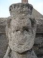 Trinity Bridge (Crowland, Lincolnshire, England) seated figure frontal.JPG 1,536 × 2,048; 1.4 MB
-
 Trinity Bridge (Crowland, Lincolnshire, England) seated figure left.JPG 1,536 × 2,048; 1.36 MB
-
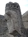 Trinity Bridge (Crowland, Lincolnshire, England) seated figure right.JPG 1,536 × 2,048; 1.42 MB
-
 Easton Hall - geograph.org.uk - 938616.jpg 640 × 427; 81 KB
-
 Easton Hall gatehouse - geograph.org.uk - 938401.jpg 640 × 427; 78 KB
-
 Easton Hall gatehouse - geograph.org.uk - 938403.jpg 640 × 427; 74 KB
-
 Easton Hall ruins - geograph.org.uk - 939058.jpg 640 × 427; 75 KB
-
 Easton Hall terrace steps - geograph.org.uk - 938422.jpg 640 × 427; 93 KB
-
 Easton Walled Gardens - geograph.org.uk - 938424.jpg 640 × 427; 80 KB
-
 Everlasting flowers - geograph.org.uk - 938463.jpg 640 × 427; 74 KB
-
 Upper Terrace - geograph.org.uk - 938939.jpg 640 × 427; 98 KB
-
 Decaying spa baths - geograph.org.uk - 949489.jpg 640 × 472; 96 KB
-
 Barrow Haven Timber Wharf - geograph.org.uk - 944378.jpg 427 × 640; 66 KB
-
 West Hann Lane, Barrow Haven - geograph.org.uk - 944456.jpg 640 × 402; 66 KB
-

-
 The "Comrade" of Hull at Ferriby Sluice - geograph.org.uk - 1045310.jpg 640 × 480; 119 KB
-
 Booth Nooking Lane, Winteringham - geograph.org.uk - 930938.jpg 640 × 480; 76 KB
-
 Rotten Sykes Lane, Winteringham - geograph.org.uk - 930765.jpg 640 × 480; 88 KB
-
 Humber Bank Footpath - geograph.org.uk - 931970.jpg 640 × 425; 101 KB
-
 The Devil's Causeway near Whitton - geograph.org.uk - 931965.jpg 640 × 425; 81 KB
-
 Humber Estuary and Chowder Ness - geograph.org.uk - 945561.jpg 640 × 393; 45 KB
-
 Power Lines - geograph.org.uk - 1005227.jpg 640 × 427; 61 KB
-
 The Haymaker, Bonby - geograph.org.uk - 936171.jpg 640 × 412; 70 KB
-
 Bringing in the Harvest, Elsham Hill - geograph.org.uk - 936465.jpg 640 × 425; 72 KB
-
 After the Harvest, Saxby All Saints - geograph.org.uk - 936494.jpg 640 × 425; 75 KB
-
 The Road down to Saxby All Saints - geograph.org.uk - 936535.jpg 640 × 425; 75 KB
-
 Chowderness Wetland and Flood Relief Site - geograph.org.uk - 937825.jpg 640 × 425; 145 KB
-
 On the banks of the Humber - geograph.org.uk - 937844.jpg 640 × 413; 82 KB
-
 HarrowbyHall.jpg 250 × 361; 68 KB
-
 Barton upon Humber - geograph.org.uk - 939653.jpg 640 × 480; 94 KB
-
 Bonby Methodist Chapel - geograph.org.uk - 939742.jpg 640 × 427; 93 KB
-
 Drain near Railway - geograph.org.uk - 939622.jpg 480 × 640; 69 KB
-
 Pylons near South Ferriby - geograph.org.uk - 939752.jpg 640 × 427; 78 KB
-

-

-
 The Church of St James, Spilsby - geograph.org.uk - 1472767.jpg 640 × 480; 68 KB
-
 Decaying spa baths, entrance - geograph.org.uk - 949499.jpg 640 × 480; 101 KB
-
 The Cottage Museum, Woodhall Spa - geograph.org.uk - 949455.jpg 640 × 469; 98 KB
-
 Would you like petrol with that^ - geograph.org.uk - 949581.jpg 640 × 480; 98 KB
-
 Bus Shelter at Barrow Haven - geograph.org.uk - 944438.jpg 640 × 476; 66 KB
-
 Aa Humber Bridge 01.jpg 1,600 × 1,200; 356 KB
-
 Adlingfleet bridleway - geograph.org.uk - 933814.jpg 640 × 405; 75 KB
-
 Akrill's Passage - geograph.org.uk - 932107.jpg 640 × 427; 73 KB
-
 Footpath-ford-river-Glen-John-Walton.jpg 640 × 428; 110 KB
-
 Hot air balloon over Barkston Heath - geograph.org.uk - 1003968.jpg 640 × 523; 71 KB
-
 Humber Bridge - geograph.org.uk - 945560.jpg 426 × 640; 46 KB
-
 Humber Bridge south tower - geograph.org.uk - 942636.jpg 452 × 640; 214 KB
-
 Humber Navigation Beacon No. 40 - geograph.org.uk - 931898.jpg 640 × 481; 90 KB
-

-
-
 Kirkby Underwood Church.jpg 1,024 × 768; 181 KB
-
 RAF Barkston Heath sunset - geograph.org.uk - 1003967.jpg 640 × 480; 56 KB
-
 River Witham - geograph.org.uk - 951936.jpg 640 × 427; 63 KB
-
 Saltend Power Station - geograph.org.uk - 924759.jpg 640 × 425; 70 KB
-
 The Junxion - geograph.org.uk - 951959.jpg 427 × 640; 57 KB
-
 The Phoenix, Spilsby - geograph.org.uk - 700807.jpg 640 × 480; 85 KB
-
 The Red Lion - geograph.org.uk - 937586 (cropped).jpg 636 × 239; 40 KB
-
 The White Swan - geograph.org.uk - 914258.jpg 640 × 427; 50 KB
-
 Upper High St, Lincoln - geograph.org.uk - 949782.jpg 481 × 640; 95 KB
-
 View over Redcliff Sand at high tide - geograph.org.uk - 914938.jpg 640 × 480; 85 KB
-
 Washingborough Station - geograph.org.uk - 934251.jpg 640 × 427; 62 KB


_Sqn._-_geograph.org.uk_-_917529.jpg)


_seated_figure_frontal.JPG)
_seated_figure_left.JPG)
_seated_figure_right.JPG)


.jpg)