Category:1940s maps of Bulgaria
Jump to navigation
Jump to search
Countries of Europe: Austria · Belarus · Belgium · Bosnia and Herzegovina · Bulgaria · Denmark · Finland · France‡ · Germany · Greece · Hungary · Iceland · Republic of Ireland · Italy · Lithuania · Luxembourg · Netherlands‡ · Norway · Poland · Portugal‡ · Romania · Russia‡ · Spain‡ · Sweden · Switzerland · Turkey‡ · Ukraine · United Kingdom
‡: partly located in Europe
‡: partly located in Europe
Media in category "1940s maps of Bulgaria"
The following 4 files are in this category, out of 4 total.
-
 1940 German military map - Übersichtskarte Bulgarien-Griechenland.jpg 24,892 × 32,442; 132.82 MB
-
 1940 German military map - Übersichtskarte Rumänien-Bulgarien.jpg 24,996 × 31,562; 153.66 MB
-
 Bulgaria - DPLA - 8561c75ed21516bede13dcbd4d7082e7.jpg 9,034 × 6,917; 8.66 MB
-
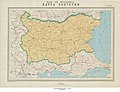
 Map of Bulgaria - btv1b53196916v.jpg 9,152 × 6,730; 8.33 MB


