Category:1920s maps of Bulgaria
Jump to navigation
Jump to search
Countries of Europe: Albania · Armenia‡ · Austria · Azerbaijan‡ · Belarus · Belgium · Bosnia and Herzegovina · Bulgaria · Croatia · Czech Republic · Denmark · Estonia · Finland · France‡ · Georgia‡ · Germany · Greece · Hungary · Iceland · Republic of Ireland · Italy · Latvia · Lithuania · Luxembourg · Montenegro · Netherlands‡ · Norway · Poland · Portugal‡ · Romania · Russia‡ · Serbia · Slovenia · Spain‡ · Sweden · Switzerland · Turkey‡ · Ukraine · United Kingdom
‡: partly located in Europe
‡: partly located in Europe
Media in category "1920s maps of Bulgaria"
The following 4 files are in this category, out of 4 total.
-
 Karta-Redina-Leskovdol.jpg 3,105 × 2,545; 3.81 MB
-
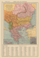 Balkan States and Greater Greece Map 1921 by Francis J Reynolds.png 3,314 × 4,795; 24.2 MB
-
 Geological Map of Bulgaria of 1928, published by Stephan Bonchev.jpg 2,634 × 2,005; 1.4 MB
-
 Скица на земетръсната област в Южна България на 14 и 18.04.1928 г.jpg 1,678 × 1,181; 1.74 MB


