Category:1940s maps of Ukraine
Jump to navigation
Jump to search
Countries of Europe: Austria · Belarus · Belgium · Bosnia and Herzegovina · Bulgaria · Denmark · Finland · France‡ · Germany · Greece · Hungary · Iceland · Republic of Ireland · Italy · Lithuania · Luxembourg · Netherlands‡ · Norway · Poland · Portugal‡ · Romania · Russia‡ · Spain‡ · Sweden · Switzerland · Turkey‡ · Ukraine · United Kingdom
‡: partly located in Europe
‡: partly located in Europe
Subcategories
This category has the following 8 subcategories, out of 8 total.
- 1940 maps of Ukraine (1 F)
- 1941 maps of Ukraine (5 F)
- 1942 maps of Ukraine (1 F)
- 1943 maps of Ukraine (2 F)
- 1946 maps of Ukraine (1 F)
- 1947 maps of Ukraine (4 F)
- 1948 maps of Ukraine (1 F)
- 1949 maps of Ukraine (2 F)
Media in category "1940s maps of Ukraine"
The following 2 files are in this category, out of 2 total.
-
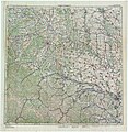
 Halicz (Галич) i okolice na mapie z 1944 r.jpg 10,704 × 11,408; 15.61 MB
-
 M-35-XXV,XXVI,XXXI,XXXII STANISLAV CHERNOVICZY 1944.jpg 9,726 × 9,983; 30.46 MB
_i_okolice_na_mapie_z_1944_r.jpg)
