List of Tyne Wear Metro stations
Tabulated
[edit]by physical features
[edit]The following table lists the stations by opening date and location, and the various physical features of the stations, plus which track section they are on (for full route details, see the next table).
| Table key/notes |
|---|
* N/C - Origin of station:
|
| Opened | N/C | Name coordinates |
Borough | O/C/U | Int. | Line | SP | P1 | P2 | Alignment |
|---|---|---|---|---|---|---|---|---|---|---|
| 1991-11-17 | New | Airport 55°02′11″N 1°42′39″W / 55.0363°N 1.7109°W |
Newcastle | Open | air | Green (Airport) | End | 2 | Airport | N-S |
| 1981-05-10 | New | Bank Foot 55°00′50″N 1°40′40″W / 55.013891°N 1.677802°W |
Newcastle | Open | car | Green (Airport) | Thru | 2 | Side (offset) |
WNW-ESE |
| 1984-03-24 | New | Bede 54°58′27″N 1°27′56″W / 54.9742°N 1.4656°W |
S. Tyneside | Open | Yellow (South Shields) | Thru | 2 | Side (staggered) |
WNW-ESE | |
| 1980-08-11 | Con. | Benton 55°00′50″N 1°34′03″W / 55.014°N 1.5674°W |
N. Tyneside | Open | Yellow (Coast loop) | Thru | 2 | Side (uneven) |
ENE-WSW | |
| 2002-03-31 | Con. | Brockley Whins 54°57′34″N 1°27′39″W / 54.9595°N 1.4609°W |
S. Tyneside | Open | Green (Sunderland) | Thru | 2 | Side (opposite) |
E-W | |
| 1982-11-14 | New | Byker 54°58′34″N 1°34′47″W / 54.9761°N 1.5798°W |
Newcastle | Open | bus | Yellow (Coast loop) | Thru | 2 | Side (opposite) |
E-W |
| 1991-11-17 | New | Callerton Parkway 55°01′40″N 1°42′13″W / 55.0279°N 1.7036°W |
Newcastle | Open | car | Green (Airport) | Thru | 2 | Side (opposite) |
NNW-SSE |
| 1981-11-15 | New | Central Station 54°58′09″N 1°36′59″W / 54.9691°N 1.6163°W |
Newcastle | Und. | rail, bus |
Shared section | Thru | 2 | Island | NNE-SSW |
| 1984-03-24 | New | Chichester 54°59′11″N 1°25′55″W / 54.9865°N 1.432°W |
S. Tyneside | Open | bus | Yellow (South Shields) | Thru | 2 | Side (opposite) |
N-S |
| 1982-11-14 | New | Chillingham Road 54°58′58″N 1°34′18″W / 54.9829°N 1.5718°W |
Newcastle | Open | Yellow (Coast loop) | Thru | 2 | Side (opposite) |
ENE-WSW | |
| 1980-08-11 | Con. | Cullercoats 55°02′06″N 1°26′11″W / 55.035°N 1.4363°W |
N. Tyneside | Open | Yellow (Coast loop) | Thru | 2 | Side (opposite) |
NNW-SSE | |
| 2002-03-31 | Con. | East Boldon 54°56′47″N 1°25′13″W / 54.9464°N 1.4202°W |
S. Tyneside | Open | car | Green (Sunderland) | Thru | 2 | Side (uneven) |
NW-SE |
| 1981-05-10 | New | Fawdon 55°00′49″N 1°38′38″W / 55.0136°N 1.644°W |
Newcastle | Open | Green (Airport) | Thru | 2 | Side (staggered) |
E-W | |
| 2002-03-31 | New | Fellgate 54°57′27″N 1°29′08″W / 54.9575°N 1.4856°W |
S. Tyneside | Open | car | Green (Sunderland) | Thru | 2 | Side (opposite) |
E-W |
| 1981-11-15 | Con. | Felling 54°57′11″N 1°34′18″W / 54.953159°N 1.571774°W |
Gateshead | Open | Shared section | Thru | 2 | Island | WNW-ESE | |
| 1980-08-11 | New | Four Lane Ends 55°00′36″N 1°34′42″W / 55.0099°N 1.5784°W |
N. Tyneside | Cov. | bus, car |
Yellow (Coast loop) | Thru | 2 | Side (opposite) |
ENE-WSW |
| 1981-11-15 | New | Gateshead 54°57′42″N 1°36′15″W / 54.9617°N 1.6041°W |
Gateshead | Und. | bus | Shared section | Thru | 2 | Island | E-W |
| 1981-11-15 | New | Gateshead Stadium 54°57′28″N 1°35′19″W / 54.9577°N 1.5885°W |
Gateshead | Open | Shared section | Thru | 2 | Island | NW-SE | |
| 1982-11-14 | New | Hadrian Road 54°59′32″N 1°30′56″W / 54.9923°N 1.5156°W |
N. Tyneside | Open | Yellow (Coast loop) | Thru | 2 | Side (opposite) |
ENE-WSW | |
| 1980-08-11 | New | Haymarket 54°58′39″N 1°36′50″W / 54.977475°N 1.613891°W |
Newcastle | Und. | bus | Shared section | Thru | 2 | Island | N-S |
| 1984-03-24 | Con. | Hebburn 54°58′30″N 1°31′19″W / 54.9749°N 1.5219°W |
S. Tyneside | Open | Yellow (South Shields) | Thru | 2 | Side (staggered) |
NE-SW | |
| 1981-11-15 | New | Heworth 54°57′06″N 1°33′21″W / 54.951545°N 1.55589°W |
Gateshead | Cov. | rail, bus, car |
Shared section | Thru | 2 | Side (opposite) |
E-W |
| 1982-11-14 | Con. | Howdon 54°59′45″N 1°29′39″W / 54.9959°N 1.4942°W |
N. Tyneside | Open | Yellow (Coast loop) | Thru | 2 | Side (staggered) |
ENE-WSW | |
| 1980-08-11 | New | Ilford Road 55°00′00″N 1°36′39″W / 55°N 1.6108°W |
Newcastle | Open | Shared section | Thru | 2 | Side (opposite) |
NNE-SSW | |
| 1984-03-24 | Con. | Jarrow 54°58′47″N 1°29′37″W / 54.979584°N 1.493567°W |
S. Tyneside | Open | bus | Yellow (South Shields) | Thru | 2 | Side (opposite) |
NW-SE |
| 1980-08-11 | New | Jesmond 54°58′58″N 1°36′20″W / 54.9828°N 1.6056°W |
Newcastle | Und. | Shared section | Thru | 2 | Side (opposite) |
NNE-SSW | |
| 1985-09-15 | New | Kingston Park 55°00′52″N 1°39′58″W / 55.0144°N 1.6661°W |
Newcastle | Open | car | Green (Airport) | Thru | 2 | Side (staggered) |
E-W |
| 1980-08-11 | Con. | Longbenton 55°00′32″N 1°35′29″W / 55.0088°N 1.5914°W |
Newcastle | Open | Yellow (Coast loop) | Thru | 2 | Side (opposite) |
WNW-ESE | |
| 1982-11-14 | New | Manors 54°58′26″N 1°36′17″W / 54.974°N 1.6048°W |
Newcastle | Und. | Yellow (Coast loop) | Thru | 2 | Side (opposite) |
WNW-ESE | |
| 1982-11-14 | New | Meadow Well 55°00′05″N 1°27′57″W / 55.0015°N 1.4658°W |
N. Tyneside | Open | Yellow (Coast loop) | Thru | 2 | Side (opposite) |
ENE-WSW | |
| 2002-03-31 | New | Millfield 54°54′23″N 1°24′03″W / 54.9065°N 1.4009°W |
Sunderland | Open | Green (Sunderland) | Thru | 2 | Side (opposite) |
NW-SE | |
| 1980-08-11 | Con. | Monkseaton 55°02′32″N 1°27′29″W / 55.0423°N 1.458°W |
N. Tyneside | Open | Yellow (Coast loop) | Thru | 2 | Side (opposite) |
WNW-ESE | |
| 1981-11-15 | New | Monument 54°58′25″N 1°36′47″W / 54.9737°N 1.6131°W |
Newcastle | Und. | bus | Shared section & Yellow (Coast loop) |
Thru | 4 | Monument | N-S & E-W |
| 1982-11-14 | Con. | North Shields 55°00′30″N 1°26′56″W / 55.008243°N 1.448768°W |
N. Tyneside | Open | bus, ferry |
Yellow (Coast loop) | Thru | 3 | North Shields | NE-SW |
| 2005-12-11 | New | Northumberland Park 55°01′59″N 1°31′11″W / 55.0331°N 1.5198°W |
N. Tyneside | Open | bus, car |
Yellow (Coast loop) | Thru | 2 | Island | NE-SW |
| 2002-03-31 | New | Pallion 54°54′46″N 1°25′04″W / 54.9128°N 1.4177°W |
Sunderland | Open | Green (Sunderland) | Thru | 2 | Side (opposite) |
E-W | |
| 1986-03-19 | New | Palmersville 55°01′26″N 1°32′27″W / 55.0239°N 1.5408°W |
N. Tyneside | Open | Yellow (Coast loop) | Thru | 2 | Side (opposite) |
NE-SW | |
| 2002-04-28 | New | Park Lane 54°54′09″N 1°23′04″W / 54.9024°N 1.3845°W |
Sunderland | Cov. | bus | Green (Sunderland) | Thru | 2 | Side (opposite) |
E-W |
| 1985-09-16 | New | Pelaw 54°57′10″N 1°32′29″W / 54.9527°N 1.5414°W |
Gateshead | Open | Shared section | Thru | 2 | Island | E-W | |
| 1982-11-14 | Con. | Percy Main 54°59′59″N 1°28′29″W / 54.9996°N 1.4746°W |
N. Tyneside | Open | Yellow (Coast loop) | Thru | 2 | Side (offset) |
ENE-WSW | |
| 1981-05-10 | New | Regent Centre 55°00′43″N 1°37′17″W / 55.0119°N 1.6215°W |
Newcastle | Cov. | bus, car |
Green (Airport) | Thru | 2 | Side (opposite) |
WNW-ESE |
| 2002-03-31 | Con. | Seaburn 54°55′47″N 1°23′11″W / 54.9296°N 1.3865°W |
Sunderland | Open | Green (Sunderland) | Thru | 2 | Side (opposite) |
N-S | |
| 1980-08-11 | New | Shiremoor 55°02′13″N 1°30′16″W / 55.037°N 1.5044°W |
N. Tyneside | Open | Yellow (Coast loop) | Thru | 2 | Side (offset) |
E-W | |
| 2008-03-17 | New | Simonside 54°58′17″N 1°27′17″W / 54.9715°N 1.4547°W |
S. Tyneside | Open | Yellow (South Shields) | Thru | 2 | Side (uneven) |
NW-SE | |
| 1980-08-11 | Con. | South Gosforth 55°00′22″N 1°36′29″W / 55.006°N 1.608°W |
Newcastle | Open | Shared section | Thru | 2 | Side (opposite) |
NNE-SSW | |
| 2002-03-31 | New | South Hylton 54°54′15″N 1°26′53″W / 54.9041°N 1.4481°W |
Sunderland | Open | Green (Sunderland) | End | 1 | Side (single) |
NE-SW | |
| 1984-03-24 | New | South Shields 54°59′55″N 1°26′01″W / 54.9985°N 1.4335°W |
S. Tyneside | Open | bus, ferry |
Yellow (South Shields) | End | 1 | Side (single) |
NNW-SSE |
| 1982-11-14 | New | St James 54°58′28″N 1°37′15″W / 54.974316°N 1.620741°W |
Newcastle | Und. | Yellow (Coast loop) | End | 2 | Side (opposite) |
E-W | |
| 2002-03-31 | New | St Peter's 54°54′40″N 1°23′01″W / 54.911°N 1.3837°W |
Sunderland | Open | Green (Sunderland) | Thru | 2 | Side (opposite) |
N-S | |
| 2002-03-31 | New | Stadium of Light 54°55′06″N 1°22′58″W / 54.9182°N 1.3829°W |
Sunderland | Open | car | Green (Sunderland) | Thru | 2 | Side (opposite) |
NNE-SSW |
| 2002-03-31 | Con. | Sunderland 54°54′22″N 1°22′55″W / 54.906°N 1.382°W |
Sunderland | Und. | rail, bus |
Green (Sunderland) | Thru | 2 | Island | N-S |
| 1984-03-24 | New | Tyne Dock 54°58′34″N 1°26′30″W / 54.9761°N 1.4417°W |
S. Tyneside | Open | Yellow (South Shields) | Thru | 2 | Side (opposite) |
NNE-SSW | |
| 1980-08-11 | Con. | Tynemouth 55°01′02″N 1°25′42″W / 55.0173°N 1.4282°W |
N. Tyneside | Open | Yellow (Coast loop) | Thru | 2 | Side (opposite) |
N-S | |
| 2002-03-31 | New | University 54°54′10″N 1°23′32″W / 54.9028°N 1.3921°W |
Sunderland | Open | Green (Sunderland) | Thru | 2 | Side (opposite) |
WNW-ESE | |
| 1982-11-14 | Con. | Walkergate 54°59′07″N 1°33′33″W / 54.9854°N 1.5592°W |
Newcastle | Open | Yellow (Coast loop) | Thru | 2 | Side (opposite) |
ENE-WSW | |
| 1982-11-14 | Con. | Wallsend 54°59′23″N 1°31′56″W / 54.9897°N 1.5323°W |
N. Tyneside | Open | bus | Yellow (Coast loop) | Thru | 2 | Side (opposite) |
ENE-WSW |
| 1981-05-10 | New | Wansbeck Road 55°00′51″N 1°38′09″W / 55.0143°N 1.6358°W |
Newcastle | Open | Green (Airport) | Thru | 2 | Side (offset) |
E-W | |
| 1980-08-11 | Con. | West Jesmond 54°59′37″N 1°36′36″W / 54.9936°N 1.6099°W |
Newcastle | Open | Shared section | Thru | 2 | Side (opposite) |
NNW-SSE | |
| 1980-08-11 | Con. | West Monkseaton 55°02′25″N 1°28′34″W / 55.0404°N 1.4762°W |
N. Tyneside | Open | Yellow (Coast loop) | Thru | 2 | Side (opposite) |
ENE-WSW | |
| 1980-08-11 | Con. | Whitley Bay 55°02′23″N 1°26′35″W / 55.03984°N 1.443031°W |
N. Tyneside | Open | Yellow (Coast loop) | Thru | 2 | Side (opposite) |
WNW-ESE |
by operational feature
[edit]The 60 stations are operated as stops on one or both of two service lines - Yellow and Green. The longest journeys possible on these lines are as follows:
- Green Line to Airport from South Hylton (31 stops)
- Green Line to South Hylton from Airport (31 stops)
- Yellow Line to St James from South Shields (42 stops)
- Yellow Line to South Shields from St James (42 stops)
The following table lists the stations as stops on these journeys, listing the associated platform details
| Table key/notes |
|---|
* Line - a stop on a journey on the Yellow or Green Line in a specific direction of travel
|
| Line | Previous | Stop | Next | Alignment | P | F | R | M |
|---|---|---|---|---|---|---|---|---|
| Green Line to Airport (stop 01 of 31) |
(none) | South Hylton | Pallion | NE-SW | 1 | NW | NE/B | E/B |
| Green Line to Airport (stop 02 of 31) |
South Hylton | Pallion | Millfield | E-W | 2 | N | E/B | E/B |
| Green Line to Airport (stop 03 of 31) |
Pallion | Millfield | University | NW-SE | 2 | NE | SE/B | E/B |
| Green Line to Airport (stop 04 of 31) |
Millfield | University | Park Lane | WNW-ESE | 2 | N | E/B | E/B |
| Green Line to Airport (stop 05 of 31) |
University | Park Lane | Sunderland | E-W | 2 | N | E/B | E/B |
| Green Line to Airport (stop 06 of 31) |
Park Lane | Sunderland | St Peter's | N-S | 2 | W | N/B | E/B |
| Green Line to Airport (stop 07 of 31) |
Sunderland | St Peter's | Stadium of Light | N-S | 2 | W | N/B | N/B |
| Green Line to Airport (stop 08 of 31) |
St Peter's | Stadium of Light | Seaburn | NNE-SSW | 2 | W | N/B | N/B |
| Green Line to Airport (stop 09 of 31) |
Stadium of Light | Seaburn | East Boldon | N-S | 2 | W | N/B | N/B |
| Green Line to Airport (stop 10 of 31) |
Seaburn | East Boldon | Brockley Whins | NW-SE | 2 | SW | NW/B | W/B |
| Green Line to Airport (stop 11 of 31) |
East Boldon | Brockley Whins | Fellgate | E-W | 2 | S | W/B | W/B |
| Green Line to Airport (stop 12 of 31) |
Brockley Whins | Fellgate | Pelaw | E-W | 2 | S | W/B | W/B |
| Green Line to Airport (stop 13 of 31) |
Fellgate | Pelaw | Heworth | E-W | 2 | S | W/B | W/B |
| Green Line to Airport (stop 14 of 31) |
Pelaw | Heworth | Felling | E-W | 2 | S | W/B | W/B |
| Green Line to Airport (stop 15 of 31) |
Heworth | Felling | Gateshead Stadium | WNW-ESE | 2 | S | W/B | W/B |
| Green Line to Airport (stop 16 of 31) |
Felling | Gateshead Stadium | Gateshead | NW-SE | 2 | SW | NW/B | W/B |
| Green Line to Airport (stop 17 of 31) |
Gateshead Stadium | Gateshead | Central Station | E-W | 2 | S | W/B | W/B |
| Green Line to Airport (stop 18 of 31) |
Gateshead | Central Station | Monument | NNE-SSW | 2 | W | N/B | N/B |
| Green Line to Airport (stop 19 of 31) |
Central Station | Monument | Haymarket | N-S | 2 | W | N/B | N/B |
| Green Line to Airport (stop 20 of 31) |
Monument | Haymarket | Jesmond | N-S | 2 | W | N/B | N/B |
| Green Line to Airport (stop 21 of 31) |
Haymarket | Jesmond | West Jesmond | NNE-SSW | 2 | W | N/B | N/B |
| Green Line to Airport (stop 22 of 31) |
Jesmond | West Jesmond | Ilford Road | NNW-SSE | 2 | W | N/B | N/B |
| Green Line to Airport (stop 23 of 31) |
West Jesmond | Ilford Road | South Gosforth | NNE-SSW | 2 | W | N/B | N/B |
| Green Line to Airport (stop 24 of 31) |
Ilford Road | South Gosforth | Regent Centre | NNE-SSW | 2 | W | N/B | N/B |
| Green Line to Airport (stop 25 of 31) |
South Gosforth | Regent Centre | Wansbeck Road | WNW-ESE | 2 | S | W/B | W/B |
| Green Line to Airport (stop 26 of 31) |
Regent Centre | Wansbeck Road | Fawdon | E-W | 2 | S | W/B | W/B |
| Green Line to Airport (stop 27 of 31) |
Wansbeck Road | Fawdon | Kingston Park | E-W | 2 | S | W/B | W/B |
| Green Line to Airport (stop 28 of 31) |
Fawdon | Kingston Park | Bank Foot | E-W | 2 | S | W/B | W/B |
| Green Line to Airport (stop 29 of 31) |
Kingston Park | Bank Foot | Callerton Parkway | WNW-ESE | 2 | S | W/B | W/B |
| Green Line to Airport (stop 30 of 31) |
Bank Foot | Callerton Parkway | Airport | NNW-SSE | 2 | W | N/B | W/B |
| Green Line to Airport (stop 31 of 31) |
Callerton Parkway | Airport | (none) | N-S | 1 | E | N/B | W/B |
| Green Line to Airport (stop 31 of 31) |
Callerton Parkway | Airport | (none) | N-S | 2 | W | N/B | W/B |
| Green Line to South Hylton (stop 01 of 31) |
(none) | Airport | Callerton Parkway | N-S | 1 | E | S/B | E/B |
| Green Line to South Hylton (stop 01 of 31) |
(none) | Airport | Callerton Parkway | N-S | 2 | W | S/B | E/B |
| Green Line to South Hylton (stop 02 of 31) |
Airport | Callerton Parkway | Bank Foot | NNW-SSE | 1 | E | S/B | E/B |
| Green Line to South Hylton (stop 03 of 31) |
Callerton Parkway | Bank Foot | Kingston Park | WNW-ESE | 1 | N | E/B | E/B |
| Green Line to South Hylton (stop 04 of 31) |
Bank Foot | Kingston Park | Fawdon | E-W | 1 | N | E/B | E/B |
| Green Line to South Hylton (stop 05 of 31) |
Kingston Park | Fawdon | Wansbeck Road | E-W | 1 | N | E/B | E/B |
| Green Line to South Hylton (stop 06 of 31) |
Fawdon | Wansbeck Road | Regent Centre | E-W | 1 | N | E/B | E/B |
| Green Line to South Hylton (stop 07 of 31) |
Wansbeck Road | Regent Centre | South Gosforth | WNW-ESE | 1 | N | E/B | E/B |
| Green Line to South Hylton (stop 08 of 31) |
Regent Centre | South Gosforth | Ilford Road | NNE-SSW | 1 | W | S/B | S/B |
| Green Line to South Hylton (stop 09 of 31) |
South Gosforth | Ilford Road | West Jesmond | NNE-SSW | 1 | E | S/B | S/B |
| Green Line to South Hylton (stop 10 of 31) |
Ilford Road | West Jesmond | Jesmond | NNW-SSE | 1 | E | S/B | S/B |
| Green Line to South Hylton (stop 11 of 31) |
West Jesmond | Jesmond | Haymarket | NNE-SSW | 1 | E | S/B | S/B |
| Green Line to South Hylton (stop 12 of 31) |
Jesmond | Haymarket | Monument | N-S | 1 | E | S/B | S/B |
| Green Line to South Hylton (stop 13 of 31) |
Haymarket | Monument | Central Station | N-S | 1 | E | S/B | S/B |
| Green Line to South Hylton (stop 14 of 31) |
Monument | Central Station | Gateshead | NNE-SSW | 1 | E | S/B | S/B |
| Green Line to South Hylton (stop 15 of 31) |
Central Station | Gateshead | Gateshead Stadium | E-W | 1 | N | E/B | E/B |
| Green Line to South Hylton (stop 16 of 31) |
Gateshead | Gateshead Stadium | Felling | NW-SE | 1 | NE | SE/B | E/B |
| Green Line to South Hylton (stop 17 of 31) |
Gateshead Stadium | Felling | Heworth | WNW-ESE | 1 | N | E/B | E/B |
| Green Line to South Hylton (stop 18 of 31) |
Felling | Heworth | Pelaw | E-W | 1 | N | E/B | E/B |
| Green Line to South Hylton (stop 19 of 31) |
Heworth | Pelaw | Fellgate | E-W | 1 | N | E/B | E/B |
| Green Line to South Hylton (stop 20 of 31) |
Pelaw | Fellgate | Brockley Whins | E-W | 1 | N | E/B | E/B |
| Green Line to South Hylton (stop 21 of 31) |
Fellgate | Brockley Whins | East Boldon | E-W | 1 | N | E/B | E/B |
| Green Line to South Hylton (stop 22 of 31) |
Brockley Whins | East Boldon | Seaburn | NW-SE | 1 | NE | SE/B | E/B |
| Green Line to South Hylton (stop 23 of 31) |
East Boldon | Seaburn | Stadium of Light | N-S | 1 | E | S/B | S/B |
| Green Line to South Hylton (stop 24 of 31) |
Seaburn | Stadium of Light | St Peter's | NNE-SSW | 1 | E | S/B | S/B |
| Green Line to South Hylton (stop 25 of 31) |
Stadium of Light | St Peter's | Sunderland | N-S | 1 | E | S/B | S/B |
| Green Line to South Hylton (stop 26 of 31) |
St Peter's | Sunderland | Park Lane | N-S | 1 | E | S/B | S/B |
| Green Line to South Hylton (stop 27 of 31) |
Sunderland | Park Lane | University | E-W | 1 | S | W/B | W/B |
| Green Line to South Hylton (stop 28 of 31) |
Park Lane | University | Millfield | WNW-ESE | 1 | S | W/B | W/B |
| Green Line to South Hylton (stop 29 of 31) |
University | Millfield | Pallion | NW-SE | 1 | SW | NW/B | W/B |
| Green Line to South Hylton (stop 30 of 31) |
Millfield | Pallion | South Hylton | E-W | 1 | S | W/B | W/B |
| Green Line to South Hylton (stop 31 of 31) |
Pallion | South Hylton | (none) | NE-SW | 1 | NW | SW/B | W/B |
| Yellow Line to South Shields (stop 01 of 42) |
(none) | St James | Monument | E-W | 1 | N | E/B | E/B |
| Yellow Line to South Shields (stop 01 of 42) |
(none) | St James | Monument | E-W | 2 | S | E/B | E/B |
| Yellow Line to South Shields (stop 02 of 42) |
St James | Monument | Manors | E-W | 3 | N | E/B | E/B |
| Yellow Line to South Shields (stop 03 of 42) |
Monument | Manors | Byker | WNW-ESE | 1 | N | E/B | E/B |
| Yellow Line to South Shields (stop 04 of 42) |
Manors | Byker | Chillingham Road | E-W | 1 | N | E/B | E/B |
| Yellow Line to South Shields (stop 05 of 42) |
Byker | Chillingham Road | Walkergate | ENE-WSW | 1 | N | E/B | E/B |
| Yellow Line to South Shields (stop 06 of 42) |
Chillingham Road | Walkergate | Wallsend | ENE-WSW | 1 | N | E/B | E/B |
| Yellow Line to South Shields (stop 07 of 42) |
Walkergate | Wallsend | Hadrian Road | ENE-WSW | 1 | N | E/B | E/B |
| Yellow Line to South Shields (stop 08 of 42) |
Wallsend | Hadrian Road | Howdon | ENE-WSW | 1 | N | E/B | E/B |
| Yellow Line to South Shields (stop 09 of 42) |
Hadrian Road | Howdon | Percy Main | ENE-WSW | 1 | N | E/B | E/B |
| Yellow Line to South Shields (stop 10 of 42) |
Howdon | Percy Main | Meadow Well | ENE-WSW | 1 | N | E/B | E/B |
| Yellow Line to South Shields (stop 11 of 42) |
Percy Main | Meadow Well | North Shields | ENE-WSW | 1 | N | E/B | E/B |
| Yellow Line to South Shields (stop 12 of 42) |
Meadow Well | North Shields | Tynemouth | NE-SW | 1 | NW | NE/B | E/B |
| Yellow Line to South Shields (stop 13 of 42) |
North Shields | Tynemouth | Cullercoats | N-S | 1 | W | N/B | N/B |
| Yellow Line to South Shields (stop 14 of 42) |
Tynemouth | Cullercoats | Whitley Bay | NNW-SSE | 1 | W | N/B | N/B |
| Yellow Line to South Shields (stop 15 of 42) |
Cullercoats | Whitley Bay | Monkseaton | WNW-ESE | 1 | S | W/B | N/B |
| Yellow Line to South Shields (stop 16 of 42) |
Whitley Bay | Monkseaton | West Monkseaton | WNW-ESE | 1 | S | W/B | W/B |
| Yellow Line to South Shields (stop 17 of 42) |
Monkseaton | West Monkseaton | Shiremoor | ENE-WSW | 1 | S | W/B | W/B |
| Yellow Line to South Shields (stop 18 of 42) |
West Monkseaton | Shiremoor | Northumberland Park | E-W | 1 | S | W/B | W/B |
| Yellow Line to South Shields (stop 19 of 42) |
Shiremoor | Northumberland Park | Palmersville | NE-SW | 1 | SE | SW/B | W/B |
| Yellow Line to South Shields (stop 20 of 42) |
Northumberland Park | Palmersville | Benton | NE-SW | 1 | SE | SW/B | W/B |
| Yellow Line to South Shields (stop 21 of 42) |
Palmersville | Benton | Four Lane Ends | ENE-WSW | 1 | S | W/B | W/B |
| Yellow Line to South Shields (stop 22 of 42) |
Benton | Four Lane Ends | Longbenton | ENE-WSW | 1 | S | W/B | W/B |
| Yellow Line to South Shields (stop 23 of 42) |
Four Lane Ends | Longbenton | South Gosforth | WNW-ESE | 1 | S | W/B | W/B |
| Yellow Line to South Shields (stop 24 of 42) |
Longbenton | South Gosforth | Ilford Road | NNE-SSW | 1 | E | S/B | S/B |
| Yellow Line to South Shields (stop 25 of 42) |
South Gosforth | Ilford Road | West Jesmond | NNE-SSW | 1 | E | S/B | S/B |
| Yellow Line to South Shields (stop 26 of 42) |
Ilford Road | West Jesmond | Jesmond | NNW-SSE | 1 | E | S/B | S/B |
| Yellow Line to South Shields (stop 27 of 42) |
West Jesmond | Jesmond | Haymarket | NNE-SSW | 1 | E | S/B | S/B |
| Yellow Line to South Shields (stop 28 of 42) |
Jesmond | Haymarket | Monument | N-S | 1 | E | S/B | S/B |
| Yellow Line to South Shields (stop 29 of 42) |
Haymarket | Monument | Central Station | N-S | 1 | E | S/B | S/B |
| Yellow Line to South Shields (stop 30 of 42) |
Monument | Central Station | Gateshead | NNE-SSW | 1 | E | S/B | S/B |
| Yellow Line to South Shields (stop 31 of 42) |
Central Station | Gateshead | Gateshead Stadium | E-W | 1 | N | E/B | E/B |
| Yellow Line to South Shields (stop 32 of 42) |
Gateshead | Gateshead Stadium | Felling | NW-SE | 1 | NE | SE/B | E/B |
| Yellow Line to South Shields (stop 33 of 42) |
Gateshead Stadium | Felling | Heworth | WNW-ESE | 1 | N | E/B | E/B |
| Yellow Line to South Shields (stop 34 of 42) |
Felling | Heworth | Pelaw | E-W | 1 | N | E/B | E/B |
| Yellow Line to South Shields (stop 35 of 42) |
Heworth | Pelaw | Hebburn | E-W | 1 | N | E/B | E/B |
| Yellow Line to South Shields (stop 36 of 42) |
Pelaw | Hebburn | Jarrow | NE-SW | 1 | NW | NE/B | E/B |
| Yellow Line to South Shields (stop 37 of 42) |
Hebburn | Jarrow | Bede | NW-SE | 1 | NE | SE/B | E/B |
| Yellow Line to South Shields (stop 38 of 42) |
Jarrow | Bede | Simonside | WNW-ESE | 1 | N | E/B | E/B |
| Yellow Line to South Shields (stop 39 of 42) |
Bede | Simonside | Tyne Dock | NW-SE | 1 | NE | SE/B | E/B |
| Yellow Line to South Shields (stop 40 of 42) |
Simonside | Tyne Dock | Chichester | NNE-SSW | 1 | W | N/B | E/B |
| Yellow Line to South Shields (stop 41 of 42) |
Tyne Dock | Chichester | South Shields | N-S | 1 | W | N/B | E/B |
| Yellow Line to South Shields (stop 42 of 42) |
Chichester | South Shields | (none) | NNW-SSE | 1 | E | N/B | E/B |
| Yellow Line to St James (stop 01 of 42) |
(none) | South Shields | Chichester | NNW-SSE | 1 | E | S/B | W/B |
| Yellow Line to St James (stop 02 of 42) |
South Shields | Chichester | Tyne Dock | N-S | 2 | E | S/B | W/B |
| Yellow Line to St James (stop 03 of 42) |
Chichester | Tyne Dock | Simonside | NNE-SSW | 2 | E | S/B | W/B |
| Yellow Line to St James (stop 04 of 42) |
Tyne Dock | Simonside | Bede | NW-SE | 2 | SW | NW/B | W/B |
| Yellow Line to St James (stop 05 of 42) |
Simonside | Bede | Jarrow | WNW-ESE | 2 | S | W/B | W/B |
| Yellow Line to St James (stop 06 of 42) |
Bede | Jarrow | Hebburn | NW-SE | 2 | SW | NW/B | W/B |
| Yellow Line to St James (stop 07 of 42) |
Jarrow | Hebburn | Pelaw | NE-SW | 2 | SE | SW/B | W/B |
| Yellow Line to St James (stop 08 of 42) |
Hebburn | Pelaw | Heworth | E-W | 2 | S | W/B | W/B |
| Yellow Line to St James (stop 09 of 42) |
Pelaw | Heworth | Felling | E-W | 2 | S | W/B | W/B |
| Yellow Line to St James (stop 10 of 42) |
Heworth | Felling | Gateshead Stadium | WNW-ESE | 2 | S | W/B | W/B |
| Yellow Line to St James (stop 11 of 42) |
Felling | Gateshead Stadium | Gateshead | NW-SE | 2 | SW | NW/B | W/B |
| Yellow Line to St James (stop 12 of 42) |
Gateshead Stadium | Gateshead | Central Station | E-W | 2 | S | W/B | W/B |
| Yellow Line to St James (stop 13 of 42) |
Gateshead | Central Station | Monument | NNE-SSW | 2 | W | N/B | N/B |
| Yellow Line to St James (stop 14 of 42) |
Central Station | Monument | Haymarket | N-S | 2 | W | N/B | N/B |
| Yellow Line to St James (stop 15 of 42) |
Monument | Haymarket | Jesmond | N-S | 2 | W | N/B | N/B |
| Yellow Line to St James (stop 16 of 42) |
Haymarket | Jesmond | West Jesmond | NNE-SSW | 2 | W | N/B | N/B |
| Yellow Line to St James (stop 17 of 42) |
Jesmond | West Jesmond | Ilford Road | NNW-SSE | 2 | W | N/B | N/B |
| Yellow Line to St James (stop 18 of 42) |
West Jesmond | Ilford Road | South Gosforth | NNE-SSW | 2 | W | N/B | N/B |
| Yellow Line to St James (stop 19 of 42) |
Ilford Road | South Gosforth | Longbenton | NNE-SSW | 2 | E | N/B | N/B |
| Yellow Line to St James (stop 20 of 42) |
South Gosforth | Longbenton | Four Lane Ends | WNW-ESE | 2 | N | E/B | E/B |
| Yellow Line to St James (stop 21 of 42) |
Longbenton | Four Lane Ends | Benton | ENE-WSW | 2 | N | E/B | E/B |
| Yellow Line to St James (stop 22 of 42) |
Four Lane Ends | Benton | Palmersville | ENE-WSW | 2 | N | E/B | E/B |
| Yellow Line to St James (stop 23 of 42) |
Benton | Palmersville | Northumberland Park | NE-SW | 2 | NW | NE/B | E/B |
| Yellow Line to St James (stop 24 of 42) |
Palmersville | Northumberland Park | Shiremoor | NE-SW | 2 | NW | NE/B | E/B |
| Yellow Line to St James (stop 25 of 42) |
Northumberland Park | Shiremoor | West Monkseaton | E-W | 2 | N | E/B | E/B |
| Yellow Line to St James (stop 26 of 42) |
Shiremoor | West Monkseaton | Monkseaton | ENE-WSW | 2 | N | E/B | E/B |
| Yellow Line to St James (stop 27 of 42) |
West Monkseaton | Monkseaton | Whitley Bay | WNW-ESE | 2 | N | E/B | E/B |
| Yellow Line to St James (stop 28 of 42) |
Monkseaton | Whitley Bay | Cullercoats | WNW-ESE | 2 | N | E/B | S/B |
| Yellow Line to St James (stop 29 of 42) |
Whitley Bay | Cullercoats | Tynemouth | NNW-SSE | 2 | E | S/B | S/B |
| Yellow Line to St James (stop 30 of 42) |
Cullercoats | Tynemouth | North Shields | N-S | 2 | E | S/B | S/B |
| Yellow Line to St James (stop 31 of 42) |
Tynemouth | North Shields | Meadow Well | NE-SW | 2 | SE | SW/B | W/B |
| Yellow Line to St James (stop 32 of 42) |
North Shields | Meadow Well | Percy Main | ENE-WSW | 2 | S | W/B | W/B |
| Yellow Line to St James (stop 33 of 42) |
Meadow Well | Percy Main | Howdon | ENE-WSW | 2 | S | W/B | W/B |
| Yellow Line to St James (stop 34 of 42) |
Percy Main | Howdon | Hadrian Road | ENE-WSW | 2 | S | W/B | W/B |
| Yellow Line to St James (stop 35 of 42) |
Howdon | Hadrian Road | Wallsend | ENE-WSW | 2 | S | W/B | W/B |
| Yellow Line to St James (stop 36 of 42) |
Hadrian Road | Wallsend | Walkergate | ENE-WSW | 2 | S | W/B | W/B |
| Yellow Line to St James (stop 37 of 42) |
Wallsend | Walkergate | Chillingham Road | ENE-WSW | 2 | S | W/B | W/B |
| Yellow Line to St James (stop 38 of 42) |
Walkergate | Chillingham Road | Byker | ENE-WSW | 2 | S | W/B | W/B |
| Yellow Line to St James (stop 39 of 42) |
Chillingham Road | Byker | Manors | E-W | 2 | S | W/B | W/B |
| Yellow Line to St James (stop 40 of 42) |
Byker | Manors | Monument | WNW-ESE | 2 | S | W/B | W/B |
| Yellow Line to St James (stop 41 of 42) |
Manors | Monument | St James | E-W | 4 | S | W/B | W/B |
| Yellow Line to St James (stop 42 of 42) |
Monument | St James | (none) | E-W | 1 | N | W/B | W/B |
| Yellow Line to St James (stop 42 of 42) |
Monument | St James | (none) | E-W | 2 | S | W/B | W/B |
Individual stations
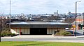
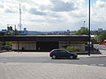
[edit]Airport
[edit]| Opened | New or converted |
Number of platforms | Track alignment | Tyne & Wear metropolitan borough |
| 17 November 1991 | New | 2 | N-S | Newcastle upon Tyne |
| Layout | ||||
| A terminal island platform in a cutting with the two tracks either side ending in buffer stops at their northern ends, partially covered at the southern end by the B6918 road bridging NW-SE | ||||
| Platform no. and position |
Direction of travel M |
Previous stop |
Route | Next stop |
| Platform 1 East |
Southbound | (none) | Green Line to South Hylton (stop 01 of 31) | Callerton Parkway |
| Northbound | Callerton Parkway | Green Line to Airport (stop 31 of 31) | (none) | |
| Platform 2 West |
Southbound | (none) | Green Line to South Hylton (stop 01 of 31) | Callerton Parkway |
| Northbound | Callerton Parkway | Green Line to Airport (stop 31 of 31) | (none) | |
| Notes | ||||
| * M - these are compass headings, which in this station's case do not correspond to the directions diagrammatically indicated on the official Metro route map archive copy at the Wayback Machine - Northbound is Westbound & Southbound is Eastbound on the Metro map | ||||
| Station buildings | ||||
| A rectangular white station hall, 70' by 40', with black full length windows set in sloped walls that rise up to a notional pyramid point (but in reality, bisected by a N-S restricted access airport road over the roof), connected by a covered walkway heading NE to the airport terminal | ||||
| Access | ||||
| A covered walkway emerging SW from the corner of station building NE of the platforms, then turning to head S and descend to platform level, to an opening at their northern end | ||||
| Protection from the elements | ||||
| Full length standalone platform canopy | ||||
| Interchanges | ||||
| air | ||||
-
 The view north east from platform level to the airport terminal buildings
9 May 2007 -
 The view east to the station sign on the other side of the track in Platform 1, with the airport's old control tower in the distance
6 October 2008 -
 The view south along Platform 2, as Metrocar No. 4048 loads for a journey to South Hylton
8 February 2010 -
 The view north along Platform 2, as Metrocar No. 4042 unloads after finishing a journey to the station
5 January 2009 -
 The view north to the buffers at the end of Platform 1. The vertical glass is part of the covered walkway to the station building (the sloped glass), beyond which the airport terminal is located
5 January 2009 -
 The view south west from Platform 1 across to Platform 2, where Metrocar No. 4059 is loading for a journey to South Hylton
5 January 2009 -
 The view north along Platform 2, as Metrocar No. 4027 unloads after finishing a journey to the station
16 February 2006 -
 The walkway between the terminal (left) and the station building (right)
3 September 2013 -
 The view south along the road the cuts through the top of the station building
3 September 2013


Bank Foot
[edit]| Opened | New or converted |
Number of platforms | Track alignment | Tyne & Wear metropolitan borough |
| 10 May 1981 | New | 2 | WNW-ESE | Newcastle upon Tyne |
| Layout | ||||
| Two side platforms at ground level, offset by half their length (north platform to the west), with platform level station buildings at their outer ends | ||||
| Platform no. and position |
Direction of travel |
Previous stop |
Route | Next stop |
| Platform 1 North |
Eastbound | Callerton Parkway | Green Line to South Hylton (stop 03 of 31) | Kingston Park |
| Platform 2 South |
Westbound | Kingston Park | Green Line to Airport (stop 29 of 31) | Callerton Parkway |
| Notes | ||||
| When it opened, Bank Foot was at the western end of the line, featuring just one platform, the south, with buffers at the west end before Station Road. Through services commenced with the opening of the extension west to the airport on 17 November 1991 | ||||
| Station buildings | ||||
| Two simple rectangular structures in the original style, both 30' by 15' | ||||
| Access | ||||
| Car park to the south; road (south) / footpath (north) heading west 100' to a level crossing for Station Road; two footpaths heading 250' east to the bridged NW-SE Main Road (B6918) | ||||
| Protection from the elements | ||||
| Station building only | ||||
| Interchanges | ||||
| car | ||||
-
 The view east to the pre-extension single platform
15 July 1981 -
 The view east along the platform pre-extension, with Metrocar No. 4052 at the front of a terminating train
15 July 1981 -
 The sign at the east end of the Platform 2 footpath where it meets Main Road
6 October 2008 -
 The entrance on the southern side of the Platform 2 building
9 May 2007 -
 The view across the Station Road level crossing to the west end of Platform 1
6 October 2008 -
 The view north west from Platform 2 across to the Platform 1 building
6 October 2008 -
 The Platform 2 building from the car park
6 October 2008 -
 The view south along Platform 2 as Metrocar No. 4048 is departing
6 October 2008 -
 The view north east along Station Road, across the level crossing
6 October 2008 -
 The view north west along Main Road, under the tracks
6 October 2008 -
 The view north west from Platform 2 across to Platform 1, to a train heading for South Hylton
6 October 2008 -
 The view south east from Platform 1 across to Platform 2
16 September 2009 -
 The view west along Platform 1, as a train bound for South Hylton approaches
16 September 2009 -
 The view west along Platform 2, across to Platform 1
2 January 2010 -
 Looking east to where the Platform 2 footpath meets Main Road
1 February 2013 -
 The view south east along Main Road, under the tracks
3 August 2013


Bede
[edit]| Opened | New or converted |
Number of platforms | Track alignment | Tyne & Wear metropolitan borough |
| 24 March 1984 | New | 2 | WNW-ESE | South Tyneside |
| Layout | ||||
| Two side platforms on an embankment, staggered 25' either side of a bridge over Monksway road (north platform to the west), with platform level station buildings at their inner ends | ||||
| Platform no. and position |
Direction of travel |
Previous stop |
Route | Next stop |
| Platform 1 North |
Eastbound | Jarrow | Yellow Line to South Shields (stop 38 of 42) | Simonside |
| Platform 2 South |
Westbound | Simonside | Yellow Line to St James (stop 05 of 42) | Jarrow |
| Notes | ||||
| None | ||||
| Station buildings | ||||
| Two simple square structures in the original style, both 20' by 20' | ||||
| Access | ||||
| Steps & ramps up from Monksway | ||||
| Protection from the elements | ||||
| 60' platform shelters attached to the front of both station buildings | ||||
| Interchanges | ||||
| None | ||||
-
 The view from the platform into one of the station buildings
9 May 2007

Benton
[edit]| Opened | New or converted |
Number of platforms | Track alignment | Tyne & Wear metropolitan borough |
| 11 August 1980 | Converted | 2 | ENE-WSW | North Tyneside |
| Layout | ||||
| Two side platforms at ground level (the southern 60' longer to the west and 20' to the east), with platform level station buildings in the eastern half (south)/eastern end (north) | ||||
| Platform no. and position |
Direction of travel |
Previous stop |
Route | Next stop |
| Platform 1 South |
Westbound | Palmersville | Yellow Line to South Shields (stop 21 of 42) | Four Lane Ends |
| Platform 2 North |
Eastbound | Four Lane Ends | Yellow Line to St James (stop 22 of 42) | Palmersville |
| Notes | ||||
| None | ||||
| Station buildings | ||||
| Two simple structures in the original style, a rectangle and cube, 20' by 15' and 20' by 20'. The old red brick station building on the south platform is also still present. | ||||
| Access | ||||
| Station forecourt to the south accessed via N-S Station Approach road; pedestrian access north to the corner of Linden Road; platforms connected by a footbridge over the eastern end | ||||
| Protection from the elements | ||||
| Station buildings only (which includes an original 3 sided 30' shelter on the north platform) | ||||
| Interchanges | ||||
| None | ||||
-
 The view north to the modern station building on Platform 1, and the station footbridge
20 August 2006 -
 The view from the front of Metrocar No. 4089 as it approaches Platform 1
10 October 2005 -
 The view from the front of Metrocar No. 4089 as it enters Platform 1
10 October 2005


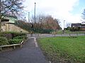
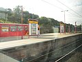
Brockley Whins
[edit]| Opened | New or converted |
Number of platforms | Track alignment | Tyne & Wear metropolitan borough |
| 31 March 2002 | Converted | 2 | E-W | South Tyneside |
| Layout | ||||
| Two side platforms in a railway junction cutting (with a single track spur branching north from a junction west of the platforms), with platform level station buildings in the western half | ||||
| Platform no. and position |
Direction of travel |
Previous stop |
Route | Next stop |
| Platform 1 North |
Eastbound | Fellgate | Green Line to South Hylton (stop 21 of 31) | East Boldon |
| Platform 2 South |
Westbound | East Boldon | Green Line to Airport (stop 11 of 31) | Fellgate |
| Notes | ||||
| None | ||||
| Station buildings | ||||
| Two simple rectangular structures in the 2002 brick style, both 15' by 10' | ||||
| Access | ||||
| Ramps down to the south platform from a turning circle forming the western end of Station Road; footpaths south to the River Don; platforms connected via ramp (north) / track (south) up to a footbridge beyond the east end of the platforms (which also continues north over the spur track to the southern end of Brisbane Avenue); | ||||
| Protection from the elements | ||||
| 35' platform shelters attached to the front of both station buildings | ||||
| Interchanges | ||||
| None | ||||
-
 The view from the front of Metrocar No. 4089 as it approaches Platform 1, en route to South Hylton
10 October 2005 -
 The view north east through the Platform 2 station building and across the tracks, with the Platform 1 building on the left
21 November 2012 -
 The view east along Platform 2 as a train for South Hylton departs Platform 1
21 November 2012

.jpg)
.jpg)
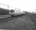
Byker
[edit]| Opened | New or converted |
Number of platforms | Track alignment | Tyne & Wear metropolitan borough |
| 14 November 1982 | New | 2 | E-W | Newcastle upon Tyne |
| Layout | ||||
| Two side platforms at the start of a cutting for the entrance to a tunnel to the east, with the station building built over the eastern end | ||||
| Platform no. and position |
Direction of travel |
Previous stop |
Route | Next stop |
| Platform 1 North |
Eastbound | Manors | Yellow Line to South Shields (stop 04 of 42) | Chillingham Road |
| Platform 2 South |
Westbound | Chillingham Road | Yellow Line to St James (stop 39 of 42) | Manors |
| Notes | ||||
| None | ||||
| Station buildings | ||||
| A rectangular station hall in the original style (white), 110' by 60' | ||||
| Access | ||||
| Steps down from a road running past the east side of the station building, then ramps down from the west side to the west ends of the platforms | ||||
| Protection from the elements | ||||
| Station building underside, plus 35' of platform canopy attached to both cutting side walls | ||||
| Interchanges | ||||
| bus | ||||
-
 The view west to the entrance of the station building
28 March 2010 -
 The view west to the entrance of the station building
8 May 2009 -
 The view west to the entrance of the station building
26 December 2009 -
 The view south along the east side of the station building, with the Byker Wall in the background
31 August 2009 -
 The view west inside the station building, with stairs left and right to Platforms 2 & 1
31 August 2009 -
 The view east from track level, prior to opening (minus overhead wires)
27 October 1979 -
 The view east along Platform 1 to the tunnel mouth
31 August 2009 -
 Looking north west from Platform 1 to a train arriving at Platform 2, bound for South Shields
4 October 2007 -
 Looking west along Platform 1 to an approaching train
24 February 2008 -
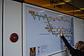 A network map
31 August 2009


Callerton Parkway
[edit]| Opened | New or converted |
Number of platforms | Track alignment | Tyne & Wear metropolitan borough |
| 17 November 1991 | New | 2 | NNW-SSE | Newcastle upon Tyne |
| Layout | ||||
| Two side platforms at ground level, with platform level station buildings at their northern ends | ||||
| Platform no. and position |
Direction of travel M |
Previous stop |
Route | Next stop |
| Platform 1 East |
Southbound | Airport | Green Line to South Hylton (stop 02 of 31) | Bank Foot |
| Platform 2 West |
Northbound | Bank Foot | Green Line to Airport (stop 30 of 31) | Airport |
| Notes | ||||
| * M - these are compass headings, which in this station's case do not correspond to the directions diagrammatically indicated on the official Metro route map archive copy at the Wayback Machine - Northbound is Westbound & Southbound is Eastbound on the Metro map | ||||
| Station buildings | ||||
| Two simple rectangular structures in the original style, both 30' by 15' | ||||
| Access | ||||
| Footpaths 75' north to a level crossing with the E-W running B6918, and another east to the access road for the parkway car park | ||||
| Protection from the elements | ||||
| Station building only | ||||
| Interchanges | ||||
| car - parkway car park directly to the east of the station (another directly to the west is a private airport parking facility) | ||||
-
 The view south across the B6918 level crossing back to the station, from the rear of a train which has just departed from Platform 2
9 May 2007

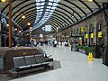
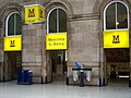
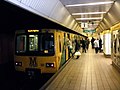
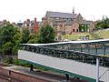
Central Station
[edit]| Opened | New or converted |
Number of platforms | Track alignment | Tyne & Wear metropolitan borough |
| 15 November 1981 | New | 2 | NNE-SSW | Newcastle upon Tyne |
| Layout | ||||
| An underground island platform and an underground station concourse beneath the mainline station building (underneath the taxi road along the front of the east side of the Neville Street mainline station frontage) | ||||
| Platform no. and position |
Direction of travel |
Previous stop |
Route | Next stop |
| Platform 1 East |
Southbound | Monument | Yellow Line to South Shields (stop 30 of 42) | Gateshead |
| Green Line to South Hylton (stop 14 of 31) | ||||
| Platform 2 West |
Northbound | Gateshead | Yellow Line to St James (stop 13 of 42) | Monument |
| Green Line to Airport (stop 18 of 31) | ||||
| Notes | ||||
| None | ||||
| Station buildings | ||||
| An entrance lobby is incorporated into part of the mainline station building along Neville Street | ||||
| Access | ||||
| Steps, lift & escalator down from ground level from inside the mainline station building, and steps down from ground level from 2 outside entrances - one at the west end of the station's north frontage in Neville Street (with steps descending east to west), the other on the east side of the NNE-SSW Grainger Street near its southern end (with steps descending north to south) | ||||
| Protection from the elements | ||||
| Tunnel roofs | ||||
| Interchanges | ||||
| rail, bus | ||||
Outside entrances
[edit]Grainger Street entrance
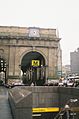
[edit]-
 The view north east to the the Grainger Street entrance
5 July 2005 -
 7 October 2013
 -
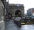
 The view south west to the Grainger Street entrance, with the mainline station building in the background
22 April 2008 -
 The view south from the bottom of the steps underneath Neville Street to the ticket hall
7 October 2013

.JPG)

.JPG)
Neville Street entrance
[edit]-
 The view west over the Neville Street entrance and along the front of the mainline station building, to its portico
5 January 2009 -
 8 January 2006
 -
 8 January 2006
 -
 The Neville Street entrance
9 May 2007

.jpg)
.jpg)

Mainline station entrance lobby
[edit]-
 The view west along the mainline station concourse, showing the lobby entrance on the right
7 October 2013 -
 The view east along the mainline station concourse, showing the lobby entrance on the left
7 October 2013 -
 The access to the lobby as seen from the concourse
12 March 2009 -
 7 October 2013
 -
 7 October 2013
 -
 The illuminated signage above the concourse entrance arches
12 March 2009 -
 The view out of the lobby, to the mainline councourse
7 October 2013 -
 The view east inside the lobby
7 October 2013 -
 The view north east inside the lobby
7 October 2013 -
 The view north inside the lobby
7 October 2013 -
 The steps inside the lobby, down to the ticket hall
5 October 2012 -
 The plaque describing Wakesweek
7 October 2013
.JPG)
.JPG)

.JPG)
.JPG)

.JPG)
.JPG)
.JPG)
.JPG)

.JPG)
Ticket hall
[edit]-
 The view south from the Grainger Street access - mainline access far right, Neville Street far left
7 October 2013
.JPG)
Escalator to platform level
[edit]-
 Escalators either side of a stairway
16 November 2005 -
 Escalators either side of a stairway
5 January 2009


Platform level
[edit]-
 The panel at the north end of the space in between Platform 2 (left) & 1 (right)
1 January 2005 -
 The panel at the north end of the space in between Platform 2 (left) & 1 (right)
6 October 2008 -
 Looking south along Platform 1
18 January 2006 -
 Looking south along Platform 1, with Metrocar No. 4018 at the rear of a train loading while en route to South Hylton
10 February 2010 -
 An airport bound train loading at Platform 2
5 January 2009 -
 The view from the front of a train arriving at Platform 2, en route to Airport station
1 March 2010 -
 Station sign on one of the tunnel walls
16 January 2010


Chichester
[edit]| Opened | New or converted |
Number of platforms | Track alignment | Tyne & Wear metropolitan borough |
| 24 March 1984 | New | 2 | N-S | South Tyneside |
| Layout | ||||
| Two side platforms in a cutting, with the station building built over the southern half | ||||
| Platform no. and position |
Direction of travel M |
Previous stop |
Route | Next stop |
| Platform 1 West |
Northbound | Tyne Dock | Yellow Line to South Shields (stop 41 of 42) | South Shields |
| Platform 2 East |
Southbound | South Shields | Yellow Line to St James (stop 02 of 42) | Tyne Dock |
| Notes | ||||
| * M - these are compass headings, which in this station's case do not correspond to the directions diagrammatically indicated on the official Metro route map archive copy at the Wayback Machine - Northbound is Eastbound & Southbound is Westbound on the Metro map | ||||
| Station buildings | ||||
| A rectangular station hall in the original style (black/white), 90' by 60' | ||||
| Access | ||||
| Ground level access via an opening in the southern side of the station building, from the roads Beaufront Terrace and Laygate on the east and west sides respectively; then internal access to platform levels | ||||
| Protection from the elements | ||||
| Station building underside | ||||
| Interchanges | ||||
| bus | ||||
-
 The view north along Platform 2, as a northbound train leaves Platform 1
5 April 2012 -
 Looking west from Platform 2 to where the station building descends to Platform 1 level
9 May 2007


Chillingham Road
[edit]| Opened | New or converted |
Number of platforms | Track alignment | Tyne & Wear metropolitan borough |
| 14 November 1982 | New | 2 | ENE-WSW | Newcastle upon Tyne |
| Layout | ||||
| Two side platforms bordered to the south by a retaining wall for an industrial park, and to the north by mainline railway tracks for Heaton Traction Maintenance Depot (TMD) and the East Coast Main Line; a platform level station building at the west end of the north platform and a street level station building in the eastern half of the south platform | ||||
| Platform no. and position |
Direction of travel |
Previous stop |
Route | Next stop |
| Platform 1 North |
Eastbound | Byker | Yellow Line to South Shields (stop 05 of 42) | Walkergate |
| Platform 2 South |
Westbound | Walkergate | Yellow Line to St James (stop 38 of 42) | Byker |
| Notes | ||||
| None | ||||
| Station buildings | ||||
| Two simple rectangular structures in the original style (brick/black panel), 20' by 15' (north) and 50' by 30' (south) | ||||
| Access | ||||
| Ramps up to the southern station building, which is at the northern end of Depot Road; a 280' long footpath east from the Chillingham Road bridge over the ECML to an elevated concrete island on the north side of the Metro tracks, with two paths from there 400' further east to the west end of the platforms - one via a long ramp down to platform level on the north side, and the other via a bridge over the tracks and then along the top of the south cutting retaining wall; a footbridge connecting both platforms at the eastern end | ||||
| Protection from the elements | ||||
| 90' platform canopies attached to both station side walls | ||||
| Interchanges | ||||
| None | ||||
-
 The Metro sign marking the point where Chillingham Road (right) meets the station access footpath (left)
12 July 2008 -
 The view east from Chillingham road along the footpath to the station
23 June 2006 -
 The view north across the tracks west of the station from the southern access footpath for Platform 2, to the point where the northern access path for Platform 1 changes from a solid ramp (right) to an elevated ramp (left)
31 August 2009 -
 The view west along Platform 2
19 March 2008 -
 The view west along Platform 2
12 June 2009 -
 The view south west to the eastern end of Platform 2, looking back from the side windows of the front end of Metrocar No. 4089 in Platform 1
10 October 2005 -
 Looking west at two mirrors and a CCTV camera at the west end of Platform 2
31 August 2009 -
 The view north east from Platform 2 across to Platform 1
31 August 2009 -
 The view west across the tracks from the top of the ramp down to Platform 2, to the station building at the end of Platform 1
31 August 2009 -
 The view east along Platform 1 as train which has just left Platform 1 passes a train about to arrive at Platform 2
21 February 2009


,_Chillingham_Rd_Metro_station_-_geograph.org.uk_-_1467274.jpg)


,_Chillingham_Rd_Metro_station_-_geograph.org.uk_-_1467263.jpg)

Cullercoats
[edit]| Opened | New or converted |
Number of platforms | Track alignment | Tyne & Wear metropolitan borough |
| 11 August 1980 | Converted | 2 | NNW-SSE | North Tyneside |
| Layout | ||||
| Two side platforms at ground level with platform level station buildings along their full length | ||||
| Platform no. and position |
Direction of travel |
Previous stop |
Route | Next stop |
| Platform 1 West |
Northbound | Tynemouth | Yellow Line to South Shields (stop 14 of 42) | Whitley Bay |
| Platform 2 East |
Southbound | Whitley Bay | Yellow Line to St James (stop 29 of 42) | Tynemouth |
| Notes | ||||
| None | ||||
| Station buildings | ||||
| The original old red brick station building/walls, 100' long on both platforms | ||||
| Access | ||||
| Station forecourt to the east, at the west end of Station Road; footpath SW to St George's Road (Cullercoats Library); with the platforms connected by a footbridge at the southern end | ||||
| Protection from the elements | ||||
| 120' platform canopies attached to both station buildings | ||||
| Interchanges | ||||
| None | ||||
-
 The view west to the outside of the Platform 2 building, along Station Road
5 April 2012 -
 The view west to the outside of the Platform 2 building
10 April 2005 -
 The view from the front of Metrocar No. 4089 as it approaches Platform 1
10 October 2005 -
 The view north along Platform 1, with Metrocar No. 4071 seen in Platform 2 forming the front half of a train bound for St James
9 February 2010 -
 The view north along Platform 1, with Metrocar No. 4045 seen in Platform 2 forming the front half of a train bound for St James
23 May 2012 -
 The view north along Platform 1 as a train departs Platform 1 en route to South Shields, while another stands in Platform 2
6 January 2010 -
 The view north east from the south end of Platform 1, under the station footbridge and across to Platform 2
6 January 2010 -
 The view south along Platform 2, with Metrocar No. 4006 seen in Platform 1 forming the front half of a train bound for South Shields
23 May 2012 -
 The station footbridge (south side)
24 July 2006 -
 The station footbridge (interior)
24 July 2006 -
 The station footbridge (interior)
21 January 2011

_-_geograph.org.uk_-_595938.jpg)


.jpg)
.jpg)
.jpg)
.jpg)
.jpg)
.jpg)

East Boldon
[edit]| Opened | New or converted |
Number of platforms | Track alignment | Tyne & Wear metropolitan borough |
| 31 March 2002 | Converted | 2 | NW-SE | South Tyneside |
| Layout | ||||
| Two side platforms on an embankment, the northern one 50' longer at its northern end | ||||
| Platform no. and position |
Direction of travel M |
Previous stop |
Route | Next stop |
| Platform 1 North East |
SE bound | Brockley Whins | Green Line to South Hylton (stop 22 of 31) | Seaburn |
| Platform 2 South West |
NW bound | Seaburn | Green Line to Airport (stop 10 of 31) | Brockley Whins |
| Notes | ||||
| * M - these are compass headings, which in this station's case do not correspond to the directions diagrammatically indicated on the official Metro route map archive copy at the Wayback Machine - NW bound is Westbound & SE bound is Eastbound on the Metro map | ||||
| Station buildings | ||||
| No building (two central single sided shelters only) | ||||
| Access | ||||
| Steps and sloped paths down to a pedestrian subway 25' north of the platform end, with track level paths also extending to a level crossing for the SW-NE Station Road, 25' further beyond the subway; car park on the north side, off Station Road | ||||
| Protection from the elements | ||||
| Two standalone 65' platform shelters | ||||
| Interchanges | ||||
| car | ||||
-
 The view from the front of Metrocar No. 4089 as it approaches Platform 1, looking across the Station Road level crossing
10 October 2005 -
 The pedestrian view of the station from the Station Road level crossing
4 December 2005 -
 A heavily processed view of Platform 2 and a train bound for Airport station
23 May 2007


Fawdon
[edit]| Opened | New or converted |
Number of platforms | Track alignment | Tyne & Wear metropolitan borough |
| 10 May 1981 | New | 2 | E-W | Newcastle upon Tyne |
| Layout | ||||
| Two side platforms at ground level, staggered 125' west and 75' east of a level crossing for Fawdon Lane (north platform to the west), with a platform level station building at the east end of the north platform, and a ground level station building in between the crossing and the west end of the south platform | ||||
| Platform no. and position |
Direction of travel |
Previous stop |
Route | Next stop |
| Platform 1 North |
Eastbound | Kingston Park | Green Line to South Hylton (stop 05 of 31) | Wansbeck Road |
| Platform 2 South |
Westbound | Wansbeck Road | Green Line to Airport (stop 27 of 31) | Kingston Park |
| Notes | ||||
| None | ||||
| Station buildings | ||||
| Two simple rectangular structures in the original style, 20' by 15' (west) and 25' by 10' (east) | ||||
| Access | ||||
| Car park outside the north platform, footpaths from the crossing to both platforms | ||||
| Protection from the elements | ||||
| Station building and a standalone 35' platform shelter on the east platform, 60' platform shelter attached to the front of the west platform station building | ||||
| Interchanges | ||||
| None | ||||
-
 The view south east from Platform 1 across the Fawdon Lane level crossing to an approaching train leaving Platform 2 bound for Bank Foot (the terminus at that time)
15 July 1981 -
 The view south west from Platform 1 across the tracks to storage tanks at the north east corner of the Nestlé Rowntree factory on Rowan Drive
2 January 2010 -
 The Platform 2 shelter
9 May 2007


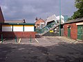
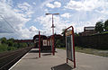
Fellgate
[edit]| Opened | New or converted |
Number of platforms | Track alignment | Tyne & Wear metropolitan borough |
| 31 March 2002 | New | 2 | E-W | South Tyneside |
| Layout | ||||
| Two side platforms on an embankment | ||||
| Platform no. and position |
Direction of travel |
Previous stop |
Route | Next stop |
| Platform 1 North |
Eastbound | Pelaw | Green Line to South Hylton (stop 20 of 31) | Brockley Whins |
| Platform 2 South |
Westbound | Brockley Whins | Green Line to Airport (stop 12 of 31) | Pelaw |
| Notes | ||||
| None | ||||
| Station buildings | ||||
| No building (two single sided shelters at the west end); lift shafts built in the 2002 brick style | ||||
| Access | ||||
| Footpaths from Durham Drive to the south and Pathside road to the north, to stairways and lift shafts/aerial walkways up to platform level; both platforms connected by a pedestrian subway 20' west of the platform ends | ||||
| Protection from the elements | ||||
| Two standalone platform shelters, 30' north and 60' south, attached to the lift shaft/stairway covered walkways | ||||
| Interchanges | ||||
| car | ||||
-
 The view from the front of Metrocar No. 4089 as it approaches Platform 1, en route to South Hylton
10 October 2005 -
 The view from the front of Metrocar No. 4089 as it approaches Platform 1, en route to South Hylton
10 October 2005 -
 The view across the tracks into one of the shelters
20 December 2005 -
 Platform 2 destination display
20 December 2005 -
 Platform 2 drivers mirror
20 December 2005 -
 The view north west to the lift shaft, walkway and stairs up to Platform 2
18 November 2005 -
 The view south west from the Platform 2 stairs to the bus stop in Durham Drive
3 March 2006 -
 The view south from the subway to Durham Drive
18 January 2006 -
 The view south from the subway to Durham Drive
18 January 2006 -
 The view south down Pathside, to the Platform 1 lift shaft and the subway
24 August 2010 -
 The view south across the turning area at the south end of Pathside, to the Platform 1 lift shaft
25 September 2005 -
 The view north west away from the Platform 1 lift shaft, across the turning area at the south end of Pathside
2 August 2006 -
 The view south through the subway
24 March 2006 -
 The view south through the subway
25 March 2006 -
 The view south through the subway
1 January 2006 -
 The view south through the subway
2 November 2006


.jpg)
.jpg)
.jpg)


.jpg)
.jpg)


.jpg)


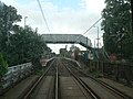
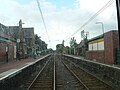
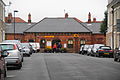
Felling
[edit]| Opened | New or converted |
Number of platforms | Track alignment | Tyne & Wear metropolitan borough |
| 15 November 1981 | Converted | 2 | WNW-ESE | Gateshead |
| Layout | ||||
| An island platform in a cutting shared with two more tracks to the north | ||||
| Platform no. and position |
Direction of travel |
Previous stop |
Route | Next stop |
| Platform 1 North |
Eastbound | Gateshead Stadium | Yellow Line to South Shields (stop 33 of 42) | Heworth |
| Green Line to South Hylton (stop 17 of 31) | ||||
| Platform 2 South |
Westbound | Heworth | Yellow Line to St James (stop 10 of 42) | Gateshead Stadium |
| Green Line to Airport (stop 15 of 31) | ||||
| Notes | ||||
| None | ||||
| Station buildings | ||||
| No building (a pair of back to back single sided shelters in the middle only). The station did originally have a station building built in the original Metro style, built at the end of and beyond the west end of the platform - this was removed to make way for the ramps for the bridges installed in 2008, being replaced by the smaller set of shelters | ||||
| Access | ||||
| Stairs and ramps in the eastern third, ascending east to footbridges across the tracks, south to the E-W Sunderland Road (B1426) and a small car park on the top of the retaining wall of the cutting, and north over the mainline to the E-W Mulberry Street (with ramps and stairs down to its level, beyond a boundary wall along the track). These steel footbridges and stairs/ramps were installed in January 2008, replacing an unramped Victorian iron and timber bridge | ||||
| Protection from the elements | ||||
| The access ramp underside, plus two 30' standalone platform shelters back to back, and two 15' by slightly wider examples to the south | ||||
| Interchanges | ||||
| None | ||||
-
 The view west from the end of the island platform to Metrocar No. 4007, which forms the front half of a train that is about to arrive at Platform 1 bound for Heworth
20 March 1982 -
 The view east along Platform 1, with Metrocar No. 4077 forming the rear half of a train bound for Heworth
20 March 1982 -
 The view east along Platform 2, with Metrocar No. 4072 forming the front half of a train bound for Benton
20 March 1982 -
 The view east along Platform 2, with Metrocar No. 4077 forming the front half of a train bound for Tynemouth
20 March 1982 -
 The view east along Platform 2, with Metrocar No. 4045 forming the front half of a train bound for Bank Foot
20 March 1982 -
 The view west from the end of the island platform to Metrocar No. 4066, which forms the rear half of a train that has just departed Platform 2 bound for Bank Foot
20 March 1982 -
 The view west from the end of the island platform to Metrocar No. 4053, which forms the rear half of a train that has just departed Platform 2 bound for Benton
20 March 1982 -
 The view from the front of Metrocar No. 4089 as it approaches Platform 1, en route to South Hylton
10 October 2005 -
 The view west across the west end of the island platform, showing the Platform 1 track empty and a westbound train in Platform 2, taken from a westbound train on the mainline (Class 155 DMU No. 156453) bound for Newcastle Central Station
10 October 2005 -
 The view north west across the station, from Sunderland Road
27 October 2005 -
 The view east along Platform 1
9 May 2007 -
 The view north from the west end of the island platform across the three tracks to the boundary wall
4 September 2008 -
 The view north west across the station, from the footbridge to Sunderland Road
8 January 2009 -
 The view south east from the Mulberry Street access ramp across the three tracks to the platform access ramp and beyond to St Patrick's Church in the distance
16 July 2010 -
 The view west from the access stairs. Metrocar No. 4069, which forms the front half of a train bound for St James, is loading in Platform 2
16 July 2010 -
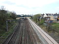 The view west from Carlisle Street bridge to the island platform and footbridges/access ramps of the station, with the mainline double track on the right
31 March 2012


.jpg)
.jpg)

Four Lane Ends
[edit]| Opened | New or converted |
Number of platforms | Track alignment | Tyne & Wear metropolitan borough |
| 11 August 1980 | New | 2 | ENE-WSW | North Tyneside |
| Layout | ||||
| Two side platforms in a cutting underneath an interchange building, with both a bus lane around the interchange building and a bridge for Benton Road (A188) to the west | ||||
| Platform no. and position |
Direction of travel |
Previous stop |
Route | Next stop |
| Platform 1 South |
Westbound | Benton | Yellow Line to South Shields (stop 22 of 42) | Longbenton |
| Platform 2 North |
Eastbound | Longbenton | Yellow Line to St James (stop 21 of 42) | Benton |
| Notes | ||||
| None | ||||
| Station buildings | ||||
| Integrated into a large semi-circular concourse building which combines the station hall with a bus station | ||||
| Access | ||||
| All round access with a main exterior entrance to the south west, then internal access to the platforms below from within the interchange | ||||
| Protection from the elements | ||||
| Bus station/station building underside | ||||
| Interchanges | ||||
| bus, car | ||||
-
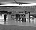 The interior of the station hall
10 August 1980 -
 The view west to an eastbound Metrocar as it exits the station, bound for Tynemouth
10 August 1980 -
 The view from the front of Metrocar No. 4089 as it approaches Platform 1, en route to South Shields
10 October 2005


Gateshead
[edit]Layout
[edit]
- Bus only lanes (grey)
- Low rise 2004 built structures (black)
- Medium rise 1981 brown brick building (brown)
- Opening Line sculpture (red)
Interchange building/bus station
[edit]-
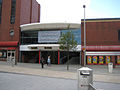 The north eastern entrance, on the east side of West Street
22 September 2013 -
 The view east into the northern one way loop of the bus station, from the top deck of a bus
7 July 2006 -
 The view east into the northern one way loop of the bus station, from inside a bus at one of the stands
7 February 2007 -
 The view west along the southern half of the bus station
unknown -
 The view west along the north side of the Opening Line sculpture
5 September 2012 -
 Looking west as a Quaylink bus exits via the south east exit/entrance of the bus station
5 May 2009 -
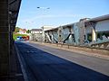 The view west along the south side of the Opening Line sculpture
2 June 2009 -
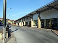 The view west along the eastbound lane of the southern half of the bus station - on the left is the end of the Opening Line sculpture
2 June 2009 -
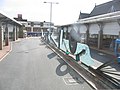 The view east from the front of a passing bus, along the north side of the Opening Line sculpture
12 July 2006


Metro station
[edit]| Opened | New or converted |
Number of platforms | Track alignment | Tyne & Wear metropolitan borough |
| 15 November 1981 | New | 2 | E-W | Gateshead |
| Layout | ||||
| An underground island platform below an intermediate underground level, beneath a ground level ticket hall in the interchange building | ||||
| Platform no. and position |
Direction of travel |
Previous stop |
Route | Next stop |
| Platform 1 North |
Eastbound | Central Station | Yellow Line to South Shields (stop 31 of 42) | Gateshead Stadium |
| Green Line to South Hylton (stop 15 of 31) | ||||
| Platform 2 South |
Westbound | Gateshead Stadium | Yellow Line to St James (stop 12 of 42) | Central Station |
| Green Line to Airport (stop 17 of 31) | ||||
| Notes | ||||
| None | ||||
| Station buildings | ||||
| Integrated at the bottom of a high rise brown brick building, with a modern brick/glass bus station to the west | ||||
| Access | ||||
| Main ground level entrances from West Street beyond the north and south ends of the high rise | ||||
| Protection from the elements | ||||
| Tunnel roofs | ||||
| Interchanges | ||||
| bus | ||||
-
 The wall at the east end of the platforms, looking south from Platform 1 across to Platform 2, from Metrocar No. 4089 bound for South Hylton
10 October 2005 -
 The view from the east end of Platform 1, from Metrocar No. 4089 bound for South Hylton
10 October 2005 -
 The view down the escalator from the intermediate level to the west end of the platforms - Platform 2 on the left and Platform 1 on the right
20 June 2006 -
 The view from the west end of Platform 2, up the escalators to the intermediate level
1 March 2010 -
 The view from the rear of a Metrocar to the tunnel mouth at the west end of Platform 1
1 January 2006


Gateshead Stadium
[edit]| Opened | New or converted |
Number of platforms | Track alignment | Tyne & Wear metropolitan borough |
| 15 November 1981 | New | 2 | NW-SE | Gateshead |
| Layout | ||||
| An island platform in a cutting shared with a mainline double-track to the north, with a station building built over the southern track at the western end, and with a bridge for St James Road west of the platform end over both the Metro and mainline tracks | ||||
| Platform no. and position |
Direction of travel M |
Previous stop |
Route | Next stop |
| Platform 1 North East |
SE bound | Gateshead | Yellow Line to South Shields (stop 32 of 42) | Felling |
| Green Line to South Hylton (stop 16 of 31) | ||||
| Platform 2 South West |
NW bound | Felling | Yellow Line to St James (stop 11 of 42) | Gateshead |
| Green Line to Airport (stop 16 of 31) | ||||
| Notes | ||||
| * M - these are compass headings, which in this station's case do not correspond to the directions diagrammatically indicated on the official Metro route map archive copy at the Wayback Machine - NW bound is Westbound & SE bound is Eastbound on the Metro map | ||||
| Station buildings | ||||
| A simple rectangular structure in the original style (concrete/red), 50' by 30' | ||||
| Access | ||||
| Street level entrance from a station forecourt at the corner of St James Road/Shelley Drive (NW-SE) into the SW side of the building, with a ramp out of the SE side down the full platform length to platform level at the east end, and stairs down from the NW side | ||||
| Protection from the elements | ||||
| Station building underside & access ramp | ||||
| Interchanges | ||||
| None | ||||
-
 The view north east from Sunderland Road to the illuminated station building, centre right
8 January 2009 -
 The view south from the north end of the St James Road, over the mainline to the south eastern half of the platform
27 October 2005 -
 The view from the front of Metrocar No. 4089 as it enters Platform 1, en route to South Hylton
10 October 2005 -
 The view west across the south east end of the platform, as Metrocar No. 4077 forms the front half of a train in Platform 1 bound for South Shields, taken from a westbound Northern Rail train on the mainline (Class 155 DMU No. 156489)
10 October 2005 -
 The view north west from the rear of a Metrocar as it leaves Platform 1
1 January 2006 -
 The view south east from the rear of a Metrocar as it leaves Platform 2
2 January 2010 -
 The view south east from the end of the station platform, as a train approaches Platform 2 bound for Bank Foot
20 February 1985


Hadrian Road
[edit]| Opened | New or converted |
Number of platforms | Track alignment | Tyne & Wear metropolitan borough |
| 14 November 1982 | New | 2 | ENE-WSW | North Tyneside |
| Layout | ||||
| Two side platforms at ground level, with platform level station buildings in the eastern half | ||||
| Platform no. and position |
Direction of travel |
Previous stop |
Route | Next stop |
| Platform 1 North |
Eastbound | Wallsend | Yellow Line to South Shields (stop 08 of 42) | Howdon |
| Platform 2 South |
Westbound | Howdon | Yellow Line to St James (stop 35 of 42) | Wallsend
|
| Notes | ||||
| None | ||||
| Station buildings | ||||
| Two simple square structures in the original style, both 20' by 20' | ||||
| Access | ||||
| Footpath SE to SW-NE Hadrian Road (A187); corner of South Terrace road (N & E) at the east end of the north platform; ramps and stairs up to a footbridge over the eastern end | ||||
| Protection from the elements | ||||
| 30' platform shelters attached to the front of both station buildings | ||||
| Interchanges | ||||
| None | ||||
-
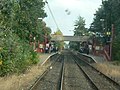 The view from the front of Metrocar No. 4089 as it approaches Platform 1, en route to South Hylton
10 October 2005 -
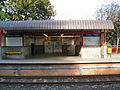 The Platform 2 building viewed from Platform 1
4 October 2007 -
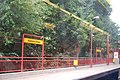 Platform 1, from a Metrocar in Platform 2
31 August 2009


Haymarket
[edit]| Opened | New or converted |
Number of platforms | Track alignment | Tyne & Wear metropolitan borough |
| 11 August 1980 | New | 2 | N-S | Newcastle upon Tyne |
| Layout | ||||
| An underground island platform beneath a ground level ticketing hall. The interior was substantially refurbished between 2007 and 2009 in conjunction with the rebuilding of the ground level station building | ||||
| Platform no. and position |
Direction of travel |
Previous stop |
Route | Next stop |
| Platform 1 East |
Southbound | Jesmond | Yellow Line to South Shields (stop 28 of 42) | Monument |
| Green Line to South Hylton (stop 12 of 31) | ||||
| Platform 2 West |
Northbound | Monument | Yellow Line to St James (stop 15 of 42) | Jesmond |
| Green Line to Airport (stop 20 of 31) | ||||
| Notes | ||||
| None | ||||
| Station buildings | ||||
| The ground level station concourse is integrated into the Haymarket Hub building, which replaced a smaller round building in the original style (brown) - construction began in 2007, being officially opened on 29 March 2010. In the paved area directly to the north stands the South African War Memorial, unveiled in 1908 | ||||
| Access | ||||
| Ground level entrances into the Haymarket Hub building, bordered by Percy Street to the west, St Mary's Place to the north, Northumberland Street to the east and a path to the south. Two escalators and a staircase between ground level and platform level were replaced with three escalators during refurbishment | ||||
| Protection from the elements | ||||
| Tunnel roofs | ||||
| Interchanges | ||||
| bus | ||||
Original station building
[edit]-
 The north side from the west (on the right)
13 July 2006 -
 The east side from the north (on the right)
13 July 2006 -
 The north side from the east
6 July 2006 -
 The north side
9 May 2007 -
 The south side
23 October 2005 -
 The interior at night as seen from outside from the north, showing the top of the escalators down to platform level
5 January 2004 -
 The interior at night as seen from outside from the north, showing the top of the escalators down to platform level
19 January 2007 -
 Percy Street pole sign (looking west)
24 August 2007


Underground portion before refurbishment
[edit]-
 The bottom of the escalators, connecting the ground level station hall with the platform level
7 October 2006 -
 The view north along Platform 1
18 November 2005 -
 Advert hoardings on one of the tunnel side walls
5 March 2006 -
 Advert hoardings and graffiti on one of the tunnel side walls
23 May 2006


.jpg)

Underground portion during refurbishment
[edit]-
 One of the platform tunnels during refurbishment
31 October 2008 -
 The view down the escalator connecting the ground level station hall with the platform level
16 February 2009


Haymarket Hub exterior
[edit]The Haymarket Hub building is a four sided modern glass structure. It is roughly square, 100' wide at its maximum width. It has a curved roof and wide radius corners, with each side featuring a full length arched feature, which roughly face each of the four compass directions. As well as containing the station hall, it also features retail units and a Nexus travel shop at ground level, while offices occupy the floors above.
-
 The north face
16 January 2009 -
 The west face
16 January 2009 -
 The north face
26 January 2009 -
 The north face
26 January 2009 -
 The west (left) & south (right) faces
8 May 2009 -
 The north face
13 May 2009 -
 The north face
13 May 2009 -
 The north face
4 July 2009 -
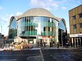 The west (left) & south (right) faces
31 January 2010 -
 The north face
1 June 2011 -
 The north face
27 July 2011 -
 The west face
3 August 2012 -
 The west face
31 March 2013 -
 The west face
15 September 2013 -
 The north face
16 September 2013
.jpg)
.jpg)
.jpg)
.jpg)


.jpg)


.JPG)
Ground level & escalators after refurbishment
[edit]-
 The interior of the station hall
27 July 2011 -
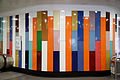 The interior wall a the top of the escalators
20 September 2010 -
 The top of the escalators connecting the ground level station hall with the platform level
20 September 2010 -
 The view down the escalators connecting the ground level station hall with the platform level
20 September 2010 -
 27 July 2011
 -
 3 September 2012
 -
 The bottom of the escalators, connecting the ground level station hall with the platform level
14 May 2011
.jpg)
.jpg)
.jpg)
.jpg)
.jpg)


Platform level after refurbishment
[edit]-
 The view north along the space in between Platform 2 (left) & 1 (right)
20 September 2010 -
 The view along the walkway from the central area to the doors of Metrocar No. 4025
20 September 2010 -
 The station name along the side of one of the platform tunnels
20 September 2010 -
 The station name at the top of one of the platform tunnels
20 September 2010 -
 The view north along Platform 1
20 September 2010 -
 The view north along Platform 1, as Metrocar No. 4051 enters the station en route to Pelaw
20 September 2010 -
 The view from the front of a Metrocar as it enters Platform 1, en route to Airport
1 March 2010 -
 The view from the front of a Metrocar as it enters Platform 2
4 August 2011 -
 The view from the front of a Metrocar as it enters Platform 2
9 January 2012 -
 The view south along Platform 2
27 July 2011 -
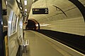 The view south along Platform 2
27 July 2011 -
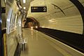 The view south along Platform 2 as a train bound for Airport arrives
27 July 2011 -
 The view south along Platform 2 as a train bound for Airport arrives
27 July 2011 -
 The view south down Platform 2, while a train bound for Airport loads
28 September 2009
.jpg)
.jpg)
.jpg)
.jpg)
.jpg)


.jpg)
.jpg)
.jpg)
.jpg)
.JPG)
Hebburn
[edit]| Opened | New or converted |
Number of platforms | Track alignment | Tyne & Wear metropolitan borough |
| 24 March 1984 | Converted | 2 | NE-SW | South Tyneside |
| Layout | ||||
| Two side platforms at ground level, staggered 180' west and 10' east of a bridge for Station Road (B1927) (north platform to the west), with another single track to the north, with platform level buildings at the inner ends | ||||
| Platform no. and position |
Direction of travel M |
Previous stop |
Route | Next stop |
| Platform 1 North West |
NE bound | Pelaw | Yellow Line to South Shields (stop 36 of 42) | Jarrow |
| Platform 2 South East |
SW bound | Jarrow | Yellow Line to St James (stop 07 of 42) | Pelaw |
| Notes | ||||
| * M - these are compass headings, which in this station's case do not correspond to the directions diagrammatically indicated on the official Metro route map archive copy at the Wayback Machine - NE bound is Eastbound & SW bound is Westbound on the Metro map | ||||
| Station buildings | ||||
| Two simple structures in the original style, a rectangle and cube, 30' by 20', and 20' by 20' | ||||
| Access | ||||
| A long ramp in line with the track, down from the Station Road bridge to the east end of the north platform; a path and car park on the south side connected to the southern end of the Station Road road bridge as it hits ground level | ||||
| Protection from the elements | ||||
| Station building and a standalone 60' platform shelter on the west platform, 60' platform shelter attached to the front of the east platform station building | ||||
| Interchanges | ||||
| None | ||||
-
 The view south west from Station Road (B1927) along the line of the access bridge connecting it to Platform 1
7 November 2009 -
 The view south west from Station Road (B1927) along the line of the access bridge connecting it to Platform 1
15 October 2005 -
 The view south west along Platform 2, under the bridge carrying Station Road (B1927), to Platform 1 on the other side
9 May 2007
_-_geograph.org.uk_-_1571485.jpg)


Heworth
[edit]| Opened | New or converted |
Number of platforms | Track alignment | Tyne & Wear metropolitan borough |
| 15 November 1981 | New | 2 | E-W | Gateshead |
| Layout | ||||
| Two side platforms in a cutting underneath a station building, with a double-track mainline to the north and a bridge for a SW-NE bus only road to the west over both Metro and mainline tracks (platforms for a mainline station are west of the bridge) | ||||
| Platform no. and position |
Direction of travel |
Previous stop |
Route | Next stop |
| Platform 1 North |
Eastbound | Felling | Yellow Line to South Shields (stop 34 of 42) | Pelaw |
| Green Line to South Hylton (stop 18 of 31) | ||||
| Platform 2 South |
Westbound | Pelaw | Yellow Line to St James (stop 09 of 42) | Felling |
| Green Line to Airport (stop 14 of 31) | ||||
| Notes | ||||
| None | ||||
| Station buildings | ||||
| A rectangular station hall in the original style (brown brick/white panel), 130' by 90' | ||||
| Access | ||||
| Ground level entrances to the station building in the south and north sides at the east ends (south from a bus station, north to another bus station via a walkway over the mainline tracks), then internal access down to platform level | ||||
| Protection from the elements | ||||
| Road bridge/station building underside | ||||
| Interchanges | ||||
| rail, bus, car | ||||
-
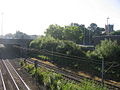 The view south east from the northern access bridge across the tracks outside the east side of the building
14 July 2006 -
 The view across the A184 to the north east corner of the station building
8 January 2009 -
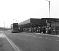 The south side of the station building
31 May 1983 -
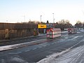 The south side of the station building
26 December 2009 -
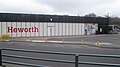 The west side of the station building
26 March 2011 -
 The south east corner of the station building
21 November 2012 -
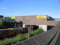 The east side of the station building, with a Metrocar approaching Platform 2
14 July 2006 -
 The gate line inside the station building
31 May 1983 -
 The view from the front of Metrocar No. 4089 as it approaches Platform 1, en route to South Hylton. Metrocar No. 4028 bound for St James is in Platform 2
10 October 2005 -
 The view through the platforms
1 January 2006 -
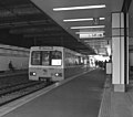 The view west along Platform 1, with Metrocar No. 4071 terminating a service from Newcastle
31 May 1983 -
 The station sign
27 April 2008 -
 The view east from the end of Platform 2 as a Metrocar arrives, en route to Airport
5 July 2005 -
 The view north east across the concrete ramps either side of the mainline station platforms, as a westbound Metrocar leaves the Metro platforms just visible to the right
20 February 1985


.jpg)
Howdon
[edit]| Opened | New or converted |
Number of platforms | Track alignment | Tyne & Wear metropolitan borough |
| 14 November 1982 | Converted | 2 | ENE-WSW | North Tyneside |
| Layout | ||||
| Two side platforms at ground level, staggered 75' either side of a level crossing for Howdon Lane (north platform to the west), with platform level station buildings at the inner ends | ||||
| Platform no. and position |
Direction of travel |
Previous stop |
Route | Next stop |
| Platform 1 North |
Eastbound | Hadrian Road | Yellow Line to South Shields (stop 09 of 42) | Percy Main |
| Platform 2 South |
Westbound | Percy Main | Yellow Line to St James (stop 34 of 42) | Hadrian Road |
| Notes | ||||
| None | ||||
| Station buildings | ||||
| Two simple rectangular structures in the original style, 30' by 15' and 30' by 20' | ||||
| Access | ||||
| Footpath east from Howdon Lane; footpath/E-W Martin Road west from Howdon Lane; a pedestrian subway under the track 30' west of the level crossing | ||||
| Protection from the elements | ||||
| 60' platform shelters attached to the front of both station buildings | ||||
| Interchanges | ||||
| None | ||||
-
 The view north along Howdon Lane, across the level crossing
10 June 2012 -
 The view from the front of a Metrocar as it approaches Platform 1
10 October 2005 -
 The view from the front of a Metrocar standing in Platform 1
10 October 2005 -
 The view north west from Howdon Lane across the tracks to the Platform 1 building
4 October 2007 -
 One of the station buildings, as seen from inside a calling Metrocar
31 August 2009
.jpg)


Ilford Road
[edit]| Opened | New or converted |
Number of platforms | Track alignment | Tyne & Wear metropolitan borough |
| 11 August 1980 | New | 2 | NNE-SSW | Newcastle upon Tyne |
| Layout | ||||
| Two side platforms in a cutting, with platform level station buildings in the northern half | ||||
| Platform no. and position |
Direction of travel |
Previous stop |
Route | Next stop |
| Platform 1 East |
Southbound | South Gosforth | Yellow Line to South Shields (stop 25 of 42) | West Jesmond |
| Green Line to South Hylton (stop 09 of 31) | ||||
| Platform 2 West |
Northbound | West Jesmond | Yellow Line to St James (stop 18 of 42) | South Gosforth |
| Green Line to Airport (stop 23 of 31) | ||||
| Notes | ||||
| None | ||||
| Station buildings | ||||
| Two simple rectangular structures in the original style, both 20' by 10' | ||||
| Access | ||||
| Sloped paths down to platform level from parallel streets, Ilford Road to the west, Albury Road/Woodthorne Road to the east, with both roads running south to an E-W bridge for Moorfield Road, 300' south of the platform ends | ||||
| Protection from the elements | ||||
| 60' platform shelters attached to the front of both station buildings | ||||
| Interchanges | ||||
| None | ||||
-
 The view north to the station from the Moorfield Road bridge; Metrocar 4010 is loading in Platform 1, en route to Park Lane
5 May 2008 -
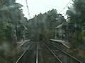 The view from the front of Metrocar No. 4089 as it approaches Platform 1, en route to South Hylton
10 October 2005 -
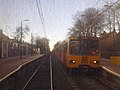 The view from the front of a Metrocar as it approaches Platform 2, en route to Airport, while another stands in Platform 1 en route to Pelaw
1 March 2010


Jarrow
[edit]| Opened | New or converted |
Number of platforms | Track alignment | Tyne & Wear metropolitan borough |
| 24 March 1984 | Converted | 2 | NW-SE | South Tyneside |
| Layout | ||||
| Two side platforms at ground level, with platform level station buildings in the eastern half, with another single track passing to the north | ||||
| Platform no. and position |
Direction of travel M |
Previous stop |
Route | Next stop |
| Platform 1 North East |
SE bound | Hebburn | Yellow Line to South Shields (stop 37 of 42) | Bede |
| Platform 2 South West |
NW bound | Bede | Yellow Line to St James (stop 06 of 42) | Hebburn |
| Notes | ||||
| * M - these are compass headings, which in this station's case do not correspond to the directions diagrammatically indicated on the official Metro route map archive copy at the Wayback Machine - NW bound is Westbound & SE bound is Eastbound on the Metro map | ||||
| Station buildings | ||||
| Two simple square structures in the original style, both 20' by 20' | ||||
| Access | ||||
| Street level entrance from the south via a concrete apron next to the parallel Grant Street, with stairs up and down from a footbridge connecting the east platform ends, and which also continues north over the passing track to Sheldon Street & a bus station; also a 200' long ramp up from the east end of the north platform, in line with the track up to the SW-NE bridge for the A185 road over all the tracks | ||||
| Protection from the elements | ||||
| 60' platform shelters attached to the front of both station buildings | ||||
| Interchanges | ||||
| bus | ||||
-
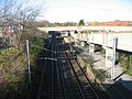 The view north west to the station from the A185 bridge, showing the ramp down to Platform 1 on the right
7 November 2009 -
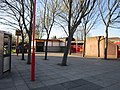 The view north across the Grant Street forecourt to the Platform 2 building
5 April 2012 -
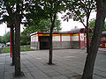 The view north across the Grant Street forecourt to the Platform 2 building
9 May 2007 -
 The Platform 2 building from the forecourt onto Grant Street
9 May 2007 -
 The view east down the steps from the station footbridge to the bus station directly ahead
16 July 2010 -
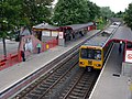 The view north west across the station from the footbridge; Metrocar No. 4018 is at the front of a train arriving in Platform 1, en route to South Shields
16 July 2010 -
 The view north west from the end of Platform 2
5 January 2006 -
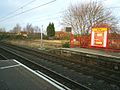 The view north from Platform 2 across to the end of Platform 1
5 January 2006 -
 The view from an empty platform across to a Metrocar in the opposite platform
30 March 2006 -
 The view across the tracks
25 October 2006

.jpg)


.jpg)
.jpg)
.jpg)


Jesmond
[edit]| Opened | New or converted |
Number of platforms | Track alignment | Tyne & Wear metropolitan borough |
| 11 August 1980 | New | 2 | NNE-SSW | Newcastle upon Tyne |
| Layout | ||||
| Two underground side platforms at the start of a cut and cover tunnel (which marks the start of the tunnel section heading south, under Newcastle city centre), with a station building above the platforms at ground level | ||||
| Platform no. and position |
Direction of travel |
Previous stop |
Route | Next stop |
| Platform 1 East |
Southbound | West Jesmond | Yellow Line to South Shields (stop 27 of 42) | Haymarket |
| Green Line to South Hylton (stop 11 of 31) | ||||
| Platform 2 West |
Northbound | Haymarket | Yellow Line to St James (stop 16 of 42) | West Jesmond |
| Green Line to Airport (stop 21 of 31) | ||||
| Notes | ||||
| None | ||||
| Station buildings | ||||
| A rectangular station hall in the original style (black/white), 80' by 70', with an indent in the NE face for a sculpture park | ||||
| Access | ||||
| Ground level access via an entrance in the SW side of the station building; then internal access to platform levels | ||||
| Protection from the elements | ||||
| Tunnel roofs | ||||
| Interchanges | ||||
| None | ||||
-
 One of the exterior Metro pole signs advertising the presence of a station nearby
10 April 2010 -
 The south west side of the station building (the entrance/exit)
27 June 2009 -
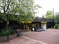 The south west side of the station building (the entrance/exit)
9 August 2013 -
 One of the illuminated exterior signs which are above the entrance/exit of the station building
20 September 2010 -
 The north east side of the station building (opposite the entrance/exit side)
9 August 2013 -
 The north east side of the station building (opposite the entrance/exit side)
9 July 2007 -
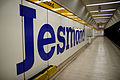 The view along Platform 1
10 April 2010 -
 The view from the front of Metrocar No. 4089 as it enters Platform 1, en route to South Hylton
10 October 2005 -
 The view south down Platform 2, as a train bound for St James arrives
26 March 2007 -
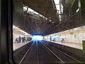 The view from the front of a Metrocar as it enters Platform 2, en route to Airport
1 March 2010 -
 The view from the front of a Metrocar as it comes to stop in Platform 2, en route to Airport
1 March 2010
.jpg)

.jpg)
.jpg)

.jpg)


Kingston Park
[edit]| Opened | New or converted |
Number of platforms | Track alignment | Tyne & Wear metropolitan borough |
| 15 September 1985 | New | 2 | E-W | Newcastle upon Tyne |
| Layout | ||||
| Two side platforms at ground level, staggered 125' either side of a level crossing for Brunton Lane (north platform to the west), with platform level station buildings at the inner ends | ||||
| Platform no. and position |
Direction of travel |
Previous stop |
Route | Next stop |
| Platform 1 North |
Eastbound | Bank Foot | Green Line to South Hylton (stop 04 of 31) | Fawdon |
| Platform 2 South |
Westbound | Fawdon | Green Line to Airport (stop 28 of 31) | Bank Foot |
| Notes | ||||
| None | ||||
| Station buildings | ||||
| Two simple structures in the original style (concrete/brown/white/red), a rectangle and cube, 30' by 30' and 35' by 30' | ||||
| Access | ||||
| Footpaths from Brunton Lane, large retail car park to the south of the south platform | ||||
| Protection from the elements | ||||
| Station buildings plus 60' standalone shelter on the north platform | ||||
| Interchanges | ||||
| car | ||||
-
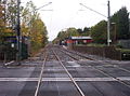 The view west across the Brunton Lane level crossing to Platform 1
23 October 2005 -
 Metrocar No. 4035 at the front of an eastbound train has just left Platform 1 and is about to cross the Brunton Lane level crossing, en route to Haymarket. The signal box has since been replaced by a smaller brick plant house
15 July 1981 -
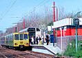 The view north west to Platform 1, where Metrocar No. 4062 forms the front of a train bound for South Shields
Spring 2001 -
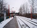 The view west along Platform 2, as a bus crosses the Brunton Lane level crossing
2 January 2010 -
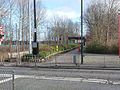 The view east along the footpath connecting Brunton Lane to Platform 2
1 February 2013 -
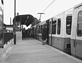 The view east along Platform 1, as passengers board an eastbound service. As shown by the numbering on the right, the train is formed by Metrocar No. 4064 at the front, 4053 at the rear
15 July 1981 -
 The view east along Platform 1, as diesel locomotive WL3 hauls a westbound works train on the opposite track
15 July 1981 -
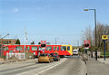 The view north along Brunton Lane, with road traffic stopped at the lights for the level crossing. Metrocar No. 4032 forms the rear of a westbound train which has just left Platform 2, to the right
Spring 2001 -
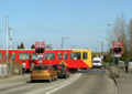


Longbenton
[edit]Manors
[edit]Meadow Well
[edit]Millfield
[edit]Monkseaton
[edit]Monument
[edit]North Shields
[edit]Northumberland Park
[edit]Northumberland Park Metro station
Pallion
[edit]Palmersville
[edit]Park Lane
[edit]Pelaw
[edit]Percy Main
[edit]Regent Centre
[edit]Seaburn
[edit]Shiremoor
[edit]Simonside
[edit]South Gosforth
[edit]South Hylton
[edit]South Shields
[edit]St James
[edit]St Peter's
[edit]Stadium of Light
[edit]Stadium of Light Metro station
Sunderland
[edit]Tyne Dock
[edit]Tynemouth
[edit]University
[edit]Walkergate
[edit]Wallsend
[edit]Wansbeck Road
[edit]West Jesmond
[edit]West Monkseaton
[edit]Whitley Bay
[edit]- Airport (Tyne and Wear) Metro station
- Gallery pages of Tyne and Wear Metro
- Bank Foot Metro station
- Bede Metro station
- Benton Metro station
- Brockley Whins Metro station
- Byker Metro station
- Callerton Parkway Metro station
- Central Station Metro station
- Chichester Metro station
- Chillingham Road Metro station
- Cullercoats Metro station
- East Boldon Metro station
- Fawdon Metro station
- Fellgate Metro station
- Felling Metro station
- Four Lane Ends Metro station
- Gateshead Metro station
- Gateshead Interchange
- Gateshead Stadium Metro station
- Hadrian Road Metro station
- Haymarket Metro station
- Hebburn Metro station
- Heworth Metro station
- Howdon Metro station
- Ilford Road Metro station
- Jarrow Metro station
- Jesmond Metro station
- Kingston Park Metro station
- Tyne and Wear Metro stations