File:Status of detailed soil surveys, Vermont. LOC 82690887.tif
Jump to navigation
Jump to search

Size of this JPG preview of this TIF file: 461 × 600 pixels. Other resolutions: 184 × 240 pixels | 369 × 480 pixels | 590 × 768 pixels | 787 × 1,024 pixels | 2,508 × 3,262 pixels.
Original file (2,508 × 3,262 pixels, file size: 23.41 MB, MIME type: image/tiff)
Captions
Captions
Add a one-line explanation of what this file represents
Summary
[edit]| Description |
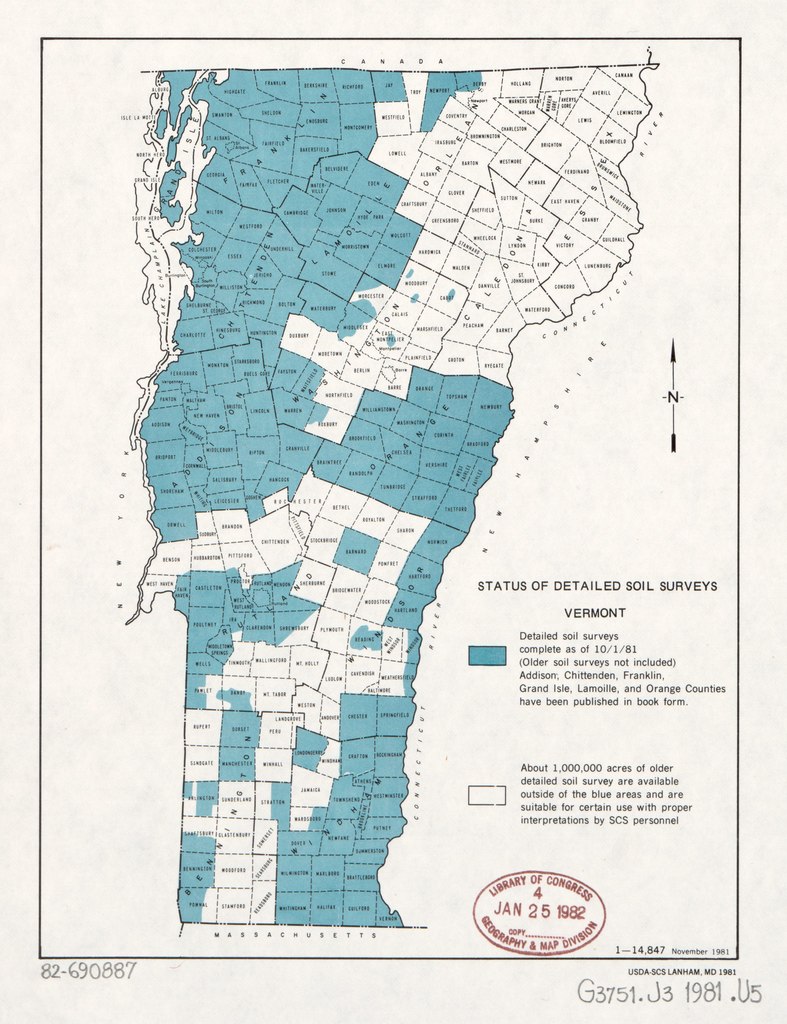
English: Shows areas of "Detailed soil surveys complete as of 10/1/81." "1-14,847 November 1981." Available also through the Library of Congress Web site as a raster image. |
||
| Title | Status of detailed soil surveys, Vermont. | ||
| Shelf ID | G3751.J3 1981 .U5 | ||
| Date | |||
| Source | https://www.loc.gov/item/82690887/ | ||
| Author | United States. Soil Conservation Service | ||
| Permission (Reusing this file) |
|
||
| Other versions |
|
||
| Location | United States · Vermont | ||
| Part of | American Memory · Catalog · Geography And Map Division · Additional Conservation And Environment Cartographic Items | ||
| Subject | Soil Surveys · Maps · Vermont · United States |


Licensing
[edit]| This work is from the Library of Congress. According to the library, there are no known copyright restrictions on the use of this work. |  |
File history
Click on a date/time to view the file as it appeared at that time.
| Date/Time | Thumbnail | Dimensions | User | Comment | |
|---|---|---|---|---|---|
| current | 06:18, 9 June 2018 |  | 2,508 × 3,262 (23.41 MB) | Fæ (talk | contribs) | LOC Maps https://www.loc.gov/item/82690887/ #9301 |
You cannot overwrite this file.
File usage on Commons
The following page uses this file: