File:Geoviden-1-2011-Nordsøens-geologi.png
Jump to navigation
Jump to search
Size of this preview: 698 × 600 pixels. Other resolutions: 279 × 240 pixels | 559 × 480 pixels | 894 × 768 pixels | 1,024 × 880 pixels.
Original file (1,024 × 880 pixels, file size: 212 KB, MIME type: image/png)
Captions
Captions
Add a one-line explanation of what this file represents
Summary
[edit]
| Description |
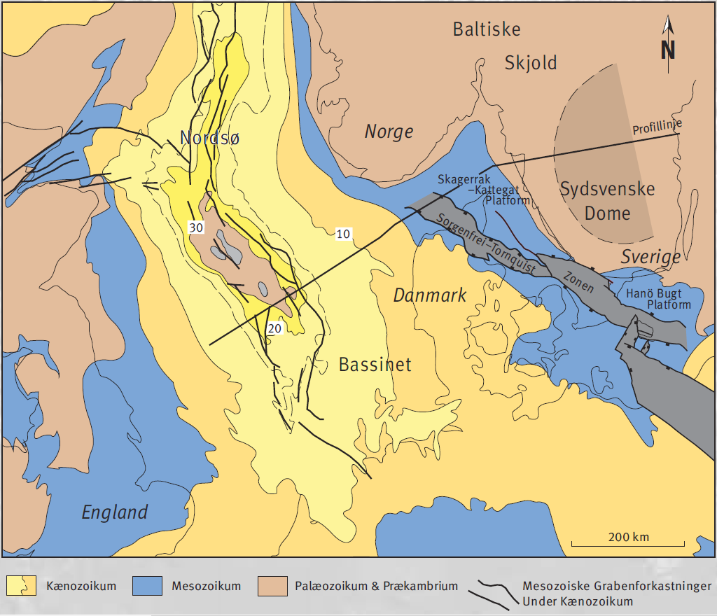
Dansk: Geologiske strukturer i det østlige Nordsø Bassin, side 6 |
| Date | |
| Source | http://geocenter.dk/xpdf/geoviden-1-2011.pdf |
| Author | Ole Graversen |
Licensing
[edit]
This file is licensed under the Creative Commons Attribution-Share Alike 4.0 International license.
- You are free:
- to share – to copy, distribute and transmit the work
- to remix – to adapt the work
- Under the following conditions:
- attribution – You must give appropriate credit, provide a link to the license, and indicate if changes were made. You may do so in any reasonable manner, but not in any way that suggests the licensor endorses you or your use.
- share alike – If you remix, transform, or build upon the material, you must distribute your contributions under the same or compatible license as the original.

|
This is a file uploaded through the Danish Wikipedia, which has not been reviewed on Commons:
|
File history
Click on a date/time to view the file as it appeared at that time.
| Date/Time | Thumbnail | Dimensions | User | Comment | |
|---|---|---|---|---|---|
| current | 15:51, 24 November 2016 | | 1,024 × 880 (212 KB) | Jensga (talk | contribs) | User created page with UploadWizard |
You cannot overwrite this file.
File usage on Commons
There are no pages that use this file.
File usage on other wikis
The following other wikis use this file:
- Usage on da.wikipedia.org
Metadata
Categories:
- North Sea Basin
- Tectonics maps
- Maps of structural basins
- Danish-language maps
- Structural basins of Europe
- Geological maps of Europe
- Geological maps of Schleswig-Holstein
- Geological maps of Lower Saxony
- Geological maps of Mecklenburg-Vorpommern
- Geological maps of Denmark
- Geological maps of Norway
- Geological maps of Sweden
- Geological maps of England
- Geological maps of the Netherlands
- Geological maps of the Baltic Sea
- Geological maps of the North Sea
- Baltic Shield
- Sorgenfrei-Tornquist Zone
- Denmark Basin