Category:Geological maps of the Baltic Sea
Jump to navigation
Jump to search
Media in category "Geological maps of the Baltic Sea"
The following 22 files are in this category, out of 22 total.
-
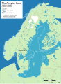
 Ancylussee.svg 961 × 1,306; 672 KB
-
 Baltic History 5000-BC-es.svg 961 × 1,306; 790 KB
-
 Baltic History 5000-BC.svg 961 × 1,306; 721 KB
-
 Baltic History 5500-BC.svg 961 × 1,306; 814 KB
-
 Baltic History 7500-BC Ru.svg 961 × 1,306; 653 KB
-
 Baltic History 7500-BC-ar.svg 961 × 1,306; 876 KB
-
 Baltic History 7500-BC-es.svg 961 × 1,306; 757 KB
-
 Baltic History 7500-BC.png 800 × 1,087; 342 KB
-
 Baltic History 7500-BC.svg 961 × 1,306; 652 KB
-
 Baltic Sea (1).JPG 2,000 × 1,244; 438 KB
-
 Baltic Sea (2).JPG 3,559 × 1,868; 1.46 MB
-
 Baltischer EisstauseeX.png 2,000 × 2,684; 1.23 MB
-
 Geoviden-1-2011-Nordsøens-geologi.png 1,024 × 880; 212 KB
-
 Geoviden-2-2005-127ka.png 729 × 805; 599 KB
-
 Geoviden-2-2005-140ka.png 746 × 811; 764 KB
-
 Geoviden-2-2005-19ka.png 727 × 808; 903 KB
-
 Geoviden-2-2005-23ka.png 728 × 805; 672 KB
-
 Geoviden-2-2005-33ka.png 729 × 807; 803 KB
-
 Litorinameri 5000 eaa.svg 961 × 1,306; 697 KB
-
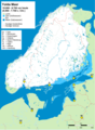
 Littorinameer.svg 961 × 1,306; 721 KB
-
 Ancyluslake.svg 349 × 372; 37 KB
-
 Yolda MeerX.png 1,994 × 2,716; 1.21 MB


.JPG)
.JPG)


