File:Castilla 1210.png

Original file (600 × 643 pixels, file size: 821 KB, MIME type: image/png)
Captions
Captions
Summary
[edit]
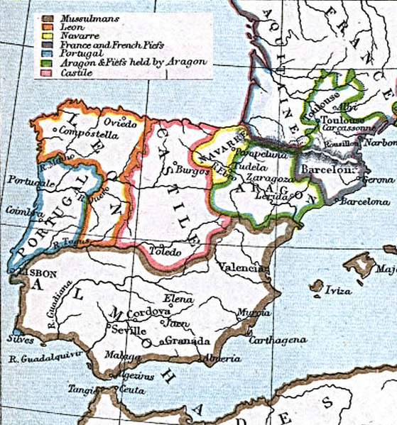
"Courtesy of the University of Texas Libraries, The University of Texas at Austin." http://www.lib.utexas.edu/maps/historical/spanish_kingdoms.html
From the Atlas To Freeman's Historical Geography, Edited by J.B. Bury, Longmans Green and Co. Third Edition 1903
Licensing
[edit]
|
The author died in 1927, so this work is in the public domain in its country of origin and other countries and areas where the copyright term is the author's life plus 95 years or fewer. This work is in the public domain in the United States because it was published (or registered with the U.S. Copyright Office) before January 1, 1929. | |
| This file has been identified as being free of known restrictions under copyright law, including all related and neighboring rights. | |
File history
Click on a date/time to view the file as it appeared at that time.
| Date/Time | Thumbnail | Dimensions | User | Comment | |
|---|---|---|---|---|---|
| current | 23:45, 16 March 2006 | | 600 × 643 (821 KB) | Ajrs (talk | contribs) | "Courtesy of the University of Texas Libraries, The University of Texas at Austin." http://www.lib.utexas.edu/maps/historical/spanish_kingdoms_1210.jpg |
You cannot overwrite this file.
File usage on Commons
The following 2 pages use this file:
File usage on other wikis
The following other wikis use this file:
- Usage on ar.wikipedia.org
- Usage on ast.wikipedia.org
- Usage on br.wikipedia.org
- Usage on cs.wikipedia.org
- Usage on cy.wikipedia.org
- Usage on de.wikipedia.org
- Usage on en.wikipedia.org
- Usage on es.wikipedia.org
- Usage on fi.wikipedia.org
- Usage on gl.wikipedia.org
- Usage on id.wikipedia.org
- Usage on io.wikipedia.org
- Usage on it.wikipedia.org
- Usage on ja.wikipedia.org
- Usage on nl.wikipedia.org
- Usage on pt.wikipedia.org
- Usage on ru.wikipedia.org
- Usage on sk.wikipedia.org
- Usage on tr.wikipedia.org
- Maps of the Iberian Peninsula in the 13th century
- Maps of 13th-century Portugal
- Maps of 13th-century Spain
- Maps showing history by William R. Shepherd
- Maps showing history of the High Middle Ages
- Maps showing 13th-century history
- Spain in the 1210s
- Maps of the Crown of Aragon
- Maps of the Kingdom of Castile
- Old maps of Medieval Iberia
- Old maps of the Kingdom of León
- 1900s maps of Portugal
- 1903 maps of Spain
- Afonso II of Portugal
- Alfonso VIII of Castile
- Alfonso IX of León
- Sancho VII of Navarre
- Peter II of Aragon
- Portugal in the 1210s