Category:Maps of the Kingdom of Castile
Jump to navigation
Jump to search
Subcategories
This category has only the following subcategory.
C
Media in category "Maps of the Kingdom of Castile"
The following 63 files are in this category, out of 63 total.
-
 España1000.jpg 442 × 379; 150 KB
-
 España1037.jpg 826 × 640; 522 KB
-
 Kingdoms of Castile and León 1097.svg 485 × 350; 747 KB
-
 800px-Pennsula iberica 1150.png 800 × 555; 77 KB
-
 España1150.jpg 830 × 640; 526 KB
-
 España1150.svg 1,703 × 1,378; 2.59 MB
-
 Tractat de Tudilén -1151-.svg 3,075 × 3,556; 206 KB
-
 Tractat de Tudilén -1151-es.svg 3,075 × 3,556; 985 KB
-
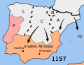
 Mapa reconquista almohades-ru.svg 474 × 368; 43 KB
-
 Mapa reconquista almohades.svg 474 × 368; 42 KB
-
 RebeliónDeIbnMardanis1160,svg.svg 2,268 × 1,396; 825 KB
-
 1173 CE, Europe.svg 512 × 438; 1.77 MB
-
 España 1190.jpg 500 × 468; 213 KB
-
 Kingdoms of Castile and León 1190.svg 550 × 375; 998 KB
-
 Castilla 1210.png 600 × 643; 821 KB
-
 Castilla 1210.svg 2,000 × 1,500; 607 KB
-
 1212 CE, Europe.svg 512 × 438; 1.73 MB
-
 1230 CE, Europe-es.svg 2,757 × 2,329; 3.31 MB
-
 1230 CE, Europe.svg 512 × 438; 1.76 MB
-
 C. 1000 Europe and Byzantine Empire.jpg 1,349 × 1,055; 1.83 MB
-
 C. 1000 Western Europe.jpg 1,454 × 1,302; 2.1 MB
-
 C. 1037 Iberian Peninsula.jpg 1,574 × 1,236; 1.45 MB
-
 C. 1097 Europe and Mediterranean Lands.jpg 1,752 × 1,375; 2.11 MB
-
 C. 1097 Western Europe and First Crusade Routes.jpg 1,068 × 1,299; 1.67 MB
-
 C. 1150 Iberian Peninsula.jpg 1,578 × 1,234; 1.52 MB
-
 C. 1190 Europe and Mediterranean Lands.jpg 1,514 × 1,173; 2.42 MB
-
 C. 1190 Iberian Peninsula.jpg 1,801 × 1,273; 1.73 MB
-
 C. 1360 Europe and Western Asia.jpg 2,112 × 1,365; 2.11 MB
-
 C. 1360 Europe.jpg 4,045 × 3,000; 3.9 MB
-
 C. 1492 Iberian Peninsula (1212-1492).jpg 1,594 × 1,258; 2.25 MB
-
 C. 1492 Iberian Peninsula (1263-1492).jpg 4,000 × 3,000; 4.43 MB
-
 C. 1513 Iberian Peninsula.jpg 4,000 × 3,000; 4.38 MB
-
 C. 910 Iberian Peninsula.jpg 1,573 × 1,242; 2 MB
-
 Castile (PSF).jpg 304 × 205; 99 KB
-
 España1212 a 1492.jpg 828 × 642; 530 KB
-
 Hispania in Harley MS 3686 - 15th century.jpg 940 × 1,230; 401 KB
-
 Iberian Peninsula fr 1000 es.svg 827 × 574; 229 KB
-
 Kingdom of Leon 1037 bg.svg 827 × 574; 253 KB
-
 Kingdom of Leon 1037-pt.svg 827 × 574; 255 KB
-
 Kingdom of Leon 1037.svg 827 × 574; 253 KB
-

-
 La frontera de los malhechores (mapa).png 1,100 × 800; 159 KB
-
 Map - Special Collections University of Amsterdam - OTM- HB-KZL 32.25.25.tif 7,340 × 6,256; 131.38 MB
-
 Map Iberian Peninsula 1000-bg.svg 827 × 574; 236 KB
-
 Map Iberian Peninsula 1000-fr.svg 827 × 574; 237 KB
-
 Map Iberian Peninsula 1000-mn.svg 827 × 574; 237 KB
-
 Map Iberian Peninsula 1000-pt.svg 827 × 574; 239 KB
-
 Map Iberian Peninsula 1030-de.svg 827 × 574; 335 KB
-
 Map Iberian Peninsula 1030-hu.svg 827 × 574; 265 KB
-
 Map Iberian Peninsula 1037-en.svg 827 × 574; 252 KB
-
 Map Iberian Peninsula 1037-hu.svg 827 × 574; 256 KB
-
 Map of Spain 1490.jpg 1,637 × 1,504; 224 KB
-
 Mapa reconquista almohades-en.svg 474 × 368; 42 KB
-
 Mapa reconquista almohades-pt.svg 474 × 368; 42 KB
-
 Península Ibèrica 1100.png 800 × 555; 49 KB
-
 Península Ibèrica 1103.png 800 × 555; 48 KB
-
 Péninsule ibérique en 1085.png 2,000 × 1,500; 1,008 KB
-
 Péninsule ibérique en 1195.png 2,000 × 1,500; 948 KB
-
 Péninsule ibérique en 1224-es.svg 2,000 × 1,500; 715 KB
-
 Péninsule ibérique en 1224.png 2,000 × 1,500; 935 KB
-
 Péninsule ibérique en 1230-es.svg 2,000 × 1,500; 662 KB
-
 Péninsule ibérique en 1230.png 2,000 × 1,500; 839 KB
-
 イベリア1474年.png 250 × 200; 7 KB


.jpg)
.jpg)


.jpg)


.png)


