Category:Maps showing history by William R. Shepherd
Jump to navigation
Jump to search
The entire atlas is available here, at the Perry-Castañeda Library Map Collection.
Note that editions published after 1928 should be marked as {{PD-old-auto|1934}} and {{PD-US-not renewed}}, as 1929 is too new for works to be PD-old in the US.
Subcategories
This category has the following 2 subcategories, out of 2 total.
H
Media in category "Maps showing history by William R. Shepherd"
The following 200 files are in this category, out of 247 total.
(previous page) (next page)-
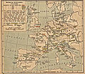
 (Shepherd, 1911 Atlas) European colonial empires in the 16th century.jpg 4,593 × 2,222; 2.09 MB
-
 Gelre1477.png 772 × 673; 937 KB
-
 C. 1490 France and England.jpg 811 × 1,252; 1.26 MB
-
 France ecc 1789 1802.jpg 1,114 × 943; 291 KB
-
 1926 Canada-Alaska 1903 boundary-map.jpg 448 × 432; 55 KB
-
 Achia.jpg 592 × 285; 82 KB
-
 Adriatic Sea, 1911.png 449 × 433; 564 KB
-
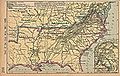
 American Revolution Campaigns 1775 to 1781.jpg 1,157 × 1,768; 547 KB
-
 Ancient Central Italy.jpg 1,600 × 1,200; 646 KB
-
 Ancient Khorasan highlighted.jpg 373 × 320; 58 KB
-
 Ancient Tabaristan highlighted.png 449 × 345; 347 KB
-
 Ancient Umbria.png 871 × 713; 1.2 MB
-
 Angles, Saxons, Jutes in Britain year 600.jpg 1,126 × 810; 301 KB
-
 Apulia - Shepherd-Arpi-c-030-031.png 742 × 599; 1.13 MB
-
 Apulia - Shepherd-c-030-031.png 1,093 × 883; 1.98 MB
-
 Apulia - Shepherd-Erdonia-c-030-031.png 742 × 599; 1.13 MB
-
 Apulia - Shepherd-Numistro-c-030-031.png 742 × 599; 1.13 MB
-
 Apulia - Shepherd-Sapriporte-c-030-031.png 742 × 599; 1.12 MB
-
 Apulia Calabria et Lucania - Shepherd-c-030-031.jpg 2,046 × 1,198; 801 KB
-
 Arab Caliphate.jpg 888 × 674; 220 KB
-
 Arab Caliphate.svg 350 × 334; 1.04 MB
-
 Arcadia.jpg 408 × 579; 115 KB
-
 Armenian Highlands.jpg 521 × 417; 101 KB
-
 Asia Menor y Estados Cruzados - 1140.jpg 1,097 × 1,185; 441 KB
-
 Asia Minor and the States of the Crusaders.jpg 1,200 × 1,282; 364 KB
-
 Asia Minor and the States of the Crusaders.svg 250 × 272; 651 KB
-
 Asia minor Mithridates retouched.jpg 1,043 × 576; 321 KB
-
 Asia minor Mithridates.jpg 1,043 × 577; 457 KB
-
 AsiamenorAntesDel90ACSinColores.svg 3,274 × 1,793; 630 KB
-
 Assyrian empire 750 625.jpg 1,821 × 1,127; 294 KB
-
 Athenian empire atheight 450 shepherd1923.png 1,094 × 895; 2.02 MB
-
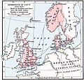
 Austria hungary 1911 and post war borders.jpg 1,525 × 1,166; 389 KB
-
 Austria hungary 1911.gif 907 × 687; 397 KB
-
 Austria hungary 1911.jpg 1,521 × 1,155; 1.76 MB
-
 Balkans 1265-es.svg 1,418 × 1,431; 1.39 MB
-
 Balkans 1265.jpg 600 × 422; 75 KB
-
 Balkans 1265.PNG 748 × 900; 1.14 MB
-
 Balkans 814.PNG 375 × 335; 258 KB
-
 Bishopric of Strasbourg 1547.png 536 × 522; 599 KB
-
 Brabant1477.png 409 × 362; 331 KB
-
 British colonies 1763-76 shepherd1923.jpg 1,651 × 1,010; 625 KB
-
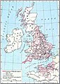
 British isles 802.jpg 1,076 × 1,127; 1.29 MB
-
 British Isles Physical map East.jpg 221 × 276; 67 KB
-
 Byzantine empire 1355.jpg 1,134 × 897; 380 KB
-
 Byzantine Empire 1355.jpg 743 × 600; 411 KB
-
 Byzantine empire 1355V2Make.svg 5,924 × 3,211; 629 KB
-
 Calatia posizione.jpg 454 × 391; 74 KB
-
 Califate 750.jpg 1,492 × 1,248; 494 KB
-
 Califate 750.png 1,229 × 1,028; 1.93 MB
-
 Caliphate 750.jpg 1,000 × 834; 185 KB
-
 Campania et Samnium - Shepherd-Beneventum-c-030-031.jpg 611 × 599; 220 KB
-
 Campania et Samnium - Shepherd-c-030-031.jpg 1,344 × 1,318; 695 KB
-
 Carolingian empire 843 888.jpg 1,755 × 1,102; 340 KB
-
 Castilla 1210.png 600 × 643; 821 KB
-
 Central Asian trade routes V2.jpg 1,280 × 836; 398 KB
-
 Central Asian trade routes.jpg 954 × 674; 206 KB
-
 Central Europe (1378).jpg 2,319 × 1,860; 1.47 MB
-
 Central europe 1648 sheperd.jpg 2,314 × 1,880; 925 KB
-
 Central europe 1814-15.jpg 887 × 1,392; 427 KB
-
 Central Europe in 1547.jpg 2,307 × 1,826; 1.35 MB
-
 Central Europe religions 1618.jpg 1,358 × 1,414; 463 KB
-
 Central Europe, 919-1125, snippet North.PNG 1,354 × 681; 1.92 MB
-
 Central Europe, 919-1125.jpg 2,281 × 1,801; 1,013 KB
-
 Chalcidice.jpg 854 × 507; 209 KB
-
 Civil war shepherd.jpg 1,716 × 1,082; 549 KB
-
 Cnut 1014 1035.jpg 765 × 731; 284 KB
-
 Comte de Foix.png 327 × 302; 194 KB
-
 Conquest mexico 1519 21.png 1,300 × 649; 1.45 MB
-
 County of Hoorne.png 332 × 318; 214 KB
-
 County of Salona.jpg 1,144 × 900; 434 KB
-
 Dalmatia1911.png 460 × 363; 438 KB
-
 Dalmazia1560.png 516 × 424; 586 KB
-
 Dräi Bistümer.png 393 × 432; 386 KB
-
 East Roman.jpg 835 × 664; 165 KB
-
 Eastern Europe 1000 CE.jpg 903 × 606; 118 KB
-
 Eastern Europe in 1190 crop.jpg 787 × 875; 373 KB
-
 Electorate of Saxony 1648.jpg 1,122 × 598; 319 KB
-
 Elis.jpg 428 × 513; 91 KB
-
 Empire of Attila.png 1,333 × 841; 644 KB
-
 England after 886.jpg 538 × 607; 99 KB
-
 Williams dominions 1087.jpg 1,062 × 1,486; 1.92 MB
-
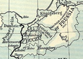 Ermland.png 290 × 205; 124 KB
-
 España 1190.jpg 500 × 468; 213 KB
-
 España 1360.jpg 429 × 317; 138 KB
-
 EspañasigloXV.jpg 285 × 252; 61 KB
-
 Europe 1360 (cropped).jpg 1,753 × 1,101; 831 KB
-
 Europe 1360.jpg 1,817 × 1,120; 695 KB
-
 Europe 1740.jpg 2,292 × 1,867; 785 KB
-
 Europe 1911 Caucasus and the Black Sea.jpg 887 × 591; 144 KB
-
 Europe 1911.jpg 2,243 × 1,840; 1.88 MB
-
 Europe 1914 Shepherd.jpg 1,789 × 1,465; 3.78 MB
-
 Europe about 1560.jpg 2,398 × 1,929; 1.25 MB
-

-
 Europe around 800.gif 1,737 × 1,361; 1.07 MB
-
 Europe byzantine empires.jpg 2,332 × 1,788; 640 KB
-
 Europe in 1560.jpg 2,308 × 1,855; 1.35 MB
-
 Europe in 1812.PNG 536 × 399; 458 KB
-
 Europe mediterranean 1097.jpg 2,270 × 1,789; 4.85 MB
-
 Europe mediterranean 1190 (cropped).jpg 774 × 525; 129 KB
-
 Europe mediterranean 1190.jpg 2,293 × 1,810; 941 KB
-
 Europe religieuse 1360.jpg 1,433 × 901; 1.06 MB
-
 Europe religions 1560.jpg 1,062 × 1,858; 594 KB
-
 Europe w asia n africa.jpg 2,305 × 1,863; 850 KB
-
 First.Crusade.Map.jpg 1,730 × 1,402; 730 KB
-
 France 12thC.jpg 968 × 1,541; 497 KB
-
 France frontiers 1601 1766-es.svg 2,024 × 2,754; 2.7 MB
-
 France frontiers 1601 1766.jpg 1,252 × 1,790; 477 KB
-
 Gallia cisalpina - Shepherd png.png 1,722 × 882; 3.64 MB
-
 German migrations 150 1066.jpg 1,767 × 1,106; 845 KB
-
 Germanic East Roman.jpg 840 × 658; 156 KB
-
 Germanic roman 486 1923.jpg 2,298 × 1,730; 740 KB
-

-
 HainautNamur1477.png 268 × 277; 133 KB
-
 Hellas 431bc.jpg 1,120 × 1,100; 306 KB
-
 Herzogtum Sachsen.png 1,007 × 544; 1.19 MB
-
 Hidatsa tribe.jpg 491 × 283; 87 KB
-
 Hugonotes1685.svg 718 × 736; 1.63 MB
-
 ImperioAqueménida500AC.svg 1,178 × 584; 941 KB
-
 India 1792 shepherd 1923.jpg 1,509 × 2,337; 2.4 MB
-
 Dioceses of Medieval Ireland.jpg 548 × 651; 111 KB
-

-
 Italy unification 1815 1870.jpg 1,073 × 1,164; 480 KB
-
 Unification of Italy 1815-1924.svg 267 × 321; 1.1 MB
-
 Italy (South) 1050.jpg 548 × 575; 100 KB
-
 Italy 1050.jpg 994 × 1,050; 643 KB
-
 Italy 1494 shepherd detail.jpg 781 × 669; 699 KB
-
 Italy 1494 shepherd.jpg 1,629 × 2,282; 1.39 MB
-
 Italy 1803.jpg 600 × 460; 115 KB
-
 Italy northern 1796.jpg 983 × 932; 451 KB
-
 KBMG1477.png 243 × 272; 123 KB
-
 Konstantinopel shepherd.jpg 866 × 906; 188 KB
-
 Leon 1030.png 620 × 654; 786 KB
-
 Liège 1477.JPG 310 × 318; 28 KB
-
 London 1300 Historical Atlas William R Shepherd (died 1934).PNG 700 × 536; 644 KB
-
 Lorraine 1000.png 488 × 572; 634 KB
-
 Lucania da The Historical Atlas, by William R. Shepherd, 1911.png 911 × 648; 3.47 MB
-
 Lucania map - Campi Veteres.jpg 800 × 533; 171 KB
-
 Lucania map.jpg 910 × 598; 222 KB
-
 Luxembourg 1477.jpg 345 × 386; 63 KB
-
 Magnesia.jpg 385 × 538; 91 KB
-
 Map 1914 WWI Alliances.jpg 1,682 × 1,328; 615 KB
-
 Map en county of Toulouse 1154.jpg 394 × 293; 74 KB
-
 Map of Ancient Italy, Southern Part.jpg 1,815 × 1,506; 2.1 MB
-
 Map of kingdom of Arles-es.svg 5,382 × 7,087; 1.74 MB
-
 Map of kingdom of Arles.jpg 500 × 659; 112 KB
-
 Map of London, 1300.svg 1,080 × 842; 294 KB
-
 Map of Medieval Universities.jpg 1,127 × 986; 574 KB
-
 Map of Pompeii in Roman Campania.png 400 × 260; 60 KB
-
 Map of Rome and Carthage at the start of the First Punic War.svg 1,077 × 776; 446 KB
-
 Map of Rome and Carthage at the start of the Second Punic War ko.svg 1,067 × 768; 363 KB
-
 Map of Rome and Carthage at the start of the Second Punic War-ar.png 1,056 × 750; 205 KB
-
 Map of Rome and Carthage at the start of the Second Punic War-es.svg 1,067 × 768; 628 KB
-
 Map of Rome and Carthage at the start of the Second Punic War-pt.svg 512 × 369; 156 KB
-
 Map of Rome and Carthage at the start of the Second Punic War-ru.svg 1,067 × 768; 357 KB
-
 Map of the Achaemenid Empire.jpg 1,314 × 635; 1.1 MB
-
 Map of Versailles in 1789 by William R Shepherd (died 1934).jpg 1,572 × 1,154; 864 KB
-
 Map Provence 1184.jpg 236 × 202; 90 KB
-
 Map the Second Punic War-hu.svg 1,067 × 768; 261 KB
-
 Mediaeval universities-ar.jpg 1,070 × 936; 387 KB
-
 Mediaeval universities.jpg 1,127 × 986; 1.17 MB
-
 Median Empire.jpg 1,306 × 735; 187 KB
-
 Median Empire2-es.svg 1,129 × 588; 876 KB
-
 Medieval Spanish Universities.png 485 × 357; 419 KB
-
 Mediterranean 1204 (cropped).jpg 564 × 614; 142 KB
-
 Mediterranean 1204.jpg 1,889 × 932; 340 KB
-
 Messenia.jpg 409 × 414; 154 KB
-
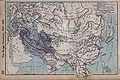 Mongol dominions.jpg 1,683 × 1,129; 333 KB
-
 Mongol dominions.png 1,683 × 1,129; 2.55 MB
-
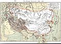 Mongol dominions1.jpg 1,280 × 938; 401 KB
-
 Netherlands 1559-1608.jpg 1,320 × 1,919; 569 KB
-
 Norditalien 1796.jpg 890 × 715; 508 KB
-
 Norditalien und Mittelitalien 1806.jpg 521 × 590; 236 KB
-
 North and Baltic Seas, 1911.png 960 × 625; 1.36 MB
-
 Northern Italy in 1494.png 601 × 541; 811 KB
-
 NorthSea395AD.jpg 684 × 775; 368 KB
-
 OoNL1786.png 565 × 481; 539 KB
-
 Oostr1477.png 800 × 600; 1.38 MB
-
 Oranje1547.png 167 × 216; 61 KB
-
 Ottoman empire 1481-1683.jpg 1,636 × 1,321; 458 KB
-
 Ottoman.jpg 776 × 651; 167 KB
-
 Panama-canal-shepherd-elevation.png 2,091 × 573; 2.51 MB
-
 Panama-canal-shepherd-map.png 2,062 × 749; 3.86 MB
-
 PaísesBajosAustriacos1786.svg 2,623 × 2,233; 621 KB
-
 Perserreich 500 v.Chr.jpg 1,314 × 635; 158 KB
-
 Plan of London in 1300.jpg 1,080 × 842; 879 KB
-
 Plan of Rome in the Middle Ages - Historical Atlas by William R. Shepherd, 1923.jpg 1,016 × 1,063; 498 KB
-
 Plan of the Battle of Waterloo.jpg 1,186 × 1,247; 457 KB
-
 Regio IX Liguria.jpg 588 × 425; 163 KB
-
 Regio X.jpg 418 × 225; 42 KB
-
 Roman campania pompeii named.jpg 400 × 260; 33 KB
-
 Roman empire 395.jpg 2,316 × 1,861; 1.87 MB
-
 Roman Empire about 395.jpg 1,899 × 1,543; 684 KB
-
 Roman expansion 264 BC Shepherd Greece and Anatolia banner.jpg 2,269 × 324; 392 KB
-
 Roman expansion 264 BC Shepherd.jpg 2,302 × 1,812; 873 KB
-
 RomanPowerAsiaMinor188BCE.JPG 763 × 420; 117 KB
-
 RomanPowerAsiaMinor63BCE-es.svg 3,274 × 1,793; 907 KB
-
 RomanPowerAsiaMinor63BCE.JPG 763 × 418; 237 KB
-
 RomanPowerAsiaMinor90BCE.JPG 762 × 420; 119 KB
-
 Rome carthage 218-ar.png 800 × 594; 877 KB
-
 Rome carthage 218.jpg 1,108 × 822; 190 KB
_European_colonial_empires_in_the_16th_century.jpg)


.jpg)


.jpg)


.jpg)


.jpg)


.jpg)


.jpg)


_1050.jpg)


.PNG)


.jpg)


.jpg)


