File:Balkans 1265-es.svg
Jump to navigation
Jump to search

Size of this PNG preview of this SVG file: 594 × 599 pixels. Other resolutions: 238 × 240 pixels | 476 × 480 pixels | 761 × 768 pixels | 1,015 × 1,024 pixels | 2,029 × 2,048 pixels | 1,418 × 1,431 pixels.
Original file (SVG file, nominally 1,418 × 1,431 pixels, file size: 1.39 MB)
Captions
Captions
Add a one-line explanation of what this file represents
Summary
[edit]
| Description |
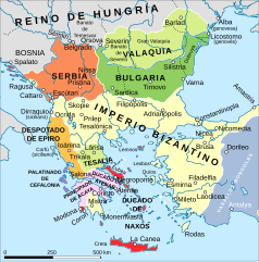
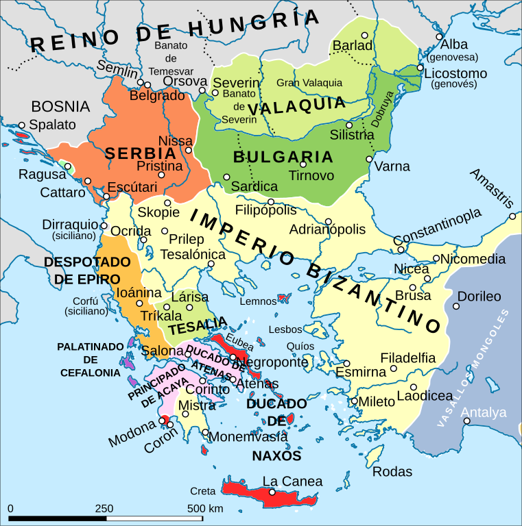
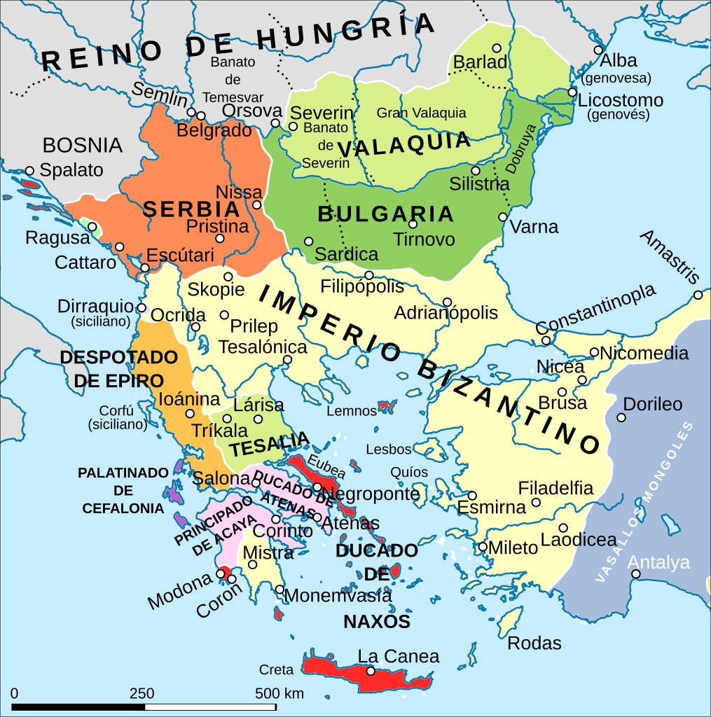
Español: Situación territorial balcánica en torno al 1265:
Serbia
Bulgaria
Territorios valacos (incluida Tesalia)
Imperio bizantino
Vasallos mongoles
Territorios venecianos
Despotado de Epiro
Estados latinos: principado de Acaya y ducado de Atenas
Palatinado de Cefalonia
Ragusa |
| Date | |
| Source | ShepherdByzempire1265-es.svg |
| Author |
|
Licensing
[edit]
This file is licensed under the Creative Commons Attribution-Share Alike 4.0 International license.
- You are free:
- to share – to copy, distribute and transmit the work
- to remix – to adapt the work
- Under the following conditions:
- attribution – You must give appropriate credit, provide a link to the license, and indicate if changes were made. You may do so in any reasonable manner, but not in any way that suggests the licensor endorses you or your use.
- share alike – If you remix, transform, or build upon the material, you must distribute your contributions under the same or compatible license as the original.
File history
Click on a date/time to view the file as it appeared at that time.
| Date/Time | Thumbnail | Dimensions | User | Comment | |
|---|---|---|---|---|---|
| current | 10:15, 13 February 2018 | | 1,418 × 1,431 (1.39 MB) | Rowanwindwhistler (talk | contribs) | Better contrast colours |
| 10:07, 13 February 2018 |  | 1,418 × 1,431 (1.38 MB) | Rowanwindwhistler (talk | contribs) | User created page with UploadWizard |
You cannot overwrite this file.
File usage on Commons
The following page uses this file:
File usage on other wikis
The following other wikis use this file:
- Usage on ca.wikipedia.org
- Usage on es.wikipedia.org
Metadata
Categories:
- Spanish-language SVG maps showing history of Europe
- Maps showing history by William R. Shepherd
- Maps of the Kingdom of Serbia (medieval)
- Maps of 13th-century Serbia
- Maps of 13th-century Bulgaria
- Maps of medieval Bosnian and neighboring states
- Maps of the history of Romania in the Middle Ages
- Romania in the 13th century
- Maps of Wallachia
- Banate of Severin
- Maps of Zeta in the Kingdom of Serbia
- 1265
- Maps based on maps by William R. Shepherd