Category:Maps of Wallachia
Jump to navigation
Jump to search
Wikimedia category | |||||
| Upload media | |||||
| Instance of | |||||
|---|---|---|---|---|---|
| Category combines topics | |||||
| Wallachia | |||||
historical and geographical region of Romania | |||||
| Instance of | |||||
| Named after | |||||
| Location |
| ||||
| Capital | |||||
| Official language | |||||
| Different from | |||||
 | |||||
Subcategories
This category has the following 4 subcategories, out of 4 total.
O
Media in category "Maps of Wallachia"
The following 107 files are in this category, out of 107 total.
-
Walachia (1).svg 1,048 × 687; 348 KB
-
Walachia af.svg 1,048 × 687; 348 KB
-
488px-Bulgarian-Wallachian-Empire.jpg 488 × 427; 227 KB
-
AmlasFagaras.svg 925 × 406; 278 KB
-
AmlasFagarasRomanian.svg 925 × 406; 295 KB
-
Armenian presence in Moldavia and Wallachia before 1800.svg 2,907 × 2,522; 251 KB
-
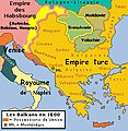
AtlBalk1600.jpg 318 × 327; 171 KB
-
Balkans 1265-es.svg 1,418 × 1,431; 1.39 MB
-
Balkans 1265.jpg 600 × 422; 75 KB
-
Balkans1355.png 551 × 352; 62 KB
-
Bulgaria Ivan Alexander (1331-1371) es.svg 2,446 × 2,000; 182 KB
-
Bulgaria Ivan Alexander (1331-1371)-ar.svg 391 × 319; 305 KB
-
Bulgaria Ivan Alexander (1331-1371)-hu.svg 391 × 319; 195 KB
-
Bulgaria Ivan Alexander (1331-1371)-pt.svg 391 × 319; 160 KB
-
Bulgaria Ivan Alexander (1331-1371)-zh.svg 391 × 319; 164 KB
-
Bulgaria Ivan Alexander (1331-1371).svg 391 × 319; 347 KB
-
Bulgaria-Theodore Svetoslav-es.svg 1,185 × 1,036; 1.09 MB
-
Bulgaria-Theodore Svetoslav-fr.svg 3,280 × 2,473; 527 KB
-
Bulgaria-Theodore Svetoslav-pt.svg 2,750 × 2,341; 582 KB
-
Bulgaria-Theodore Svetoslav.png 1,853 × 1,993; 1.57 MB
-
ByzantineEmpire1265 el.svg 1,708 × 816; 554 KB
-
ByzantineEmpire1265-el.svg 1,708 × 816; 549 KB
-
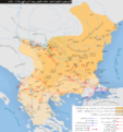
Campaigns of Ivan Assen II-ar.png 5,165 × 5,503; 5.41 MB
-
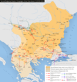
Campaigns of Ivan Assen II.png 2,156 × 2,297; 1.3 MB
-
Daakiansodat.png 936 × 498; 462 KB
-
Danubian Principalities 1800 es.svg 551 × 387; 381 KB
-
Danubian Principalities 1800 no.svg 549 × 386; 89 KB
-
Danubian Principalities 1800.svg 549 × 386; 89 KB
-
Danubian Principalities basic locator map, 1861, with counties.svg 800 × 600; 38 KB
-
Fiefs wallachia.png 1,084 × 746; 356 KB
-
Galicia1836.gif 658 × 806; 318 KB
-
Greater Wallachia.PNG 301 × 224; 46 KB
-
Greater Wallachia.svg 1,958 × 1,380; 1.38 MB
-
Havasalfold.gif 297 × 215; 9 KB
-
Hrizea's revolts in Wallachia.svg 2,623 × 1,424; 1.59 MB
-
Industry in the Danubian Principalities before 1800.svg 5,307 × 5,022; 303 KB
-
JudeteWallachia.png 865 × 510; 54 KB
-
Judetul Saac 1601-1718.svg 2,230 × 1,100; 1.39 MB
-
Lesser Wallachia.PNG 301 × 224; 47 KB
-
Lesser Wallachia.svg 1,958 × 1,380; 1.38 MB
-
Map of the Holy League in 1595.svg 1,140 × 990; 525 KB
-
Map of Turkey in Europe, Greece and the Balkans.png 1,209 × 879; 2.3 MB
-
Marii.svg 1,052 × 790; 104 KB
-
Mihai 1600 es.svg 551 × 387; 457 KB
-
Mihai 1600-ar.png 587 × 413; 79 KB
-
Muntenia.png 283 × 214; 11 KB
-
Muntenia.svg 1,958 × 1,380; 1.38 MB
-
MunteniaVoevodatul.jpg 533 × 247; 172 KB
-
Ottoman invasion of Wallachia, 1821-es.svg 1,493 × 1,000; 1.79 MB
-
Ottoman invasion of Wallachia, 1821.svg 960 × 643; 2.04 MB
-
Pitesti, Curtea de Arges, Campulung (Cantacuzino map).PNG 519 × 431; 507 KB
-
Postelnic Leca's domains in Wallachia, 1616.svg 1,365 × 866; 836 KB
-
Principate Judete 1800.jpg 1,249 × 1,024; 616 KB
-
Raiale sec 17-18-es.svg 2,500 × 2,200; 2.46 MB
-
Raiale sec 17-18.svg 2,500 × 2,200; 1.9 MB
-
Roemenië 1600.png 360 × 284; 37 KB
-
Rom1793-1812 fr2.png 588 × 413; 100 KB
-
Rom1793-1812.png 587 × 413; 78 KB
-
Roman Byzantine Gothic Walls Romania Plain.svg 1,500 × 1,300; 1,005 KB
-
Roman Gothic Walls Romania Plain-pt.svg 512 × 444; 131 KB
-
Roman Gothic Walls Romania Plain.svg 1,500 × 1,300; 384 KB
-
Romania 1600.png 367 × 285; 27 KB
-
Romania 1938 - Arges.svg 1,052 × 790; 104 KB
-
Romania 1938 - Dunarii.svg 1,052 × 790; 104 KB
-
Romania1484-1672.jpg 587 × 413; 77 KB
-
Romania1673-1713-es.svg 551 × 387; 432 KB
-
Romania1673-1713.jpg 587 × 413; 92 KB
-
Romania1713-1812.jpg 587 × 413; 81 KB
-
Romania1812-1829.jpg 588 × 413; 77 KB
-
Romania1829-56.jpg 588 × 413; 70 KB
-
RomanianPrincipalities1812-1829.jpg 588 × 413; 78 KB
-
RomanianPrincipalities1848.jpg 588 × 413; 72 KB
-
Romantart.png 588 × 413; 44 KB
-
Románia területe 1713-1812.svg 551 × 387; 168 KB
-
România Judeţe.png 800 × 571; 132 KB
-
Rumanía1713-1812.svg 551 × 387; 168 KB
-
Salt trade in Wallachia (16th–19th centuries).svg 1,003 × 759; 1.87 MB
-
Tara Fagarasului.svg 801 × 486; 305 KB
-
Tara Rumaneasca map.png 866 × 510; 223 KB
-
Tarile romanesti 271 - 1247.jpg 536 × 473; 137 KB
-
Tarile romanesti in timpul lui Mircea cel Batran.jpg 573 × 477; 157 KB
-
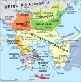
The-Balkans-in-1355-es.svg 882 × 703; 1.19 MB
-
The-Balkans-in-1355-pt.svg 882 × 703; 692 KB
-
The-Balkans-in-1355.png 888 × 729; 408 KB
-
TR XIII - XVI copy.jpg 7,000 × 4,732; 18.24 MB
-
ValachiaPhysical.jpg 555 × 229; 158 KB
-
Vladimirescu's uprising, 1821-es.svg 1,253 × 1,000; 1.53 MB
-
Vladimirescu's uprising, 1821.svg 804 × 643; 1.68 MB
-
Voivodeship of Wallachia (1789).svg 450 × 456; 792 KB
-
Voivodeship of Wallachia (1812).svg 450 × 456; 585 KB
-
Walachia.png 302 × 225; 12 KB
-
Walachia.svg 1,958 × 1,380; 1.38 MB
-
Wallachia 13-16c-es.svg 900 × 400; 716 KB
-
Wallachia 13-16c.svg 900 × 400; 1.22 MB
-
Wallachia cca1390 fr.svg 812 × 478; 319 KB
-
Wallachia cca1390-es.svg 812 × 478; 555 KB
-
Wallachia cca1390-hu.svg 812 × 478; 355 KB
-
Wallachia cca1390.svg 812 × 478; 319 KB
-
Wallachia Mircea the Elder.png 865 × 510; 59 KB
-
Wallachia voting share, 1857.svg 800 × 406; 266 KB
-
Wallachia-StolnicConstantinCantacuzino.jpg 700 × 362; 45 KB
-
Wallachian revolt of Aslan and Aga Matei, 1630–1632.svg 1,019 × 687; 593 KB
-
White Wallachia (In white) in the Balkan Peninsula.jpg 799 × 694; 434 KB
-
Wołoszczyzna XII-XVI w.svg 900 × 400; 1.22 MB


