Category:Worsthorne
Jump to navigation
Jump to search
English: Worsthorne is a rural village on the eastern outskirts of Burnley in Lancashire, England. The parish of Worsthorne-with-Hurstwood has a population of 2,986. The village was known as Worthesthorn in 1202, which means thorn tree of a man named 'Weorth'.

village in United Kingdom  | |||||
| Upload media | |||||
| Instance of | |||||
|---|---|---|---|---|---|
| Location | Worsthorne-with-Hurstwood, Burnley, Lancashire, North West England, England | ||||
 | |||||
Subcategories
This category has the following 3 subcategories, out of 3 total.
B
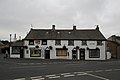
- Bay Horse Inn, Worsthorne (3 F)
C
- Crooked Billet, Worsthorne (4 F)
Media in category "Worsthorne"
The following 31 files are in this category, out of 31 total.
-
 Approaching Worsthorne - geograph.org.uk - 1527567.jpg 640 × 480; 82 KB
-
 Brownside Road, Worsthorne - geograph.org.uk - 1527582.jpg 640 × 480; 64 KB
-
 BurnleyBUA2011.png 1,101 × 816; 827 KB
-
 Gorple Mill, Worsthorne - geograph.org.uk - 770601.jpg 640 × 480; 225 KB
-
 JacksonsHouseWorsthorne(JohnIllingworth)Feb2007.jpg 640 × 480; 143 KB
-
 New houses on Lennox Street, Worsthorne - geograph.org.uk - 770591.jpg 640 × 480; 185 KB
-
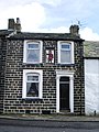 No 8 Ormerod Street, Worsthorne - geograph.org.uk - 772007.jpg 480 × 640; 179 KB
-
 No 8 Ormerod Street, Worsthorne, Detail - geograph.org.uk - 772047.jpg 462 × 618; 174 KB
-
 Ormerod Street Worsthorne - geograph.org.uk - 1235043.jpg 640 × 426; 56 KB
-
 Road junction - geograph.org.uk - 770602.jpg 640 × 480; 222 KB
-
 Water Street, Worsthorne - geograph.org.uk - 770600.jpg 640 × 480; 188 KB
-
 Water Street, Worsthorne, Lancashire - geograph.org.uk - 553599.jpg 640 × 427; 90 KB
-
 Former Wesleyan Church, Worsthorne - geograph.org.uk - 771674.jpg 640 × 480; 204 KB
-

-
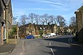
 Worsthorne village - geograph.org.uk - 657441.jpg 640 × 427; 42 KB
-
 Worsthorne Village - geograph.org.uk - 685643.jpg 640 × 413; 58 KB
-
 Worsthorne Village - geograph.org.uk - 685684.jpg 640 × 427; 77 KB
-
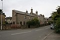
 Worsthorne Village School - geograph.org.uk - 685624.jpg 640 × 427; 78 KB
-
 Annarly Fold, Worsthorne, Lancashire - geograph.org.uk - 553572.jpg 640 × 427; 70 KB
-
 Brownside Road Worsthorne - geograph.org.uk - 682308.jpg 640 × 427; 71 KB
-
 Church Square, Worsthorne - geograph.org.uk - 771665.jpg 640 × 480; 225 KB
-
 Church Square, Worsthorne - geograph.org.uk - 771670.jpg 640 × 480; 214 KB
-
 Church Square, Worsthorne, Lancashire - geograph.org.uk - 553555.jpg 640 × 427; 61 KB
-

-
 Day Nursery, Worsthorne, Lancashire - geograph.org.uk - 554013.jpg 640 × 427; 112 KB
-
 High Ridehalgh - geograph.org.uk - 102196.jpg 640 × 426; 157 KB
-

-
-
 Worsthorne Village - geograph.org.uk - 685566.jpg 640 × 427; 52 KB
-
 Worsthorne Village - geograph.org.uk - 685636.jpg 640 × 413; 57 KB
-
 Worsthorne Village - geograph.org.uk - 685671.jpg 640 × 427; 97 KB


Feb2007.jpg)


