Category:Borough of Burnley
Jump to navigation
Jump to search
local government district of Lancashire, England  Neuadd y Dref, Burnley  | |||||
| Upload media | |||||
| Instance of | |||||
|---|---|---|---|---|---|
| Location | Lancashire, North West England, England | ||||
| Capital | |||||
| Legislative body |
| ||||
| Inception |
| ||||
| Population |
| ||||
| Area |
| ||||
| official website | |||||
 | |||||
Deutsch: Burnley ist ein Verwaltungsbezirk mit dem Status eines Borough in der Grafschaft Lancashire in England. Verwaltungssitz ist die gleichnamige Stadt Burnley, in der mehr als vier Fünftel der Bevölkerung lebt. Darüber hinaus umfasst der Bezirk mehrere Dörfer, von denen Padiham das größte ist. Burnley ist eine Hochburg der rechtsextremen British National Party. (→Burnley (Borough))
English: Burnley is a local government district of Lancashire, England, with the status of a Non-metropolitan district and borough. It has an area of ), and is named after its largest town, Burnley. The borough is bounded by Hyndburn, Ribble Valley, Pendle, Rossendale — all in Lancashire — and the borough of Calderdale — in West Yorkshire. It is governed by Burnley Borough Council, which has been controlled by the Liberal Democrats since 2008. (→Burnley (borough))
Italiano: Burnley è un distretto con status di borough del Lancashire, Inghilterra, Regno Unito, con sede nella città omonima. (→Burnley (borough))
Nederlands: Burnley is een district in het graafschap Lancashire en telt 89.542 inwoners. De oppervlakte bedraagt 110,7 km². Hoofdplaats is Burnley. (→Burnley (district))
Norsk bokmål: Burnley er et administrativt distrikt i Lancashire, England. Det har navn etter administrasjonssenteret, byen Burnley. (→Burnley (distrikt))
Svenska: Burnley är ett distrikt i Lancashire i England i Storbritannien. Den största staden är Burnley. (→Burnley (distrikt))
Subcategories
This category has the following 14 subcategories, out of 14 total.
B
C
D
H
I
P
W
Media in category "Borough of Burnley"
The following 200 files are in this category, out of 949 total.
(previous page) (next page)-

-

-
-

-

-

-

-

-

-

-
 "Kwik-Fit" Active Way, Burnley, Lancashire BB11 1BS - geograph.org.uk - 2332491.jpg 3,069 × 1,339; 784 KB
-
 "Ladies" Yorkshire Street, Burnley - geograph.org.uk - 1919145.jpg 1,224 × 1,632; 476 KB
-

-
-

-

-

-

-

-

-

-
-

-
-

-

-
 1 Mile to Burnley - geograph.org.uk - 4506210.jpg 2,848 × 2,134; 1.66 MB
-
 2021 Burnley election map changes.png 1,838 × 863; 178 KB
-
 2021 Burnley Election Map.png 2,171 × 1,326; 369 KB
-
 A Corner of Thompson Park, Burnley - geograph.org.uk - 4979145.jpg 1,600 × 1,067; 616 KB
-
 A fishing pond - geograph.org.uk - 4972217.jpg 4,589 × 2,826; 7.92 MB
-
 A path with a view over Burnley - geograph.org.uk - 4949300.jpg 4,592 × 3,056; 7.45 MB
-
 A Sharp Bend on the Leeds Liverpool Canal - geograph.org.uk - 5303796.jpg 5,184 × 3,456; 4.45 MB
-

-
 A646 nearing Coal Clough Lane junction - geograph.org.uk - 6308101.jpg 1,024 × 768; 113 KB
-
 A646 nears the A679 at Rose Grove - geograph.org.uk - 6308124.jpg 1,024 × 769; 138 KB
-
 A646 Rossendale Road - geograph.org.uk - 4394482.jpg 640 × 482; 306 KB
-
 A646 Rossendale Road - geograph.org.uk - 6308089.jpg 1,024 × 769; 87 KB
-
 A646, Rossendale Road - geograph.org.uk - 4394861.jpg 640 × 480; 310 KB
-
 A671, Todmorden Road - geograph.org.uk - 2104566.jpg 640 × 480; 141 KB
-
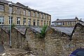
 Abandoned Shops, Branch Road, Burnley - geograph.org.uk - 1920073.jpg 1,632 × 1,224; 529 KB
-
 Access road for the leisure centre - geograph.org.uk - 4958838.jpg 4,586 × 2,606; 7.5 MB
-
 Access Track behind Houses on Manchester Road, Burnley - geograph.org.uk - 5302813.jpg 5,184 × 3,456; 7.53 MB
-
 Accrington Road (A679) - geograph.org.uk - 5229722.jpg 640 × 480; 131 KB
-
 Accrington Road (A679) - geograph.org.uk - 5252245.jpg 2,848 × 2,136; 1.27 MB
-
 Accrington Road, Burnley - geograph.org.uk - 2041680.jpg 1,627 × 982; 511 KB
-

-
 Alley off Bristol Street, Burnley - geograph.org.uk - 5302716.jpg 5,184 × 3,456; 7.12 MB
-
 Alleyway between Cog Lane and Bristol Street, Burnley - geograph.org.uk - 5302713.jpg 5,184 × 3,456; 6.22 MB
-

-
 An old mill, Burnley - geograph.org.uk - 6645112.jpg 640 × 427; 94 KB
-
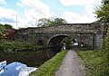
 Approaching Bridge 130 - geograph.org.uk - 4668177.jpg 3,264 × 2,448; 1.56 MB
-
 Approaching the end of Casterton Avenue - geograph.org.uk - 4743757.jpg 6,000 × 4,000; 3.61 MB
-
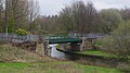
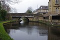
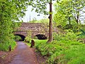 Aqueduct over the River Brun, Burnley, Lancashire - geograph.org.uk - 4506101.jpg 2,848 × 2,134; 1.96 MB
-
 Arncliffe Road - geograph.org.uk - 4980334.jpg 1,600 × 1,067; 327 KB
-
 Ash Street, Burnley, Lancashire - geograph.org.uk - 1919191.jpg 1,632 × 1,224; 493 KB
-
 Athletic Street, Burnley - geograph.org.uk - 2690414.jpg 3,872 × 2,592; 4.28 MB
-
 Athletic Street, Burnley - geograph.org.uk - 2690427.jpg 3,872 × 2,592; 4.24 MB
-
 Awaiting Demolition, Duke Bar - geograph.org.uk - 1908315.jpg 1,632 × 1,224; 568 KB
-
 Back Alley behind Crowther Street - geograph.org.uk - 4980212.jpg 1,600 × 1,067; 554 KB
-
 Back Alley behind Reed Street - geograph.org.uk - 4980209.jpg 1,600 × 1,067; 509 KB
-
 Back Alley between Cromwell Street and Gordon Street - geograph.org.uk - 4979458.jpg 1,600 × 1,067; 581 KB
-
 Back Alley leading off Gordon Street - geograph.org.uk - 4979447.jpg 5,184 × 3,456; 7.36 MB
-

-
 Bank Hall Arm canal basin - geograph.org.uk - 4590323.jpg 640 × 425; 192 KB
-

-
-
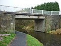
 Barden Lane Bridge - geograph.org.uk - 4959836.jpg 4,509 × 2,477; 6.63 MB
-
 Barden Lane Bridge - geograph.org.uk - 4959869.jpg 4,261 × 3,000; 7.89 MB
-

-
 Barden Lane, Burnley - geograph.org.uk - 1908293.jpg 1,224 × 1,632; 962 KB
-
 Barden Lane, Burnley - geograph.org.uk - 1908319.jpg 1,629 × 1,121; 521 KB
-
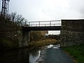
 Barden Railway Bridge - geograph.org.uk - 4573264.jpg 2,560 × 1,920; 2.63 MB
-
 Barden Railway Bridge No 132A - geograph.org.uk - 5953352.jpg 640 × 405; 83 KB
-
 Barges on the Leeds-Liverpool Canal, Burnley - geograph.org.uk - 1908321.jpg 1,630 × 976; 397 KB
-
 Basnett Street - geograph.org.uk - 5040361.jpg 640 × 480; 67 KB
-
 Beer mecca, Moorhouse's Brewery - geograph.org.uk - 2211445.jpg 3,872 × 2,438; 1.8 MB
-
 Behind the houses in Burnley - geograph.org.uk - 4238833.jpg 3,646 × 2,604; 1.93 MB
-
 Belle Vue Mill - geograph.org.uk - 5815649.jpg 1,280 × 850; 602 KB
-
 Belvedere Road in Burnley - geograph.org.uk - 1954921.jpg 2,100 × 1,335; 288 KB
-
 Belvedere Road, Burnley - geograph.org.uk - 5042097.jpg 640 × 480; 78 KB
-
 Benchmark on former Healey Wood School - geograph.org.uk - 2884180.jpg 3,498 × 5,248; 4.17 MB
-

-
 Beverley Street, Burnley - geograph.org.uk - 2393790.jpg 640 × 480; 124 KB
-
 Boating lake, Thompson Park - geograph.org.uk - 4590346.jpg 640 × 566; 294 KB
-
 Bobby's Convenience Store - geograph.org.uk - 5230098.jpg 640 × 480; 63 KB
-
 Bootleggers and Roy's Jewellers (geograph 7258620).jpg 1,920 × 1,664; 2.4 MB
-
 Branch Road, Burnley Wood - geograph.org.uk - 2647729.jpg 640 × 480; 99 KB
-
 Branch Road, Burnley Wood, Burnley, Lancashire - geograph.org.uk - 1920074.jpg 1,632 × 1,224; 889 KB
-
 Branch Road, Burnley Wood, Burnley, Lancashire - geograph.org.uk - 2568667.jpg 3,063 × 1,322; 474 KB
-
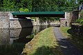
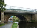
 Bridge 122C on the Leeds Liverpool Canal - geograph.org.uk - 5303943.jpg 5,184 × 3,456; 5.85 MB
-
-
 Bridge 126A, Leeds and Liverpool Canal - geograph.org.uk - 5814688.jpg 1,280 × 850; 680 KB
-
 Bridge 126A, Lowerhouse Lane - geograph.org.uk - 2158651.jpg 800 × 600; 275 KB
-
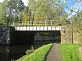
 Bridge 129, Leeds and Liverpool Canal - geograph.org.uk - 5814318.jpg 1,280 × 850; 554 KB
-
 Bridge 129A, Leeds and Liverpool Canal - geograph.org.uk - 5746225.jpg 1,280 × 720; 528 KB
-
 Bridge 129A, Leeds and Liverpool Canal - geograph.org.uk - 5814295.jpg 1,280 × 850; 708 KB
-
 Bridge 129A, Leeds and Liverpool Canal - geograph.org.uk - 5814299.jpg 1,280 × 850; 657 KB
-
 Bridge 129A, Leeds and Liverpool Canal - geograph.org.uk - 5814309.jpg 1,280 × 1,280; 911 KB
-
 Bridge 129A, Leeds ^ Liverpool Canal - geograph.org.uk - 3709593.jpg 1,600 × 1,200; 999 KB
-
 Bridge 129B, Leeds and Liverpool Canal - geograph.org.uk - 5815647.jpg 1,280 × 850; 654 KB
-
 Bridge 131, Leeds and Liverpool Canal - geograph.org.uk - 5743285.jpg 1,280 × 850; 522 KB
-
 Bridge 131A, Leeds and Liverpool Canal - geograph.org.uk - 5743290.jpg 1,280 × 850; 538 KB
-

-
 Bridge 131B, Leeds and Liverpool Canal - geograph.org.uk - 5743295.jpg 1,280 × 850; 524 KB
-

-
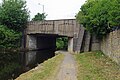
 Bridge 132A, Leeds and Liverpool Canal - geograph.org.uk - 5743298.jpg 1,280 × 850; 630 KB
-

-

-
 Bridge over M65 - Burnley - geograph.org.uk - 2285719.jpg 3,976 × 2,162; 1.7 MB
-
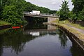
 Bridge over the River Calder - geograph.org.uk - 4680681.jpg 6,000 × 4,000; 5.17 MB
-
 Bridge to Springwood House Farm over the M65 - geograph.org.uk - 4248108.jpg 1,500 × 999; 101 KB
-

-

-
-
-

-

-
 Bridge ^129B Westgate over the L^L Canal - geograph.org.uk - 2103517.jpg 800 × 600; 216 KB
-
-

-

-
 Bridge ^130D over the L^L Canal - geograph.org.uk - 2103558.jpg 800 × 600; 312 KB
-
-

-
-

-

-
-

-
 Bridge ^134 is two bridges side by side - geograph.org.uk - 2104133.jpg 800 × 600; 227 KB
-
 Brooklands Road, Burnley - geograph.org.uk - 2332259.jpg 3,069 × 1,499; 680 KB
-

-
 Brunshaw Golf Course - geograph.org.uk - 4980326.jpg 1,600 × 1,067; 366 KB
-
 Brunshaw Road - geograph.org.uk - 1991064.jpg 612 × 460; 137 KB
-
 Brunshaw Road - geograph.org.uk - 2104555.jpg 640 × 480; 118 KB
-
 Brunshaw Road - geograph.org.uk - 5040463.jpg 640 × 480; 58 KB
-
 Brunshaw Road, Burnley - geograph.org.uk - 2104549.jpg 640 × 480; 197 KB
-
 Brunshaw Road, Pike Hill - geograph.org.uk - 2104543.jpg 640 × 480; 115 KB
-
 Brunswick Street, Burnley Wood - geograph.org.uk - 2647737.jpg 640 × 480; 93 KB
-
 Building Site, Burnley Wood, Burnley - geograph.org.uk - 2568664.jpg 3,072 × 1,536; 770 KB
-
 Building Site, Burnley Wood, Burnley - geograph.org.uk - 2568673.jpg 3,072 × 2,304; 1.23 MB
-
 Building Site, Oxford Road, Burnley Wood, Burnley - geograph.org.uk - 2332295.jpg 3,072 × 2,304; 1.16 MB
-
 Burdett Street, Burnley - geograph.org.uk - 2041678.jpg 1,629 × 850; 387 KB
-
 Burnham Gate, Burnley - geograph.org.uk - 5251348.jpg 640 × 480; 73 KB
-
 Burnley - Bo-Jangles - geograph.org.uk - 2638985.jpg 1,600 × 1,417; 719 KB
-
 Burnley - chimney pots on Hobart Street - geograph.org.uk - 2620197.jpg 1,600 × 1,185; 699 KB
-
 Burnley - footbridge near Finsley Gate - geograph.org.uk - 2637419.jpg 1,600 × 1,194; 719 KB
-
 Burnley - Hammerton Street - geograph.org.uk - 2639271.jpg 1,600 × 1,183; 744 KB
-
 Burnley - Hammerton Street - geograph.org.uk - 2639275.jpg 1,203 × 1,600; 708 KB
-
 Burnley - head post office - geograph.org.uk - 2639284.jpg 640 × 484; 137 KB
-
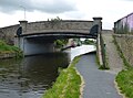
 Burnley - Manchester Road bridge over canal - geograph.org.uk - 2637416.jpg 1,600 × 1,175; 504 KB
-
 Burnley - offices on Grimshaw Street - geograph.org.uk - 2639294.jpg 1,185 × 1,600; 608 KB
-
 Burnley - Technical Institute - geograph.org.uk - 2637987.jpg 1,163 × 1,600; 589 KB
-
 Burnley Ambulance Station - geograph.org.uk - 5923176.jpg 640 × 410; 56 KB
-
 Burnley Barracks Railway Bridge - geograph.org.uk - 4376927.jpg 640 × 481; 339 KB
-
 Burnley Canal Festival - geograph.org.uk - 5096239.jpg 640 × 420; 156 KB
-
 Burnley Council 2015.svg 360 × 185; 3 KB
-
 Burnley Council 2016.svg 360 × 185; 3 KB
-
 Burnley Council 2018.svg 360 × 185; 3 KB
-
 Burnley Council 2019.svg 360 × 185; 3 KB
-
 Burnley Council 2021.svg 360 × 185; 4 KB
-
 Burnley Council Election Results Map 2003.svg 1,425 × 1,223; 302 KB
-
 Burnley Council Election Results Map 2010.svg 1,425 × 1,223; 298 KB
-
 Burnley Council Election Results Map 2012.svg 1,425 × 1,223; 296 KB
-
 Burnley Council Election Results Map 2016.svg 1,425 × 1,223; 236 KB
-
 Burnley Council Election Results Map 2018.svg 1,425 × 1,223; 182 KB
-
 Burnley Council Election Results Map 2019.svg 1,425 × 1,223; 296 KB
-
 Burnley Council Election Results Map 2021.svg 1,425 × 1,223; 277 KB
-
 Burnley Council Election Results Map 2022.svg 1,425 × 1,223; 277 KB
-
 Burnley Crematorium chapel - geograph.org.uk - 2211338.jpg 3,872 × 2,592; 2.55 MB
-
 Burnley Cricket Club - Entrance - geograph.org.uk - 6138144.jpg 1,200 × 1,600; 474 KB
-
 Burnley Cricket Club - geograph.org.uk - 5040425.jpg 640 × 480; 56 KB
-
 Burnley Cricket Ground - geograph.org.uk - 3920606.jpg 1,800 × 1,052; 407 KB
-
 Burnley Cricket Ground - geograph.org.uk - 4506139.jpg 4,617 × 1,827; 1,003 KB
-
-
 Burnley Fire Station - geograph.org.uk - 1991081.jpg 640 × 449; 97 KB
-
 Burnley Gasometer - geograph.org.uk - 4376442.jpg 640 × 480; 349 KB
-
 Burnley Market Hall - geograph.org.uk - 5612912.jpg 4,352 × 2,557; 1.9 MB
-
 Burnley Public Library - geograph.org.uk - 4668182.jpg 3,264 × 2,448; 1.98 MB
-
 Burnley Road, Habergham - geograph.org.uk - 2717955.jpg 3,872 × 2,592; 3.23 MB
-
 Burnley Telephone Exchange - geograph.org.uk - 2332484.jpg 3,066 × 2,103; 1,001 KB
-
 Burnley Way near Whittlefield - geograph.org.uk - 5302016.jpg 5,184 × 3,456; 4.39 MB
-
 Burnley Way, Leeds and Liverpool Canal - geograph.org.uk - 4349474.jpg 640 × 480; 283 KB
-
 Burnley Wharf - geograph.org.uk - 4572734.jpg 2,496 × 1,832; 2.29 MB
-
 Burnley Wharf - geograph.org.uk - 4750189.jpg 1,280 × 851; 353 KB
-
 Burnley Wharf - geograph.org.uk - 6645358.jpg 640 × 427; 75 KB
-
 Burnley Wharf Bridge No 130 - geograph.org.uk - 5939161.jpg 640 × 441; 65 KB
-
 Burnley Wharf, Leeds and Liverpool Canal - geograph.org.uk - 4350912.jpg 640 × 480; 255 KB
-
 Burnley Wharf, Leeds and Liverpool Canal - geograph.org.uk - 5096234.jpg 640 × 425; 156 KB
-
 Burnley Wood - geograph.org.uk - 2103086.jpg 2,048 × 1,536; 1.47 MB
-
 Burnley Wood - geograph.org.uk - 2647813.jpg 640 × 480; 111 KB
-
 Burnley Wood - geograph.org.uk - 3292498.jpg 640 × 480; 105 KB
-
-

-
 Burnley Wood from the railway - geograph.org.uk - 3414487.jpg 3,264 × 2,448; 1.83 MB
-
 Burnley Wood Training ^ Community Centre - geograph.org.uk - 2647811.jpg 640 × 480; 108 KB
-
 Burnley, Gannow Lane - geograph.org.uk - 4374985.jpg 640 × 480; 333 KB
-
 Burnley, Harold Avenue - geograph.org.uk - 4394859.jpg 640 × 480; 320 KB
-
 Burnley, Plover Street - geograph.org.uk - 4375138.jpg 640 × 480; 303 KB


_170_St_James_Street,_Burnley,_Lancashire_BB11_1NR_-_geograph.org.uk_-_2332487.jpg)


_-_geograph.org.uk_-_5229722.jpg)
_-_geograph.org.uk_-_5252245.jpg)


.jpg)


