Category:Worsthorne-with-Hurstwood
Jump to navigation
Jump to search
English: Worsthorne-with-Hurstwood is a civil parish in the borough of Burnley, in Lancashire, England. It is situated on the eastern outskirts of Burnley.
Polski: Worsthorne-with-Hurstwood – civil parish w Anglii, w Lancashire, w dystrykcie Burnley. W 2011 civil parish liczyła 2963 mieszkańców.

civil parish in Burnley, Lancashire, England, UK  | |||||
| Upload media | |||||
| Instance of | |||||
|---|---|---|---|---|---|
| Location | Burnley, Lancashire, North West England, England | ||||
| Population |
| ||||
 | |||||
Subcategories
This category has the following 7 subcategories, out of 7 total.
B
- Brownside (13 F)
C
- Cant Clough Reservoir (18 F)
H
- Hurstwood Reservoir (17 F)
L
- Lea Green Reservoir (13 F)
S
- Swinden Reservoir (2 F)
W
Media in category "Worsthorne-with-Hurstwood"
The following 200 files are in this category, out of 298 total.
(previous page) (next page)-
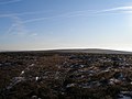
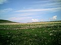
 A Carpet of Cotton Grass - geograph.org.uk - 3543754.jpg 4,320 × 3,240; 4.32 MB
-
 A Field to the North of Brownside - geograph.org.uk - 1535504.jpg 640 × 480; 104 KB
-
 Abandoned Motor Roller on Slipper Hill - geograph.org.uk - 3542035.jpg 4,320 × 3,240; 3.54 MB
-
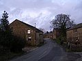
 Approaching Worsthorne - geograph.org.uk - 1527567.jpg 640 × 480; 82 KB
-
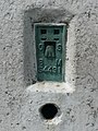 Bench mark on the triangulation pillar on Hoof Stones Height - geograph.org.uk - 2454459.jpg 1,500 × 2,000; 1.03 MB
-
 Black Clough - geograph.org.uk - 1233579.jpg 640 × 478; 115 KB
-
 Black Clough - geograph.org.uk - 1233590.jpg 640 × 479; 58 KB
-
 Black Hameldon - geograph.org.uk - 118944.jpg 1,024 × 683; 184 KB
-
 Black Hameldon - northern summit^ - geograph.org.uk - 2767929.jpg 3,072 × 2,304; 1.14 MB
-
 Black Hameldon towards Hoof Stones Height - geograph.org.uk - 2767932.jpg 3,072 × 2,304; 1.1 MB
-
 Bottin Farms - geograph.org.uk - 2755803.jpg 3,072 × 2,304; 1.14 MB
-
 Boundary Fence on Hoof Stones Height - geograph.org.uk - 3543725.jpg 4,320 × 3,240; 3.94 MB
-
 Boundary Stone - geograph.org.uk - 2454474.jpg 1,533 × 2,000; 1.34 MB
-
 Boundary Stone On Hameldon - geograph.org.uk - 3400365.jpg 3,072 × 2,304; 5.7 MB
-
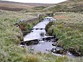
 Bridge at Ram's Clough - geograph.org.uk - 924755.jpg 640 × 480; 99 KB
-

-
 Bridleway above Rams Clough - geograph.org.uk - 2823498.jpg 640 × 480; 48 KB
-
 Brownside Mill - geograph.org.uk - 678465.jpg 640 × 427; 80 KB
-
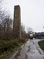 Brownside Mill, Chimney - geograph.org.uk - 2192859.jpg 480 × 640; 83 KB
-
 Burnley Way north of Hurstwood Lane - geograph.org.uk - 5517104.jpg 1,600 × 1,200; 529 KB
-

-
 Cant Clough - geograph.org.uk - 674429.jpg 640 × 427; 64 KB
-
 Cant Clough Farm - geograph.org.uk - 2216388.jpg 3,872 × 2,592; 4.74 MB
-
 Cant Clough Farm - geograph.org.uk - 659261.jpg 640 × 427; 35 KB
-
 Cant Clough Reservoir - geograph.org.uk - 3543986.jpg 4,320 × 3,240; 2.76 MB
-
 Cant Clough Reservoir - geograph.org.uk - 4413492.jpg 5,093 × 3,147; 1.55 MB
-
 Cant Clough Reservoir - geograph.org.uk - 6625037.jpg 6,000 × 4,000; 1.71 MB
-
 Cant Clough Reservoir Dam - geograph.org.uk - 3546467.jpg 4,320 × 3,240; 4.03 MB
-
 Cant Clough Reservoir Valve House - geograph.org.uk - 2946138.jpg 640 × 480; 52 KB
-
 Cant Clough Reservoir, the north-west corner - geograph.org.uk - 3590761.jpg 3,264 × 2,448; 2.22 MB
-
 Church at Worsthorne - geograph.org.uk - 3920605.jpg 1,800 × 1,197; 1.09 MB
-
 Confluence of Hurstwood Brook and Rock Water, forming the River Brun.jpg 640 × 427; 150 KB
-
 Corner of the forest - geograph.org.uk - 2200872.jpg 3,676 × 2,494; 4.95 MB
-
-
 Delf Hill - geograph.org.uk - 4413619.jpg 4,773 × 2,854; 1.75 MB
-
 Delf Hill Quarries - geograph.org.uk - 4979709.jpg 1,600 × 1,200; 294 KB
-
 Descending off Black Hameldon - geograph.org.uk - 3543782.jpg 4,320 × 3,240; 3.78 MB
-
 Direction Sign – Signpost at Pike Hill - geograph.org.uk - 6679744.jpg 472 × 880; 135 KB
-
 Direction Sign – Signpost in Worsthorne - geograph.org.uk - 6687893.jpg 482 × 929; 121 KB
-
 Direction Sign – Signpost in Worsthorne - geograph.org.uk - 6687905.jpg 684 × 1,446; 330 KB
-

-

-
 Drystone wall at the east end of Cant Clough Reservoir - geograph.org.uk - 3639809.jpg 4,320 × 3,240; 4.64 MB
-
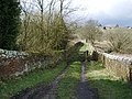
 Entrance to Rowley Hall - geograph.org.uk - 1226548.jpg 640 × 480; 132 KB
-

-
 Extwistle Road - geograph.org.uk - 642953.jpg 640 × 427; 73 KB
-
 Extwistle Road by Bottin Farms (geograph 2206788).jpg 3,872 × 2,592; 2.9 MB
-
 Fields near Hurstwood - geograph.org.uk - 1527661.jpg 640 × 480; 65 KB
-
 Filling Cant Clough Reservoir - geograph.org.uk - 3639793.jpg 4,320 × 3,240; 4.93 MB
-
 Foggy day on Gorple Road - geograph.org.uk - 5616986.jpg 1,630 × 1,222; 339 KB
-
 Footbridge over the River Brun - geograph.org.uk - 1224059.jpg 640 × 480; 137 KB
-

-
 Footpath and track to Lee Green Reservoir - geograph.org.uk - 772075.jpg 640 × 480; 213 KB
-

-
 Footpath heading North towards Swinden Reservoirs - geograph.org.uk - 3542053.jpg 4,320 × 3,240; 3.11 MB
-
 Footpath leaving Extwistle Road - geograph.org.uk - 2206790.jpg 3,872 × 2,592; 2.85 MB
-
 Footpath to Houghtons Farm - geograph.org.uk - 1220781.jpg 640 × 426; 67 KB
-
 Footpath to Swinden - geograph.org.uk - 2192868.jpg 640 × 480; 108 KB
-
 Footpath to Swinden Reservoir.jpg 640 × 480; 172 KB
-
 Footpath, Rowley Park - geograph.org.uk - 1224048.jpg 640 × 480; 127 KB
-
 Footpath, Rowley Park - geograph.org.uk - 1226462.jpg 640 × 480; 131 KB
-

-

-

-
 Foxstones Bridge, near Hurstwood - geograph.org.uk - 5517120.jpg 1,600 × 1,200; 954 KB
-
 Gate and stile - geograph.org.uk - 772057.jpg 640 × 480; 157 KB
-
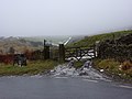
 Gate on Gorple Road - geograph.org.uk - 1528873.jpg 640 × 480; 93 KB
-
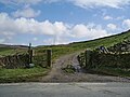
 Gate on Pennine Bridleway - geograph.org.uk - 1270746.jpg 640 × 480; 79 KB
-
 Gorple Road - geograph.org.uk - 1233630.jpg 640 × 427; 87 KB
-
 Gorple Road - geograph.org.uk - 924744.jpg 640 × 480; 102 KB
-
 Gorple Road becomes a track as it leaves Worsthorne - geograph.org.uk - 5867467.jpg 4,000 × 3,000; 2.94 MB
-
 Gorple Road near Ben Edge - geograph.org.uk - 2823490.jpg 640 × 480; 67 KB
-
 Gorple Road near Brown Edge - geograph.org.uk - 2823468.jpg 640 × 480; 46 KB
-
 Gorple Road, head of Rams Clough - geograph.org.uk - 1256607.jpg 640 × 480; 61 KB
-
 Gorple Road, Worsthorne - geograph.org.uk - 2295567.jpg 2,000 × 1,500; 1.07 MB
-
 Gorple Stones - geograph.org.uk - 118915.jpg 1,024 × 683; 171 KB
-
 Hameldon - geograph.org.uk - 4413625.jpg 5,184 × 3,141; 1.67 MB
-
 Hameldon Moorland - geograph.org.uk - 110904.jpg 640 × 480; 47 KB
-
 Hare Stones - geograph.org.uk - 6464979.jpg 2,592 × 1,944; 1.48 MB
-
 Hazel Edge - geograph.org.uk - 6693454.jpg 1,024 × 576; 201 KB
-
 Heading into the mist - geograph.org.uk - 4181626.jpg 3,264 × 2,448; 2.96 MB
-
 Heading south east on Brunshaw Road - geograph.org.uk - 5040472.jpg 640 × 480; 55 KB
-
 Heckenhurst - geograph.org.uk - 1535493.jpg 640 × 480; 105 KB
-
 High Halstead (geograph 2755793).jpg 3,072 × 2,304; 1.11 MB
-
 High Halstead - geograph.org.uk - 1160702.jpg 640 × 427; 74 KB
-
 Hindle Banks - geograph.org.uk - 4413892.jpg 5,184 × 3,083; 1.92 MB
-
 Hindle Banks - geograph.org.uk - 675305.jpg 640 × 479; 83 KB
-
 Hindle Banks - geograph.org.uk - 682329.jpg 640 × 427; 96 KB
-
 Hoof Stones Height - geograph.org.uk - 3345642.jpg 2,592 × 1,944; 1.09 MB
-
 Hoof Stones Height - geograph.org.uk - 3542969.jpg 4,320 × 3,240; 2.95 MB
-
 Houghton Hag Wood - geograph.org.uk - 1153646.jpg 640 × 426; 88 KB
-
 Hurstwod Brook - geograph.org.uk - 4413898.jpg 5,184 × 3,456; 1.83 MB
-
 Hurstwood - geograph.org.uk - 2200846.jpg 3,872 × 2,592; 1.42 MB
-
 Hurstwood - geograph.org.uk - 3147264.jpg 640 × 480; 191 KB
-
 Hurstwood - geograph.org.uk - 675265.jpg 640 × 479; 119 KB
-
 Hurstwood Brook - geograph.org.uk - 1120390.jpg 480 × 640; 100 KB
-
 Hurstwood Brook - geograph.org.uk - 657413.jpg 640 × 479; 121 KB
-
 Hurstwood Church - geograph.org.uk - 2200838.jpg 3,872 × 2,592; 4.75 MB
-
 Hurstwood Church - geograph.org.uk - 2295580.jpg 2,000 × 1,471; 698 KB
-
 Hurstwood Church and Graveyard - geograph.org.uk - 5867483.jpg 4,000 × 3,000; 3.22 MB
-
 Hurstwood Lane - geograph.org.uk - 5867471.jpg 4,000 × 3,000; 2.86 MB
-
 Hurstwood Lane, Worsthorne - geograph.org.uk - 2338688.jpg 2,000 × 1,500; 659 KB
-
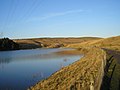 Hurstwood Reservoir - geograph.org.uk - 2763813.jpg 1,600 × 1,200; 456 KB
-
 Hurstwood Reservoir - geograph.org.uk - 3543805.jpg 4,320 × 3,240; 2.24 MB
-
 Hurstwood Reservoir - geograph.org.uk - 4413893.jpg 5,180 × 2,909; 1.84 MB
-
 Hurstwood Reservoir - geograph.org.uk - 4413896.jpg 5,143 × 3,429; 1.65 MB
-
 Hurstwood Reservoir - geograph.org.uk - 6693444.jpg 1,024 × 576; 220 KB
-
 Hurstwood woods - geograph.org.uk - 2763830.jpg 1,600 × 1,200; 359 KB
-
 In Shedden Clough - geograph.org.uk - 5421760.jpg 5,184 × 3,456; 6.4 MB
-

-
 Laurel and Hardy's - geograph.org.uk - 786995.jpg 640 × 480; 197 KB
-

-
 Looking up Hurstwood Brook - geograph.org.uk - 1528867.jpg 640 × 480; 88 KB
-
 Looking West down Gorple Road - geograph.org.uk - 3543791.jpg 4,320 × 3,240; 3.68 MB
-
 Meadowside, Worsthorne - geograph.org.uk - 3139593.jpg 640 × 480; 144 KB
-
 Memorial benches beyond the gate - geograph.org.uk - 2216409.jpg 3,872 × 2,592; 4.27 MB
-
 New house on Buttermere Road - geograph.org.uk - 828884.jpg 640 × 480; 238 KB
-
 Newly-constructed spillway - geograph.org.uk - 4181631.jpg 3,264 × 2,448; 1.62 MB
-

-

-
 Old Hall Square, Worsthorne - geograph.org.uk - 3139591.jpg 640 × 480; 162 KB
-
 On Gorple Road - geograph.org.uk - 1528923.jpg 640 × 480; 74 KB
-
 On the Black Hameldon Ridge - geograph.org.uk - 3543758.jpg 4,320 × 3,240; 3.75 MB
-
 Ormerod Copse - geograph.org.uk - 2200942.jpg 3,872 × 2,592; 1.85 MB
-
 Ormerod Street, Worsthorne - geograph.org.uk - 2298608.jpg 2,000 × 1,277; 544 KB
-
 Outskirts of Hurstwood village - geograph.org.uk - 6693431.jpg 1,024 × 576; 228 KB
-
 Overhead cables near Hurstwood Reservoir - geograph.org.uk - 2200900.jpg 3,872 × 2,592; 1.26 MB
-
 Path leaving the Pennine Bridleway - geograph.org.uk - 2200989.jpg 3,872 × 2,592; 1.8 MB
-
 Path on the Cliviger - Worsthorne boundary - geograph.org.uk - 2453394.jpg 3,072 × 2,304; 3.33 MB
-
 Pendle Hill - geograph.org.uk - 639122.jpg 640 × 427; 57 KB
-
 Pennine Bridleway - geograph.org.uk - 2946144.jpg 640 × 480; 51 KB
-
 Pennine Bridleway - geograph.org.uk - 3706785.jpg 1,600 × 1,200; 440 KB
-

-
 Pennine Bridleway ascending away from Cant Clough Reservoir - geograph.org.uk - 3543851.jpg 4,320 × 3,240; 3.38 MB
-
 Pennine Bridleway near Shedden Heys - geograph.org.uk - 2823441.jpg 640 × 480; 70 KB
-
 Pennine Bridleway on Worsthorne Moor - geograph.org.uk - 3546514.jpg 4,320 × 3,240; 4.95 MB
-
 Pennine Bridleway zigzag - geograph.org.uk - 3706777.jpg 1,600 × 1,200; 458 KB
-
 Picnic tables beside Rowley Lake - geograph.org.uk - 1226452.jpg 640 × 480; 100 KB
-
 Pike Hill - geograph.org.uk - 1117026.jpg 640 × 427; 68 KB
-
 Pike Hill - geograph.org.uk - 1117050.jpg 640 × 427; 82 KB
-
 Pike Hill - geograph.org.uk - 1117089.jpg 640 × 427; 67 KB
-
 Pike Hill Brunshaw Road - geograph.org.uk - 1117055.jpg 640 × 427; 75 KB
-
 Pipeline over River Brun - geograph.org.uk - 1224057.jpg 640 × 480; 116 KB
-
 Ram's Clough - geograph.org.uk - 924768.jpg 640 × 480; 128 KB
-
 Rams Clough - geograph.org.uk - 118923.jpg 640 × 427; 139 KB
-

-
 Rhododendron bushes by the Pennine Bridleway - geograph.org.uk - 2216173.jpg 3,872 × 2,592; 3.36 MB
-
 Ring Stones, Worsthorne.jpg 5,344 × 3,008; 3.96 MB
-
 River Brun from Brownside Bridge - geograph.org.uk - 2192861.jpg 640 × 480; 178 KB
-
 Road going towards Swinden Reservoirs - geograph.org.uk - 2206773.jpg 3,872 × 2,592; 3.28 MB
-
 Road to Brown Edge Farm - geograph.org.uk - 762351.jpg 640 × 480; 164 KB
-
 Road to Cant Clough Reservoir - geograph.org.uk - 1160860.jpg 640 × 427; 64 KB
-
 Road to Hollins - geograph.org.uk - 1652108.jpg 640 × 480; 112 KB
-
 Road to Hollins Hall - geograph.org.uk - 784157.jpg 640 × 480; 153 KB
-
 Road to Saville Green Farm - geograph.org.uk - 762296.jpg 640 × 480; 171 KB
-
 Rowley - geograph.org.uk - 1233657.jpg 640 × 427; 93 KB
-
 Rowley Bridge - geograph.org.uk - 3756975.jpg 1,600 × 1,200; 349 KB
-
 Rowley Colliery.jpg 4,008 × 3,005; 6.63 MB
-
 Rowley Farmland - geograph.org.uk - 1152938.jpg 640 × 426; 86 KB
-
 Rowley Hall - geograph.org.uk - 110930.jpg 640 × 480; 133 KB
-
 Rowley Hall - geograph.org.uk - 1152929.jpg 640 × 426; 122 KB
-
 Rowley Hall, Burnley.jpg 4,008 × 3,005; 4.11 MB
-
 Rowley Lake - geograph.org.uk - 1152912.jpg 640 × 427; 63 KB
-
 Rowley Lake - geograph.org.uk - 1161084.jpg 640 × 479; 54 KB
-
 Rowley Lake - geograph.org.uk - 1226416.jpg 640 × 480; 121 KB
-
 Rowley Lake - geograph.org.uk - 657002.jpg 640 × 479; 85 KB
-
 Rowley Lake - geograph.org.uk - 657020.jpg 640 × 467; 87 KB
-
 Rowley Lake, Burnley - geograph.org.uk - 553501.jpg 640 × 427; 72 KB
-
 Service road for Hurstwood Reservoir - geograph.org.uk - 2947460.jpg 480 × 640; 99 KB
-
 Shedden Brook - geograph.org.uk - 651712.jpg 640 × 427; 65 KB
-
 Shedden Clough Ford - geograph.org.uk - 5479651.jpg 4,032 × 3,024; 4.18 MB
-
 Shedden Heys - geograph.org.uk - 1234868.jpg 640 × 427; 63 KB
-
 Shedden Heys - geograph.org.uk - 695572.jpg 640 × 427; 71 KB
-
 Sheddings, Shedden Clough - geograph.org.uk - 2032663.jpg 2,000 × 1,500; 1.13 MB
-
 Sheddon Heys - geograph.org.uk - 682318.jpg 640 × 427; 59 KB
-
 Sheep and walls above Hurstwood - geograph.org.uk - 2200793.jpg 3,872 × 2,592; 2.22 MB
-
 Sign at Houghton Hagg Wood - geograph.org.uk - 945128.jpg 640 × 480; 107 KB
-
 Sledging at Hurstwood Reservoir - geograph.org.uk - 1161105.jpg 640 × 479; 92 KB
-
 Smallshaw Clough - geograph.org.uk - 1528905.jpg 640 × 480; 88 KB
-
 Snow covered field south of Hollins - geograph.org.uk - 1652105.jpg 640 × 480; 45 KB
-
 Spencer's House, Hurstwood - geograph.org.uk - 6463465.jpg 2,592 × 1,944; 1.65 MB
-
 Spoil heaps at Hindle Banks - geograph.org.uk - 5207025.jpg 1,600 × 1,200; 425 KB
-
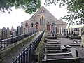
 St John's Church, Worsthorne - geograph.org.uk - 2200099.jpg 3,872 × 2,592; 7.46 MB
-
 Standing stone, Gorple Road - geograph.org.uk - 2307897.jpg 425 × 640; 284 KB
-
 Stone Wall beside Cant Clough Reservoir - geograph.org.uk - 3543997.jpg 4,320 × 3,240; 3.8 MB
-
 StoneCircleWorsthorne(RichardSpencer)Jan2006.jpg 640 × 480; 74 KB
-
 Swinden Bridge Extwistle Road - geograph.org.uk - 675006.jpg 640 × 427; 57 KB
-
 Swinden Bridge Extwistle Road - geograph.org.uk - 675021.jpg 640 × 427; 63 KB
-
 Swinden Reservoir - geograph.org.uk - 4413617.jpg 5,152 × 3,406; 1.54 MB
-
 Swinden Reservoirs - geograph.org.uk - 3542013.jpg 4,320 × 3,240; 2.72 MB
-
 Swinden Water - geograph.org.uk - 1152972.jpg 640 × 427; 145 KB
-
 Swinden Water - geograph.org.uk - 1152995.jpg 640 × 426; 116 KB
-
 Swinden Water - geograph.org.uk - 1153006.jpg 640 × 426; 107 KB
-
 Swinden Water - geograph.org.uk - 4413627.jpg 5,184 × 3,456; 1.68 MB
-
 The bottom of Rams Clough - geograph.org.uk - 2216428.jpg 3,872 × 2,592; 3.89 MB
-
 The dam at Cant Clough Reservoir - geograph.org.uk - 2823446.jpg 640 × 480; 46 KB
-
 The dam at Lee Green Reservoir - geograph.org.uk - 3936160.jpg 1,600 × 1,200; 497 KB
-
 The footpath to Worsthorne leaving Hurstwood Lane - geograph.org.uk - 2200796.jpg 3,872 × 2,592; 1.43 MB
-
 The head of Cant Clough Reservoir - geograph.org.uk - 2216422.jpg 3,872 × 2,592; 2.76 MB
-
 The Lancashire - Yorkshire boundary on Black Hameldon - geograph.org.uk - 2454481.jpg 2,000 × 1,500; 1.2 MB


.jpg)


.jpg)


Jan2006.jpg)


