Category:United Kingdom photographs taken on 2010-02-13
Jump to navigation
Jump to search
| ← | Saturday 13 February 2010 | → | ||
| ← | February 2010 | → | ||

United Kingdom photographs taken on 13 February 2010.
Image files should be categorized here automatically using {{taken on}} template. Direct categorisation is also possible, if automatic is impossible.
Subcategories
This category has the following 2 subcategories, out of 2 total.
C
- Canterbury flash mob 2010 (38 F)
L
Media in category "United Kingdom photographs taken on 2010-02-13"
The following 200 files are in this category, out of 1,226 total.
(previous page) (next page)-
 "Bikus" cycle shop, Bovey Tracey - geograph.org.uk - 1716376.jpg 2,736 × 2,050; 2.17 MB
-
 "Sandhurst" sign, Belfast - geograph.org.uk - 1707068.jpg 640 × 428; 110 KB
-
 "Wemberley.......Wemberley" - geograph.org.uk - 1770078.jpg 640 × 480; 73 KB
-

-
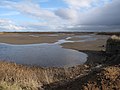 (Former) Brackish Marsh - geograph.org.uk - 1714784.jpg 1,600 × 1,200; 673 KB
-
 1 Quy Road, Lode - geograph.org.uk - 1710856.jpg 640 × 480; 56 KB
-

-
 222001 , Ogston (4353986080).jpg 2,500 × 2,038; 2.78 MB
-
 222020 , Ogston (4354863362).jpg 2,975 × 3,796; 3.2 MB
-
 43357 , Ogston (4353131913).jpg 2,500 × 1,667; 3.78 MB
-

-
 66159 , Ogston (4353935190).jpg 2,500 × 3,067; 3.57 MB
-
 A bench by the track - geograph.org.uk - 1732985.jpg 1,500 × 1,000; 365 KB
-
 A branch spans the River Thame - geograph.org.uk - 1727892.jpg 1,500 × 973; 271 KB
-
 A broken down wall on Bonfire Hill - geograph.org.uk - 1707243.jpg 3,872 × 2,592; 4.03 MB
-
 A cut out of the Common - geograph.org.uk - 1708230.jpg 4,000 × 3,000; 2.26 MB
-
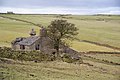 A deserted farmhouse - geograph.org.uk - 1707216.jpg 3,872 × 2,592; 4.37 MB
-
 A field by the River Thame - geograph.org.uk - 1727897.jpg 1,500 × 976; 194 KB
-
 A junction of paths - geograph.org.uk - 1707202.jpg 3,872 × 2,592; 3.89 MB
-
 A modern barn south of Flecknoe - geograph.org.uk - 1707468.jpg 640 × 430; 74 KB
-
 A northern top of Beinn Donn - geograph.org.uk - 1714486.jpg 640 × 359; 89 KB
-
 A northern top of Beinn Donn - geograph.org.uk - 1731369.jpg 640 × 359; 83 KB
-
 A ploughed field near Barton - geograph.org.uk - 1709230.jpg 1,500 × 1,000; 226 KB
-
 A Somerfield parking sign in Galashiels - geograph.org.uk - 1706718.jpg 640 × 480; 151 KB
-
 A stile in a field at Ickford - geograph.org.uk - 1727880.jpg 1,500 × 1,000; 297 KB
-
 A topical warning - geograph.org.uk - 1707196.jpg 3,872 × 2,592; 3.95 MB
-

-
 A typical Rossendale farm - geograph.org.uk - 1707213.jpg 3,872 × 2,592; 3.83 MB
-
 A typical wet crossing on Swinshaw Moor - geograph.org.uk - 1707238.jpg 3,872 × 2,592; 6.1 MB
-
 A view back to Wharfedale. - geograph.org.uk - 1706465.jpg 480 × 640; 77 KB
-
 A Wharfedale barn. - geograph.org.uk - 1706491.jpg 640 × 480; 121 KB
-
 A21 Roundabout at Kipping's Cross - geograph.org.uk - 1706497.jpg 2,048 × 1,536; 1.07 MB
-
 A4117 Cornbrook Corner - geograph.org.uk - 1707908.jpg 4,000 × 3,000; 2.4 MB
-
 A439 Black Hill crossroads - geograph.org.uk - 1706443.jpg 2,000 × 1,433; 330 KB
-
 A449 Ross Spur 1 - geograph.org.uk - 1706366.jpg 640 × 480; 209 KB
-
 A449 Ross Spur 2 - geograph.org.uk - 1706374.jpg 640 × 480; 185 KB
-
 A449 Ross Spur 3 - geograph.org.uk - 1706381.jpg 640 × 480; 170 KB
-
 A449 Ross Spur 4 - geograph.org.uk - 1706383.jpg 640 × 480; 169 KB
-
 A93 and Car Park, Glenshee Ski Area - geograph.org.uk - 1721871.jpg 800 × 579; 72 KB
-
 A93 crosses into Aberdeenshire - geograph.org.uk - 1726037.jpg 1,024 × 696; 98 KB
-
 A93 near Baddoch - geograph.org.uk - 1726808.jpg 1,024 × 761; 177 KB
-
 A93,Bridge over River Dee - geograph.org.uk - 1726790.jpg 800 × 768; 147 KB
-
 A939 between Cock bridge and Lecht Ski Centre - geograph.org.uk - 1726011.jpg 1,600 × 1,129; 150 KB
-
 A939 climbing towards the Lecht - geograph.org.uk - 1726013.jpg 1,024 × 748; 67 KB
-
 A939 entering Tomintoul - geograph.org.uk - 1726022.jpg 640 × 474; 40 KB
-
 Abram Bryn Gates Primary School - geograph.org.uk - 1706881.jpg 4,592 × 3,056; 5.78 MB
-
 Access road to Dower House Touring Park - geograph.org.uk - 1709676.jpg 640 × 480; 161 KB
-
 Acharossan Burn - geograph.org.uk - 1706661.jpg 3,648 × 2,736; 2.36 MB
-
 Across the field - geograph.org.uk - 1728800.jpg 4,000 × 3,000; 2.34 MB
-
 Across the field - geograph.org.uk - 1730251.jpg 4,000 × 3,000; 4.53 MB
-
 Across the field - geograph.org.uk - 1730273.jpg 4,000 × 3,000; 4.43 MB
-
 Across the fields (1) - geograph.org.uk - 1730333.jpg 4,000 × 3,000; 2.17 MB
-
 Across the fields (2) - geograph.org.uk - 1730335.jpg 4,000 × 3,000; 2.45 MB
-
 Across the road - geograph.org.uk - 1730322.jpg 4,000 × 3,000; 2.83 MB
-
 Adrian Boult Hall - Birmingham Conservatoire - from Chamberlain Square (4368844122).jpg 3,648 × 2,736; 2.31 MB
-
 Adventure playground behind the Village Hall - geograph.org.uk - 1709355.jpg 1,500 × 1,000; 172 KB
-
 Afon Artro at Pen-sarn - geograph.org.uk - 1710043.jpg 2,848 × 2,136; 1.57 MB
-
 Afon Gwril at the coast - geograph.org.uk - 1709528.jpg 800 × 600; 176 KB
-
 Afon Gwril, as it flows into sea - geograph.org.uk - 1708074.jpg 800 × 600; 191 KB
-
 Agricultural shelter by the road to Stanton St John - geograph.org.uk - 1709218.jpg 1,500 × 1,000; 240 KB
-
 The Parish Church - geograph.org.uk - 1707345.jpg 1,600 × 1,200; 813 KB
-
 The Parish Church - geograph.org.uk - 1707359.jpg 1,200 × 1,600; 720 KB
-
 Airport apron, Newcastle International - geograph.org.uk - 1713033.jpg 1,024 × 768; 124 KB
-
 Alder Grange School - geograph.org.uk - 1707267.jpg 3,872 × 2,592; 3.48 MB
-
 Alongside the stream - geograph.org.uk - 1728762.jpg 4,000 × 3,000; 3.56 MB
-
 Amateur league game at Loughgall Country Park - geograph.org.uk - 1706963.jpg 3,648 × 2,736; 2.35 MB
-
 An icy tank at Clee Hill Quarry - geograph.org.uk - 1708321.jpg 4,000 × 3,000; 2.3 MB
-

-
 Andean Flamingo (Phoenicoparrus andinus).jpg 800 × 800; 93 KB
-
 Angel Bank Garage - geograph.org.uk - 1707935.jpg 4,000 × 3,000; 2.36 MB
-
 Anglers' hut by the Lune - geograph.org.uk - 1710044.jpg 1,280 × 960; 328 KB
-

-
-
 Anti-tank traps, Bridge 99, Kennet and Avon Canal - geograph.org.uk - 1706450.jpg 1,600 × 1,200; 1.2 MB
-
 Anyone need a unicycle^ - geograph.org.uk - 1708332.jpg 640 × 479; 129 KB
-
 Approaching Bayswater Road - geograph.org.uk - 1709237.jpg 1,500 × 1,000; 171 KB
-

-
 Approaching Glas Mheall Mòr in winter - geograph.org.uk - 1729548.jpg 640 × 480; 174 KB
-
 Approaching the Dumhampstead Tunnel - geograph.org.uk - 1711261.jpg 640 × 426; 82 KB
-
 Artle Beck joins the River Lune - geograph.org.uk - 1710009.jpg 640 × 480; 103 KB
-
 Aughton Woods, River Lune - geograph.org.uk - 1711500.jpg 480 × 640; 122 KB
-
 Back entrance to MOD land^ - geograph.org.uk - 1707093.jpg 640 × 480; 64 KB
-
 Bacup and Rawtenstall Grammar School - geograph.org.uk - 1706336.jpg 3,872 × 2,592; 5 MB
-
 Bailey Mill, Delph - geograph.org.uk - 1707199.jpg 417 × 640; 60 KB
-
 Ballynahatty Road, Beagh - geograph.org.uk - 1706721.jpg 640 × 479; 76 KB
-
 Bampfylde Road, Torquay - geograph.org.uk - 1716639.jpg 452 × 640; 112 KB
-
 Baptist Chapel - geograph.org.uk - 1708731.jpg 1,024 × 768; 215 KB
-
 Barmouth Bridge in February - geograph.org.uk - 1713670.jpg 2,848 × 2,136; 1.72 MB
-
 Barn conversions - geograph.org.uk - 1730238.jpg 4,000 × 3,000; 2.57 MB
-
 Barns at Depot Lodge - geograph.org.uk - 1730260.jpg 4,000 × 3,000; 3.66 MB
-
 Barracks Bank - geograph.org.uk - 1706874.jpg 3,072 × 2,304; 1.54 MB
-
 Bath Lane, Torquay - geograph.org.uk - 1716718.jpg 482 × 640; 69 KB
-
 Batsford Timber yard - geograph.org.uk - 1730699.jpg 4,000 × 3,000; 2.98 MB
-
 Beach at Snettisham - geograph.org.uk - 1714646.jpg 1,600 × 1,200; 671 KB
-
 Beach Hill - geograph.org.uk - 1710821.jpg 536 × 800; 108 KB
-
 Beach, Glen Salachan - geograph.org.uk - 1713053.jpg 640 × 480; 96 KB
-
 Beagh Road - geograph.org.uk - 1706740.jpg 640 × 479; 68 KB
-
 Beagh Road - geograph.org.uk - 1706743.jpg 640 × 479; 60 KB
-
 Beagh Road - geograph.org.uk - 1706750.jpg 640 × 479; 52 KB
-
 Beagh Road - geograph.org.uk - 1706754.jpg 640 × 479; 71 KB
-
 Beagh Road, Beagh - geograph.org.uk - 1706732.jpg 640 × 479; 77 KB
-
 Beagh Townland - geograph.org.uk - 1706689.jpg 640 × 479; 79 KB
-
 Beagh Townland - geograph.org.uk - 1706699.jpg 640 × 479; 71 KB
-
 Beagh Townland - geograph.org.uk - 1706705.jpg 640 × 479; 80 KB
-
 Beagh Townland - geograph.org.uk - 1706708.jpg 640 × 479; 67 KB
-
 Beagh Townland - geograph.org.uk - 1706712.jpg 640 × 479; 76 KB
-
 Beagh Townland - geograph.org.uk - 1706715.jpg 640 × 479; 79 KB
-
 Beagh Townland - geograph.org.uk - 1706717.jpg 640 × 479; 77 KB
-
 Beagh Townland - geograph.org.uk - 1706722.jpg 640 × 479; 109 KB
-
 Beagh Townland - geograph.org.uk - 1706725.jpg 640 × 479; 70 KB
-
 Beagh Townland - geograph.org.uk - 1706728.jpg 640 × 479; 54 KB
-
 Beagh Townland - geograph.org.uk - 1706736.jpg 640 × 479; 73 KB
-
 Beagh Townland - geograph.org.uk - 1706747.jpg 640 × 479; 68 KB
-
 Beagh Townland - geograph.org.uk - 1706755.jpg 640 × 479; 55 KB
-
 Beagh Townland - geograph.org.uk - 1706760.jpg 640 × 479; 76 KB
-
 Bealach and Beinn Sgluich - geograph.org.uk - 1714449.jpg 640 × 359; 90 KB
-
 BedfordBusStation.JPG 1,280 × 960; 414 KB
-
 Beech Boundary - geograph.org.uk - 1706550.jpg 480 × 640; 115 KB
-
 Beesfield Lane, Farningham - geograph.org.uk - 1706180.jpg 2,048 × 1,536; 1,003 KB
-
 Beesfield Lane, near Farningham - geograph.org.uk - 1706184.jpg 2,048 × 1,536; 1.1 MB
-
 Beinn Donn - geograph.org.uk - 1714498.jpg 640 × 359; 77 KB
-
 Beinn Donn - geograph.org.uk - 1715015.jpg 640 × 359; 92 KB
-
 Beinn Donn - geograph.org.uk - 1715016.jpg 640 × 359; 71 KB
-
 Beinn Donn - geograph.org.uk - 1715017.jpg 640 × 359; 73 KB
-
 Beltring Railway Station - geograph.org.uk - 1706573.jpg 2,048 × 1,536; 1.04 MB
-
 Beltring Road, Beltring - geograph.org.uk - 1706508.jpg 2,048 × 1,536; 1.27 MB
-
 Belvidere Road. - geograph.org.uk - 1711945.jpg 640 × 480; 58 KB
-
 Bempton Crescent, Bridlington - geograph.org.uk - 1706335.jpg 800 × 562; 79 KB
-
 Bench and information board in Bernwood Forest - geograph.org.uk - 1743624.jpg 1,500 × 982; 346 KB
-
 Bench mark by the corner - geograph.org.uk - 1725695.jpg 1,024 × 768; 152 KB
-
 Bench mark on Wallingford Bridge - geograph.org.uk - 1724753.jpg 640 × 480; 96 KB
-
 Bendy bus 6022 - S1 TWM - in Old Square (4353513229).jpg 3,648 × 2,736; 2.4 MB
-
 Bendy bus 6022 - S1 TWM - turning into Corporation Street (4353521627).jpg 3,648 × 2,736; 2.28 MB
-
 Benover Road - geograph.org.uk - 1708068.jpg 2,048 × 1,536; 1.08 MB
-
 Benover Road, Yalding - geograph.org.uk - 1707613.jpg 2,048 × 1,536; 1.06 MB
-
 Bernwood Forest - geograph.org.uk - 1730158.jpg 1,500 × 962; 342 KB
-
 Bernwood Forest - geograph.org.uk - 1741462.jpg 960 × 1,500; 484 KB
-
 Bernwood Forest - geograph.org.uk - 1743501.jpg 1,000 × 1,500; 332 KB
-
 Bernwood Meadows - geograph.org.uk - 1732974.jpg 1,500 × 980; 164 KB
-

-
 Best Kept Village - Prettiest Village - geograph.org.uk - 1710153.jpg 640 × 480; 137 KB
-
 Big Match - geograph.org.uk - 1708935.jpg 3,296 × 2,197; 1.46 MB
-
 Birch Cross Road - geograph.org.uk - 1706216.jpg 2,048 × 1,536; 1.24 MB
-
 Birchin Cross Road - geograph.org.uk - 1706209.jpg 2,048 × 1,536; 1.25 MB
-
 Birchin Cross Road - geograph.org.uk - 1706212.jpg 2,048 × 1,536; 1.26 MB
-
 Birchin Cross Road, junction with Clarke's Green Road - geograph.org.uk - 1706208.jpg 2,048 × 1,536; 1.19 MB
-
 Birmingham Central Library from Centenary Way (4368213581).jpg 3,648 × 2,736; 2.23 MB
-
 Birmingham Central Library from Chamberlain Square - panoramic (8288267829).jpg 7,052 × 3,882; 2.41 MB
-
 Blackfort Road, Lissan - geograph.org.uk - 1706667.jpg 640 × 479; 83 KB
-
 Blackshaw Brook at Red Bridge - geograph.org.uk - 1707407.jpg 1,200 × 1,600; 1.25 MB
-
 Blind corner in Salcombe Regis - geograph.org.uk - 1706309.jpg 640 × 480; 80 KB
-
 Blocked footpath - geograph.org.uk - 1728776.jpg 4,000 × 3,000; 3.8 MB
-
 Blocked off skate boarding ramp in Colmore Square (4360122879).jpg 3,648 × 2,736; 2.48 MB
-
 Boarded up - geograph.org.uk - 1724721.jpg 1,024 × 768; 160 KB
-
-
 Bog on Beinn Donn - geograph.org.uk - 1731381.jpg 640 × 359; 83 KB
-
 Bookies in Leadenhall Street - geograph.org.uk - 1710054.jpg 480 × 640; 75 KB
-
 Boundary fence in North Otter Forest - geograph.org.uk - 1706564.jpg 3,648 × 2,736; 2.33 MB
-
 Boundary stone by the Lune - geograph.org.uk - 1710023.jpg 480 × 640; 109 KB
-
 Boundary Stone On The Scots' Dike - geograph.org.uk - 1707306.jpg 640 × 480; 162 KB
-

-
-
 Boundary wall in Acharossan Forest - geograph.org.uk - 1706623.jpg 3,648 × 2,736; 2.39 MB
-
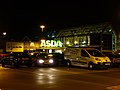 Bournemouth , ASDA Superstore - geograph.org.uk - 1712597.jpg 3,264 × 2,448; 2.99 MB
-
 Bovey Handloom Weavers in Station Road - geograph.org.uk - 1716085.jpg 3,648 × 2,736; 2.42 MB
-

-
 Bovington, the post office - geograph.org.uk - 1708386.jpg 640 × 480; 70 KB
-
 Bower Lane - geograph.org.uk - 1706204.jpg 2,048 × 1,536; 1.03 MB
-
 Branbridges Road (A228), Beltring - geograph.org.uk - 1706504.jpg 2,048 × 1,536; 1.22 MB
-
 Brancaster Road junction - geograph.org.uk - 1714837.jpg 1,600 × 1,200; 599 KB
-
 Breakwater, River Lune - geograph.org.uk - 1710030.jpg 640 × 480; 93 KB
-
 Brenchley Road, Horsmonden - geograph.org.uk - 1708763.jpg 2,048 × 1,536; 1.09 MB
-
 Bridge 99 and the Kennet and Avon Canal - geograph.org.uk - 1706439.jpg 640 × 480; 113 KB
-
 Bridge 99 over the Kennet and Avon canal - geograph.org.uk - 1706449.jpg 1,600 × 1,200; 877 KB
-
 Bridge 99, Kennet and Avon Canal, near Crofton - geograph.org.uk - 1706435.jpg 1,600 × 1,200; 873 KB
-
 Bridge of Cally Hotel - geograph.org.uk - 1721454.jpg 640 × 438; 68 KB
-
 Bridge over River Don - geograph.org.uk - 1737248.jpg 800 × 554; 93 KB
-
 Bridge over the brook - geograph.org.uk - 1728741.jpg 4,000 × 3,000; 3.68 MB
-
 Bridge over the brook - geograph.org.uk - 1728748.jpg 4,000 × 3,000; 5.3 MB
-
 Bridge over the brook - geograph.org.uk - 1728766.jpg 4,000 × 3,000; 3.21 MB
-
 Bridge over the M40 - geograph.org.uk - 1710921.jpg 1,500 × 1,000; 210 KB
-
 Bridge over the River Don - geograph.org.uk - 1737223.jpg 1,024 × 811; 164 KB
-

-
 Brookside Cafe, Bovey Tracey - geograph.org.uk - 1716104.jpg 3,481 × 2,610; 1.12 MB
-
 Buckden bridge. - geograph.org.uk - 1706493.jpg 640 × 480; 90 KB
-
 Buckden village stores. - geograph.org.uk - 1706464.jpg 640 × 480; 78 KB
-
 Bull Beck flows under the old railway - geograph.org.uk - 1710059.jpg 480 × 640; 136 KB
-
 Bull Beck joins the River Lune - geograph.org.uk - 1710055.jpg 640 × 480; 109 KB
-
 Burn from Loch Stellaig - geograph.org.uk - 1715020.jpg 640 × 359; 105 KB
-
 Burn, Glen Stockdale - geograph.org.uk - 1715021.jpg 359 × 640; 98 KB
-
 Burn, Glen Stockdale - geograph.org.uk - 1731394.jpg 640 × 359; 98 KB
-
 Burn, Glen Stockdale - geograph.org.uk - 1731406.jpg 640 × 359; 130 KB
-
 Bus shelter in Stanton St John - geograph.org.uk - 1709296.jpg 1,500 × 981; 237 KB
-
 Bush Hill campsite deserted in winter - geograph.org.uk - 1707469.jpg 640 × 422; 124 KB
-
 Butcher's Broom, Vernditch - geograph.org.uk - 1708353.jpg 480 × 640; 219 KB
-
 Butterly towards Marsden - geograph.org.uk - 1706775.jpg 640 × 480; 136 KB
-
 Cairo, Orme and Majestic Mills - geograph.org.uk - 1707169.jpg 640 × 421; 69 KB
-
 Calfstock Lane, Farningham - geograph.org.uk - 1706175.jpg 2,048 × 1,536; 1.29 MB
-
 Canal at Yalding - geograph.org.uk - 1707524.jpg 2,048 × 1,536; 1.17 MB
-
 Car Park - Loch of the Lowes - geograph.org.uk - 1721375.jpg 800 × 600; 168 KB


_Brackish_Marsh_-_geograph.org.uk_-_1714784.jpg)


.jpg)
.jpg)
.jpg)

.jpg)


_-_geograph.org.uk_-_1730333.jpg)
_-_geograph.org.uk_-_1730335.jpg)

.jpg)


.jpg)


.jpg)
.jpg)


.jpg)
.jpg)


.jpg)


,_Beltring_-_geograph.org.uk_-_1706504.jpg)


