Category:United Kingdom photographs taken on 2010-02-09
Jump to navigation
Jump to search
| ← | Tuesday 9 February 2010 | → | ||
| ← | February 2010 | → | ||

United Kingdom photographs taken on 9 February 2010.
Image files should be categorized here automatically using {{taken on}} template. Direct categorisation is also possible, if automatic is impossible.
Subcategories
This category has the following 4 subcategories, out of 4 total.
H
L
Media in category "United Kingdom photographs taken on 2010-02-09"
The following 200 files are in this category, out of 842 total.
(previous page) (next page)-
 "Castle" in Doddington Park.jpg 640 × 428; 161 KB
-
 East end, Newcastle Central Station, 9 February 2010.jpg 640 × 456; 76 KB
-
 20mph zone sign, Belfast - geograph.org.uk - 1700267.jpg 640 × 402; 75 KB
-
 4 GATE - geograph.org.uk - 1730585.jpg 1,280 × 959; 423 KB
-
 47-141 Hatton Bank 23-10-85 (33049556315).jpg 2,592 × 1,728; 462 KB
-
 58001 Hatton North 24-10-85 (33049599985).jpg 2,477 × 1,651; 411 KB
-
 58012 Hatton North 24-10-85 (33185269355).jpg 2,592 × 1,728; 610 KB
-
 66 with hoppers - geograph.org.uk - 1706075.jpg 1,280 × 876; 272 KB
-
 66525 , Chesterfield (4344110245).jpg 2,500 × 2,953; 887 KB
-
 9Q-CTD HS Trident ACS CVT 08-10-85 (32780323512).jpg 2,411 × 1,615; 764 KB
-
 A bench with a view - geograph.org.uk - 1702688.jpg 3,296 × 2,472; 1.94 MB
-
 A cat puts its life on the line - geograph.org.uk - 1703593.jpg 3,072 × 2,304; 1.98 MB
-
 A family tragedy in Kansas - geograph.org.uk - 1709938.jpg 600 × 800; 146 KB
-

-
 A Frozen Lochan at Garvault Lodge - geograph.org.uk - 1702732.jpg 640 × 427; 73 KB
-
 A late torpedo - geograph.org.uk - 1719848.jpg 1,280 × 858; 225 KB
-
 A winter view - Salt marshes south of Laugharne - geograph.org.uk - 1710959.jpg 1,600 × 1,200; 554 KB
-
 A1085 Trunk Road - geograph.org.uk - 1730589.jpg 1,280 × 959; 288 KB
-
 A1120 Hackney Road and the Causeway - geograph.org.uk - 1702354.jpg 3,072 × 2,304; 1.37 MB
-
 A45 crosses River Sowe Bridge - geograph.org.uk - 1700951.jpg 640 × 427; 490 KB
-

-
 A52 near Saxondale - geograph.org.uk - 1710705.jpg 1,600 × 1,067; 309 KB
-
 Abbey brook. - geograph.org.uk - 1700575.jpg 480 × 640; 104 KB
-

-
 Across the Tees - geograph.org.uk - 1719951.jpg 640 × 473; 86 KB
-
 Afon Taf below Gwal-y-filiast - geograph.org.uk - 1705281.jpg 800 × 600; 132 KB
-
 Afon Taf southwest of Llanglydwen - geograph.org.uk - 1703237.jpg 800 × 600; 131 KB
-
 Agenmore townland - geograph.org.uk - 1700511.jpg 640 × 480; 70 KB
-

-
 Albion Lane, Belfast - geograph.org.uk - 1703358.jpg 800 × 603; 567 KB
-
 Alder coppice, Stonebridge Meadows - geograph.org.uk - 1700927.jpg 640 × 427; 463 KB
-
 Altheela Bridge nameplate - geograph.org.uk - 1700443.jpg 640 × 480; 107 KB
-
 An empty car park, Coventry airport - geograph.org.uk - 1702557.jpg 640 × 426; 342 KB
-
 Animal Trap, Helmsley Moor - geograph.org.uk - 1700699.jpg 427 × 640; 289 KB
-

-

-
 Arboreal Oddity, Oak House Plantation - geograph.org.uk - 1700273.jpg 427 × 640; 311 KB
-
 Arches near Pant-gwyn Farm - geograph.org.uk - 1700992.jpg 3,296 × 2,472; 1.87 MB
-
 Archway to St Cledwyn's - geograph.org.uk - 1708634.jpg 800 × 600; 133 KB
-
 Argyll Street - geograph.org.uk - 1707718.jpg 640 × 480; 86 KB
-

-
 At Braid Port - geograph.org.uk - 1702553.jpg 800 × 584; 190 KB
-
 B1117 Halesworth Road - geograph.org.uk - 1701790.jpg 3,072 × 2,304; 1.39 MB
-
 B1117 Halesworth Road and Walpole Bridge - geograph.org.uk - 1701782.jpg 3,072 × 2,304; 1.5 MB
-
 Back alley, Ford - geograph.org.uk - 1708490.jpg 500 × 640; 81 KB
-
 Ballyholme Bay at night - geograph.org.uk - 1706434.jpg 800 × 537; 284 KB
-
 Ballypatrick Forest - geograph.org.uk - 1700483.jpg 640 × 480; 83 KB
-
 Ballypatrick Forest - geograph.org.uk - 1700497.jpg 640 × 480; 104 KB
-
-
 Bank buildings in Stowmarket town centre - geograph.org.uk - 1702181.jpg 1,024 × 768; 410 KB
-
 Barguillean Farm - geograph.org.uk - 1707661.jpg 640 × 480; 63 KB
-
 Bark graffiti - geograph.org.uk - 1705045.jpg 600 × 800; 155 KB
-
 Barne Road, Barne Barton - geograph.org.uk - 1709124.jpg 640 × 452; 82 KB
-
 Barne Road, St Budeaux - geograph.org.uk - 1709924.jpg 480 × 640; 93 KB
-
 Beach front cottages, Gorran Haven - geograph.org.uk - 1713537.jpg 640 × 427; 84 KB
-
 Beach Huts, North Sands - geograph.org.uk - 1700367.jpg 800 × 600; 117 KB
-
 Beamsley Milepost - geograph.org.uk - 1700646.jpg 3,000 × 4,000; 2.93 MB
-
 Beer kegs, Albion lane - geograph.org.uk - 1703362.jpg 600 × 800; 429 KB
-
 Bellever - geograph.org.uk - 1704890.jpg 685 × 1,024; 242 KB
-
 Bench mark along the wall - geograph.org.uk - 1708514.jpg 1,024 × 768; 170 KB
-
 Bench mark on the wall - geograph.org.uk - 1708507.jpg 1,024 × 768; 250 KB
-
 Big Bridge's Little brother - geograph.org.uk - 1700316.jpg 640 × 427; 118 KB
-
 Birnie Burn - geograph.org.uk - 1704099.jpg 640 × 425; 86 KB
-
 Boats at Airds Bay - geograph.org.uk - 1707711.jpg 640 × 480; 79 KB
-

-
 Bradford Beck at Shipley - geograph.org.uk - 1733200.jpg 480 × 640; 114 KB
-
 Bradford Beck at Shipley - geograph.org.uk - 1733222.jpg 480 × 640; 110 KB
-
 Bran sands - geograph.org.uk - 1706062.jpg 1,280 × 853; 258 KB
-
 Bran Sands - geograph.org.uk - 1709318.jpg 1,280 × 845; 311 KB
-
 Bran Sands - geograph.org.uk - 1709337.jpg 1,280 × 853; 204 KB
-
 Bran Sands dunes and Corus Redcar - geograph.org.uk - 1706064.jpg 1,280 × 789; 159 KB
-
 Breaking waves at Portmellon - geograph.org.uk - 1713394.jpg 480 × 640; 83 KB
-
 Brereton Heath Lane - geograph.org.uk - 1700105.jpg 2,048 × 1,536; 619 KB
-

-

-
 Bridge into Teesport - geograph.org.uk - 1730544.jpg 1,280 × 959; 495 KB
-
 Bridge on the Musdale road - geograph.org.uk - 1705538.jpg 640 × 480; 90 KB
-
 Bridge on the Taynuilt to Kilmore road - geograph.org.uk - 1707611.jpg 640 × 480; 103 KB
-
 Bridge over Feochan Mhor - geograph.org.uk - 1705673.jpg 640 × 480; 110 KB
-
 Bridge over the Feochan Bheag - geograph.org.uk - 1705374.jpg 640 × 500; 100 KB
-
 Bridge over the River Thet - geograph.org.uk - 1703339.jpg 640 × 466; 160 KB
-

-
 Bridge over the Tyne at Corbridge - geograph.org.uk - 1700284.jpg 640 × 480; 91 KB
-
 Bridleway at Newgate Bank - geograph.org.uk - 1700485.jpg 427 × 640; 301 KB
-
 Bridleway near Walpole Bridge - geograph.org.uk - 1701783.jpg 2,304 × 3,072; 1.64 MB
-
 Bridleway near Walpole Bridge - geograph.org.uk - 1701839.jpg 3,072 × 2,304; 1.68 MB
-
 British Oxygen plant - geograph.org.uk - 1706070.jpg 1,280 × 839; 236 KB
-
 British Oxygen Plant - geograph.org.uk - 1730526.jpg 1,280 × 959; 301 KB
-
 British Oxygen Plant - geograph.org.uk - 1730539.jpg 1,280 × 959; 322 KB
-
 British Oxygen, Teesside - geograph.org.uk - 1709356.jpg 1,280 × 853; 169 KB
-
 British Oxygen, Teesside - geograph.org.uk - 1709376.jpg 1,280 × 852; 249 KB
-
 British Vita Factory - geograph.org.uk - 1700977.jpg 1,024 × 768; 219 KB
-
 British Vita Factory - geograph.org.uk - 1700980.jpg 1,024 × 768; 246 KB
-
 Bulk cargo ship - geograph.org.uk - 1719945.jpg 1,280 × 959; 351 KB
-
 Burn at Bushburn Bridge - geograph.org.uk - 1700432.jpg 640 × 480; 139 KB
-
 Burn by Stoneyfield Loch - geograph.org.uk - 1700458.jpg 480 × 640; 180 KB
-
 Bury Street, Stowmarket - geograph.org.uk - 1702190.jpg 1,024 × 710; 468 KB
-
 Bushburn Bridge - geograph.org.uk - 1700423.jpg 640 × 480; 125 KB
-
 Bushburn Bridge - geograph.org.uk - 1700462.jpg 640 × 480; 89 KB
-
 Butterfield Homes, Glusburn - geograph.org.uk - 1702784.jpg 3,995 × 1,651; 1.52 MB
-
 Byway from Lochmeyler - geograph.org.uk - 1700660.jpg 640 × 480; 244 KB
-
 Caerhayes Castle2.jpg 640 × 480; 98 KB
-
 Caerhays Castle - geograph.org.uk - 1713567.jpg 640 × 480; 104 KB
-
 Caerhays Castle - geograph.org.uk - 1713571.jpg 640 × 427; 88 KB
-
 Calmac ferry approaching Oban pier - geograph.org.uk - 1705347.jpg 640 × 480; 56 KB
-
 Capel Nebo from the south - geograph.org.uk - 1711025.jpg 800 × 600; 137 KB
-
 Capel Nebo standing stone - geograph.org.uk - 1710177.jpg 800 × 600; 150 KB
-
 Capel Nebo, rear view - geograph.org.uk - 1709773.jpg 800 × 600; 144 KB
-
 Carey River glen - geograph.org.uk - 1701214.jpg 640 × 480; 67 KB
-

-
 Catalina flying boat propeller in Mitchell Lane, Alness - geograph.org.uk - 1702737.jpg 1,200 × 1,600; 284 KB
-
 Cattle and wall at Kilbride - geograph.org.uk - 1705387.jpg 640 × 480; 92 KB
-
 Cattle at Cairnside - geograph.org.uk - 1702635.jpg 2,981 × 2,187; 1.61 MB
-
 Cefn-Llwyn - geograph.org.uk - 1702769.jpg 3,296 × 2,472; 1.85 MB
-
 Cheapside, Bampton - geograph.org.uk - 1720549.jpg 1,024 × 776; 241 KB
-
 Church of St John the Baptist, Llanhennock - geograph.org.uk - 1702728.jpg 3,296 × 2,472; 1.79 MB
-
 Church of St John the Baptist, Llanhennock - geograph.org.uk - 1702733.jpg 3,296 × 2,472; 1.84 MB
-
 Church of St Peter and St Mary - geograph.org.uk - 1702156.jpg 782 × 1,024; 569 KB
-
 Church Street, Gorran Haven - geograph.org.uk - 1713549.jpg 479 × 640; 84 KB
-
 Churchyard at Stowmarket - geograph.org.uk - 1702141.jpg 1,024 × 807; 567 KB
-
 Clachadubh - geograph.org.uk - 1707626.jpg 640 × 480; 70 KB
-
 Clarkson's Farm - geograph.org.uk - 1702029.jpg 640 × 426; 302 KB
-
 Class 66 at Lackenby - geograph.org.uk - 1706068.jpg 640 × 427; 56 KB
-
 Clayton Street, Newcastle - geograph.org.uk - 1708032.jpg 1,024 × 823; 178 KB
-
 Clear felled Forestry - geograph.org.uk - 1704904.jpg 1,600 × 1,071; 578 KB
-
 Cliff-Top Walk by Loch Ryan - geograph.org.uk - 1702699.jpg 1,600 × 1,200; 831 KB
-
 Clinging to the cliffs - geograph.org.uk - 1713374.jpg 640 × 427; 80 KB
-
 Clock tower, HMS Drake - geograph.org.uk - 1708869.jpg 480 × 640; 72 KB
-
 Clodderoch Hall - geograph.org.uk - 1700293.jpg 1,024 × 768; 407 KB
-
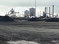
 Coal stocking area - geograph.org.uk - 1719872.jpg 1,280 × 959; 413 KB
-
 Coal stocking area - geograph.org.uk - 1719882.jpg 1,280 × 959; 360 KB
-
 Coal stocking area - geograph.org.uk - 1719907.jpg 1,280 × 793; 180 KB
-
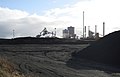 Coal storage area - geograph.org.uk - 1709327.jpg 1,280 × 826; 168 KB
-
 Coal storage area - geograph.org.uk - 1709330.jpg 1,280 × 846; 202 KB
-
 Coed-y-fon, near Tredunnock - geograph.org.uk - 1702586.jpg 3,296 × 2,472; 1.67 MB
-
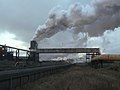 Coke quenching at South Bank - geograph.org.uk - 1730612.jpg 1,280 × 959; 204 KB
-
 Collace from the Dunsinane Hill path - geograph.org.uk - 1702554.jpg 640 × 480; 102 KB
-
 Colohendy Cottages, Llanhennock - geograph.org.uk - 1702702.jpg 3,296 × 2,472; 1.83 MB
-
 Colourful door - geograph.org.uk - 1707666.jpg 640 × 480; 107 KB
-
 Convenient for the graveyard - geograph.org.uk - 1709910.jpg 600 × 800; 151 KB
-
 Coombe Viaduct from Barne Barton - geograph.org.uk - 1709171.jpg 640 × 477; 111 KB
-
 Copse by road between Bow and Little Orton - geograph.org.uk - 1700157.jpg 1,240 × 979; 571 KB
-
 Corner of Clayton Street and Westgate road, Newcastle - geograph.org.uk - 1708057.jpg 1,600 × 1,200; 336 KB
-
 Corus Lackenby - geograph.org.uk - 1730602.jpg 1,280 × 948; 328 KB
-
 Corus Lackenby - geograph.org.uk - 1730604.jpg 1,280 × 786; 205 KB
-
 Corus Redcar - geograph.org.uk - 1730607.jpg 1,280 × 959; 321 KB
-
 Court House - geograph.org.uk - 1700065.jpg 2,560 × 1,920; 1.03 MB
-
 Court House, Cork tree - geograph.org.uk - 1700071.jpg 2,560 × 1,920; 1.05 MB
-
 Coventry airport, passenger terminals - geograph.org.uk - 1701873.jpg 640 × 426; 365 KB
-
 Craigentaggart - geograph.org.uk - 1705365.jpg 640 × 480; 99 KB
-
 Craigeven Bay - geograph.org.uk - 1711899.jpg 1,000 × 377; 172 KB
-
 Creag Mhòr - geograph.org.uk - 1705420.jpg 640 × 480; 110 KB
-
 Croesllywarch House - geograph.org.uk - 1702609.jpg 3,296 × 2,472; 1.82 MB
-
 Croesonen, Tredunnock - geograph.org.uk - 1701044.jpg 3,296 × 2,472; 1.86 MB
-
 Crookmuir Farm entrance - geograph.org.uk - 1701227.jpg 640 × 480; 65 KB
-
 Crossley Evans Scrap Yard, Shipley - geograph.org.uk - 1733160.jpg 640 × 480; 101 KB
-
 Crossley Evans Scrap Yard, Shipley - geograph.org.uk - 1733173.jpg 640 × 480; 89 KB
-
 Cullercoats Metro Station - geograph.org.uk - 1707656.jpg 1,600 × 1,200; 533 KB
-
 Culvert in the Causeway - geograph.org.uk - 1702349.jpg 2,304 × 3,072; 1.41 MB
-
 Cushendall Road - geograph.org.uk - 1700410.jpg 640 × 480; 51 KB
-
 Cushendall Road - geograph.org.uk - 1700475.jpg 640 × 480; 55 KB
-
 Cycle lane in Malet Street - geograph.org.uk - 1702323.jpg 600 × 800; 148 KB
-
 Cycle lane in Montague Place - geograph.org.uk - 1702316.jpg 600 × 800; 148 KB
-
 Cycle lane in Tavistock Place - geograph.org.uk - 1702348.jpg 600 × 800; 108 KB
-
 Dead tree by the Tyne - geograph.org.uk - 1700305.jpg 640 × 480; 100 KB
-
 Decorated Shelter above North Sands - geograph.org.uk - 1700347.jpg 800 × 600; 97 KB
-
 Detail of Stowmarket church - geograph.org.uk - 1702164.jpg 768 × 1,024; 509 KB
-

-
 Diesel unit 158 858 on its way to Ely - geograph.org.uk - 1702916.jpg 640 × 449; 110 KB
-

-
 Dilapidated barn in Glen Lonan - geograph.org.uk - 1707635.jpg 640 × 480; 88 KB
-
 Discovery Museum, Newcastle - geograph.org.uk - 1708423.jpg 1,600 × 1,176; 515 KB
-
 Display in the window - geograph.org.uk - 1708532.jpg 1,024 × 768; 150 KB
-
 Disused post-box inside the garden of Roughton Lodge - geograph.org.uk - 1702776.jpg 3,296 × 2,472; 1.84 MB
-
 DMU Hatton Bank 23-10-85 (32234217323).jpg 2,220 × 1,497; 297 KB
-
 DMU Hatton North 24-10-85 (32234297613).jpg 2,246 × 1,486; 363 KB
-
 Donkeys by the Bream Road - geograph.org.uk - 1700468.jpg 640 × 480; 243 KB
-
 Down Abbey bank. - geograph.org.uk - 1700603.jpg 640 × 480; 80 KB
-
 Draining the Marsh - geograph.org.uk - 1702610.jpg 800 × 532; 205 KB
-
 Drake House, HMS Drake - geograph.org.uk - 1708601.jpg 640 × 480; 73 KB
-
 Drews Stores - geograph.org.uk - 1700006.jpg 2,560 × 1,920; 1.07 MB
-
 Drive to Hill House - geograph.org.uk - 1702032.jpg 640 × 426; 331 KB
-
 Driveway to Manor Farm, Bridgham - geograph.org.uk - 1701449.jpg 640 × 480; 120 KB
-
 Dun-neil - geograph.org.uk - 1707422.jpg 640 × 509; 89 KB
-
 Dunes, cranes and ship - geograph.org.uk - 1719999.jpg 1,280 × 959; 426 KB
-
 Dunsinane Hill fort - geograph.org.uk - 1702584.jpg 640 × 480; 99 KB
-
 Dylan Thomas' Cartref - 'The Boat House' - geograph.org.uk - 1720226.jpg 1,200 × 1,600; 548 KB
-
 Early Christian masonry^ - geograph.org.uk - 1706785.jpg 800 × 600; 176 KB
-

-

-
 Eastern slopes of Creag Ghlasrach. - geograph.org.uk - 1705411.jpg 640 × 480; 123 KB
-
 Efailwen, southern end - geograph.org.uk - 1709754.jpg 800 × 600; 118 KB
-
 St Matthew's Church, Big Lamp, Newcastle - geograph.org.uk - 1709049.jpg 1,600 × 1,200; 519 KB
-
 Embanked bridge over Latchmore Brook - geograph.org.uk - 1700239.jpg 640 × 427; 294 KB
-
 Enjoy Loch Ryan Safely - geograph.org.uk - 1702665.jpg 414 × 640; 73 KB
-

-
 Entrance to BrockMill - geograph.org.uk - 1702062.jpg 640 × 426; 338 KB
-
 Entrance to Bull Point Barracks - geograph.org.uk - 1709153.jpg 640 × 480; 75 KB
-
 Entrance to Candwr Farm - geograph.org.uk - 1702767.jpg 3,296 × 2,472; 1.92 MB
-
 Entrance to Croes Llywarch, near Tredunnock - geograph.org.uk - 1702599.jpg 3,296 × 2,472; 1.89 MB


.jpg)
.jpg)
.jpg)

.jpg)
.jpg)


.jpg)
.jpg)


