Category:United Kingdom photographs taken on 2010-02-08
Jump to navigation
Jump to search
| ← | Monday 8 February 2010 | → | ||
| ← | February 2010 | → | ||

United Kingdom photographs taken on 8 February 2010.
Image files should be categorized here automatically using {{taken on}} template. Direct categorisation is also possible, if automatic is impossible.
Subcategories
This category has the following 3 subcategories, out of 3 total.
Media in category "United Kingdom photographs taken on 2010-02-08"
The following 200 files are in this category, out of 381 total.
(previous page) (next page)-
 15 Manor Road, Hatfield - geograph.org.uk - 1709128.jpg 1,280 × 959; 356 KB
-
 A fine specimen - geograph.org.uk - 1705077.jpg 640 × 506; 91 KB
-
 A429 heading south from Moreton - geograph.org.uk - 1700730.jpg 640 × 480; 200 KB
-
 AA village sign - geograph.org.uk - 1709313.jpg 1,280 × 959; 422 KB
-
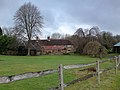
 Ahead, Cestersover Farm - geograph.org.uk - 1705679.jpg 1,024 × 768; 161 KB
-
 Aith Voe pier, Cunningsburgh - geograph.org.uk - 1700740.jpg 640 × 426; 61 KB
-
 Aldborough Dairy - geograph.org.uk - 1709263.jpg 1,280 × 959; 308 KB
-
 Aldborough Manor - geograph.org.uk - 1709299.jpg 1,280 × 959; 326 KB
-
 Aldborough Manor wall - geograph.org.uk - 1709302.jpg 1,280 × 959; 422 KB
-
 Aldborough Maypole - geograph.org.uk - 1709228.jpg 959 × 1,280; 260 KB
-
 Aldborough Roman Town - geograph.org.uk - 1709217.jpg 959 × 1,280; 591 KB
-
 Aldborough Village Hall - geograph.org.uk - 1709306.jpg 1,280 × 959; 297 KB
-
 Aldborough, The Square - geograph.org.uk - 1709226.jpg 1,280 × 959; 274 KB
-
 Aldborough, the stocks - geograph.org.uk - 1709232.jpg 1,280 × 959; 522 KB
-

-
 Alleyway off Quay Street, Bristol - geograph.org.uk - 1707934.jpg 800 × 600; 103 KB
-
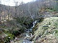 Allt Gleann a' Chaolais - geograph.org.uk - 1703724.jpg 640 × 480; 147 KB
-
 Almost horizontal snow storm - geograph.org.uk - 1705603.jpg 1,024 × 768; 205 KB
-
 An unusual garden collection - geograph.org.uk - 1700736.jpg 640 × 482; 278 KB
-
 Armadale Academy - geograph.org.uk - 1700388.jpg 640 × 338; 50 KB
-
 Ashton New Road - geograph.org.uk - 1701993.jpg 640 × 492; 125 KB
-
 At St German's Quay - geograph.org.uk - 1713182.jpg 640 × 427; 101 KB
-

-
 B4077 towards Tewkesbury - geograph.org.uk - 1700688.jpg 640 × 480; 220 KB
-
 Back Street - geograph.org.uk - 1709219.jpg 1,280 × 959; 353 KB
-

-
 Barn conversion, Thornton le Clay - geograph.org.uk - 1708811.jpg 3,174 × 1,925; 1.32 MB
-
 Barnett Demesne - geograph.org.uk - 1703312.jpg 640 × 494; 107 KB
-
 Battle Cross plaque - geograph.org.uk - 1709291.jpg 1,280 × 959; 511 KB
-
 Bay of Fladdabister - geograph.org.uk - 1700577.jpg 800 × 534; 177 KB
-

-
 Bere Farm near West meon - geograph.org.uk - 1704531.jpg 640 × 480; 77 KB
-
 Birch, boat and water - geograph.org.uk - 1704281.jpg 640 × 480; 150 KB
-
 Boatyard at St German's Quay - geograph.org.uk - 1712425.jpg 640 × 427; 105 KB
-
 Bootham Lane - geograph.org.uk - 1709032.jpg 1,280 × 959; 648 KB
-
 Bootham Lane - geograph.org.uk - 1709081.jpg 1,280 × 959; 527 KB
-
 Bootham Lane bridleway - geograph.org.uk - 1709013.jpg 1,280 × 853; 323 KB
-
 Bootham Lane landfill - geograph.org.uk - 1709077.jpg 1,280 × 959; 364 KB
-
 Bowsprit and Harbour - geograph.org.uk - 1707767.jpg 800 × 600; 68 KB
-
 Bramwith Lane level crossing - geograph.org.uk - 1709161.jpg 1,280 × 959; 278 KB
-

-

-
 Bridleway, Redesdale Riding Centre - geograph.org.uk - 1707632.jpg 800 × 600; 134 KB
-
 Brighton's Stadium taking shape - geograph.org.uk - 1708936.jpg 800 × 600; 84 KB
-
 Bristol, view from Broad Quay - geograph.org.uk - 1706410.jpg 640 × 480; 69 KB
-
 Burnside, Cunningsburgh - geograph.org.uk - 1700726.jpg 800 × 534; 159 KB
-
 Castle Park Road - geograph.org.uk - 1757554.jpg 640 × 457; 94 KB
-
 Castle Stalker - geograph.org.uk - 1705114.jpg 640 × 389; 40 KB
-
 Cathedral over the Floating Harbour - geograph.org.uk - 1706826.jpg 640 × 479; 51 KB
-
 Cattle at Rudhargarbh wood - geograph.org.uk - 1705233.jpg 640 × 480; 146 KB
-
 Causeway to Cramond Island - geograph.org.uk - 1718685.jpg 640 × 480; 160 KB
-
 Chapel Cottage - geograph.org.uk - 1709224.jpg 640 × 480; 83 KB
-
 Chapel Hill - geograph.org.uk - 1709222.jpg 1,280 × 959; 387 KB
-
 Charlotte Street, Bristol - geograph.org.uk - 1707837.jpg 640 × 480; 73 KB
-
 Church and cottage - geograph.org.uk - 1704937.jpg 640 × 480; 133 KB
-
 Church at Churchover - geograph.org.uk - 1701514.jpg 800 × 600; 76 KB
-
 Church in the square - geograph.org.uk - 1706294.jpg 1,456 × 1,092; 229 KB
-
 Church Lodge - geograph.org.uk - 1709105.jpg 1,280 × 959; 464 KB
-
 Churchover village - geograph.org.uk - 1705868.jpg 1,024 × 768; 160 KB
-

-
 Coastline at Cumlewick Ness - geograph.org.uk - 1702551.jpg 800 × 534; 157 KB
-
 Colliery reflections - geograph.org.uk - 1709052.jpg 1,280 × 944; 428 KB
-
 Concrete monolith - geograph.org.uk - 1706058.jpg 1,280 × 853; 127 KB
-
 Coney Gut - geograph.org.uk - 1757529.jpg 480 × 640; 94 KB
-
 Coney Gut valley - geograph.org.uk - 1757578.jpg 640 × 403; 62 KB
-
 Coombe Farm - geograph.org.uk - 1757782.jpg 640 × 433; 61 KB
-
 Cornish Fudge Shop, Fore Street, St Ives - geograph.org.uk - 1701281.jpg 640 × 426; 119 KB
-
 Cottage at Kentallen - geograph.org.uk - 1704925.jpg 640 × 480; 102 KB
-
 Cottage in the trees - geograph.org.uk - 1704584.jpg 640 × 480; 127 KB
-
 Cottage, Redesdale Riding Centre - geograph.org.uk - 1707623.jpg 1,024 × 768; 178 KB
-
 Cottages on Riverside, Cramond - geograph.org.uk - 1718705.jpg 640 × 482; 88 KB
-
 Cramond Green - geograph.org.uk - 1718788.jpg 640 × 468; 127 KB
-
 Cramond Kirk - geograph.org.uk - 1718736.jpg 640 × 471; 123 KB
-
 Cramond Kirk tower - geograph.org.uk - 1718747.jpg 480 × 640; 114 KB
-
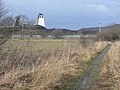
 Cramond's mast - geograph.org.uk - 1718667.jpg 458 × 640; 57 KB
-
 Crane at Floating Harbour, Bristol - geograph.org.uk - 1706816.jpg 600 × 800; 78 KB
-
 Croft building on Rubha Beag - geograph.org.uk - 1705052.jpg 640 × 480; 95 KB
-
 Crossing field, west of Churchover - geograph.org.uk - 1705773.jpg 1,024 × 768; 184 KB
-
 Cuckoo Lane - geograph.org.uk - 1709093.jpg 1,280 × 959; 467 KB
-
 Cuil Bay - geograph.org.uk - 1705055.jpg 640 × 480; 116 KB
-
 Cuil Bay - geograph.org.uk - 1705061.jpg 640 × 480; 71 KB
-
 Culcharron - geograph.org.uk - 1705260.jpg 640 × 480; 88 KB
-
 Cunningsburgh Industrial Estate - geograph.org.uk - 1700632.jpg 800 × 534; 193 KB
-

-
 Dilapidated estate building - geograph.org.uk - 1704301.jpg 640 × 480; 142 KB
-
 Dinghies stacked up for the winter - geograph.org.uk - 1713167.jpg 640 × 427; 110 KB
-
 Docklands Light Railway Depot Poplar - geograph.org.uk - 1705768.jpg 1,600 × 1,154; 323 KB
-
 Down the garden path - geograph.org.uk - 1701521.jpg 480 × 640; 74 KB
-
 Dr Waters Gardens (1) - geograph.org.uk - 1709137.jpg 1,280 × 959; 608 KB
-
 Dr Waters Gardens (2) - geograph.org.uk - 1709140.jpg 640 × 480; 111 KB
-
 Dr Waters Gardens (3) - geograph.org.uk - 1709149.jpg 1,280 × 959; 581 KB
-
 Drive to Batsford Arboretum 2 - geograph.org.uk - 1700766.jpg 640 × 480; 237 KB
-
 Driveway to Callert House - geograph.org.uk - 1704573.jpg 640 × 480; 133 KB
-
 Duror Parish Church - geograph.org.uk - 1704941.jpg 640 × 480; 100 KB
-
 East Lane Drain - geograph.org.uk - 1709046.jpg 1,280 × 959; 475 KB
-
 Edinburgh, George Street, 8 February 2010.jpg 480 × 640; 93 KB
-
 Ee-usk on the North Pier - geograph.org.uk - 1705271.jpg 640 × 480; 58 KB
-
 Emmetts Hill - geograph.org.uk - 1700266.jpg 640 × 626; 69 KB
-
-
 Farm buildings - geograph.org.uk - 1709280.jpg 1,280 × 959; 363 KB
-
 Farmland at Markwell - geograph.org.uk - 1712390.jpg 640 × 427; 70 KB
-

-
 Field and towers - geograph.org.uk - 1709172.jpg 640 × 480; 52 KB
-
 Field boundary near Churchover - geograph.org.uk - 1705763.jpg 768 × 1,024; 207 KB
-
 Field footpath beside River Swift, Churchover - geograph.org.uk - 1705610.jpg 1,024 × 768; 123 KB
-
 Field footpath, Churchover - geograph.org.uk - 1705566.jpg 1,024 × 768; 112 KB
-
 Field view, Churchover - geograph.org.uk - 1705714.jpg 768 × 1,024; 143 KB
-
 Fields and river, Churchover - geograph.org.uk - 1705557.jpg 1,024 × 768; 131 KB
-
 Fields near Harborough Fields Farm - geograph.org.uk - 1705731.jpg 1,024 × 768; 307 KB
-
 Fields off Bootham Lane - geograph.org.uk - 1709036.jpg 1,280 × 959; 319 KB
-
 First 32760 & PCB 410, Pymouth bus station, 8 February 2010.jpg 3,669 × 1,394; 3.95 MB
-
-
 Fishing boats at Heritage Wharf - geograph.org.uk - 1705355.jpg 640 × 480; 59 KB
-
 Floating Harbour, Bristol - geograph.org.uk - 1706797.jpg 640 × 480; 49 KB
-
 Footpath to the church - geograph.org.uk - 1709266.jpg 959 × 1,280; 399 KB
-
 Former Borders Books store - geograph.org.uk - 1708512.jpg 640 × 389; 154 KB
-
 Former riding school, Oldway - geograph.org.uk - 1707620.jpg 640 × 480; 104 KB
-
 Former Vicarage, Aldborough - geograph.org.uk - 1709272.jpg 1,280 × 959; 421 KB
-
 Former Woolworths, St Ives - geograph.org.uk - 1701294.jpg 444 × 640; 82 KB
-

-
 Foston and Thornton le Clay village hall - geograph.org.uk - 1708793.jpg 3,264 × 2,448; 2.01 MB
-
 Four Counties Garden Centre - geograph.org.uk - 1700750.jpg 640 × 480; 238 KB
-
 Foyles Bookshop - geograph.org.uk - 1708501.jpg 640 × 517; 171 KB
-
 Free range pig arks - geograph.org.uk - 1700747.jpg 640 × 480; 239 KB
-
 Front Street - geograph.org.uk - 1709261.jpg 1,280 × 959; 311 KB
-
 Garden feature, Oldway - geograph.org.uk - 1707481.jpg 462 × 640; 108 KB
-
 Gatepost near Harborough fields - geograph.org.uk - 1705743.jpg 768 × 1,024; 196 KB
-
-
 Grassland at Portnacroish - geograph.org.uk - 1705117.jpg 640 × 480; 75 KB
-
 Graveyard at Appin - geograph.org.uk - 1705129.jpg 640 × 480; 91 KB
-
 Great Britain, Bristol - geograph.org.uk - 1706843.jpg 768 × 1,024; 141 KB
-
 Halfway House - geograph.org.uk - 1702003.jpg 640 × 469; 126 KB
-
 Halfway House - geograph.org.uk - 1702013.jpg 640 × 480; 127 KB
-
 Hatfield bus terminus - geograph.org.uk - 1709151.jpg 1,280 × 959; 338 KB
-
 Hatfield churchyard - geograph.org.uk - 1709096.jpg 1,280 × 959; 526 KB
-
 Hatfield Colliery - geograph.org.uk - 1709065.jpg 1,280 × 959; 337 KB
-
 Hatfield Colliery - geograph.org.uk - 1709067.jpg 640 × 470; 49 KB
-
 Hatfield Grange - geograph.org.uk - 1709118.jpg 1,280 × 959; 347 KB
-

-
 Hauled out for the winter - geograph.org.uk - 1713164.jpg 640 × 427; 81 KB
-
 Hazeldene - geograph.org.uk - 1709257.jpg 1,280 × 959; 353 KB
-
 Height marker, River Swift, Churchover - geograph.org.uk - 1705841.jpg 768 × 1,024; 127 KB
-
 Holy Trinity Church, Churchover - geograph.org.uk - 1705581.jpg 1,024 × 768; 183 KB
-
 Homebase, Barnstaple - geograph.org.uk - 1757534.jpg 640 × 443; 77 KB
-
 Hoswick - geograph.org.uk - 1702580.jpg 800 × 534; 206 KB
-
 Houses at South Cuil - geograph.org.uk - 1705081.jpg 640 × 480; 101 KB
-
 Houses on Clifton Wood - geograph.org.uk - 1706889.jpg 640 × 480; 58 KB
-
 Housing at Stainforth - geograph.org.uk - 1709025.jpg 1,280 × 853; 271 KB
-
 HSBC - New Street - geograph.org.uk - 1700292.jpg 480 × 640; 79 KB
-
 Ice Factor - geograph.org.uk - 1703752.jpg 640 × 480; 74 KB
-
 Ingram Arms - geograph.org.uk - 1709123.jpg 1,280 × 947; 378 KB
-
 Inverfolla Farm - geograph.org.uk - 1705239.jpg 640 × 480; 86 KB
-
 Inverfolla farmhouse - geograph.org.uk - 1705252.jpg 640 × 480; 83 KB
-
 Jameson Court, Moreton-in-Marsh - geograph.org.uk - 1700719.jpg 640 × 480; 205 KB
-
 Jetties at Port Appin - geograph.org.uk - 1705135.jpg 640 × 480; 81 KB
-
 Jetty at Gortan nam Bruin - geograph.org.uk - 1709595.jpg 640 × 480; 105 KB
-
 Jetty on Loch Leven - geograph.org.uk - 1704206.jpg 640 × 480; 122 KB
-
 John Cabot, Bristol - geograph.org.uk - 1707805.jpg 1,024 × 787; 212 KB
-
 Joy Cross - geograph.org.uk - 1757816.jpg 640 × 480; 95 KB
-
 Junction of field paths, Churchover - geograph.org.uk - 1705758.jpg 1,024 × 768; 220 KB
-
 Kentallen Church of Scotland - geograph.org.uk - 1704933.jpg 640 × 480; 131 KB
-
 Kinlochleven Post Office - geograph.org.uk - 1703733.jpg 640 × 480; 74 KB
-
 Landfill site - geograph.org.uk - 1709087.jpg 1,280 × 959; 296 KB
-
 Lane at East Acland - geograph.org.uk - 1757964.jpg 640 × 480; 110 KB
-
 Lane at Westacott - geograph.org.uk - 1757572.jpg 465 × 640; 120 KB
-
 Lane near East Acland - geograph.org.uk - 1757924.jpg 640 × 479; 100 KB
-
 Lane north of Westacott - geograph.org.uk - 1757592.jpg 640 × 480; 102 KB
-
 Lane past Hall Farm - geograph.org.uk - 1757616.jpg 640 × 437; 83 KB
-
 Lane to East Acland - geograph.org.uk - 1757932.jpg 640 × 480; 80 KB
-
 Lane to Willesleigh Cross - geograph.org.uk - 1757688.jpg 640 × 445; 101 KB
-
 Laura Avenue, Paignton - geograph.org.uk - 1707516.jpg 640 × 480; 81 KB
-
 Light over the Rheidol Wind Farm - geograph.org.uk - 1701848.jpg 640 × 418; 84 KB
-
 Loading bank - geograph.org.uk - 1709010.jpg 1,280 × 853; 251 KB
-
 Loading hopper - geograph.org.uk - 1709041.jpg 1,280 × 959; 389 KB
-
 Loch Linnhe - geograph.org.uk - 1703503.jpg 640 × 480; 98 KB
-
 Loch Linnhe - geograph.org.uk - 1705071.jpg 640 × 480; 90 KB
-
 Lochleven Seafood Cafe - geograph.org.uk - 1704270.jpg 640 × 480; 100 KB
-

-
 Looking north up Barnoon Hill, St Ives - geograph.org.uk - 1701280.jpg 640 × 426; 101 KB
-

-
 Looking up Front Street - geograph.org.uk - 1709304.jpg 1,280 × 959; 352 KB
-

-
 Manchester - New car for Metrolink - geograph.org.uk - 1699877.jpg 3,264 × 2,448; 1.94 MB
-
 Manchester, Ashton Canal, Ducie Street Bridge 1 - geograph.org.uk - 1700252.jpg 3,264 × 2,448; 2.75 MB
-
 Manchester, Ashton Canal, Ducie Wharf - geograph.org.uk - 1700236.jpg 3,264 × 2,448; 2.32 MB
-
 Manchester, Ashton Canal, Jutland Street Bridge 2 - geograph.org.uk - 1700216.jpg 3,264 × 2,448; 2.04 MB
-
 Manchester, Ashton Canal, Jutland Street bridge 2 - geograph.org.uk - 1700243.jpg 3,264 × 2,448; 1.83 MB
-
 Manchester, Ashton Canal, top of Store Street Aqueduct - geograph.org.uk - 1700225.jpg 3,264 × 2,448; 2.08 MB
-
 Manchester, Ducie House and Aqueduct Street - geograph.org.uk - 1700181.jpg 3,264 × 2,448; 1.5 MB
-
 Manchester, Linda's Pantry sandwich bar, Ducie Street - geograph.org.uk - 1700196.jpg 3,264 × 2,448; 1.68 MB
-
 Manchester, Old paving alongside Ducie Street - geograph.org.uk - 1700208.jpg 3,264 × 2,448; 2.83 MB
-
 Manchester, Paradise Wharf, Ashton Canal - geograph.org.uk - 1700204.jpg 3,264 × 2,448; 2.33 MB
-
 Manchester, Rochdale Canal, head of Dale Street Lock No 84 - geograph.org.uk - 1700268.jpg 3,264 × 2,448; 2.39 MB
-
 Manchester, Rochdale Canal, Tariff Street Bridge 91 - geograph.org.uk - 1700275.jpg 3,264 × 2,448; 1.68 MB
-
 Manchester, Rochdale Canal, Tariff Street Lock No 83 - geograph.org.uk - 1700289.jpg 3,264 × 2,448; 2.38 MB
-
 Manchester, The 'Jolly Angler', Ducie Street - geograph.org.uk - 1700035.jpg 3,264 × 2,448; 2.2 MB
-
 Manor Cottage - geograph.org.uk - 1709286.jpg 1,280 × 959; 349 KB
-
 Marton Lane - geograph.org.uk - 1709209.jpg 1,280 × 959; 354 KB
-
 Meadow at Hall Farm - geograph.org.uk - 1757663.jpg 640 × 442; 103 KB
-
 Meadow off Castle Park Road - geograph.org.uk - 1757550.jpg 640 × 480; 78 KB


_-_geograph.org.uk_-_1709137.jpg)
_-_geograph.org.uk_-_1709140.jpg)
_-_geograph.org.uk_-_1709149.jpg)


_and_Sutton_Park_-_geograph.org.uk_-_1704537.jpg)


_-_geograph.org.uk_-_1709132.jpg)


.jpg)