Category:United Kingdom photographs taken on 2007-05-03
Jump to navigation
Jump to search

Subcategories
This category has only the following subcategory.
Media in category "United Kingdom photographs taken on 2007-05-03"
The following 200 files are in this category, out of 774 total.
(previous page) (next page)-
 2 Carlisle Road - geograph.org.uk - 421862.jpg 640 × 497; 100 KB
-
 A double-stiled footbridge - geograph.org.uk - 421980.jpg 640 × 480; 180 KB
-
 A gem in the grounds of Fountains Abbey - geograph.org.uk - 631594.jpg 480 × 640; 124 KB
-
 A tanker train approaches Newport - geograph.org.uk - 423123.jpg 640 × 419; 82 KB
-
 A Welcome Seat in Horton in Ribblesdale - geograph.org.uk - 430407.jpg 640 × 480; 234 KB
-

-
 A470 North, Pentrebach - geograph.org.uk - 421685.jpg 640 × 480; 61 KB
-
 Abandoned church, Abercarn - geograph.org.uk - 423418.jpg 640 × 457; 79 KB
-
 Abercarn, High Street.jpg 640 × 459; 75 KB
-
 Across Loch More - geograph.org.uk - 425099.jpg 640 × 480; 168 KB
-
-
 Alkham Valley Garden Centre - geograph.org.uk - 426959.jpg 640 × 480; 94 KB
-

-
 Animal feed cages - geograph.org.uk - 422511.jpg 640 × 480; 111 KB
-
 Animal, vegetable^ - geograph.org.uk - 423849.jpg 640 × 480; 130 KB
-

-
 Antonine Wall Sign - geograph.org.uk - 422572.jpg 640 × 480; 69 KB
-
 Approach to Hirn - geograph.org.uk - 422496.jpg 640 × 447; 71 KB
-
 Ardmore Trigpoint, Islay - geograph.org.uk - 1749971.jpg 567 × 378; 163 KB
-
 ASDA Ellesmere Port - geograph.org.uk - 422516.jpg 640 × 480; 81 KB
-
 Noble Temple - geograph.org.uk - 425018.jpg 640 × 480; 104 KB
-
 At the top of Malham Cove - geograph.org.uk - 640656.jpg 640 × 480; 406 KB
-
 Attenborough railway bridge - geograph.org.uk - 1054833.jpg 640 × 480; 80 KB
-
 Avon valley at Avoncliff - geograph.org.uk - 438759.jpg 640 × 477; 135 KB
-
 Avoncliff aqueduct - geograph.org.uk - 438769.jpg 640 × 477; 87 KB
-
 Azaleas at Crarae - geograph.org.uk - 460599.jpg 640 × 480; 109 KB
-
 Azaleas at Crarae - geograph.org.uk - 460604.jpg 640 × 468; 107 KB
-
 Backhill of Kininvie - geograph.org.uk - 422195.jpg 640 × 427; 264 KB
-
 Backhill of Kininvie - geograph.org.uk - 422201.jpg 640 × 427; 269 KB
-
 Backhill of Kininvie - geograph.org.uk - 422203.jpg 640 × 427; 267 KB
-
 Backhill of Kininvie - geograph.org.uk - 422207.jpg 640 × 427; 262 KB
-
 Backhill of Kininvie - geograph.org.uk - 422230.jpg 640 × 427; 278 KB
-
 Backhill of Kininvie - geograph.org.uk - 422233.jpg 640 × 427; 267 KB
-

-
 Entrance to Polling Station - geograph.org.uk - 422865.jpg 557 × 640; 136 KB
-
 Beckington Memorial Hall - geograph.org.uk - 439072.jpg 640 × 477; 89 KB
-
 Bede Terrace Jarrow - geograph.org.uk - 1386021.jpg 640 × 480; 79 KB
-
 Belfast's new dome - geograph.org.uk - 421827.jpg 640 × 426; 158 KB
-
 Below Malham Cove - geograph.org.uk - 640645.jpg 640 × 480; 435 KB
-
 Bishop Elphinstone's tomb, Old Aberdeen - geograph.org.uk - 421988.jpg 640 × 480; 424 KB
-
 Bluebells at Crarae - geograph.org.uk - 460619.jpg 480 × 640; 150 KB
-
 Boundary stone - geograph.org.uk - 423355.jpg 480 × 640; 143 KB
-
 Branch line - geograph.org.uk - 1724774.jpg 640 × 480; 78 KB
-
 Brawlands - geograph.org.uk - 422139.jpg 640 × 398; 207 KB
-
-

-
 Bridleway south of Broadfield Wood - geograph.org.uk - 421790.jpg 640 × 480; 76 KB
-
 Bridleway Southeast of Kirk Hammerton - geograph.org.uk - 421821.jpg 640 × 480; 118 KB
-
 Britannia at Iford Bridge - geograph.org.uk - 438784.jpg 640 × 477; 126 KB
-

-
 Buildings in Westwood - geograph.org.uk - 438775.jpg 640 × 477; 83 KB
-
 Burial ground and Creag An Sgriodain - geograph.org.uk - 425132.jpg 640 × 480; 163 KB
-
 Burn of Drumhendry - geograph.org.uk - 422223.jpg 640 × 427; 287 KB
-
 Burn of Westertown - geograph.org.uk - 422308.jpg 640 × 427; 320 KB
-
 Burntisland docks - geograph.org.uk - 422339.jpg 640 × 424; 44 KB
-
 Burntisland docks - geograph.org.uk - 424608.jpg 640 × 424; 50 KB
-
 Burntisland docks - geograph.org.uk - 425890.jpg 640 × 566; 67 KB
-
 Burntisland harbour - geograph.org.uk - 422416.jpg 640 × 424; 30 KB
-
 Burntisland viaduct - geograph.org.uk - 422407.jpg 640 × 424; 50 KB
-
 Burntisland viaduct - geograph.org.uk - 426294.jpg 640 × 417; 45 KB
-
 Burntisland viaduct - geograph.org.uk - 426409.jpg 640 × 462; 65 KB
-
 Bus Shelter, Wyck Rissington - geograph.org.uk - 423269.jpg 640 × 480; 148 KB
-
 Bwlch Oerddrws - geograph.org.uk - 422853.jpg 640 × 480; 113 KB
-
 Caerketton from Swanston Burn - geograph.org.uk - 422912.jpg 640 × 480; 91 KB
-
 Cafe - geograph.org.uk - 425164.jpg 640 × 480; 103 KB
-
 Cairn on Mynydd Maen - geograph.org.uk - 423352.jpg 640 × 445; 92 KB
-
 Cambrian Quartzite - geograph.org.uk - 425208.jpg 640 × 426; 155 KB
-
 Cambridge Road School - geograph.org.uk - 422518.jpg 640 × 480; 94 KB
-
 Canal and evening Sun. - geograph.org.uk - 422031.jpg 640 × 480; 89 KB
-
 Carr Road Calverley - geograph.org.uk - 433104.jpg 640 × 480; 111 KB
-
 Caw seen from Stickle Pike - geograph.org.uk - 1124482.jpg 640 × 480; 66 KB
-
 Chaos - geograph.org.uk - 425056.jpg 464 × 620; 147 KB
-
 Children's Playground, Whitby Park - geograph.org.uk - 422538.jpg 640 × 480; 77 KB
-
 The former Rode Church - geograph.org.uk - 439034.jpg 477 × 640; 78 KB
-

-
 Close up of Hill Fort, on Twmbarlwm - geograph.org.uk - 422778.jpg 640 × 449; 72 KB
-
 Coalbournbrook Bridge - geograph.org.uk - 421814.jpg 640 × 480; 140 KB
-
-
 Communications masts, Mynydd Maen - geograph.org.uk - 423358.jpg 640 × 427; 62 KB
-
 Coppiced woodland with bluebells - geograph.org.uk - 426972.jpg 640 × 480; 177 KB
-
 Corporation Street joins the Ring Road - geograph.org.uk - 423681.jpg 640 × 480; 105 KB
-
 Crabb House, Tellisford - geograph.org.uk - 438993.jpg 640 × 477; 87 KB
-
 Craighouse from the sea - geograph.org.uk - 475183.jpg 640 × 435; 48 KB
-
 Cranes - geograph.org.uk - 422430.jpg 640 × 601; 54 KB
-
 Cross Guns, Avoncliff - geograph.org.uk - 438761.jpg 640 × 477; 92 KB
-
 Crossroads in Horton in Ribblesdale - geograph.org.uk - 429946.jpg 640 × 480; 154 KB
-
 Cwm Carn - geograph.org.uk - 423348.jpg 640 × 463; 91 KB
-
 Cwm Hafod-fach - geograph.org.uk - 423391.jpg 640 × 441; 63 KB
-
 Demolition Site - geograph.org.uk - 425497.jpg 640 × 480; 127 KB
-
-
 Dock Bridge, Workington.jpg 640 × 480; 103 KB
-
 Dog's Mercury (Mercurialis perennis) - geograph.org.uk - 422121.jpg 640 × 427; 295 KB
-
 Doocot and television transmitter - geograph.org.uk - 422369.jpg 640 × 424; 36 KB
-
 Drope Road bridge (A4232).jpg 487 × 370; 77 KB
-
 Dunkeld House Hotel - geograph.org.uk - 424707.jpg 640 × 480; 75 KB
-
 Durlock, Minster, Thanet, Kent - geograph.org.uk - 425949.jpg 640 × 429; 96 KB
-
 Dwellings in the village of Drope - geograph.org.uk - 421750.jpg 640 × 426; 94 KB
-

-
 Ellesmere Port Bus Station - geograph.org.uk - 422513.jpg 640 × 480; 63 KB
-
 Ellesmere Port Civic Hall.jpg 640 × 480; 70 KB
-
 Elton - Manor Farm.jpg 640 × 480; 93 KB
-
 Entrance to Workington Dock - geograph.org.uk - 425183.jpg 640 × 480; 102 KB
-

-

-
 Exterior of Nunney Castle - geograph.org.uk - 440672.jpg 477 × 640; 97 KB
-

-
 Fenland Crossroads - geograph.org.uk - 434402.jpg 640 × 480; 82 KB
-
 Field of Rape Seed at Glendelvine - geograph.org.uk - 424651.jpg 640 × 480; 114 KB
-
 Field system, Glen Moy. - geograph.org.uk - 423818.jpg 640 × 480; 54 KB
-
 The New Church Fleet - geograph.org.uk - 421784.jpg 640 × 480; 178 KB
-
 Holy Trinity Church, Sandgate Road, Folkestone, Kent.jpg 640 × 480; 321 KB
-
 Font, St Kentigern's Church, Aspatria - geograph.org.uk - 425067.jpg 640 × 480; 147 KB
-
 Footbridge over River Greta - geograph.org.uk - 426451.jpg 640 × 480; 102 KB
-
 Footpath down to Avoncliff - geograph.org.uk - 438772.jpg 640 × 477; 141 KB
-
 Former Lockhart Memorial Church - geograph.org.uk - 425489.jpg 640 × 480; 105 KB
-
-

-
 Fountain in front of Civic Hall - geograph.org.uk - 422531.jpg 640 × 480; 90 KB
-

-
 Trinity Methodist Church, Frodsham - geograph.org.uk - 422607.jpg 480 × 640; 71 KB
-
 Gargoyle at the British Natural History Museum.jpg 1,024 × 768; 137 KB
-

-
 Gateholm Island - geograph.org.uk - 520463.jpg 640 × 482; 54 KB
-
 Gates of Langham House - geograph.org.uk - 439025.jpg 640 × 477; 129 KB
-
 George Street, Cwmcarn - geograph.org.uk - 423442.jpg 640 × 476; 78 KB
-
 Gibsmuir - geograph.org.uk - 422143.jpg 640 × 427; 283 KB
-
 Glenmoy in Glen Moy. - geograph.org.uk - 421929.jpg 640 × 480; 66 KB
-
 Good Runner, One Careful Lady Owner - geograph.org.uk - 424232.jpg 640 × 480; 152 KB
-
 Gorm Loch Mor - geograph.org.uk - 430399.jpg 640 × 481; 102 KB
-
 Gorm Loch Mor - geograph.org.uk - 430403.jpg 640 × 481; 97 KB
-
 Gorm Loch Mor - geograph.org.uk - 437644.jpg 640 × 481; 61 KB
-
 Gorse on the Great Orme - geograph.org.uk - 468967.jpg 640 × 480; 137 KB
-
 Gothersley Lane Foal - geograph.org.uk - 421900.jpg 640 × 480; 164 KB
-
 Great Orme Cable Car - geograph.org.uk - 468972.jpg 480 × 640; 133 KB
-
 Green Alkanet (Pentaglottis sempervirens) - geograph.org.uk - 422096.jpg 640 × 409; 249 KB
-
 Grouse Butts^ - geograph.org.uk - 421933.jpg 640 × 480; 90 KB
-
 Grove House - Chapeltown - geograph.org.uk - 421873.jpg 640 × 427; 78 KB
-
 Grove Terrace - geograph.org.uk - 421868.jpg 640 × 521; 93 KB
-
 Gwyddon Road, Abercarn - geograph.org.uk - 423423.jpg 640 × 448; 75 KB
-
 Hafod-fach quarry - geograph.org.uk - 423389.jpg 640 × 468; 91 KB
-
 Haggieshaw Wood - geograph.org.uk - 422289.jpg 640 × 400; 234 KB
-
 Hapsford Hall and Farm - geograph.org.uk - 422574.jpg 640 × 480; 124 KB
-
 Harestanes Aqueduct - geograph.org.uk - 422509.jpg 640 × 480; 118 KB
-
 St Paul's Church, Helsby.jpg 640 × 480; 88 KB
-
 Hill-top Temple - geograph.org.uk - 560012.jpg 640 × 480; 101 KB
-
 Hillside towards Loch Eas na Maoile - geograph.org.uk - 425156.jpg 640 × 480; 162 KB
-
 Horse and Jockey, Helsby - geograph.org.uk - 422598.jpg 640 × 480; 65 KB
-
 Horse Ploughing - geograph.org.uk - 426719.jpg 640 × 480; 65 KB
-
 St Oswalds, Horton in Ribblesdale - geograph.org.uk - 428513.jpg 640 × 480; 171 KB
-

-
 Horton in Ribblesdale - geograph.org.uk - 429350.jpg 640 × 480; 165 KB
-
 Horton in Ribblesdale and the Pennine Way - geograph.org.uk - 430418.jpg 640 × 480; 145 KB
-
 Horton in Ribblesdale Station - geograph.org.uk - 430029.jpg 640 × 480; 161 KB
-
 Horton in Ribblesdale Station - geograph.org.uk - 430218.jpg 640 × 480; 232 KB
-
 Houses at the Downs village - geograph.org.uk - 421556.jpg 640 × 426; 124 KB
-
 Houses in Beckington - geograph.org.uk - 439077.jpg 640 × 477; 104 KB
-
 How flooded are we^ - geograph.org.uk - 439018.jpg 640 × 477; 111 KB
-
-
 Iford Bridge - geograph.org.uk - 438781.jpg 640 × 477; 126 KB
-
 Iford Manor - geograph.org.uk - 438788.jpg 640 × 477; 117 KB
-
 Interior of Nunney Castle - geograph.org.uk - 440665.jpg 640 × 477; 114 KB
-

-

-

-

-

-

-
 Interior Ripon Cathedral.jpg 480 × 640; 96 KB
-
 Jamesville, Abercarn - geograph.org.uk - 423436.jpg 640 × 480; 81 KB
-
 Job Centre - Church Lane - geograph.org.uk - 421882.jpg 640 × 478; 105 KB
-
 Junction in The Million - geograph.org.uk - 421871.jpg 640 × 480; 149 KB
-
 Keswick Police Station - geograph.org.uk - 426447.jpg 640 × 480; 102 KB
-
 King's College, Old Aberdeen - geograph.org.uk - 421973.jpg 640 × 480; 356 KB
-
 Kininvie School - geograph.org.uk - 422245.jpg 640 × 421; 233 KB
-
 Kininvie School and School House - geograph.org.uk - 422188.jpg 640 × 400; 236 KB
-
 Kininvie School House - geograph.org.uk - 422252.jpg 640 × 427; 263 KB
-
 A Leafy Lane - geograph.org.uk - 421831.jpg 640 × 480; 161 KB
-
 Langham House - geograph.org.uk - 439024.jpg 640 × 477; 90 KB
-
 Large Red Damselfly on nettle - geograph.org.uk - 422336.jpg 640 × 503; 58 KB
-
 Large sea cave under Deerpark - geograph.org.uk - 427482.jpg 640 × 482; 70 KB
-
 Laurel Farm, Elton - geograph.org.uk - 422561.jpg 640 × 480; 97 KB
-
 Leaving Orchardleigh Wood - geograph.org.uk - 439434.jpg 640 × 477; 116 KB
-
 Limestone Pavement, Malham Cove - geograph.org.uk - 640664.jpg 640 × 480; 414 KB
-
 Little Sound - geograph.org.uk - 427471.jpg 640 × 482; 60 KB
-
 Llandudno pier - geograph.org.uk - 468956.jpg 640 × 480; 129 KB
-
 Llyn -y-Mynydd - geograph.org.uk - 1147341.jpg 640 × 480; 79 KB
-

-
 Local trains call at Newport - geograph.org.uk - 422786.jpg 640 × 480; 81 KB
-
 Loch Brack. - geograph.org.uk - 514136.jpg 640 × 480; 100 KB
-
 Loch More near Aultanrynie - geograph.org.uk - 425107.jpg 640 × 480; 160 KB
-
 Lochan Fada from Canisp SE Ridge - geograph.org.uk - 425211.jpg 640 × 426; 156 KB
-
 Lochend - geograph.org.uk - 422219.jpg 640 × 427; 293 KB
-
 Lochpark Wood - geograph.org.uk - 422299.jpg 640 × 427; 295 KB
-
 London train passes Somerton - geograph.org.uk - 423116.jpg 640 × 446; 96 KB
-
 Lone sheep - geograph.org.uk - 423367.jpg 640 × 454; 92 KB
-
 Looking east near Midford - geograph.org.uk - 475074.jpg 640 × 480; 129 KB
-
 Loughborough Big Meadow - geograph.org.uk - 422808.jpg 640 × 427; 155 KB
-
 Loughborough Viaduct - geograph.org.uk - 422815.jpg 640 × 427; 85 KB
-
 Lullington pump - geograph.org.uk - 439375.jpg 640 × 477; 105 KB
-
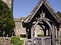 Lych Gate, Buckland Dinham church - geograph.org.uk - 439449.jpg 640 × 477; 114 KB


_-_geograph.org.uk_-_422121.jpg)
.jpg)


,_Ynysangharad_Park_-_geograph.org.uk_-_421725.jpg)


_-_geograph.org.uk_-_422096.jpg)


