Category:United Kingdom photographs taken on 2007-04-03
Jump to navigation
Jump to search
| ← | Tuesday 3 April 2007 | → | ||
| ← | April 2007 | → | ||

United Kingdom photographs taken on 3 April 2007.
Image files should be categorized here automatically using {{taken on}} template. Direct categorisation is also possible, if automatic is impossible.
Subcategories
This category has only the following subcategory.
Media in category "United Kingdom photographs taken on 2007-04-03"
The following 200 files are in this category, out of 599 total.
(previous page) (next page)-
 19th Century post box - geograph.org.uk - 442939.jpg 436 × 640; 77 KB
-
 A big ash - geograph.org.uk - 442585.jpg 640 × 480; 92 KB
-
 A driveway entrance to Clova House - geograph.org.uk - 387724.jpg 640 × 480; 125 KB
-
-
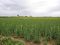
 A field of cauliflower stumps. - geograph.org.uk - 386807.jpg 640 × 427; 75 KB
-
 A line down - geograph.org.uk - 387233.jpg 480 × 640; 112 KB
-
-

-
 A spring at Ticknall - geograph.org.uk - 387489.jpg 480 × 640; 107 KB
-

-
 A470 - geograph.org.uk - 386792.jpg 640 × 428; 165 KB
-
 A470 - geograph.org.uk - 386806.jpg 640 × 428; 146 KB
-
 A605 roundabout - geograph.org.uk - 387168.jpg 640 × 480; 103 KB
-
 A944 lay-by - geograph.org.uk - 387583.jpg 640 × 480; 89 KB
-
 A944 westbound - geograph.org.uk - 387547.jpg 640 × 396; 56 KB
-
 Aberdeen Golf Centre - geograph.org.uk - 387756.jpg 640 × 480; 66 KB
-
 Abergynolwyn School - geograph.org.uk - 392941.jpg 640 × 480; 158 KB
-
 Access to Brig o'Lead farm - geograph.org.uk - 387682.jpg 640 × 480; 115 KB
-
 Access track to Tulloch - geograph.org.uk - 387715.jpg 640 × 480; 117 KB
-
 Across to Ember Hill - geograph.org.uk - 388940.jpg 640 × 478; 261 KB
-
 Afon Eden - geograph.org.uk - 387455.jpg 640 × 428; 206 KB
-
 Allt Dderw and Valley - geograph.org.uk - 390894.jpg 640 × 480; 61 KB
-

-
 Anstruther - geograph.org.uk - 396932.jpg 496 × 372; 63 KB
-
 Approaching Scriven - geograph.org.uk - 388748.jpg 478 × 640; 310 KB
-
 Arable land, Clungunford - geograph.org.uk - 406400.jpg 640 × 438; 47 KB
-
 Arable land, Clungunford - geograph.org.uk - 442576.jpg 640 × 392; 31 KB
-
 Ardrossan Marina - geograph.org.uk - 394730.jpg 640 × 480; 112 KB
-
 B5006 Road Junction - geograph.org.uk - 386704.jpg 640 × 480; 93 KB
-
 Bachawy Valley - geograph.org.uk - 390773.jpg 640 × 480; 70 KB
-
 Badger path - geograph.org.uk - 442565.jpg 480 × 640; 155 KB
-
 Balderton Brook and the River Dee - geograph.org.uk - 388770.jpg 640 × 480; 159 KB
-
 Baldyvin road - geograph.org.uk - 387668.jpg 640 × 480; 99 KB
-
 Battle of Myton - geograph.org.uk - 388876.jpg 640 × 478; 208 KB
-
 Battlefield - Myton-on-Swale - geograph.org.uk - 388886.jpg 640 × 478; 300 KB
-
 Between the stiles - geograph.org.uk - 387692.jpg 640 × 480; 106 KB
-
 Bishop Monkton - geograph.org.uk - 388845.jpg 640 × 478; 227 KB
-
 Bishop Monkton Church - geograph.org.uk - 388843.jpg 640 × 478; 256 KB
-
 Black Horse - geograph.org.uk - 388931.jpg 640 × 478; 232 KB
-
 Black Poplar, Newtown, Powys - geograph.org.uk - 567320.jpg 480 × 640; 147 KB
-
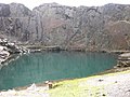 Blue Lake above Friog - geograph.org.uk - 392897.jpg 640 × 480; 130 KB
-
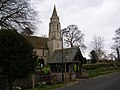
 St John's Church, Bowling - geograph.org.uk - 386895.jpg 475 × 636; 42 KB
-
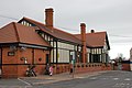
 Bradford Interchange Railway Station - geograph.org.uk - 386940.jpg 637 × 449; 60 KB
-

-

-
 Bridge on the river Faughan - geograph.org.uk - 388565.jpg 640 × 480; 166 KB
-
 BridgeAtFrogmoreCornwallGeograph.jpg 640 × 480; 149 KB
-
 Bridleway near The Elms - geograph.org.uk - 387470.jpg 640 × 480; 104 KB
-
 Bridleway to Ingleby Toft - geograph.org.uk - 387655.jpg 640 × 480; 106 KB
-
 Bridleway to Melbourne - geograph.org.uk - 386717.jpg 640 × 480; 115 KB
-
 Bridleway to Myton-on-Swale - geograph.org.uk - 388872.jpg 640 × 478; 283 KB
-
 Bridleways to Haresdean and Pangdean - geograph.org.uk - 388364.jpg 640 × 480; 69 KB
-
 Bryngwyn Village Green - geograph.org.uk - 390960.jpg 640 × 480; 125 KB
-
 Building at Dean Farm - geograph.org.uk - 387538.jpg 640 × 480; 136 KB
-
 Building at Devil's dyke - geograph.org.uk - 387191.jpg 640 × 480; 82 KB
-
 Burnt out Car Silpho Moor - geograph.org.uk - 395961.jpg 640 × 524; 146 KB
-
 Burton Leonard - geograph.org.uk - 388763.jpg 640 × 478; 287 KB
-
 Bushmoor - geograph.org.uk - 406510.jpg 640 × 480; 62 KB
-
 Butts downhill - geograph.org.uk - 387214.jpg 480 × 640; 115 KB
-
 Caerhays Castle from the car park - geograph.org.uk - 995349.jpg 640 × 480; 60 KB
-
 Cafe at Fiveways, Cullerlie - geograph.org.uk - 387758.jpg 640 × 480; 69 KB
-
 Camden High Street, London. - geograph.org.uk - 428745.jpg 640 × 480; 98 KB
-
 Camden lock in Camden Town, London. - geograph.org.uk - 428747.jpg 640 × 480; 87 KB
-

-

-
 Cannon down grange valley - panoramio.jpg 3,072 × 2,304; 1.69 MB
-
 Carrickfergus railway station - geograph.org.uk - 386761.jpg 640 × 426; 92 KB
-
-
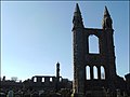
 Castle at St. Andrews - geograph.org.uk - 396936.jpg 500 × 376; 75 KB
-
 Cathedral at St. Andrews - geograph.org.uk - 396938.jpg 500 × 376; 54 KB
-
 Centre of Teeton - geograph.org.uk - 490263.jpg 640 × 480; 96 KB
-
 Cheddleton Flint Mill - geograph.org.uk - 413182.jpg 640 × 428; 128 KB
-

-
 Cheney Longville - geograph.org.uk - 406455.jpg 640 × 480; 86 KB
-
 Cheney Longville - geograph.org.uk - 406461.jpg 640 × 480; 65 KB
-
 Church in Eglinton - geograph.org.uk - 387159.jpg 640 × 480; 142 KB
-
 Chwarel Rhiw-bach - geograph.org.uk - 387039.jpg 480 × 640; 102 KB
-

-
 Clott House Farm - geograph.org.uk - 388858.jpg 640 × 478; 220 KB
-
 Coastline at Portholland - geograph.org.uk - 995324.jpg 640 × 480; 69 KB
-
 Cockfosters - geograph.org.uk - 388002.jpg 640 × 480; 91 KB
-
 Colindale, The New Chandos Public House - geograph.org.uk - 388408.jpg 640 × 461; 122 KB
-
 Commercial Road in Jarrow - geograph.org.uk - 1597949.jpg 640 × 480; 83 KB
-
 Corby's Crags - geograph.org.uk - 407405.jpg 640 × 480; 80 KB
-
 Cottage at a junction - geograph.org.uk - 388847.jpg 640 × 478; 232 KB
-
 Cottages in Orchard Lane - geograph.org.uk - 446437.jpg 640 × 486; 145 KB
-
 Cowslips - geograph.org.uk - 387431.jpg 480 × 640; 163 KB
-
 Cowslips in the verge - geograph.org.uk - 387430.jpg 640 × 480; 146 KB
-
 Cromarty East Kirk - geograph.org.uk - 494149.jpg 640 × 480; 80 KB
-
 Crossdyke on Newtimber Hill - geograph.org.uk - 388338.jpg 640 × 480; 92 KB
-
 Deer, Sherwood Pines - geograph.org.uk - 388481.jpg 640 × 480; 296 KB
-
 Defaid Dolgau Sheep - geograph.org.uk - 387087.jpg 640 × 428; 181 KB
-
-
-
 Devil's dyke coombe - geograph.org.uk - 387225.jpg 640 × 480; 86 KB
-
 Devil's Dyke Coombe - geograph.org.uk - 388237.jpg 640 × 480; 76 KB
-
 Dew pond North hill, Newtimber - geograph.org.uk - 388299.jpg 640 × 480; 103 KB
-
 Dew pond on West hill, Newtimber - geograph.org.uk - 388352.jpg 640 × 480; 69 KB
-
 Dewpond, North hill, Newtimber - geograph.org.uk - 388292.jpg 640 × 480; 95 KB
-
 Dibden Foreshore - Tide In - geograph.org.uk - 387026.jpg 640 × 477; 101 KB
-
 Down the bridleway - geograph.org.uk - 387664.jpg 640 × 480; 115 KB
-
 Down the Hill - geograph.org.uk - 388830.jpg 640 × 478; 235 KB
-
 Dual Carriageway - geograph.org.uk - 386882.jpg 640 × 400; 43 KB
-

-
 Easter holidays - geograph.org.uk - 387748.jpg 640 × 441; 56 KB
-
 Ellenthorpe Lane - geograph.org.uk - 388853.jpg 478 × 640; 206 KB
-
 Ellenthorpe Lodge - geograph.org.uk - 388856.jpg 640 × 478; 226 KB
-
 Empshill Farm - geograph.org.uk - 387371.jpg 640 × 480; 115 KB
-
 Entry to Corrennie Forest - geograph.org.uk - 387573.jpg 640 × 480; 79 KB
-
 Estate boundary stone - geograph.org.uk - 387649.jpg 640 × 480; 123 KB
-
 Evening on Hemmick Beach - geograph.org.uk - 995379.jpg 640 × 480; 52 KB
-
 Exmoor ponies at Skipwith Common - geograph.org.uk - 645151.jpg 640 × 480; 254 KB
-
 Fairbourne from Golwen Quarry - geograph.org.uk - 392904.jpg 640 × 480; 125 KB
-
 Farm and converted windmill - geograph.org.uk - 388934.jpg 640 × 478; 223 KB
-
 Farm house - geograph.org.uk - 391815.jpg 640 × 427; 127 KB
-
 Farm in Highdales - geograph.org.uk - 395933.jpg 640 × 480; 105 KB
-
 Farnham village green - geograph.org.uk - 388753.jpg 640 × 478; 277 KB
-
 Fferm Dolgau - geograph.org.uk - 386765.jpg 640 × 428; 166 KB
-
 Field of corn - geograph.org.uk - 387662.jpg 640 × 480; 98 KB
-
 Fir tree - geograph.org.uk - 388315.jpg 640 × 618; 85 KB
-
 Firlands Farm - geograph.org.uk - 388761.jpg 640 × 478; 219 KB
-
 Footpath heading South - geograph.org.uk - 387384.jpg 640 × 478; 117 KB
-
 Footpath to Several Woods Farm - geograph.org.uk - 386692.jpg 640 × 480; 76 KB
-
 Footpath to Veals Farm from Hythe - geograph.org.uk - 386976.jpg 640 × 475; 108 KB
-
 Foremark Reservoir - geograph.org.uk - 386714.jpg 640 × 480; 57 KB
-
 Foremark viewpoint - geograph.org.uk - 387594.jpg 640 × 480; 64 KB
-
 Forestry work - geograph.org.uk - 406432.jpg 640 × 480; 138 KB
-
 Forfar Loch - geograph.org.uk - 402175.jpg 640 × 480; 129 KB
-
 Forfar Loch - geograph.org.uk - 402610.jpg 640 × 480; 106 KB
-
 Fork in tracks - geograph.org.uk - 397186.jpg 640 × 480; 93 KB
-

-

-

-
 Former Gaumont Cinema - geograph.org.uk - 387052.jpg 638 × 463; 52 KB
-
 Fountain Brewery demolition - geograph.org.uk - 1342459.jpg 640 × 480; 110 KB
-
 Fulking escarpment and spring line - geograph.org.uk - 388244.jpg 640 × 480; 53 KB
-
 Fulking lime kiln - geograph.org.uk - 387263.jpg 640 × 480; 120 KB
-
 Garden ornaments at Fiveways cafe - geograph.org.uk - 387760.jpg 480 × 640; 132 KB
-
 Gated lane near Farnborough - geograph.org.uk - 489806.jpg 640 × 480; 81 KB
-
 Gated road - geograph.org.uk - 387382.jpg 640 × 480; 131 KB
-
 Gelli Goch - geograph.org.uk - 386814.jpg 640 × 428; 157 KB
-
 Gellifawr, North Pembrokeshire - geograph.org.uk - 392601.jpg 640 × 480; 121 KB
-
 Golden Lion in Jarrow - geograph.org.uk - 1393413.jpg 640 × 480; 77 KB
-
 Grace Road Cricket Ground - 1 - geography-387387.jpg 640 × 425; 125 KB
-
 Grahame Park, Barnet College, NW9 - geograph.org.uk - 390908.jpg 640 × 396; 99 KB
-
 Grahame Park, Community Centre, NW9 - geograph.org.uk - 389940.jpg 640 × 480; 81 KB
-
 Grahame Park, The Concourse, NW9 - geograph.org.uk - 389689.jpg 640 × 480; 94 KB
-
 Green lane near Hill Farm, Kislingbury - geograph.org.uk - 489849.jpg 640 × 480; 102 KB
-

-

-
 Health Centre Eglinton - geograph.org.uk - 443765.jpg 640 × 480; 114 KB
-
 Helicopters near Sunhill - geograph.org.uk - 387428.jpg 640 × 427; 92 KB
-
 Higher Melcombe House - geograph.org.uk - 391857.jpg 640 × 480; 104 KB
-
 Highland Cattle - geograph.org.uk - 388372.jpg 640 × 427; 101 KB
-
 Horn Hill - geograph.org.uk - 386696.jpg 640 × 480; 68 KB
-
 House in Penare - geograph.org.uk - 995386.jpg 640 × 480; 88 KB
-
 House on Paley Road - geograph.org.uk - 386908.jpg 637 × 484; 64 KB
-
 How Caple Church - geograph.org.uk - 465442.jpg 640 × 480; 120 KB
-
 Hungry lambs - geograph.org.uk - 388900.jpg 640 × 478; 266 KB
-
 Hyacinthoides on the How Caple Estate - geograph.org.uk - 465417.jpg 640 × 480; 148 KB
-
 Hythe to Veals Farm Footpath - geograph.org.uk - 386958.jpg 640 × 480; 142 KB
-
 Hythe to Veals Farm Footpath - geograph.org.uk - 386970.jpg 640 × 473; 142 KB
-
 In Broxa Forest - geograph.org.uk - 387826.jpg 640 × 480; 115 KB
-
 In Broxa Forest - geograph.org.uk - 395917.jpg 480 × 640; 148 KB
-
 Interior, St Peter, Dormington - geograph.org.uk - 639456.jpg 640 × 468; 72 KB
-
 J Cawthra and Co - Wakefield Road - geograph.org.uk - 386883.jpg 639 × 393; 31 KB
-
 Kinneff old Church - geograph.org.uk - 386963.jpg 640 × 480; 149 KB
-
 Lambing shed - geograph.org.uk - 442941.jpg 640 × 480; 79 KB
-

-
 Lamledra - geograph.org.uk - 995397.jpg 640 × 480; 54 KB
-

-
 Lindisfarne Castle from the beach.jpg 3,648 × 2,736; 2.44 MB
-
 Lindisfarne Priory and parish church.jpg 3,648 × 2,736; 2.41 MB
-
 Links Bay - geograph.org.uk - 1250475.jpg 640 × 480; 88 KB
-
 Little Brington spire - geograph.org.uk - 490145.jpg 480 × 640; 96 KB
-
 Llwybr i Hendy - Track to Hendy - geograph.org.uk - 387071.jpg 640 × 428; 157 KB
-
 Llyn y Frithgraig - geograph.org.uk - 387078.jpg 640 × 480; 81 KB
-

-
 Loch Morlich Branches - panoramio.jpg 2,333 × 1,555; 3.42 MB
-
 Loch Morlich Waters - panoramio.jpg 2,527 × 1,685; 4.25 MB
-
 Lock at Lilford - geograph.org.uk - 387120.jpg 640 × 367; 83 KB
-
 Lonely house at Porthcurnick Beach - geograph.org.uk - 978096.jpg 640 × 480; 80 KB
-
 Long Hill - geograph.org.uk - 387835.jpg 640 × 480; 88 KB
-

-
 Longhorn Cow on the How Caple Estate - geograph.org.uk - 465431.jpg 640 × 480; 151 KB
-

-

-
 Looking towards Lilley Bottom Road - geograph.org.uk - 388027.jpg 640 × 480; 102 KB
-
 Looking Up Loch Long From Ardgartan - panoramio.jpg 2,916 × 1,944; 3.63 MB
-
 Looking upstream - geograph.org.uk - 386957.jpg 640 × 480; 107 KB
-
 Lossiemouth Fish market - geograph.org.uk - 498911.jpg 640 × 480; 61 KB
-
 M1 Motorway, Junction 2 - geograph.org.uk - 390942.jpg 640 × 480; 76 KB
-
 Mawddach estuary from Barmouth Bridge - geograph.org.uk - 392929.jpg 640 × 480; 82 KB
-
 Milby - geograph.org.uk - 388846.jpg 640 × 478; 240 KB
-
 Milestone - geograph.org.uk - 387099.jpg 480 × 640; 144 KB
-
 Milligan Road in Aylestone, Leicester. - geograph.org.uk - 387389.jpg 640 × 533; 109 KB
-
 Milligan Road. - geograph.org.uk - 387394.jpg 640 × 392; 92 KB
-
 Myton-on-Swale - geograph.org.uk - 388892.jpg 640 × 478; 264 KB
-
 Name on a stone - geograph.org.uk - 387069.jpg 640 × 480; 136 KB
-
 Nant Gwernol Station - geograph.org.uk - 392951.jpg 640 × 480; 186 KB


_-_geograph.org.uk_-_386786.jpg)
_-_geograph.org.uk_-_386796.jpg)
_-_geograph.org.uk_-_386810.jpg)


_and_Cadythew_Rock_-_geograph.org.uk_-_995394.jpg)


.jpg)


