Category:United Kingdom photographs taken on 2007-04-27
Jump to navigation
Jump to search
| ← | Friday 27 April 2007 | → | ||
| ← | April 2007 | → | ||

United Kingdom photographs taken on 27 April 2007.
Image files should be categorized here automatically using {{taken on}} template. Direct categorisation is also possible, if automatic is impossible.
Subcategories
This category has the following 2 subcategories, out of 2 total.
S
Media in category "United Kingdom photographs taken on 2007-04-27"
The following 200 files are in this category, out of 949 total.
(previous page) (next page)-

-

-
 A 'jigger' leading to the White Lion - geograph.org.uk - 416222.jpg 480 × 640; 71 KB
-
 A cave in the headland - geograph.org.uk - 434078.jpg 640 × 480; 139 KB
-
 A close-up of the cave - geograph.org.uk - 434085.jpg 640 × 480; 142 KB
-
 A common spotted orchid at Mariandyrys - geograph.org.uk - 417147.jpg 640 × 479; 208 KB
-
 A dilapidated helm near Penmon Priory - geograph.org.uk - 417348.jpg 640 × 480; 80 KB
-
 A lichen - Ramalina fastigiata - geograph.org.uk - 914821.jpg 640 × 480; 75 KB
-
 A'Mhaighdean from Beinn a Chaisgein Mor - panoramio - SteveMi.jpg 2,560 × 1,920; 2.44 MB
-
 A'Mhaighdean from Beinn a Chaisgein Mor - panoramio.jpg 2,560 × 1,920; 2.44 MB
-
 A5, Maida Vale - geograph.org.uk - 467284.jpg 640 × 480; 138 KB
-

-
 Above Curlusk - geograph.org.uk - 415262.jpg 640 × 427; 278 KB
-
 Abyssinia plantation in Glen Kinglas - geograph.org.uk - 415260.jpg 640 × 480; 177 KB
-
 Across the River Dee - geograph.org.uk - 426008.jpg 640 × 480; 87 KB
-
 Alden Valley - geograph.org.uk - 417116.jpg 640 × 480; 118 KB
-
 Allaloth road end - geograph.org.uk - 1478026.jpg 640 × 427; 85 KB
-
 Almshouses, Halifax Road, Brighouse - geograph.org.uk - 417887.jpg 640 × 399; 68 KB
-
 Aqueduct over the River Brock - geograph.org.uk - 1127711.jpg 640 × 480; 128 KB
-
 Ardoch Wood - geograph.org.uk - 415114.jpg 640 × 427; 276 KB
-
 Asher House - geograph.org.uk - 415187.jpg 640 × 440; 75 KB
-
 Church of St Michael - Askerswell - geograph.org.uk - 415876.jpg 480 × 640; 185 KB
-
 Cottages at Askerswell - geograph.org.uk - 415887.jpg 640 × 480; 188 KB
-
 Auchindachy - geograph.org.uk - 415413.jpg 640 × 427; 255 KB
-
 Auchlunkart - geograph.org.uk - 415082.jpg 640 × 427; 279 KB
-
 Auchlunkart Home Farm - geograph.org.uk - 415076.jpg 640 × 427; 285 KB
-
 Avenue leading to Chadlington Downs Farm - geograph.org.uk - 415548.jpg 480 × 640; 154 KB
-
 Avenue Washlands Conservation Area - geograph.org.uk - 415719.jpg 640 × 480; 132 KB
-
 Aves Ditch - geograph.org.uk - 417917.jpg 640 × 480; 133 KB
-
 Badsworth Grange - geograph.org.uk - 417013.jpg 480 × 640; 128 KB
-
 Bae Penmon Bay - geograph.org.uk - 434290.jpg 640 × 480; 73 KB
-

-
 Banana News - geograph.org.uk - 415700.jpg 640 × 480; 108 KB
-
 Barn, Shammer - geograph.org.uk - 415030.jpg 640 × 480; 141 KB
-
 Barter's Hill Farm - geograph.org.uk - 419229.jpg 640 × 480; 111 KB
-
 Barwick Fish Tower.jpg 426 × 640; 122 KB
-
 Bateman's Tower - geograph.org.uk - 423982.jpg 640 × 480; 66 KB
-
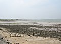
 Beach at low tide - geograph.org.uk - 415387.jpg 640 × 480; 52 KB
-
 Beach below the church at Kilmore - geograph.org.uk - 863479.jpg 640 × 480; 99 KB
-
 Beach Hut - geograph.org.uk - 424000.jpg 640 × 480; 43 KB
-
 Beach Huts - geograph.org.uk - 424008.jpg 640 × 480; 74 KB
-
 Beaumaris Castle from The Green - geograph.org.uk - 416244.jpg 640 × 480; 60 KB
-
 Beinn Dearg Bheag & Beinn Dearg Mor - panoramio - SteveMi.jpg 2,560 × 1,920; 2.38 MB
-
 Beinn Dearg Bheag & Beinn Dearg Mor - panoramio.jpg 2,560 × 1,920; 2.18 MB
-
 Beinn Dearg Bheag - panoramio - SteveMi.jpg 2,560 × 1,920; 2.43 MB
-
 Beinn Dearg Bheag - panoramio.jpg 2,560 × 1,920; 2.4 MB
-
 Beinn Dearg Mor - panoramio - SteveMi.jpg 2,560 × 1,920; 2.17 MB
-
 Beinn Dearg Mor - panoramio.jpg 2,560 × 1,920; 2.31 MB
-
 Birdwell obelisk.jpg 480 × 640; 57 KB
-

-
 Sacred Heart Church,Blackburn - geograph.org.uk - 415525.jpg 640 × 480; 99 KB
-
 St Silas' Church, Blackburn.jpg 480 × 640; 110 KB
-
 Blackford Hill Viewfinder - geograph.org.uk - 418190.jpg 640 × 480; 106 KB
-
 Blackhazel Beck - geograph.org.uk - 415905.jpg 480 × 640; 94 KB
-
 Blackhazel Beck - geograph.org.uk - 415912.jpg 640 × 480; 92 KB
-
 Blackhazel Beck and sheepfold - geograph.org.uk - 415899.jpg 640 × 480; 67 KB
-
 Blaeberry Flowers - geograph.org.uk - 415062.jpg 640 × 587; 360 KB
-
 Blaeloch - geograph.org.uk - 415590.jpg 640 × 468; 99 KB
-
 Blockhouse, Yatesbury - geograph.org.uk - 415161.jpg 640 × 480; 109 KB
-
 Bluebell Wood - geograph.org.uk - 1127700.jpg 480 × 640; 165 KB
-
 Bluebells, Crackley Lane - geograph.org.uk - 414959.jpg 640 × 480; 97 KB
-
 Boat House at Traeth Lleiniog - geograph.org.uk - 435053.jpg 640 × 480; 103 KB
-

-

-

-
 Bourton Farm, Shropshire - geograph.org.uk - 417882.jpg 640 × 442; 99 KB
-

-
 Bracknell railway station 1.jpg 480 × 640; 92 KB
-
 Breckland Species Zonation and Soils - geograph.org.uk - 415797.jpg 640 × 480; 147 KB
-
 Bredy Farmhouse - geograph.org.uk - 415836.jpg 592 × 640; 161 KB
-
 Bridge 205 - geograph.org.uk - 415572.jpg 480 × 640; 143 KB
-
 Bridleway to Bucks Head - geograph.org.uk - 415180.jpg 640 × 480; 121 KB
-
 Bridleway to Intake Lane - geograph.org.uk - 415716.jpg 640 × 480; 92 KB
-
 Bridleway to Mollyhurst Lane - geograph.org.uk - 415192.jpg 640 × 480; 81 KB
-
 Bridleway to Woolley Village - geograph.org.uk - 415729.jpg 640 × 480; 88 KB
-

-
 Broad Street and ICC cityscape - geograph.org.uk - 1634209.jpg 480 × 640; 85 KB
-
 Broadfield - geograph.org.uk - 415449.jpg 640 × 427; 201 KB
-
 Buckden Wood - geograph.org.uk - 416134.jpg 480 × 640; 148 KB
-
 Burn of Tauchers - geograph.org.uk - 415217.jpg 640 × 427; 261 KB
-
 Burnpark Wood - geograph.org.uk - 415475.jpg 427 × 640; 278 KB
-
 Burnpark Wood - geograph.org.uk - 415479.jpg 427 × 640; 326 KB
-
 Cabbachs - geograph.org.uk - 415200.jpg 640 × 427; 245 KB
-
 Cachanhead - geograph.org.uk - 415489.jpg 640 × 427; 281 KB
-
 Cachanhead - geograph.org.uk - 415496.jpg 640 × 427; 261 KB
-
 Cachanhead - geograph.org.uk - 415505.jpg 640 × 289; 169 KB
-
 Cairngorm Funicular Station - geograph.org.uk - 419616.jpg 640 × 257; 55 KB
-
 Camfa gerrig. Stone stile. - geograph.org.uk - 415754.jpg 427 × 640; 89 KB
-
 Camphill Reservoir - geograph.org.uk - 415573.jpg 640 × 480; 132 KB
-
 Canal at Caunsall - geograph.org.uk - 414921.jpg 640 × 480; 178 KB
-
 Castle Street looking west - geograph.org.uk - 416187.jpg 640 × 480; 74 KB
-
 Cattle in Chipping Warden - geograph.org.uk - 460572.jpg 640 × 477; 99 KB
-

-
 Chadwell Street, EC1 - geograph.org.uk - 415632.jpg 640 × 480; 102 KB
-
 Cherry trees on Princess Road - Malton - geograph.org.uk - 415368.jpg 640 × 479; 146 KB
-
 Chessel Bay, Southampton - geograph.org.uk - 415238.jpg 640 × 427; 146 KB
-
 Chilcombe Church - geograph.org.uk - 415863.jpg 640 × 507; 148 KB
-
 Chilcombe Farmhouse - geograph.org.uk - 415857.jpg 640 × 480; 154 KB
-
 Chipping Warden church - geograph.org.uk - 460546.jpg 640 × 477; 97 KB
-
 Church Farm and Church - geograph.org.uk - 415052.jpg 640 × 480; 78 KB
-

-
 Church yard at Bourton - geograph.org.uk - 417829.jpg 439 × 640; 94 KB
-
-
 Church, Much Wenlock - geograph.org.uk - 417951.jpg 429 × 640; 84 KB
-
 Clach Bharriag - geograph.org.uk - 419625.jpg 446 × 640; 80 KB
-
 Claydon railway crossing - geograph.org.uk - 460962.jpg 640 × 477; 78 KB
-
 Clifftop at Fedw Fawr - geograph.org.uk - 435481.jpg 640 × 480; 65 KB
-
 Clitheroe United Reformed Church - geograph.org.uk - 415696.jpg 640 × 480; 103 KB
-
 Cnap Coire na Spreidhe - geograph.org.uk - 419630.jpg 640 × 382; 72 KB
-
 Coire Cas - geograph.org.uk - 419612.jpg 469 × 640; 142 KB
-

-
 Connah's Quay Power Station - geograph.org.uk - 415961.jpg 640 × 426; 87 KB
-
 Corner Cottage, Badsworth - geograph.org.uk - 417007.jpg 640 × 480; 106 KB
-
 Corporation Park - geograph.org.uk - 415543.jpg 640 × 480; 100 KB
-
 Coryates (2) - geograph.org.uk - 415769.jpg 640 × 480; 184 KB
-
 Coryates - geograph.org.uk - 415765.jpg 480 × 640; 185 KB
-

-
 Cottages in Chipping Warden - geograph.org.uk - 460534.jpg 640 × 477; 78 KB
-
 Court Lodge Farm - geograph.org.uk - 415486.jpg 640 × 480; 79 KB
-
 Court-at-Street - geograph.org.uk - 415403.jpg 640 × 480; 109 KB
-
 Craiganlea - geograph.org.uk - 415760.jpg 640 × 480; 154 KB
-

-
 Crib gwelltog. Grassy Ridge. - geograph.org.uk - 415748.jpg 427 × 640; 80 KB
-
 Crocker's Folly, Aberdeen Place - geograph.org.uk - 415074.jpg 640 × 480; 94 KB
-
 Crop spraying - geograph.org.uk - 419277.jpg 640 × 480; 95 KB
-
 Crow Lane - geograph.org.uk - 417891.jpg 640 × 480; 150 KB
-
 Curlusk - geograph.org.uk - 415237.jpg 640 × 427; 270 KB
-
 Curlusk - geograph.org.uk - 415297.jpg 640 × 427; 245 KB
-
 Cut-Off Channel - geograph.org.uk - 416568.jpg 640 × 427; 56 KB
-
 Cut-Off Channel near Whiteplot Farm - geograph.org.uk - 416560.jpg 640 × 411; 56 KB
-
 Cut-off Channel, Methwold Hythe - geograph.org.uk - 416533.jpg 640 × 427; 94 KB
-
 D Byrne and Co - geograph.org.uk - 415695.jpg 640 × 480; 101 KB
-
-
 Derelict hangar, Yatesbury - geograph.org.uk - 415033.jpg 640 × 480; 89 KB
-
 Derelict hangar, Yatesbury, another view - geograph.org.uk - 415160.jpg 640 × 480; 103 KB
-
 Derelict Mains of Campfield - geograph.org.uk - 414882.jpg 640 × 480; 165 KB
-
 Dereliction in Calves Close Spinney - geograph.org.uk - 460513.jpg 640 × 477; 110 KB
-
 Des res^ Would suit DIY enthusiast - geograph.org.uk - 461130.jpg 640 × 477; 133 KB
-
 Descent from Farnborough - geograph.org.uk - 461074.jpg 640 × 477; 105 KB
-
 Detail - geograph.org.uk - 415538.jpg 640 × 480; 104 KB
-
 Distinctive sheep - geograph.org.uk - 460556.jpg 640 × 477; 79 KB
-
 Disused hangar, Yatesbury - geograph.org.uk - 505028.jpg 640 × 426; 236 KB
-
 Doorway, Market Square, Kineton - geograph.org.uk - 451487.jpg 480 × 640; 105 KB
-
 Driveway to Farnborough Hall - geograph.org.uk - 461100.jpg 640 × 477; 115 KB
-
 Druminnor Castle Drive - geograph.org.uk - 422382.jpg 480 × 640; 142 KB
-
 Drury Lane, WC2 (1) - geograph.org.uk - 416486.jpg 640 × 480; 115 KB
-
 Drury Lane, WC2 (2) - geograph.org.uk - 416507.jpg 640 × 480; 127 KB
-

-
 Eglwys St Cawrdaf, Llangoed - geograph.org.uk - 415454.jpg 640 × 422; 90 KB
-
 Entrance Gate to Norton Conyers House - geograph.org.uk - 419478.jpg 640 × 480; 118 KB
-
 Entrance to Lightwater Valley - geograph.org.uk - 414822.jpg 640 × 480; 80 KB
-
 Entrance to Rapkyns Farm - geograph.org.uk - 415389.jpg 640 × 480; 91 KB
-
 Entrance to the O2 Centre - geograph.org.uk - 415653.jpg 480 × 640; 101 KB
-
 Rectory Barn, Eydon - geograph.org.uk - 460430.jpg 640 × 477; 89 KB
-

-
-
 Poultry Farm - geograph.org.uk - 460978.jpg 640 × 477; 71 KB
-
 Farnborough Hall 1.jpg 640 × 477; 117 KB
-
 Farnborough Lake - geograph.org.uk - 461116.jpg 640 × 477; 150 KB
-
 Farnborough village hall - geograph.org.uk - 461083.jpg 640 × 477; 95 KB
-

-
 Feeding troughs on the grazing land - geograph.org.uk - 461690.jpg 640 × 477; 88 KB
-
 Felled^ - geograph.org.uk - 415127.jpg 640 × 427; 266 KB
-
 Fields north of Cornelyn - geograph.org.uk - 435474.jpg 640 × 480; 91 KB
-
 Fields Of Gold. - geograph.org.uk - 442411.jpg 426 × 640; 103 KB
-
 Fleabane^ - geograph.org.uk - 415386.jpg 640 × 427; 333 KB
-
 Fleabane^ - geograph.org.uk - 415401.jpg 640 × 510; 230 KB
-
 Flora MacDonald hostel - geograph.org.uk - 856992.jpg 640 × 480; 79 KB
-
 Flower bed - geograph.org.uk - 415540.jpg 640 × 480; 99 KB
-
 Footbridge over the River Brock - geograph.org.uk - 1127708.jpg 640 × 480; 153 KB
-
 Footbridge over the River Caldew - geograph.org.uk - 416491.jpg 640 × 480; 99 KB
-
 Footpath from Gipsy Lane - geograph.org.uk - 415057.jpg 640 × 480; 89 KB
-
 Footpath from Mollyhurst Lane Bridleway - geograph.org.uk - 415703.jpg 640 × 480; 136 KB
-
 Footpath in Castle Wood - geograph.org.uk - 461572.jpg 640 × 477; 157 KB
-
 Footpath in Castle Wood - geograph.org.uk - 461628.jpg 640 × 477; 160 KB
-
 Footpath through rape - geograph.org.uk - 417910.jpg 640 × 480; 133 KB
-
 Footpath to Radway - geograph.org.uk - 461570.jpg 640 × 477; 127 KB
-
 Footpath to the O2 Centre - geograph.org.uk - 415251.jpg 519 × 640; 88 KB
-
 Footpath towards Ratley - geograph.org.uk - 461544.jpg 640 × 477; 126 KB
-
 Forest Avenue on Highbirch Hill - geograph.org.uk - 415247.jpg 640 × 480; 127 KB
-
 Forest Road - geograph.org.uk - 415208.jpg 640 × 427; 272 KB
-
 Forget-me-not - geograph.org.uk - 415382.jpg 640 × 521; 402 KB
-
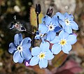 Forget-me-not - geograph.org.uk - 415384.jpg 640 × 564; 253 KB
-
 Foxhills Industrial Estate, Scunthorpe - geograph.org.uk - 415117.jpg 640 × 480; 391 KB
-
 Fryars Bay - geograph.org.uk - 435437.jpg 640 × 462; 78 KB
-
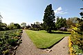
 Gardens at Geilston House - geograph.org.uk - 415739.jpg 640 × 427; 108 KB
-
 Garland - geograph.org.uk - 415347.jpg 640 × 427; 253 KB
-
 Gas Street basin and cityscape - geograph.org.uk - 1634215.jpg 480 × 640; 89 KB
-
 Gates to Corporation Park - geograph.org.uk - 415533.jpg 640 × 480; 100 KB
-
 Gates to Corporation Park - geograph.org.uk - 415537.jpg 625 × 466; 105 KB
-
 Gateside - geograph.org.uk - 415156.jpg 640 × 427; 272 KB
-
 Gateside - geograph.org.uk - 415162.jpg 640 × 296; 163 KB
-
 Gateside - geograph.org.uk - 415169.jpg 640 × 427; 265 KB
-
 Gateside - geograph.org.uk - 415181.jpg 640 × 427; 247 KB
-
 Geilston House - geograph.org.uk - 415737.jpg 640 × 427; 96 KB
-
 Geilston House - geograph.org.uk - 415744.jpg 640 × 427; 112 KB
-
 Geilston House.jpg 640 × 427; 108 KB
-

-
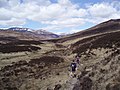 Glen Dee - geograph.org.uk - 426013.jpg 640 × 480; 92 KB
-
 Glentauchers Distillery - geograph.org.uk - 415343.jpg 640 × 257; 141 KB


_-_geograph.org.uk_-_415769.jpg)


_-_geograph.org.uk_-_416486.jpg)
_-_geograph.org.uk_-_416507.jpg)


