Category:United Kingdom photographs taken on 2007-04-20
Jump to navigation
Jump to search
| ← | Friday 20 April 2007 | → | ||
| ← | April 2007 | → | ||

United Kingdom photographs taken on 20 April 2007.
Image files should be categorized here automatically using {{taken on}} template. Direct categorisation is also possible, if automatic is impossible.
Subcategories
This category has only the following subcategory.
S
Media in category "United Kingdom photographs taken on 2007-04-20"
The following 200 files are in this category, out of 807 total.
(previous page) (next page)-
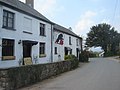 "Black Bear" pub, Bettws Newydd - geograph.org.uk - 407173.jpg 640 × 480; 78 KB
-
 "Snap" - geograph.org.uk - 407275.jpg 640 × 480; 238 KB
-
 1935 SS (636862448).jpg 1,105 × 777; 223 KB
-
 1951 Austin A90 Atlantic (636862542).jpg 1,184 × 771; 306 KB
-
 1981 Triumph Spitfire Last off the Line (636862362).jpg 1,188 × 781; 268 KB
-
 A choice of which way to go - geograph.org.uk - 407266.jpg 640 × 480; 239 KB
-
 A liverwort - Conocephalum conicum - geograph.org.uk - 930674.jpg 640 × 480; 101 KB
-
 A Very Wet Byway, Wooton, Shropshire - geograph.org.uk - 408921.jpg 480 × 640; 142 KB
-
 A walk around Glenarm forest (1) - geograph.org.uk - 407177.jpg 640 × 426; 182 KB
-
 A walk around Glenarm forest (10) - geograph.org.uk - 407313.jpg 640 × 426; 189 KB
-
 A walk around Glenarm forest (11) - geograph.org.uk - 407333.jpg 640 × 426; 165 KB
-
 A walk around Glenarm forest (12) - geograph.org.uk - 407348.jpg 640 × 426; 147 KB
-
 A walk around Glenarm forest (13) - geograph.org.uk - 407361.jpg 640 × 426; 138 KB
-
 A walk around Glenarm forest (2) - geograph.org.uk - 407185.jpg 640 × 426; 178 KB
-
 A walk around Glenarm forest (4) - geograph.org.uk - 407204.jpg 640 × 426; 187 KB
-
 A walk around Glenarm forest (6) - geograph.org.uk - 407258.jpg 640 × 426; 193 KB
-
 A walk around Glenarm forest (7) - geograph.org.uk - 407273.jpg 640 × 426; 195 KB
-
 A walk around Glenarm forest (8) - geograph.org.uk - 407287.jpg 640 × 426; 203 KB
-
 A walk around Glenarm forest (9) - geograph.org.uk - 407302.jpg 640 × 426; 196 KB
-
 A water works building. - geograph.org.uk - 407210.jpg 640 × 480; 99 KB
-
 A177 View - geograph.org.uk - 408406.jpg 640 × 480; 102 KB
-
 A181 View - geograph.org.uk - 408554.jpg 640 × 480; 106 KB
-
 A689 Dual carriageway - geograph.org.uk - 407627.jpg 640 × 480; 69 KB
-

-
 Abbotsbury-Railway-Building-by-Ray-Beer.jpg 640 × 480; 187 KB
-
 Abernant - geograph.org.uk - 406801.jpg 640 × 480; 183 KB
-
 Above Wrynose Pass - geograph.org.uk - 408745.jpg 640 × 480; 54 KB
-

-
 Afon Cledwen - geograph.org.uk - 407312.jpg 640 × 480; 177 KB
-

-
 Alders - geograph.org.uk - 411137.jpg 640 × 427; 268 KB
-
 All Saints church, Walcott - geograph.org.uk - 1555155.jpg 640 × 480; 74 KB
-

-

-
 Allium ursinum in Glenarm forest (3) - geograph.org.uk - 407196.jpg 640 × 426; 172 KB
-
 Allium ursinum in Glenarm forest (5) - geograph.org.uk - 407214.jpg 640 × 426; 185 KB
-
 Allt Mor na h-Uamha - geograph.org.uk - 411141.jpg 640 × 427; 290 KB
-
 Allt Mor na h-Uamha - geograph.org.uk - 411143.jpg 640 × 427; 290 KB
-
 Allt Mor na h-Uamha - geograph.org.uk - 411166.jpg 640 × 427; 86 KB
-
 Allt nam Fraoch-choire - geograph.org.uk - 407102.jpg 640 × 427; 297 KB
-
 Allt nam Fraoch-choire - geograph.org.uk - 407104.jpg 640 × 426; 260 KB
-
 Allt nam Fraoch-choire - geograph.org.uk - 407126.jpg 640 × 480; 335 KB
-
 Approaching Bourton-on-the-Hill - geograph.org.uk - 407542.jpg 640 × 480; 99 KB
-
 Ar y gwastad. On level ground. - geograph.org.uk - 407419.jpg 640 × 480; 146 KB
-

-
 Arable land - geograph.org.uk - 407639.jpg 640 × 480; 99 KB
-
 Arisaig Bay - geograph.org.uk - 412222.jpg 640 × 480; 69 KB
-
 Aston Martin DB4 Zagato (636862534).jpg 1,178 × 777; 207 KB
-
 Aston Martin Ulster (636862520).jpg 1,171 × 773; 306 KB
-
 Avenue of Trees, Chyknell Park, Shropshire - geograph.org.uk - 407244.jpg 1,440 × 1,080; 1.67 MB
-

-
 Back door - geograph.org.uk - 407179.jpg 640 × 480; 167 KB
-
 Backglen and Crosh Roads - geograph.org.uk - 407818.jpg 640 × 480; 53 KB
-
 Bailey Green Cottages - geograph.org.uk - 407303.jpg 640 × 480; 202 KB
-
 Ballynamullan - geograph.org.uk - 407831.jpg 640 × 480; 52 KB
-
 Ballynamullan Road - geograph.org.uk - 407830.jpg 640 × 301; 47 KB
-
 Bank of the Wye - geograph.org.uk - 409731.jpg 640 × 480; 90 KB
-

-

-
 Barclays Bank in Holsworthy - geograph.org.uk - 472872.jpg 640 × 426; 104 KB
-
 Barclays Bank in Holsworthy.jpg 640 × 426; 63 KB
-
 Barnsley Darton Railway - geograph.org.uk - 407049.jpg 640 × 480; 92 KB
-

-
 Bassingham Wesleyan Methodist Church - geograph.org.uk - 1017296.jpg 625 × 464; 192 KB
-
 Bathams Brewery - geograph.org.uk - 424449.jpg 480 × 640; 85 KB
-
 Bathams brewery - geograph.org.uk - 424453.jpg 640 × 480; 93 KB
-
 Bathams brewery - geograph.org.uk - 424456.jpg 640 × 480; 70 KB
-
 Bathams brewery - geograph.org.uk - 424460.jpg 640 × 480; 75 KB
-
 Bay at Liddesdale - geograph.org.uk - 410413.jpg 640 × 480; 91 KB
-
 Beacon and Brewery - geograph.org.uk - 414152.jpg 640 × 480; 96 KB
-
 Becket's Bridge - geograph.org.uk - 457400.jpg 640 × 427; 74 KB
-
 Benton Castle - geograph.org.uk - 407464.jpg 640 × 480; 85 KB
-
 Berryfield Farm - geograph.org.uk - 408420.jpg 640 × 480; 152 KB
-
 Beryl Burton Garden - geograph.org.uk - 409047.jpg 640 × 480; 128 KB
-
 Bike Park - geograph.org.uk - 408550.jpg 640 × 480; 149 KB
-
 Birkdale High School - geograph.org.uk - 410951.jpg 640 × 480; 65 KB
-
 Blea Tarn - geograph.org.uk - 408755.jpg 640 × 480; 79 KB
-
 Blea Tarn - geograph.org.uk - 408768.jpg 640 × 480; 74 KB
-
 Blea Tarn - geograph.org.uk - 408787.jpg 480 × 640; 60 KB
-
 Blossom, Cleveley, Oxfordshire. - geograph.org.uk - 412307.jpg 640 × 480; 152 KB
-
 Boats on the bank of the River Dee - geograph.org.uk - 409353.jpg 640 × 480; 52 KB
-
 Bridge over disused railway line - geograph.org.uk - 407558.jpg 640 × 480; 133 KB
-
 Brooklands Farm - geograph.org.uk - 407515.jpg 640 × 480; 116 KB
-
 Brown's farm, Coleford - geograph.org.uk - 1403423.jpg 640 × 480; 103 KB
-
 Burstwick Drain - geograph.org.uk - 408425.jpg 640 × 480; 123 KB
-
 Burstwick Drain - geograph.org.uk - 408437.jpg 640 × 480; 111 KB
-
 Burstwick Drain Bridleway - geograph.org.uk - 407229.jpg 640 × 480; 140 KB
-
 Burstwick Drain Footbridge - geograph.org.uk - 408433.jpg 640 × 480; 123 KB
-
 Burstwick Drain Railway Bridge - geograph.org.uk - 407232.jpg 640 × 480; 99 KB
-
 Byway Approaching Wooton, Shropshire - geograph.org.uk - 407050.jpg 640 × 439; 139 KB
-
 Byway Approaching Wooton, Shropshire - geograph.org.uk - 408927.jpg 479 × 640; 140 KB
-
 Byway near Woundale, Shropshire - geograph.org.uk - 407239.jpg 1,440 × 1,022; 1.95 MB
-
 Canal basin at Dunhampstead - geograph.org.uk - 466798.jpg 640 × 480; 146 KB
-

-
 Canning Town, Normandy Terrace, E16 - geograph.org.uk - 408315.jpg 640 × 480; 79 KB
-

-
 Capel Beulah - geograph.org.uk - 407268.jpg 640 × 480; 109 KB
-
 Carrickfergus castle (detail) (1) - geograph.org.uk - 407081.jpg 640 × 426; 154 KB
-
 Carrickfergus castle (detail) (2) - geograph.org.uk - 407085.jpg 640 × 426; 167 KB
-
 Carrickfergus castle (detail) (3) - geograph.org.uk - 407091.jpg 640 × 426; 144 KB
-
 Castle Bay, Stromemore - geograph.org.uk - 410522.jpg 427 × 640; 124 KB
-

-

-
 Cefnen - geograph.org.uk - 407274.jpg 640 × 480; 129 KB
-
 Celebration Cross - geograph.org.uk - 407344.jpg 640 × 480; 131 KB
-
 Chester to Holyhead Railway - West - geograph.org.uk - 411918.jpg 480 × 640; 206 KB
-
 Church Bell - geograph.org.uk - 412247.jpg 640 × 480; 115 KB
-
 Class 03, No.03162 Built 1960 by BR.jpg 3,543 × 2,362; 1.61 MB
-

-
 Cofeb ryfel Talwrn War memorial - geograph.org.uk - 409043.jpg 640 × 428; 191 KB
-
 Coleford, Devon - geograph.org.uk - 1403424.jpg 640 × 480; 91 KB
-

-
 Corn Exchange Interior - geograph.org.uk - 408202.jpg 480 × 640; 126 KB
-
 Coruisk - geograph.org.uk - 410960.jpg 640 × 418; 205 KB
-

-
 Cromwell's Bridge - geograph.org.uk - 407322.jpg 640 × 480; 178 KB
-
 Crop Fields near Wooton, Shropshire - geograph.org.uk - 408957.jpg 640 × 480; 113 KB
-
 Crossroads and track - geograph.org.uk - 407252.jpg 640 × 480; 84 KB
-
 Crossroads at Penpedairheol - geograph.org.uk - 407059.jpg 640 × 480; 86 KB
-
 Cruggleton Church - sourrounding wall - geograph.org.uk - 604377.jpg 640 × 480; 162 KB
-
 Cruggleton Church through iron gate - geograph.org.uk - 604373.jpg 480 × 640; 136 KB
-
 Cruggleton church.jpg 640 × 480; 117 KB
-
 Custom House railway station - geograph.org.uk - 408729.jpg 640 × 480; 99 KB
-
 Cylch yr Orsedd Llangefni Gorsedd Circle - geograph.org.uk - 408855.jpg 640 × 428; 173 KB
-
 Daff Reservoir - geograph.org.uk - 410008.jpg 640 × 480; 80 KB
-
 Ddôl-Frwynog - geograph.org.uk - 407286.jpg 640 × 480; 92 KB
-
 Delph locks - geograph.org.uk - 424468.jpg 640 × 480; 99 KB
-
 Delph locks - geograph.org.uk - 424475.jpg 640 × 480; 99 KB
-
 Delph locks - geograph.org.uk - 424483.jpg 640 × 480; 110 KB
-
 Delph locks - geograph.org.uk - 424485.jpg 640 × 480; 101 KB
-
 Delph locks - geograph.org.uk - 424489.jpg 640 × 480; 109 KB
-
 Dethick lane junction - geograph.org.uk - 792058.jpg 640 × 480; 65 KB
-
 Devil's Kitchen from Llyn Idwal - geograph.org.uk - 691764.jpg 640 × 480; 83 KB
-
 Dibidil Track - geograph.org.uk - 411146.jpg 640 × 427; 283 KB
-
 Dismantled Railway Track - geograph.org.uk - 411546.jpg 640 × 386; 128 KB
-
 Disused railway line - geograph.org.uk - 408003.jpg 640 × 480; 177 KB
-
 Disused Railway Track - geograph.org.uk - 411535.jpg 640 × 480; 215 KB
-
 Dorset Square, London NW1 - geograph.org.uk - 407511.jpg 640 × 480; 316 KB
-
 Drive to Gottenham - geograph.org.uk - 408400.jpg 640 × 480; 80 KB
-
 Driveway to Sacombe Hill Farm - geograph.org.uk - 407213.jpg 640 × 480; 87 KB
-
 Duck pond - geograph.org.uk - 407531.jpg 640 × 480; 110 KB
-

-
 St Mary's Church, East Guldeford - geograph.org.uk - 443236.jpg 640 × 427; 96 KB
-
 East India DLR station - geograph.org.uk - 410659.jpg 640 × 480; 80 KB
-

-

-
 Eglwys Sadwrn Sant - St Sadwrn's Church - geograph.org.uk - 408904.jpg 640 × 428; 173 KB
-
-

-
 Entering Hook Norton - geograph.org.uk - 407990.jpg 640 × 480; 134 KB
-
 Entering Weston-sub-Edge - geograph.org.uk - 407521.jpg 640 × 480; 118 KB
-
 Entrance and road to Lower Clerk Hill - geograph.org.uk - 407407.jpg 640 × 480; 189 KB
-
 Entrance to Briarwood Holiday Camp - geograph.org.uk - 407250.jpg 640 × 480; 172 KB
-
 Entrance to Centenary Gardens - geograph.org.uk - 407341.jpg 640 × 480; 64 KB
-
 Entrance to Little Mitton Farm - geograph.org.uk - 407349.jpg 640 × 480; 248 KB
-

-
 Entrance to Smithy Farm - geograph.org.uk - 407291.jpg 640 × 480; 218 KB
-
 Erosion between Exmouth and Budleigh - geograph.org.uk - 705976.jpg 640 × 480; 137 KB
-
 Esgairdawe Church - geograph.org.uk - 406783.jpg 640 × 480; 114 KB
-
 Estuary of Ullapool River - geograph.org.uk - 1475959.jpg 640 × 480; 56 KB
-
 Euthrix potatoria - geograph.org.uk - 410173.jpg 640 × 480; 113 KB
-
 Evening skies near Tottons Down Barn - geograph.org.uk - 407469.jpg 640 × 480; 108 KB
-
 Ewes and Lambs, Birdsgreen, Shropshire - geograph.org.uk - 407027.jpg 640 × 480; 124 KB
-
 Farm at Llancayo - geograph.org.uk - 407299.jpg 640 × 463; 55 KB
-
 Farm buildings and road - geograph.org.uk - 785788.jpg 640 × 480; 81 KB
-
 Farmland - geograph.org.uk - 407321.jpg 640 × 480; 104 KB
-
 Fence over the Moorland - geograph.org.uk - 410652.jpg 640 × 480; 82 KB
-
 Fermenting Tanks - geograph.org.uk - 414279.jpg 640 × 480; 89 KB
-
 Ferry Inn at Horning - geograph.org.uk - 1025869.jpg 640 × 486; 82 KB
-
 Field near Standon Green End - geograph.org.uk - 407206.jpg 640 × 480; 81 KB
-
 Field of carrots - geograph.org.uk - 407772.jpg 640 × 480; 103 KB
-
 Fields of Gold - Flickr - Ella's Dad.jpg 800 × 449; 88 KB
-
 Five Watering Sewer - geograph.org.uk - 457404.jpg 427 × 640; 46 KB
-
-

-
 Flintshire bridge.jpg 480 × 640; 157 KB
-
 Flock of sheep at Dutton, Lancashire, England.jpg 640 × 480; 249 KB
-
 Flour Gill - geograph.org.uk - 407911.jpg 640 × 480; 69 KB
-
 Fly Tipping. Wooton, Shropshire - geograph.org.uk - 408432.jpg 640 × 487; 138 KB
-
 Flying practice - geograph.org.uk - 431811.jpg 640 × 477; 30 KB
-
 Foel Rhudd. - geograph.org.uk - 407758.jpg 640 × 427; 95 KB
-

-
 Footpath through Cruggleton Woods - geograph.org.uk - 604389.jpg 640 × 480; 150 KB
-
 Ford GT40 (636898788).jpg 1,178 × 777; 244 KB
-

-
 Forestry road - geograph.org.uk - 407163.jpg 640 × 480; 133 KB
-
 Former Banbury to Cheltenham railway line - geograph.org.uk - 407560.jpg 640 × 427; 105 KB
-
 Former workhouse and church, Eastry - geograph.org.uk - 407323.jpg 640 × 480; 131 KB
-
 Frampton Marsh - geograph.org.uk - 431800.jpg 640 × 477; 76 KB
-
 Farming inside the sea bank - geograph.org.uk - 431847.jpg 640 × 477; 73 KB
-

-
 George Street, Whithorn - geograph.org.uk - 605654.jpg 640 × 480; 84 KB
-
 Gibbet stone - geograph.org.uk - 792103.jpg 640 × 480; 127 KB
-

-
 Godington Village Hall - geograph.org.uk - 407042.jpg 640 × 480; 270 KB
-

-
 Gottenham - geograph.org.uk - 407446.jpg 640 × 480; 112 KB
-
 Apple tree in blossom - geograph.org.uk - 407616.jpg 640 × 488; 167 KB
-
 D'Arcy Dalton Way - geograph.org.uk - 407587.jpg 480 × 640; 149 KB
-


.jpg)
.jpg)
.jpg)


_-_geograph.org.uk_-_407177.jpg)
_-_geograph.org.uk_-_407313.jpg)
_-_geograph.org.uk_-_407333.jpg)
_-_geograph.org.uk_-_407348.jpg)
_-_geograph.org.uk_-_407361.jpg)
_-_geograph.org.uk_-_407185.jpg)
_-_geograph.org.uk_-_407204.jpg)
_-_geograph.org.uk_-_407258.jpg)
_-_geograph.org.uk_-_407273.jpg)
_-_geograph.org.uk_-_407287.jpg)
_-_geograph.org.uk_-_407302.jpg)


_-_geograph.org.uk_-_407373.jpg)
_-_geograph.org.uk_-_407196.jpg)
_-_geograph.org.uk_-_407214.jpg)


.jpg)
.jpg)


_(1)_-_geograph.org.uk_-_407081.jpg)
_(2)_-_geograph.org.uk_-_407085.jpg)
_(3)_-_geograph.org.uk_-_407091.jpg)


_stone_house_in_St_Fillans_village,_Perthshire_-_geograph.org.uk_-_1595161.jpg)


.jpg)


.jpg)


_-_geograph.org.uk_-_407564.jpg)