Category:United Kingdom photographs taken on 2006-07-30
Jump to navigation
Jump to search

Subcategories
This category has the following 3 subcategories, out of 3 total.
Media in category "United Kingdom photographs taken on 2006-07-30"
The following 200 files are in this category, out of 1,054 total.
(previous page) (next page)-
 "The Engine" is leaving Hampton in Arden - geograph.org.uk - 211519.jpg 640 × 480; 127 KB
-

-
 ... But Seriously - geograph.org.uk - 212230.jpg 640 × 480; 48 KB
-
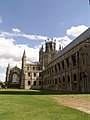
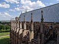
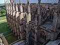
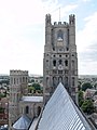
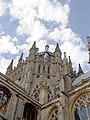
 26-Ely-001.jpg 2,448 × 3,264; 4.53 MB
-
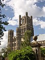
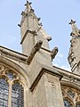
 26-Ely-002.jpg 2,448 × 3,264; 4.63 MB
-
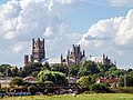
 26-Ely-003.jpg 2,448 × 3,264; 4.1 MB
-
 26-Ely-004.jpg 2,448 × 3,264; 4.56 MB
-
 26-Ely-006.jpg 3,264 × 2,448; 4.55 MB
-
 26-Ely-007.jpg 3,264 × 2,448; 4.51 MB
-
 26-Ely-008.jpg 2,448 × 3,264; 4.95 MB
-
 26-Ely-009.jpg 3,264 × 2,448; 4.77 MB
-
 26-Ely-010.jpg 2,448 × 3,264; 4.54 MB
-
 26-Ely-012.jpg 2,448 × 3,264; 3.87 MB
-
 26-Ely-013.jpg 3,264 × 2,448; 3.81 MB
-
 26-Ely-023.jpg 3,264 × 2,448; 3.1 MB
-
 26-Ely-025.jpg 2,448 × 3,264; 2.78 MB
-
 26-Ely-026.jpg 2,448 × 3,264; 3.59 MB
-
 26-Ely-028.jpg 2,448 × 3,264; 5.27 MB
-
 26-Ely-029.jpg 2,448 × 3,264; 3.9 MB
-
 26-Ely-030.jpg 2,448 × 3,264; 3.64 MB
-
 26-Ely-031.jpg 2,448 × 3,264; 3.58 MB
-
 26-Ely-032.jpg 2,448 × 3,264; 3.84 MB
-
 26-Ely-033.jpg 2,448 × 3,264; 3.7 MB
-
 26-Ely-035.jpg 3,264 × 2,448; 3.82 MB
-
 26-Ely-036.jpg 2,448 × 3,264; 4.24 MB
-
 26-Ely-037.jpg 2,448 × 3,264; 3.72 MB
-
 26-Ely-038.jpg 2,448 × 3,264; 3.61 MB
-
 26-Ely-039.jpg 2,448 × 3,264; 3.32 MB
-
 26-Ely-040.jpg 2,448 × 3,264; 3.99 MB
-
 26-Ely-041.jpg 2,448 × 3,264; 4.34 MB
-
 26-Ely-043.jpg 2,448 × 3,264; 4 MB
-
 26-Ely-044.jpg 2,448 × 3,264; 3.1 MB
-
 26-Ely-045.jpg 2,448 × 3,264; 3.91 MB
-
 26-Ely-046.jpg 2,448 × 3,264; 3.7 MB
-
 26-Ely-047.jpg 2,448 × 3,264; 3.52 MB
-
 26-Ely-048.jpg 2,448 × 3,264; 3.47 MB
-
 26-Ely-049.jpg 2,448 × 3,264; 3.16 MB
-
 26-Ely-050.jpg 2,448 × 3,264; 4.72 MB
-
 26-Ely-054.jpg 2,448 × 3,264; 7.29 MB
-
 26-Ely-057.jpg 2,448 × 3,264; 4.26 MB
-
 26-Ely-058.jpg 2,448 × 3,264; 4.27 MB
-
 26-Ely-059.jpg 2,448 × 3,264; 3.93 MB
-
 26-Ely-060.jpg 2,448 × 3,264; 4.01 MB
-
 26-Ely-061.jpg 2,448 × 3,264; 4.64 MB
-
 26-Ely-062.jpg 2,448 × 3,264; 4.78 MB
-
 26-Ely-064.jpg 3,264 × 2,448; 4.48 MB
-
 26-Ely-065.jpg 2,448 × 3,264; 4.67 MB
-
 26-Ely-066.jpg 2,448 × 3,264; 4.42 MB
-
 26-Ely-067.jpg 2,448 × 3,264; 4.65 MB
-
 26-Ely-068.jpg 2,448 × 3,264; 3.8 MB
-
 26-Ely-069.jpg 2,448 × 3,264; 4.31 MB
-
 26-Ely-071.jpg 3,264 × 2,448; 4.86 MB
-
 A Chioch on Beinn an Eoin - geograph.org.uk - 216647.jpg 640 × 480; 97 KB
-

-

-
 A95, Croftnahaven plantation - geograph.org.uk - 219856.jpg 423 × 640; 64 KB
-
 St James Church Ab Kettleby.jpg 640 × 480; 81 KB
-
 Abbey Hotel, Norfolk Terrace - geograph.org.uk - 211792.jpg 462 × 640; 145 KB
-
 Abernethy Forest - geograph.org.uk - 212234.jpg 424 × 640; 100 KB
-
 Abernethy Forest walk - geograph.org.uk - 212239.jpg 640 × 424; 90 KB
-
 Above Thinhope Burn - geograph.org.uk - 214609.jpg 640 × 478; 151 KB
-
 Albert Road - geograph.org.uk - 212409.jpg 479 × 640; 155 KB
-
 Alexandra Villas - geograph.org.uk - 212406.jpg 479 × 640; 149 KB
-
 Allt na Criche - geograph.org.uk - 212710.jpg 424 × 640; 55 KB
-
 Allt na Criche Deise - geograph.org.uk - 215176.jpg 480 × 640; 161 KB
-
 American War Memorial, Saltash Passage - geograph.org.uk - 211173.jpg 640 × 427; 299 KB
-
 American War Memorial, Saltash Passage - geograph.org.uk - 211175.jpg 640 × 427; 324 KB
-
 Amphibious Bistort (Persicaria amphibia) - geograph.org.uk - 215891.jpg 500 × 640; 293 KB
-

-
 Approaching the Jump - geograph.org.uk - 301677.jpg 640 × 427; 94 KB
-
 Ardwell Church, Ardwell, Stranraer - geograph.org.uk - 212584.jpg 640 × 480; 104 KB
-
 Arr Farm. - geograph.org.uk - 211141.jpg 640 × 427; 77 KB
-
 Awaiting Harvesting - geograph.org.uk - 211546.jpg 640 × 420; 127 KB
-

-
 Bamfords Yard - geograph.org.uk - 212840.jpg 640 × 480; 79 KB
-
 Banc Bronffin - geograph.org.uk - 1484701.jpg 640 × 480; 77 KB
-
 Barley near Gowthorpe - geograph.org.uk - 211284.jpg 640 × 479; 47 KB
-
 Barn - geograph.org.uk - 212416.jpg 600 × 430; 81 KB
-
 Barns - geograph.org.uk - 212296.jpg 640 × 476; 95 KB
-
 Barnsbury, Matilda Street, N1 - geograph.org.uk - 211423.jpg 640 × 480; 84 KB
-

-
 Barton Central Surgery - geograph.org.uk - 233381.jpg 640 × 426; 113 KB
-
 Bassingthorpe New Plantation - geograph.org.uk - 211708.jpg 640 × 427; 153 KB
-
 Beach - geograph.org.uk - 211635.jpg 640 × 393; 30 KB
-
 Beach at northern end of 'Shell Island' - geograph.org.uk - 218923.jpg 640 × 480; 138 KB
-
 Bear Paw Public House - geograph.org.uk - 213597.jpg 640 × 389; 19 KB
-
 Bedford Square - geograph.org.uk - 211454.jpg 640 × 474; 134 KB
-
 Beinn Mheadhoin panorama - geograph.org.uk - 229285.jpg 640 × 224; 43 KB
-
 Bend - geograph.org.uk - 219722.jpg 640 × 424; 87 KB
-
 Bentinck Dock at King's Lynn - geograph.org.uk - 228722.jpg 441 × 640; 90 KB
-
 Between Bishop Wilton and Youlthorpe - geograph.org.uk - 211279.jpg 640 × 479; 39 KB
-
 Between Wilberfoss and Fangfoss - geograph.org.uk - 211201.jpg 640 × 479; 46 KB
-
 Big Beach, Big Sky - geograph.org.uk - 211637.jpg 640 × 441; 37 KB
-

-
 Bishop Wilton - Fleece Inn - geograph.org.uk - 211271.jpg 640 × 479; 41 KB
-
 Bishop Wilton - geograph.org.uk - 211273.jpg 640 × 479; 52 KB
-
 Blackhills steadings looking southwest. - geograph.org.uk - 211083.jpg 640 × 427; 127 KB
-
 Bog Cotton and Mountain Path - geograph.org.uk - 215528.jpg 640 × 480; 117 KB
-
 Borough Farm Fields - geograph.org.uk - 211795.jpg 640 × 480; 156 KB
-
 Bow Creek - geograph.org.uk - 212926.jpg 640 × 480; 84 KB
-
 Bow Creek - geograph.org.uk - 213005.jpg 480 × 640; 97 KB
-
 Braeside Farm. - geograph.org.uk - 211138.jpg 640 × 427; 105 KB
-
-
 Bridge over Afon Aber - geograph.org.uk - 1283769.jpg 640 × 480; 97 KB
-
 Bridges over the Tyne - geograph.org.uk - 404373.jpg 640 × 480; 65 KB
-
 Bridleway near Saxelby Pastures - geograph.org.uk - 212192.jpg 640 × 480; 106 KB
-
 Brighton and Hove High School for Girls - geograph.org.uk - 211814.jpg 479 × 640; 170 KB
-
 St Nicholas' Church - geograph.org.uk - 212517.jpg 469 × 627; 167 KB
-
 St Paul's Church - geograph.org.uk - 211977.jpg 479 × 640; 111 KB
-
 Buckingham Road - geograph.org.uk - 212401.jpg 640 × 479; 165 KB
-
 Bughtrig - geograph.org.uk - 211967.jpg 640 × 480; 99 KB
-
 Bughtrig Garden - geograph.org.uk - 211976.jpg 640 × 480; 138 KB
-

-

-
 By Balnallan - geograph.org.uk - 219778.jpg 640 × 424; 84 KB
-
 By Claggersnich - geograph.org.uk - 212663.jpg 640 × 424; 64 KB
-
 By Clury - geograph.org.uk - 219890.jpg 640 × 424; 77 KB
-
 By Coulnakyle Cottages - geograph.org.uk - 219899.jpg 640 × 424; 83 KB
-
 By Easter Auchnagallin - geograph.org.uk - 212812.jpg 640 × 424; 61 KB
-
 By Mullochard Farm - geograph.org.uk - 213367.jpg 640 × 424; 66 KB
-
 By Netherfield, Dulnain Bridge - geograph.org.uk - 212917.jpg 640 × 424; 77 KB
-
 By Rhymore, Tulloch - geograph.org.uk - 212193.jpg 640 × 424; 72 KB
-
 By Speybridge - geograph.org.uk - 212482.jpg 640 × 424; 98 KB
-
 By West Croftmore - geograph.org.uk - 212086.jpg 640 × 424; 70 KB
-
 By Wester Galovie - geograph.org.uk - 213372.jpg 640 × 424; 59 KB
-
 Cairn by Clury - geograph.org.uk - 213391.jpg 640 × 425; 58 KB
-
 Cairnsmore of Carsphairn SW Flank - geograph.org.uk - 211676.jpg 640 × 426; 151 KB
-
 Cairnsmore of Carsphairn W Flank - geograph.org.uk - 211679.jpg 640 × 426; 161 KB
-
 Calshot Marshes Nature Reserve - geograph.org.uk - 327488.jpg 640 × 480; 91 KB
-

-
 Canal between Barnoldswick and Marton - geograph.org.uk - 211095.jpg 640 × 480; 77 KB
-
 Cannon Place - geograph.org.uk - 211988.jpg 640 × 479; 136 KB
-
 Castlelaw - geograph.org.uk - 211906.jpg 640 × 480; 151 KB
-
 Castlelaw Farm - geograph.org.uk - 211914.jpg 640 × 480; 81 KB
-
 Cefn y Bryn - geograph.org.uk - 1240167.jpg 640 × 480; 74 KB
-
 Centurion Road - geograph.org.uk - 212516.jpg 640 × 479; 125 KB
-
 Charleton Point from Salcombe - geograph.org.uk - 276465.jpg 640 × 480; 91 KB
-
 Chepstow castle - geograph.org.uk - 1480613.jpg 640 × 457; 301 KB
-
 Chepstow castle - geograph.org.uk - 1480620.jpg 640 × 457; 290 KB
-
 Chepstow castle - geograph.org.uk - 1480627.jpg 640 × 457; 288 KB
-
 Chepstow castle - geograph.org.uk - 1480636.jpg 640 × 457; 292 KB
-
 Chepstow castle - geograph.org.uk - 1480642.jpg 457 × 640; 267 KB
-
 Chepstow castle - geograph.org.uk - 1480761.jpg 640 × 457; 382 KB
-
 Chepstow castle - geograph.org.uk - 1480766.jpg 640 × 457; 350 KB
-
 Chepstow castle - geograph.org.uk - 1480773.jpg 640 × 457; 454 KB
-
 Chepstow castle - geograph.org.uk - 1480776.jpg 640 × 457; 421 KB
-
 Church House, Warmingham - geograph.org.uk - 213623.jpg 640 × 480; 28 KB
-
 Church of St Bartholomew, Welby - geograph.org.uk - 212118.jpg 640 × 480; 83 KB
-
 Clachaig - geograph.org.uk - 212248.jpg 640 × 424; 74 KB
-
 Claggersnich - geograph.org.uk - 212668.jpg 640 × 424; 51 KB
-
 Clarence Gardens - geograph.org.uk - 211917.jpg 479 × 640; 159 KB
-
 Cliffs at Vivian quarry - geograph.org.uk - 212069.jpg 640 × 480; 132 KB
-
 Clifton Road - geograph.org.uk - 212365.jpg 478 × 640; 151 KB
-
 Clifton Street - geograph.org.uk - 212418.jpg 479 × 640; 123 KB
-
 Clifton Terrace - geograph.org.uk - 212348.jpg 475 × 640; 143 KB
-
 Codrington House, Hampden Place - geograph.org.uk - 211857.jpg 480 × 640; 125 KB
-
 Coire - geograph.org.uk - 215492.jpg 480 × 640; 66 KB
-
 Cold Fell - geograph.org.uk - 213099.jpg 640 × 478; 133 KB
-
 Cold Fell - geograph.org.uk - 214600.jpg 640 × 478; 133 KB
-
 Commemorative plaque - geograph.org.uk - 1479883.jpg 640 × 457; 381 KB
-
 Common Farm - geograph.org.uk - 211767.jpg 640 × 480; 135 KB
-
 Cornworthy - geograph.org.uk - 212985.jpg 480 × 640; 102 KB
-
 Cornworthy - geograph.org.uk - 212987.jpg 640 × 480; 123 KB
-
 Cornworthy Court and church - geograph.org.uk - 224616.jpg 640 × 480; 92 KB
-
 Corpach3.jpg 640 × 480; 81 KB
-
 Cottages in Abbey Road, Cornworthy - geograph.org.uk - 212972.jpg 640 × 480; 94 KB
-
 Cottages in Cornworthy - geograph.org.uk - 212963.jpg 640 × 480; 100 KB
-
 Coulnakyle - geograph.org.uk - 213400.jpg 640 × 424; 58 KB
-
 Country lane through Woodnook Valley - geograph.org.uk - 211746.jpg 640 × 427; 85 KB
-
 Countryside at Woodnook Valley - geograph.org.uk - 211655.jpg 640 × 427; 84 KB
-
 Countryside Office - geograph.org.uk - 211800.jpg 640 × 480; 113 KB
-
 Countryside public footpath - geograph.org.uk - 211855.jpg 640 × 480; 133 KB
-
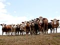
 Cows near Fangfoss - geograph.org.uk - 211290.jpg 640 × 479; 54 KB
-
 Crabtree Farm - geograph.org.uk - 211803.jpg 640 × 480; 134 KB
-
 Crags - geograph.org.uk - 215521.jpg 640 × 480; 102 KB
-
 Crags above col - geograph.org.uk - 212471.jpg 640 × 424; 129 KB
-
 Craig River near Craig - geograph.org.uk - 215366.jpg 640 × 480; 147 KB
-
 Creag Loisgte - geograph.org.uk - 229263.jpg 640 × 480; 77 KB
-
 Crich Wesley Methodist Church - geograph.org.uk - 211821.jpg 640 × 480; 184 KB
-
 Croftgowan - geograph.org.uk - 214173.jpg 640 × 480; 123 KB
-
 Croome D'Abitot Church - geograph.org.uk - 286916.jpg 640 × 407; 49 KB
-
 Crops on fire south of Moor Farm - geograph.org.uk - 267676.jpg 640 × 480; 81 KB
-
 Cross Dyke Pincombe Down - geograph.org.uk - 304570.jpg 640 × 427; 83 KB
-

-
 Dartmouth Park, Chetwynd Road, NW5 - geograph.org.uk - 216835.jpg 640 × 480; 98 KB
-
 Dartmouth Park, College Lane, NW5 - geograph.org.uk - 216837.jpg 640 × 480; 113 KB
-
 Day Mark Tower, Near Coleton Fishacre - geograph.org.uk - 359751.jpg 480 × 640; 63 KB
-

-
-
 Derelict Oerfa near Nant Y Rhiw - geograph.org.uk - 211218.jpg 640 × 427; 78 KB
-
 Derelict Remains of Bryn-y-Gwynt - geograph.org.uk - 211183.jpg 640 × 427; 94 KB
-
 Disguised Mobile Phone Mast - geograph.org.uk - 211892.jpg 481 × 640; 50 KB
-
 Disused mill stream at Itchen Abbas - geograph.org.uk - 211513.jpg 640 × 480; 319 KB
-

-

-
 Dorcas Lane, Stoke Hammond - geograph.org.uk - 211779.jpg 640 × 480; 175 KB
-
 Downland, near to Bere Down Farm, Dorset - geograph.org.uk - 325682.jpg 480 × 640; 125 KB
-
 Driveway to Woolah - geograph.org.uk - 211079.jpg 640 × 480; 155 KB
-
 Droitwich Long Wave Masts - geograph.org.uk - 211504.jpg 480 × 640; 45 KB
-
 Dwyryd Estuary - geograph.org.uk - 259669.jpg 640 × 480; 92 KB


_-_geograph.org.uk_-_215891.jpg)


