Category:United Kingdom photographs taken on 2006-07-27
Jump to navigation
Jump to search

Media in category "United Kingdom photographs taken on 2006-07-27"
The following 200 files are in this category, out of 671 total.
(previous page) (next page)-
 "Esso Extra" - geograph.org.uk - 873123.jpg 1,024 × 768; 745 KB
-

-
 -4EvaLeitchDetail.jpg 3,264 × 2,448; 8.77 MB
-
 07-Durham-002.jpg 2,448 × 3,264; 4.76 MB
-
 07-Durham-006.jpg 3,264 × 2,448; 5.78 MB
-
 07-Durham-009.jpg 3,264 × 2,448; 4.52 MB
-
 07-Durham-010.jpg 2,448 × 3,264; 5.09 MB
-
 07-Durham-020.jpg 2,315 × 3,087; 4.49 MB
-
 07-Durham-022.jpg 2,448 × 3,264; 3.78 MB
-
 07-Durham-025.jpg 3,264 × 2,448; 6.02 MB
-
 07-Durham-026.jpg 3,264 × 2,448; 5.62 MB
-
 07-Durham-028.jpg 2,206 × 2,941; 4.32 MB
-
 07-Durham-030.jpg 2,448 × 3,264; 3.96 MB
-
 07-Durham-037.jpg 3,264 × 2,448; 3.77 MB
-
 08-Hadrians Wall-001.jpg 3,264 × 2,448; 4.69 MB
-
 08-Hadrians Wall-003.jpg 3,264 × 2,448; 5.32 MB
-
 08-Hadrians Wall-005.jpg 3,264 × 2,448; 5.83 MB
-
 08-Hadrians Wall-007.jpg 3,264 × 2,448; 4.75 MB
-
 08-Hadrians Wall-008.jpg 3,264 × 2,448; 6.75 MB
-
 08-Hadrians Wall-009.jpg 3,264 × 2,448; 3.85 MB
-
 08-Hadrians Wall-010.jpg 2,448 × 3,264; 3.71 MB
-
 08-Hadrians Wall-011.jpg 3,264 × 2,448; 3.57 MB
-
 08-Hadrians Wall-012.jpg 3,264 × 2,448; 3.33 MB
-
 08-Hadrians Wall-013.jpg 3,264 × 2,448; 3.65 MB
-
 08-Hadrians Wall-014.jpg 3,264 × 2,448; 3.67 MB
-
 08-Hadrians Wall-015.jpg 3,264 × 2,448; 3.84 MB
-
 08-Hadrians Wall-024.jpg 3,264 × 2,448; 4.44 MB
-
 08-Hadrians Wall-025.jpg 3,264 × 2,448; 4.39 MB
-
 08-Hadrians Wall-026.jpg 3,264 × 2,448; 4.26 MB
-
 08-Hadrians Wall-027.jpg 3,264 × 2,448; 4.78 MB
-
 08-Hadrians Wall-028.jpg 2,520 × 1,890; 3.63 MB
-
 08-Hadrians Wall-029.jpg 3,264 × 2,448; 5.01 MB
-
 08-Hadrians Wall-030.jpg 3,264 × 2,448; 4.72 MB
-
 08-Hadrians Wall-031.jpg 3,264 × 2,448; 4.35 MB
-
 08-Hadrians Wall-032.jpg 3,264 × 2,448; 3.83 MB
-
 08-Hadrians Wall-033.jpg 3,264 × 2,448; 4.54 MB
-
 08-Hadrians Wall-034.jpg 3,264 × 2,448; 4.71 MB
-
 08-Hadrians Wall-035.jpg 3,264 × 2,448; 4.22 MB
-
 08-Hadrians Wall-036.jpg 3,264 × 2,448; 4.46 MB
-
 08-Hadrians Wall-037.jpg 3,264 × 2,448; 4.4 MB
-
 08-Hadrians Wall-038.jpg 2,095 × 1,571; 2.48 MB
-
 16th green, Bamburgh Golf Course - geograph.org.uk - 1130797.jpg 640 × 480; 49 KB
-
 A Road Junction Near Pennant - geograph.org.uk - 210952.jpg 640 × 480; 143 KB
-

-
 A272 at Cheesefoot Head - geograph.org.uk - 209846.jpg 640 × 480; 109 KB
-
 A53 Flyover - geograph.org.uk - 209824.jpg 640 × 480; 36 KB
-
 Aberaeron RFC Clubhouse - geograph.org.uk - 209950.jpg 640 × 480; 109 KB
-
 Aberaeron Rugby Football Club - geograph.org.uk - 873097.jpg 640 × 480; 237 KB
-
 Aberaeron Rugby Football Club - geograph.org.uk - 873099.jpg 640 × 480; 183 KB
-
 Aberaeron-panorama.jpg 640 × 480; 233 KB
-
 Aberarth - geograph.org.uk - 209965.jpg 640 × 480; 130 KB
-
 Above Deganwy - geograph.org.uk - 290143.jpg 640 × 480; 169 KB
-
 Access to coastal path - geograph.org.uk - 873093.jpg 640 × 480; 141 KB
-
 Access to the Ceredigion Coastal Path - geograph.org.uk - 873083.jpg 640 × 480; 181 KB
-
 Access to the Ceredigion Coastal Path - geograph.org.uk - 873087.jpg 640 × 480; 205 KB
-
 Access to the sea at Aberarth - geograph.org.uk - 873107.jpg 640 × 480; 219 KB
-
 Aglais io - geograph.org.uk - 215851.jpg 640 × 436; 242 KB
-
 Aglais urticae - geograph.org.uk - 215853.jpg 438 × 640; 178 KB
-
 Ainstable - geograph.org.uk - 212975.jpg 640 × 478; 98 KB
-
 Another view of houses in Ayston - geograph.org.uk - 209882.jpg 640 × 427; 82 KB
-
 Aphantophus hyperantus - geograph.org.uk - 215852.jpg 640 × 523; 316 KB
-
 Approaching Kilchoan from North West - geograph.org.uk - 212095.jpg 640 × 480; 90 KB
-
 Are you looking at me^ Whelpley Level - geograph.org.uk - 210046.jpg 640 × 479; 144 KB
-
 Armathwaite Bridge - geograph.org.uk - 212935.jpg 640 × 478; 129 KB
-
 Arriving at Mallaig - geograph.org.uk - 354048.jpg 640 × 480; 62 KB
-
 B3357 near Princetown - geograph.org.uk - 211515.jpg 640 × 480; 108 KB
-
 Balmerino - geograph.org.uk - 209767.jpg 640 × 424; 85 KB
-
 Balmerino - geograph.org.uk - 210265.jpg 640 × 424; 88 KB
-
 Balmerino Bay - geograph.org.uk - 210271.jpg 640 × 424; 92 KB
-
 Bardsea village - geograph.org.uk - 210424.jpg 640 × 480; 137 KB
-
 Barn conversion Moor Lane Footherley - geograph.org.uk - 309467.jpg 640 × 480; 89 KB
-
 Barton Village Hall - geograph.org.uk - 209798.jpg 640 × 480; 221 KB
-
 Market Lane - geograph.org.uk - 220932.jpg 640 × 480; 118 KB
-
 Somerfield's - geograph.org.uk - 209617.jpg 640 × 479; 109 KB
-
 Beardown Farm - geograph.org.uk - 211451.jpg 640 × 480; 118 KB
-
 Beech trees and barn at Beardown Farm - geograph.org.uk - 211466.jpg 480 × 640; 130 KB
-
 Beech woodland at sunset, Cheesefoot Head - geograph.org.uk - 209849.jpg 640 × 480; 224 KB
-
 Black Head, Isle of Man - geograph.org.uk - 210110.jpg 640 × 480; 100 KB
-
 Blackham Village Hall - geograph.org.uk - 231527.jpg 640 × 480; 117 KB
-
 Bleaklow Hill - geograph.org.uk - 210616.jpg 640 × 480; 87 KB
-
 Bluebells (Campanula rotundifolia) - geograph.org.uk - 215834.jpg 442 × 640; 140 KB
-
 Bodyboarding on Treyarnon Bay beach - geograph.org.uk - 483217.jpg 640 × 480; 57 KB
-
 Boulder in wall - geograph.org.uk - 211592.jpg 640 × 480; 119 KB
-
 Bow, main street - geograph.org.uk - 209802.jpg 640 × 427; 168 KB
-
 Bow, main street - geograph.org.uk - 209808.jpg 640 × 427; 168 KB
-
 Bridge Farm, Rickney - geograph.org.uk - 210026.jpg 640 × 479; 158 KB
-
 Bridleway near Wedlake - geograph.org.uk - 212694.jpg 640 × 480; 89 KB
-
 Brighton & Hove bus (41).jpg 576 × 768; 77 KB
-
 Brighton & Hove bus (42).jpg 1,200 × 1,600; 328 KB
-

-
 Browns Bay, Islandmagee - geograph.org.uk - 209605.jpg 640 × 426; 148 KB
-
 By Kinshaldy - geograph.org.uk - 209754.jpg 640 × 424; 61 KB
-
 By Logie Farm - geograph.org.uk - 209830.jpg 640 × 424; 53 KB
-

-
 Calshot Marshes and power station - geograph.org.uk - 209867.jpg 480 × 640; 66 KB
-
 Castell Deganwy Castle from the East - geograph.org.uk - 290134.jpg 640 × 480; 180 KB
-
 Castle Hotel, New Cumnock - geograph.org.uk - 222490.jpg 640 × 460; 55 KB
-
 Cattle Market, Hailsham - geograph.org.uk - 210052.jpg 640 × 479; 94 KB
-
 Cei Bach, Llanina - geograph.org.uk - 872883.jpg 640 × 480; 181 KB
-
 Central Hotel, Llanon - geograph.org.uk - 209977.jpg 640 × 480; 119 KB
-
 Ceredigion Coastal Path - geograph.org.uk - 209698.jpg 640 × 480; 124 KB
-
 Chapel at Pennant - geograph.org.uk - 245762.jpg 640 × 480; 123 KB
-
 Church Rise - geograph.org.uk - 210373.jpg 640 × 409; 83 KB
-
 Church Street, Modbury. - geograph.org.uk - 384436.jpg 640 × 480; 89 KB
-
 Clais Bhuidhe, Sea Cave. - geograph.org.uk - 702045.jpg 640 × 427; 94 KB
-
 Clarkson Green Farm, Catforth - geograph.org.uk - 542635.jpg 640 × 480; 137 KB
-
 Cleared Woodland - geograph.org.uk - 767864.jpg 640 × 479; 84 KB
-
 Cleveland Way Starting Point - geograph.org.uk - 515371.jpg 640 × 458; 170 KB
-
 Cleveland Way views - geograph.org.uk - 516312.jpg 640 × 381; 113 KB
-
 Cliff Erosion at Aberarth - geograph.org.uk - 209968.jpg 640 × 480; 150 KB
-
 Close-up of Milestone beside the A487 - geograph.org.uk - 209961.jpg 640 × 480; 179 KB
-

-
 Christ Church, Cobridge - geograph.org.uk - 209848.jpg 640 × 480; 35 KB
-
 Coire Lagan - geograph.org.uk - 220052.jpg 640 × 493; 102 KB
-
 St Michael's Church Tower - geograph.org.uk - 516331.jpg 480 × 640; 148 KB
-
 Cold Kirby Cottage - geograph.org.uk - 516339.jpg 640 × 410; 134 KB
-
 Collecting Nectar Points ^ - geograph.org.uk - 516373.jpg 640 × 640; 169 KB
-
 Collecting the bales, Pevensey Levels - geograph.org.uk - 210030.jpg 640 × 479; 112 KB
-
 Colly Brook valley - geograph.org.uk - 212330.jpg 640 × 480; 98 KB
-
 Conveyors, Hope Cement Works - geograph.org.uk - 210527.jpg 640 × 480; 167 KB
-
 Corsham Fire Station - geograph.org.uk - 210360.jpg 640 × 480; 39 KB
-
 Cote Moor Road View - geograph.org.uk - 516346.jpg 640 × 340; 93 KB
-

-
 Cottages at Aberarth - geograph.org.uk - 873104.jpg 640 × 480; 205 KB
-
 Country Lane near Aberarth - geograph.org.uk - 210940.jpg 640 × 480; 73 KB
-
 Country Lanes - geograph.org.uk - 209682.jpg 640 × 480; 130 KB
-
 Cowsic River - geograph.org.uk - 211474.jpg 480 × 640; 140 KB
-

-
 Cremyll , Coastline - geograph.org.uk - 1145243.jpg 640 × 480; 54 KB
-
 Cricket Club bowling green - geograph.org.uk - 209857.jpg 640 × 480; 25 KB
-
 Crockern - geograph.org.uk - 211317.jpg 640 × 480; 97 KB
-
 Crockern from the Devonport Leat - geograph.org.uk - 211417.jpg 480 × 640; 131 KB
-
 Croglin Water - geograph.org.uk - 212983.jpg 640 × 478; 221 KB
-
 Cross-roads at Pennant - geograph.org.uk - 210002.jpg 640 × 480; 109 KB
-
 Cruickshank Botanic Garden, Old Aberdeen - geograph.org.uk - 221728.jpg 463 × 640; 185 KB
-
 Dartmoor Inn, Merrivale - geograph.org.uk - 212808.jpg 640 × 480; 76 KB
-

-
 Daymer Bay - from the path from Rock - geograph.org.uk - 1172859.jpg 640 × 480; 71 KB
-
 Derwen - geograph.org.uk - 873116.jpg 640 × 480; 242 KB
-
 Derwent Water from Friar's Crag - geograph.org.uk - 218106.jpg 640 × 480; 106 KB
-

-
 Devonport Leat - geograph.org.uk - 209765.jpg 480 × 640; 126 KB
-

-
 Devonport Leat near Beardown Farm - geograph.org.uk - 211446.jpg 480 × 640; 104 KB
-
 Dewstow Gardens - geograph.org.uk - 656367.jpg 640 × 637; 174 KB
-
 Dewstow Gardens - geograph.org.uk - 656371.jpg 640 × 637; 174 KB
-
 Dewstow Gardens - geograph.org.uk - 656373.jpg 603 × 452; 122 KB
-
 Dewstow Gardens - geograph.org.uk - 659337.jpg 640 × 480; 118 KB
-
 Dirt Low - geograph.org.uk - 210403.jpg 640 × 480; 136 KB
-
 Dolgoch Youth Hostel, Ceredigion - geograph.org.uk - 369185.jpg 640 × 415; 158 KB
-
 Don Street - geograph.org.uk - 221390.jpg 640 × 436; 126 KB
-
 Downhill to Great Urswick - geograph.org.uk - 210552.jpg 592 × 476; 197 KB
-
 Dry leat, Walkham valley - geograph.org.uk - 212267.jpg 480 × 640; 112 KB
-

-
 Durdham Downs - geograph.org.uk - 212478.jpg 640 × 480; 123 KB
-
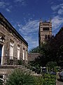
 Durham Castle 20060727 010.jpg 2,024 × 1,518; 2.56 MB
-
 Durham Castle Keep seen from the Catheadal 20060727 010.jpg 1,466 × 1,100; 1.88 MB
-
 Durham Castle Keep seen from the Catheadal 20060727 011.jpg 2,036 × 1,527; 3.22 MB
-
 Durham Castle Keep seen from the Catheadal 20060727 012.jpg 1,843 × 2,457; 3.93 MB
-
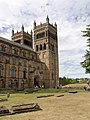
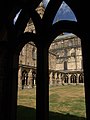
 Durham Cathedral 20060727 010.jpg 2,154 × 2,872; 4.38 MB
-
 Durham Cathedral 20060727 011.jpg 2,852 × 2,139; 6.01 MB
-
 Durham Cathedral 20060727 012.jpg 3,264 × 2,448; 7.13 MB
-
 Durham, Cathedral 20060727 001.jpg 4,242 × 5,656; 11.72 MB
-
 Durham, Cathedral 20060727 002.jpg 4,242 × 5,656; 11.03 MB
-
 Durham, Cathedral 20060727 003.jpg 4,243 × 5,657; 10.74 MB
-

-
 Eden Bridge - geograph.org.uk - 212997.jpg 640 × 478; 108 KB
-
 Emerson Valley Middle School - geograph.org.uk - 209633.jpg 640 × 480; 118 KB
-
 Enjoying the cricket - geograph.org.uk - 608349.jpg 640 × 512; 95 KB
-

-

-
 Ethie Mains - geograph.org.uk - 215824.jpg 640 × 427; 234 KB
-
 Fallen trees in Beardown Hill Plantation - geograph.org.uk - 211433.jpg 640 × 480; 149 KB
-
 Farm Gates - geograph.org.uk - 209689.jpg 640 × 480; 127 KB
-
 Farmland, Ainstable - geograph.org.uk - 212952.jpg 640 × 478; 144 KB
-
 Farmland, Staffield - geograph.org.uk - 212986.jpg 640 × 478; 130 KB
-

-
 Ferris Point lighthouse, Larne Lough - geograph.org.uk - 209647.jpg 640 × 426; 117 KB
-
 Field of barley near Pilton - geograph.org.uk - 209895.jpg 640 × 427; 83 KB
-
 Field with sheep near Winsley - geograph.org.uk - 209872.jpg 640 × 480; 83 KB
-
 Fields beside the A487T - geograph.org.uk - 209929.jpg 640 × 480; 89 KB
-
 Fished out-Grizedale - geograph.org.uk - 1128014.jpg 640 × 480; 116 KB
-
 Flagpole on Roos Tor - geograph.org.uk - 212236.jpg 640 × 480; 97 KB
-
 Fleur de Lys, Market Street, Hailsham - geograph.org.uk - 210048.jpg 640 × 492; 121 KB
-
 Flisk Point - geograph.org.uk - 210274.jpg 640 × 424; 97 KB
-
-

-
 Foreshore at Aberarth - geograph.org.uk - 209970.jpg 640 × 480; 123 KB
-
 Frederick Street, Waddesdon - geograph.org.uk - 210151.jpg 640 × 480; 89 KB
-
 G-Wiz -2 28 07 2007 (932064472).jpg 752 × 500; 144 KB
-
 Gate and overgrown path beside the A487 - geograph.org.uk - 209964.jpg 480 × 640; 192 KB
-
 Gate. - geograph.org.uk - 209730.jpg 640 × 480; 107 KB
-
 Giles Brook Primary School - geograph.org.uk - 209637.jpg 640 × 480; 113 KB
-
 Glynhir Farm - geograph.org.uk - 209945.jpg 640 × 480; 100 KB
-
 Great Central Way, Neasden - geograph.org.uk - 209506.jpg 640 × 480; 73 KB
-
 Great Mis Tor from the River Walkham - geograph.org.uk - 212251.jpg 640 × 480; 99 KB
-
 Great Staple Tor from near Roos Tor - geograph.org.uk - 210317.jpg 640 × 480; 99 KB
-
 Great Western Reave east of Roos Tor - geograph.org.uk - 212199.jpg 480 × 640; 104 KB
-
 Green Reflections - geograph.org.uk - 515470.jpg 640 × 480; 161 KB
-


_-_geograph.org.uk_-_215834.jpg)


.jpg)
.jpg)


.jpg)


_-_geograph.org.uk_-_215846.jpg)