Category:United Kingdom photographs taken on 2006-04-14
Jump to navigation
Jump to search
| ← | Friday 14 April 2006 | → | ||
| ← | April 2006 | → | ||

United Kingdom photographs taken on 14 April 2006.
Image files should be categorized here automatically using {{taken on}} template. Direct categorisation is also possible, if automatic is impossible.
Subcategories
This category has only the following subcategory.
S
Media in category "United Kingdom photographs taken on 2006-04-14"
The following 200 files are in this category, out of 823 total.
(previous page) (next page)-

-
 125 and 127 Main St.jpg 2,592 × 1,944; 884 KB
-
 2006-04-14 - London - South Bank - Street Artist Shop (4888231561).jpg 2,592 × 1,726; 3.06 MB
-
 321409 HarrowWealdstone.jpg 1,024 × 768; 650 KB
-
 5722 Clapham.jpg 1,024 × 768; 737 KB
-
 East Coast Main Line - geograph.org.uk - 152382.jpg 640 × 480; 91 KB
-

-
 A43 Bridge near Towcester - geograph.org.uk - 1568759.jpg 640 × 480; 78 KB
-
 A859, Laxdale - geograph.org.uk - 153678.jpg 640 × 480; 90 KB
-

-
 Abbey Farm - geograph.org.uk - 154079.jpg 640 × 480; 102 KB
-
 Alfred Pryor House - geograph.org.uk - 151892.jpg 426 × 640; 74 KB
-
 All Saints, Poringland - geograph.org.uk - 151554.jpg 640 × 474; 91 KB
-

-
 Along The B709 - geograph.org.uk - 152112.jpg 640 × 480; 77 KB
-
 Ammanford New Bypass at Pontamman - geograph.org.uk - 875659.jpg 640 × 480; 68 KB
-
 An Gearanach - geograph.org.uk - 155413.jpg 360 × 480; 23 KB
-
 Ann Griffiths Memorial Chapel, Dolanog - geograph.org.uk - 1547669.jpg 640 × 480; 111 KB
-
-
-
 Arable Field - geograph.org.uk - 152349.jpg 640 × 480; 59 KB
-
 Arable Field, Greystone House Farm - geograph.org.uk - 152345.jpg 640 × 480; 61 KB
-
 Artspace - geograph.org.uk - 386540.jpg 480 × 640; 84 KB
-
 St. Andrew's - Ashingdon - geograph.org.uk - 151691.jpg 640 × 480; 60 KB
-
 Avenue of trees - geograph.org.uk - 151725.jpg 640 × 434; 128 KB
-
 B24 Bomber crash memorial - geograph.org.uk - 159929.jpg 640 × 480; 95 KB
-
 B24 Memorial plaque - geograph.org.uk - 159930.jpg 640 × 480; 73 KB
-
 Back to nature - geograph.org.uk - 170573.jpg 640 × 480; 159 KB
-
 Balbinny Farmhouse and Fields - geograph.org.uk - 151705.jpg 640 × 475; 83 KB
-
 Balbirnie stone circle - geograph.org.uk - 151939.jpg 640 × 480; 370 KB
-
 Bank street, Castletown - geograph.org.uk - 151726.jpg 640 × 480; 242 KB
-
 Bar Lodge, Loe Bar, Porthleven - geograph.org.uk - 182283.jpg 640 × 480; 84 KB
-
 Barkby beach - geograph.org.uk - 151649.jpg 640 × 480; 35 KB
-
 Barkby beach - geograph.org.uk - 151652.jpg 640 × 480; 53 KB
-
 Barra Hall, Hayes - geograph.org.uk - 153360.jpg 640 × 480; 109 KB
-
 Barry causeway (381783850).jpg 790 × 524; 100 KB
-
 Church of St. Peter - geograph.org.uk - 261529.jpg 640 × 480; 107 KB
-
 Meldan Works - geograph.org.uk - 151763.jpg 640 × 480; 93 KB
-
 Bay - geograph.org.uk - 155372.jpg 640 × 425; 243 KB
-
 Bay at Ptarmigan Lodge - geograph.org.uk - 152045.jpg 640 × 480; 126 KB
-
 Beach - geograph.org.uk - 155375.jpg 640 × 425; 221 KB
-
 Beach at Port na Feamainn - geograph.org.uk - 302462.jpg 640 × 480; 90 KB
-
 Beach by Dunnottar Castle - geograph.org.uk - 158054.jpg 640 × 480; 114 KB
-
 Beckney Wood - Footpath near S.W. Corner - geograph.org.uk - 151695.jpg 480 × 640; 143 KB
-
 Bellie Churchyard near Fochabers - geograph.org.uk - 152921.jpg 640 × 480; 112 KB
-
 Bellie Churchyard near Fochabers - geograph.org.uk - 152937.jpg 640 × 480; 134 KB
-
 Benthall Woods - geograph.org.uk - 161836.jpg 640 × 480; 160 KB
-
 Beside the green, Tanner's Green - geograph.org.uk - 154016.jpg 640 × 480; 352 KB
-
 Betws-y-coed bridge - geograph.org.uk - 992064.jpg 640 × 446; 222 KB
-
 Betws-y-coed waterfall - geograph.org.uk - 992065.jpg 640 × 429; 204 KB
-
 Betws-y-coed waterfall - geograph.org.uk - 992066.jpg 429 × 640; 192 KB
-
 Bird hide, Lowmoor Point - geograph.org.uk - 153497.jpg 640 × 480; 141 KB
-
 Black Notley church and Hall, Essex - geograph.org.uk - 153768.jpg 640 × 480; 77 KB
-
 Blacksmiths Arms - geograph.org.uk - 152423.jpg 640 × 480; 76 KB
-

-
 Bowling Green - geograph.org.uk - 154724.jpg 640 × 480; 82 KB
-
 Brayford Pool-Lincoln - geograph.org.uk - 699256.jpg 640 × 402; 72 KB
-
 Brennand River - geograph.org.uk - 151598.jpg 640 × 480; 131 KB
-
 Brethren's Meeting Room, Harnham - geograph.org.uk - 152411.jpg 640 × 480; 297 KB
-
 Brick Ruin Near Arnprior - geograph.org.uk - 152583.jpg 640 × 479; 136 KB
-
 Brickworks near Hollinthorpe - geograph.org.uk - 153168.jpg 640 × 480; 127 KB
-
 Bridge on Dismantled Railway - geograph.org.uk - 151696.jpg 640 × 475; 124 KB
-

-
 Bridge over the River Frome at Frampton - geograph.org.uk - 151949.jpg 640 × 480; 141 KB
-
 Bridleway - SE974628 - geograph.org.uk - 154235.jpg 640 × 480; 136 KB
-

-
 Bridleway to Bell Green - geograph.org.uk - 154066.jpg 640 × 480; 413 KB
-
 Brinkburn Bell - geograph.org.uk - 178232.jpg 480 × 640; 110 KB
-
 Brinkburn Priory - geograph.org.uk - 154229.jpg 480 × 640; 124 KB
-

-
 Brompton Ralph, Rook's Nest - geograph.org.uk - 152274.jpg 640 × 427; 129 KB
-
 Broomhill Farm - geograph.org.uk - 151741.jpg 640 × 479; 79 KB
-
-
 Bunnahabhain distillery from pier. - geograph.org.uk - 303017.jpg 640 × 480; 119 KB
-
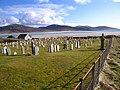 Burial Ground, Losgaintir - geograph.org.uk - 153733.jpg 640 × 480; 93 KB
-
 Burnside Crossroads near Slaley - geograph.org.uk - 151563.jpg 3,264 × 2,448; 1.58 MB
-
 Burradon House Farm - geograph.org.uk - 154210.jpg 640 × 465; 76 KB
-
 Butterwick - geograph.org.uk - 154094.jpg 640 × 480; 87 KB
-
 Cadham, Glenrothes.jpg 640 × 480; 347 KB
-
 Cae Coch standing stone - geograph.org.uk - 196627.jpg 640 × 427; 73 KB
-
 Caffi Empire Cafe - geograph.org.uk - 386531.jpg 640 × 480; 89 KB
-
 Calves at Manor Farm, Broughton - geograph.org.uk - 151950.jpg 640 × 480; 367 KB
-
 Canal diversion under the M42 - geograph.org.uk - 154584.jpg 640 × 480; 329 KB
-
 Capel Pisgah, Pen-y-Stryt - geograph.org.uk - 151663.jpg 640 × 435; 69 KB
-
 Caravan Site, Stonehaven - geograph.org.uk - 156173.jpg 640 × 480; 115 KB
-
 Carnau'r Garreg Las - geograph.org.uk - 152246.jpg 640 × 480; 125 KB
-
 Carron reservoir & Fintry hills - panoramio.jpg 1,280 × 960; 888 KB
-
 Carron reservoir run off - panoramio.jpg 1,280 × 960; 942 KB
-

-
 Celtic Cross by the Roadside - geograph.org.uk - 155220.jpg 640 × 427; 112 KB
-
 Centenary Mill - geograph.org.uk - 151769.jpg 640 × 480; 91 KB
-
 Chapel, Maunby - geograph.org.uk - 440917.jpg 640 × 480; 82 KB
-
 Chark - geograph.org.uk - 151703.jpg 640 × 427; 104 KB
-
 Chatelherault - geograph.org.uk - 435220.jpg 640 × 427; 151 KB
-
 Chiddingstone Castle - geograph.org.uk - 151581.jpg 640 × 480; 122 KB
-
 Chiddingstone Mill.jpg 640 × 480; 122 KB
-
 Chiddingstone Village High Street - geograph.org.uk - 151560.jpg 640 × 480; 92 KB
-
 Chimney - geograph.org.uk - 152030.jpg 480 × 640; 113 KB
-
 Chirk Castle - geograph.org.uk - 708265.jpg 640 × 479; 72 KB
-

-
 Church Drive Infant School - geograph.org.uk - 153153.jpg 640 × 480; 94 KB
-
 Church of St. James, Woodmancott - geograph.org.uk - 151717.jpg 640 × 427; 238 KB
-
 Churchyard gates - geograph.org.uk - 386591.jpg 640 × 480; 128 KB
-
 Clervaux Castle , from Richmond Road. - geograph.org.uk - 151829.jpg 640 × 479; 89 KB
-
 Clevedon Pier - geograph.org.uk - 1057863.jpg 640 × 480; 282 KB
-
 Coastguard Cottages, Ross - geograph.org.uk - 153493.jpg 640 × 480; 156 KB
-
 Cofton Road, West Heath - geograph.org.uk - 155236.jpg 640 × 480; 400 KB
-
 Collapsed bales - geograph.org.uk - 157202.jpg 640 × 480; 111 KB
-
 Colourful Farm Outbuildings - geograph.org.uk - 154600.jpg 640 × 426; 134 KB
-
 Communication Mast - geograph.org.uk - 154153.jpg 640 × 480; 106 KB
-
 Corbie Crag - geograph.org.uk - 152075.jpg 640 × 455; 113 KB
-
 Corstorphine Old Parish Church - geograph.org.uk - 1196712.jpg 640 × 480; 98 KB
-
 Cottage yards, Woolsthorpe - geograph.org.uk - 151969.jpg 640 × 427; 134 KB
-
 Cottages - geograph.org.uk - 151898.jpg 640 × 480; 65 KB
-
 Cottages, Upper Wield - geograph.org.uk - 151774.jpg 640 × 427; 183 KB
-
 Country Road, Low Cowlam - geograph.org.uk - 154230.jpg 640 × 480; 89 KB
-
 Countryside at Shalford, Essex - geograph.org.uk - 152481.jpg 640 × 480; 92 KB
-

-
 Croom Dale Plantation.jpg 640 × 480; 150 KB
-
 Crosby Well Cross - geograph.org.uk - 152586.jpg 480 × 640; 77 KB
-
 Cross Street - geograph.org.uk - 154725.jpg 640 × 480; 94 KB
-
 Crossroads at Chattis Hill - geograph.org.uk - 151945.jpg 640 × 480; 301 KB
-
 Crowhurst Station - geograph.org.uk - 151806.jpg 640 × 480; 155 KB
-

-
 Cuthbert's Way, Post Office - geograph.org.uk - 152422.jpg 640 × 480; 54 KB
-
 Daffs in Wythall - geograph.org.uk - 151831.jpg 640 × 480; 401 KB
-
 Belvoir Road near Denton - geograph.org.uk - 151997.jpg 640 × 427; 158 KB
-
 Countryside near Denton - geograph.org.uk - 151983.jpg 640 × 427; 122 KB
-
 Farmland near Gorse Lane - geograph.org.uk - 151986.jpg 640 × 427; 93 KB
-
 Disused Railway Viaduct - geograph.org.uk - 152352.jpg 640 × 480; 65 KB
-
 Downland Sheep - geograph.org.uk - 281804.jpg 640 × 480; 103 KB
-
 Dry Stone Wall on Tal y Fan Summit - geograph.org.uk - 220314.jpg 640 × 427; 79 KB
-
 Ducks - geograph.org.uk - 154054.jpg 640 × 480; 387 KB
-
 Dunster, Conygar Tower - geograph.org.uk - 152318.jpg 427 × 640; 238 KB
-
 Earlswood Railway Station.jpg 640 × 480; 344 KB
-
 Earthworks - geograph.org.uk - 154083.jpg 640 × 480; 152 KB
-
 Eastbury School - geograph.org.uk - 151886.jpg 640 × 426; 60 KB
-
 Eglwys y Bedd, Holyhead - geograph.org.uk - 386545.jpg 480 × 640; 70 KB
-
 Elan Pipeline Crossing River - geograph.org.uk - 152042.jpg 640 × 480; 83 KB
-
 Elan Valley Aqueduct - geograph.org.uk - 152040.jpg 640 × 480; 52 KB
-
 Elan Valley Aqueduct - geograph.org.uk - 152043.jpg 640 × 480; 236 KB
-
 Elan Valley Aqueduct - geograph.org.uk - 152044.jpg 640 × 480; 88 KB
-
 Elan Valley Aqueduct - geograph.org.uk - 152046.jpg 640 × 480; 75 KB
-
 Elan Valley Aqueduct - geograph.org.uk - 152047.jpg 640 × 480; 145 KB
-
 Elan Valley Hotel - geograph.org.uk - 154346.jpg 640 × 480; 130 KB
-
 Elworthy, churchyard - geograph.org.uk - 152297.jpg 427 × 640; 259 KB
-
 Emirates B777 A6-EBA (2269554177).jpg 2,339 × 1,559; 1.53 MB
-
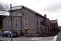
 Empire Cinema - geograph.org.uk - 386529.jpg 640 × 480; 80 KB
-
 Humber Bridge - geograph.org.uk - 583504.jpg 640 × 480; 88 KB
-
 Entrance to Wast Hills House - geograph.org.uk - 154061.jpg 640 × 480; 408 KB
-
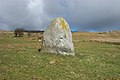
 Erratic - geograph.org.uk - 155600.jpg 480 × 640; 73 KB
-

-
 Farmland and Houses at Coopers Corner - geograph.org.uk - 151948.jpg 640 × 480; 117 KB
-
 Farmyard Animals - geograph.org.uk - 154587.jpg 640 × 480; 148 KB
-
 Fasset Hill - geograph.org.uk - 152087.jpg 640 × 430; 91 KB
-
 Felton Church - geograph.org.uk - 151752.jpg 640 × 479; 113 KB
-

-
 Field near Stonehouse Farm - geograph.org.uk - 151784.jpg 640 × 479; 77 KB
-
 Field of Daffodils, Kirby Bedon - geograph.org.uk - 151549.jpg 640 × 480; 129 KB
-

-
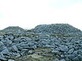
 Finavon Doocot - geograph.org.uk - 151702.jpg 640 × 475; 100 KB
-
 Finavon Hotel next to A90 - geograph.org.uk - 151699.jpg 640 × 475; 57 KB
-
 Fleam Dyke near Dungate Farm - geograph.org.uk - 306836.jpg 640 × 480; 109 KB
-
 Footpath From West Holywell - geograph.org.uk - 154207.jpg 640 × 480; 81 KB
-
 Footpath in Haw Park Woods - geograph.org.uk - 151778.jpg 640 × 480; 171 KB
-
 Footpath under the Bridge - geograph.org.uk - 155193.jpg 640 × 427; 79 KB
-
 Fortified observatory, Wast Hills - geograph.org.uk - 151866.jpg 640 × 480; 256 KB
-
 Fulford Heath Golf Club, Tanner's Green - geograph.org.uk - 151832.jpg 640 × 480; 309 KB
-
 Gallop, Near Maunby - geograph.org.uk - 151930.jpg 480 × 640; 93 KB
-
 Ganton(StephenHorncastle)Apr2006.jpg 640 × 480; 127 KB
-
 Garton Bottom - geograph.org.uk - 154243.jpg 640 × 480; 122 KB
-
 Garton Bottom - geograph.org.uk - 154248.jpg 640 × 480; 97 KB
-
 Gateway from churchyard to the port - geograph.org.uk - 386559.jpg 640 × 480; 151 KB
-
 Gatwick Air Traffic Control tower - geograph.org.uk - 237405.jpg 563 × 422; 91 KB
-
 Gidleigh Leat near Scorhill Circle - geograph.org.uk - 152090.jpg 640 × 480; 104 KB
-
 Good Friday at St Andrew's - geograph.org.uk - 151729.jpg 640 × 546; 90 KB
-
 Goodmayes Hospital - geograph.org.uk - 151924.jpg 640 × 426; 85 KB
-
 Goodmayes Rec - geograph.org.uk - 151920.jpg 640 × 426; 115 KB
-
 Gorsey Lane, Wythall - geograph.org.uk - 154004.jpg 640 × 480; 377 KB
-
 Gospel Green - geograph.org.uk - 152049.jpg 640 × 452; 161 KB
-
 Grange Caravan Club Site - Durham - geograph.org.uk - 155679.jpg 640 × 480; 113 KB
-
 Grassland above Taliesin - geograph.org.uk - 1225244.jpg 640 × 427; 89 KB
-
 Grassland and Oak, Felton - geograph.org.uk - 151748.jpg 640 × 479; 81 KB
-
 Great day,great birds. - geograph.org.uk - 196363.jpg 640 × 480; 105 KB
-
 Great Gable at the head of Wasdale - geograph.org.uk - 1057614.jpg 640 × 416; 48 KB
-
 Grinding to a Halt - geograph.org.uk - 151813.jpg 640 × 427; 99 KB
-
 Gronant sand dunes - geograph.org.uk - 151646.jpg 640 × 480; 66 KB
-
 Hafod Lodge, Cwmstwyth - geograph.org.uk - 154316.jpg 640 × 480; 139 KB
-
 Hamlet - geograph.org.uk - 154276.jpg 480 × 640; 93 KB
-
 Hardwick Hall West Frontage - geograph.org.uk - 316259.jpg 640 × 480; 91 KB
-
 Hare on track leading from Loch Ardnave - geograph.org.uk - 302490.jpg 640 × 443; 110 KB
-
 Harewood Bridge - geograph.org.uk - 152028.jpg 640 × 480; 94 KB
-
 Harrowing, Crabtree Farm - geograph.org.uk - 470989.jpg 640 × 480; 66 KB
-
 Harston Hill, near Belvoir Castle - geograph.org.uk - 151959.jpg 640 × 427; 116 KB
-
 Earsdon - Hartley Pit Memorial - geograph.org.uk - 461071.jpg 480 × 640; 144 KB
-
 Haw Park Woods. - geograph.org.uk - 151770.jpg 640 × 480; 124 KB
-
 Haw Park Woods. - geograph.org.uk - 151772.jpg 640 × 480; 111 KB
-
 Haw Park Woods. - geograph.org.uk - 151775.jpg 640 × 480; 139 KB
-
 Haw Park Woods. - geograph.org.uk - 151780.jpg 640 × 480; 140 KB
-
 Hebridean Bus on the A859 - geograph.org.uk - 153670.jpg 640 × 480; 79 KB


.jpg)


.jpg)


.jpg)


Apr2006.jpg)


