Category:Trees in Oxfordshire
Appearance
Ceremonial counties of England: Bedfordshire · Berkshire · Buckinghamshire · Cambridgeshire · Cheshire · Cornwall · Cumbria · Derbyshire · Devon · Dorset · Durham · East Riding of Yorkshire · East Sussex · Essex · Gloucestershire · Greater London · Greater Manchester · Hampshire · Herefordshire · Hertfordshire · Isle of Wight · Kent · Lancashire · Leicestershire · Lincolnshire · Merseyside · Norfolk · North Yorkshire · Northamptonshire · Northumberland · Nottinghamshire · Oxfordshire · Rutland · Shropshire · Somerset · South Yorkshire · Staffordshire · Suffolk · Surrey · Warwickshire · West Midlands · West Sussex · West Yorkshire · Wiltshire · Worcestershire
City-counties: Bristol · City of London
Former historic counties:
Other former counties:
City-counties: Bristol · City of London
Former historic counties:
Other former counties:
Subcategories
This category has the following 14 subcategories, out of 14 total.
A
- Avenues in Oxfordshire (32 F)
B
- Brightwell Barrow (9 F)
C
F
H
- Harcourt Arboretum (29 F)
O
- Orchards in Oxfordshire (11 F)
- Trees in Oxford (387 F)
P
- The Poem Tree (6 F)
Q
Media in category "Trees in Oxfordshire"
The following 200 files are in this category, out of 1,298 total.
(previous page) (next page)-
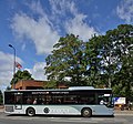
"Oxford" or Wheatley Services - geograph.org.uk - 7024.jpg 640 × 480; 104 KB
-
St Mary's Church Pyrton Oxfordshire England path from lychgate 01.jpg 4,086 × 6,130; 33.58 MB
-
St Mary's churchyard path Pyrton Oxfordshire England.jpg 6,240 × 4,160; 42.03 MB
-
Loranthus mistletoe St Mary's churchyard Pyrton Oxfordshire England.jpg 4,160 × 6,240; 35.39 MB
-
St Mary's Church Pyrton Oxfordshire England path from lychgate 02.jpg 4,160 × 6,240; 34.08 MB
-
Brightwell Baldwin cherry tree flowering blossom Oxfordshire England 01.jpg 6,240 × 4,160; 29.86 MB
-
Brightwell Baldwin cherry tree flowering blossom Oxfordshire England 02.jpg 6,240 × 4,160; 31.04 MB
-
Brightwell Baldwin cherry tree flowering blossom Oxfordshire England 03.jpg 4,160 × 4,160; 19.51 MB
-
Autumn on the Oxfordshire Way - geograph.org.uk - 1588783.jpg 640 × 480; 190 KB
-
A narrowboat on the Thames - geograph.org.uk - 2039916.jpg 1,500 × 1,000; 337 KB
-
20th-century houses at Abingdon, Oxfordshire.jpg 1,024 × 768; 367 KB
-
Berry Abingdon Cemetery CWGC.jpg 802 × 1,280; 598 KB
-
Mercedes-Benz Citaro EF57 OXF Abingdon.jpg 1,280 × 1,197; 891 KB
-
Path in Albert Park - geograph.org.uk - 1299813.jpg 640 × 427; 94 KB
-
Path through the trees in Albert Park - geograph.org.uk - 1299806.jpg 607 × 640; 168 KB
-
Scania AlexanderDennis Enviro400 PF10 OXF Abingdon OxfordRd.jpg 1,069 × 713; 603 KB
-
The Nags Head, Abingdon - geograph.org.uk - 318525.jpg 640 × 411; 116 KB
-
Volvo Wright Eclipse Gemini2 N1 OXF Abingdon right.jpg 1,225 × 612; 589 KB
-
Volvo Wright Eclipse Gemini2 R8 OXF Abingdon.jpg 1,273 × 1,280; 912 KB
-
Volvo Wright Eclipse Gemini2 V14 OXF Abingdon right.jpg 1,115 × 669; 601 KB
-
Volvo Wright Eclipse Gemini2 V14 OXF Abingdon.jpg 1,280 × 1,252; 725 KB
-
Volvo Wright EclipseGemini2 K1 OXF Abingdon.jpg 1,280 × 698; 540 KB
-
Abingdon - geograph.org.uk - 291331.jpg 640 × 480; 540 KB
-
Abingdon Abbey Gardens 02.jpg 4,128 × 3,096; 7.33 MB
-
Abingdon and Witney College - geograph.org.uk - 1299775.jpg 640 × 406; 73 KB
-
Abingdon BaptistChurch SSE.jpg 1,280 × 850; 579 KB
-
Abingdon Cemetery Entrance - geograph.org.uk - 15364.jpg 640 × 480; 108 KB
-
Abingdon ConduitHouse SE.jpg 840 × 1,280; 828 KB
-
Abingdon ConduitHouse SW.jpg 853 × 1,280; 753 KB
-
Abingdon Former Congregational Chapel.jpg 1,280 × 1,280; 852 KB
-
Abingdon Long Alley & St Helen's.jpg 850 × 1,280; 657 KB
-
Abingdon LongAlley north.jpg 1,280 × 761; 638 KB
-
Abingdon MarketSquare17–21.jpg 1,024 × 614; 313 KB
-
Abingdon OckStreet 161–167.jpg 1,280 × 850; 589 KB
-
Abingdon OckStreet 35 east.jpg 1,267 × 1,280; 847 KB
-
Abingdon OckStreet 75–81.jpg 1,280 × 684; 438 KB
-
Abingdon OurLady&StEdmund SE&Presbytery.jpg 1,280 × 719; 481 KB
-
Abingdon OurLady&StEdmund south.jpg 1,280 × 719; 500 KB
-
Abingdon OurLady&StEdmund.JPG 2,440 × 1,830; 498 KB
-
Abingdon SSMichael&AllAngels NW.jpg 1,278 × 1,280; 746 KB
-
Abingdon StHelen west wide.jpg 1,280 × 720; 539 KB
-
Abingdon StHelen west.jpg 1,280 × 1,233; 773 KB
-
Abingdon StMichael&AllAngels north.jpg 1,280 × 851; 641 KB
-
Abingdon The Square north side.jpg 1,280 × 720; 629 KB
-
Abingdon Tomkin's almshouses arch.jpg 835 × 1,280; 800 KB
-
Abingdon WarMemorial.jpg 768 × 1,024; 417 KB
-
Albert Park in Abingdon - geograph.org.uk - 1299787.jpg 640 × 427; 79 KB
-
Albert Park in Abingdon - geograph.org.uk - 1299798.jpg 640 × 427; 90 KB
-
Albert Park, Abingdon - geograph.org.uk - 15093.jpg 480 × 640; 76 KB
-
The gate into Albert Park - geograph.org.uk - 1299795.jpg 640 × 427; 105 KB
-
Abingdon Baptist Church - geograph.org.uk - 15089.jpg 640 × 480; 92 KB
-
Tomkin's Almshouses. Abingdon. Wellcome L0003045.jpg 1,536 × 1,200; 1,014 KB
-
Adwell House, Oxfordshire-14484296501.jpg 4,320 × 2,432; 4.73 MB
-
Adwell House, Oxfordshire-14487681695.jpg 4,030 × 2,269; 3.39 MB
-
Trees in Alkerton - geograph.org.uk - 1566951.jpg 502 × 640; 139 KB
-
All boarded up - geograph.org.uk - 1348446.jpg 640 × 480; 103 KB
-
All together now - geograph.org.uk - 1117509.jpg 640 × 426; 91 KB
-
Optare Solo AE56 LUO Alvescot.jpg 1,280 × 719; 489 KB
-
Branch line to Bicester - geograph.org.uk - 1506016.jpg 640 × 427; 100 KB
-
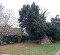
Ancient yew in Didcot - geograph.org.uk - 4362216.jpg 800 × 739; 240 KB
-
Appleton Manor Geograph-3058101-by-Des-Blenkinsopp.jpg 1,600 × 874; 543 KB
-
Appleton StLaurence east.jpg 1,280 × 664; 385 KB
-
Appleton StLaurence ENE.jpg 1,280 × 646; 347 KB
-
Appleton war memorial - geograph.org.uk - 1390031.jpg 640 × 427; 131 KB
-
Ardington Mill Offices - geograph.org.uk - 1769613.jpg 1,500 × 985; 255 KB
-
Brick in the root - geograph.org.uk - 1197966.jpg 640 × 426; 98 KB
-
Cause of the damage - geograph.org.uk - 1195551.jpg 400 × 600; 100 KB
-
Optare SoloSR OU13 DZE Aston Oxon front.jpg 1,280 × 738; 729 KB
-
Aston StJames east.jpg 1,278 × 1,280; 857 KB
-
Aston StJames GatesTransept.jpg 1,024 × 1,280; 892 KB
-
St. Michael's Church, Aston Tirrold - geograph.org.uk - 78640.jpg 640 × 481; 76 KB
-
Aston&Cote SchoolSE.jpg 1,280 × 719; 467 KB
-
Autumn leaves at Nuney Green - geograph.org.uk - 1071607.jpg 479 × 640; 144 KB
-
B4009, Groves Lane, Ewelme - geograph.org.uk - 1082253.jpg 640 × 480; 158 KB
-
Back across the park - geograph.org.uk - 784775.jpg 640 × 427; 100 KB
-
Back to the canal - geograph.org.uk - 1640875.jpg 640 × 480; 131 KB
-
Back up the millstream - geograph.org.uk - 1410531.jpg 450 × 600; 92 KB
-
Baldon Lane in Marsh Baldon - geograph.org.uk - 1566132.jpg 640 × 427; 64 KB
-
Church of St. Mary, Bampton - geograph.org.uk - 91741.jpg 640 × 481; 75 KB
-
Bampton StMaryV south1.jpg 1,060 × 1,280; 685 KB
-
Bampton StMaryV south2.jpg 1,280 × 1,280; 729 KB
-
AlexanderDennis Enviro200 MMC YX65 PXW Banbury BridgeSt LeftQuarter.jpg 1,280 × 761; 709 KB
-
AlexanderDennis Enviro200 MMC YX65 PXW Banbury BridgeSt LeftThreeQuarter.jpg 1,280 × 958; 825 KB
-
AlexanderDennis Enviro200 OU61 AUV Neithrop WarwickRd left.jpg 1,280 × 668; 466 KB
-
AlexanderDennis Enviro200 OU61 AUV Neithrop WarwickRd right.jpg 1,280 × 719; 399 KB
-
Bus IMG 0869 (16172149587).jpg 2,366 × 1,775; 1.18 MB
-
Dennis Dart Plaxton Pointer KV53 NHD Banbury BridgeSt.jpg 1,280 × 1,280; 1.28 MB
-
Scania AlexanderDennis Enviro300 YM15 FPL Banbury.jpg 1,280 × 854; 561 KB
-
Scania K230UB SN58 FWL Banbury.jpg 1,280 × 714; 582 KB
-
Semi-detached house in Banbury, Oxfordshire.jpg 640 × 480; 149 KB
-
Banbury bus station - Stagecoach 31361 (16354512455).jpg 2,309 × 1,732; 1.2 MB
-
Banbury Cross 1.JPG 1,331 × 1,884; 478 KB
-
Banbury Peoples' park 10.jpg 873 × 589; 641 KB
-
Banbury StJohnE belfry.jpg 853 × 1,280; 705 KB
-
St Hugh's Church, Banbury - geograph.org.uk - 236878.jpg 640 × 480; 57 KB
-
St Mary's church - Banbury - 3.jpg 2,592 × 3,456; 5.16 MB
-
Neithrop StPaul south bus.jpg 1,280 × 942; 597 KB
-
Baulking StNicholas NNE.jpg 1,280 × 738; 589 KB
-
Benson church.jpg 640 × 427; 260 KB
-
Fyfield Manor.jpg 1,500 × 1,110; 543 KB
-
Graveyard at the Church - geograph.org.uk - 1616808.jpg 640 × 427; 112 KB
-
St. Helen's Church, Benson - geograph.org.uk - 355896.jpg 500 × 615; 91 KB
-
Berinsfield SSMary&Berin ESE.jpg 1,280 × 649; 575 KB
-
Berinsfield SSMary&Berin SE.jpg 1,280 × 720; 504 KB
-
Beside the Green Belt Way - geograph.org.uk - 3965529.jpg 1,600 × 948; 360 KB
-
NEW MX13 BCV Wright Streetlite + MX13 BCU, Bicester, 1-4-13 (8612220837).jpg 4,272 × 2,848; 4.29 MB
-
Volvo B11R Plaxton Elite YX64 WCD Bicester.jpg 1,280 × 1,280; 633 KB
-
Bicester LondonRd villas+tree.jpg 1,024 × 512; 303 KB
-
Road near Binfield Heath - geograph.org.uk - 1067141.jpg 480 × 640; 196 KB
-
Binfield Heath Congregational Church - geograph.org.uk - 65916.jpg 640 × 481; 49 KB
-
Weir Cottage by the Thames - geograph.org.uk - 1760200.jpg 1,500 × 1,000; 316 KB
-
Optare Solo AE56 LUO BlackBourton.jpg 1,280 × 720; 549 KB
-
Black Bourton war graves.jpg 640 × 480; 107 KB
-
Black Bourton war memorial - geograph.org.uk - 1116076.jpg 640 × 427; 91 KB
-
BlackBourton SchoolHouse.jpg 1,280 × 720; 501 KB
-
BlackBourton StMaryV CWGC.jpg 1,280 × 853; 710 KB
-
Bladon StMartin south.JPG 2,700 × 1,800; 766 KB
-
Rose garden, Blenheim Palace - geograph.org.uk - 1433097.jpg 480 × 640; 162 KB
-
Bletchingdon St Giles south.JPG 3,000 × 2,000; 2.52 MB
-
Bletchingdon StGiles south.jpg 1,280 × 1,280; 817 KB
-
Bletchingdon Village Green - geograph.org.uk - 1040411.jpg 640 × 480; 136 KB
-
Barn across the road - geograph.org.uk - 1377858.jpg 640 × 480; 77 KB
-
Burglar scarecrow - Blewbury Scarecrow Competition, Oxfordshire.jpg 450 × 600; 96 KB
-
Cottage by Bessels lea - geograph.org.uk - 1377646.jpg 640 × 480; 75 KB
-
Graveyard through the gate - geograph.org.uk - 1377754.jpg 640 × 480; 119 KB
-
Scania AlexanderDennis Enviro400 AF10 OXF Blewbury (cropped).jpg 462 × 360; 147 KB
-
Scania AlexanderDennis Enviro400 AF10 OXF Blewbury.jpg 1,280 × 852; 753 KB
-
St Michael's Church in Blewbury-geograph-1664544-by-Steve-Daniels.jpg 1,500 × 1,000; 267 KB
-
The new graveyard - geograph.org.uk - 1377816.jpg 640 × 480; 75 KB
-
The old graveyard - geograph.org.uk - 1377796.jpg 640 × 480; 123 KB
-
Towards Berry lane - geograph.org.uk - 1377656.jpg 640 × 480; 93 KB
-
Tree in the road - geograph.org.uk - 1359178.jpg 640 × 426; 95 KB
-
Blewbury AshbrookMews SSW.jpg 1,280 × 616; 463 KB
-
Blewbury GreatTreeFarm barn SSE.jpg 1,280 × 647; 400 KB
-
Blewbury Humphreys.jpg 1,280 × 719; 665 KB
-
Blewbury Stocks south.jpg 1,280 × 852; 671 KB
-
Blewbury Stocks SSW.jpg 1,280 × 784; 756 KB
-
Blewbury TurnpikeHouse southeast.jpg 1,280 × 719; 506 KB
-
Banbury-Bodicote- Oxford Road - geograph.org.uk - 287042.jpg 640 × 480; 94 KB
-
Grants Lock on the Southern Oxford Canal - geograph.org.uk - 30776.jpg 640 × 480; 100 KB
-
Oxford Road - geograph.org.uk - 1340996.jpg 640 × 457; 313 KB
-
Oxford Road - geograph.org.uk - 1341003.jpg 640 × 457; 288 KB
-
Bodicote SpiceRoom.jpg 1,280 × 720; 606 KB
-
Bodicote StJohnB east.jpg 1,280 × 625; 547 KB
-
Bodicote StJohnB ESE.jpg 1,280 × 653; 494 KB
-
Bodicote StJohnB SamuelsonDK.jpg 853 × 1,280; 964 KB
-
Bodicote StJohnB southeast.jpg 1,280 × 721; 640 KB
-
Bodicote StJohnB SSW.jpg 1,280 × 852; 766 KB
-
Back of the Chapel - geograph.org.uk - 1633779.jpg 480 × 640; 96 KB
-
Chapel by the hut - geograph.org.uk - 1633767.jpg 640 × 480; 87 KB
-
Elms Parade - geograph.org.uk - 1632773.jpg 640 × 480; 126 KB
-
Entrance to the Chapel - geograph.org.uk - 1633535.jpg 480 × 640; 110 KB
-
Snail Cottage - geograph.org.uk - 1633517.jpg 640 × 480; 99 KB
-
The former Carpenters Arms, Botley, Oxfordshire, Nov 2012.jpg 3,264 × 2,448; 2.67 MB
-
Across to the pavilion - geograph.org.uk - 1634781.jpg 640 × 480; 121 KB
-
Back of the cross - geograph.org.uk - 1633914.jpg 480 × 640; 71 KB
-
Commonwealth War Graves - geograph.org.uk - 1607363.jpg 640 × 480; 106 KB
-
Commonwealth War Graves - geograph.org.uk - 1607367.jpg 640 × 480; 92 KB
-
Cross in the cemetery - geograph.org.uk - 1633891.jpg 480 × 640; 95 KB
-
In a corner far from home - geograph.org.uk - 1634758.jpg 640 × 480; 108 KB
-
Italian graves - geograph.org.uk - 1634766.jpg 480 × 640; 97 KB
-
Pavilion in the cemetery - geograph.org.uk - 1633909.jpg 640 × 480; 108 KB
-
Pavilion in the cemetery - geograph.org.uk - 1634746.jpg 640 × 480; 108 KB
-
Botley SSPeter&Paul Barclays.jpg 1,280 × 594; 387 KB
-
Botley War Grave Cemetery - geograph.org.uk - 1633903.jpg 640 × 480; 82 KB
-
Bourton Cross.JPG 2,000 × 3,008; 2.47 MB
-
Braziers Park left side.jpg 4,320 × 3,240; 3.14 MB
-
Braziers Park.jpg 2,592 × 1,944; 655 KB
-
Bridge and Crack Willow - geograph.org.uk - 184947.jpg 640 × 480; 80 KB
-
Bridge in Brightwell Park (geograph 2253436).jpg 3,648 × 2,736; 1.32 MB
-
Ice house in Brightwell Park (geograph 3444810).jpg 640 × 427; 204 KB
-
Lodge house, Brightwell Baldwin (geograph 3905585).jpg 4,320 × 3,240; 5 MB
-
Old Stone Shed, Brightwell Park (geograph 3452048).jpg 3,888 × 2,592; 3.59 MB
-
St Bartholomews church, Brightwell Baldwin (geograph 3905580).jpg 4,220 × 3,102; 4.79 MB
-
St. Bartholomews church (geograph 3444829).jpg 640 × 444; 241 KB
-
The Lord Nelson (geograph 2028485).jpg 2,980 × 2,404; 2.56 MB
-
Brightwell Manor House - geograph.org.uk - 921263.jpg 640 × 395; 81 KB
-
Brightwell Vineyard, Wallingford - geograph.org.uk - 72607.jpg 640 × 480; 97 KB
-
Houses past the tree - geograph.org.uk - 1671139.jpg 1,024 × 683; 143 KB
-
The school - geograph.org.uk - 1671130.jpg 1,024 × 683; 192 KB
-
BrightwellBaldwin OldForge SE.jpg 1,280 × 847; 770 KB
-
Britwell House, Britwell Salome (geograph 3428822).jpg 640 × 360; 160 KB
-
Brize Norton, the Chequers Inn - geograph.org.uk - 1761051.jpg 640 × 480; 85 KB
-
End of the slip road - geograph.org.uk - 2057963.jpg 640 × 480; 87 KB
-
BrizeNorton StBritius & War Memorial.JPG 2,905 × 1,933; 2.32 MB
-
Broadwell "dole pillars" - geograph.org.uk - 363204.jpg 640 × 480; 107 KB
-
Pillars in the snow - geograph.org.uk - 1149320.jpg 640 × 480; 65 KB
-
St. Peter and St. Paul's in the snow.jpg 640 × 480; 74 KB
-
Broughton church - geograph.org.uk - 801320.jpg 640 × 480; 110 KB


