Category:Trees in Herefordshire
Jump to navigation
Jump to search
Subcategories
This category has the following 12 subcategories, out of 12 total.
- Acer in Herefordshire (1 F)
- Apple trees in Herefordshire (5 F)
A
B
- Trees in Bromyard (8 F)
L
- Trees in Ledbury (3 F)
- Trees in Leominster (9 F)
O
- Orchards in Herefordshire (160 F)
R
- Trees in Ross-on-Wye (18 F)
S
Media in category "Trees in Herefordshire"
The following 200 files are in this category, out of 395 total.
(previous page) (next page)-
 A fine beech at Hergest Croft - geograph.org.uk - 605463.jpg 480 × 640; 96 KB
-

-
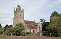
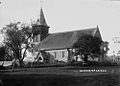
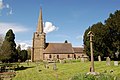
 St Giles church, Acton Beauchamp-geograph.org.uk-2921668.jpg 800 × 451; 188 KB
-

-
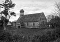
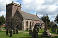
 St Andrew, Allensmore, Heref - geograph.org.uk - 346169.jpg 640 × 428; 106 KB
-
 Ancient Hulk - Croft Castle - Feb 2012 - panoramio.jpg 3,000 × 4,000; 4.73 MB
-
 Ancient hulks in Croft Wood - Feb 2012 - panoramio.jpg 4,000 × 3,000; 4.5 MB
-
 Ancient Oaks - Croft Castle - Feb 2012 - panoramio (1).jpg 4,000 × 3,000; 4.09 MB
-
 Ancient Oaks - Croft Castle - Feb 2012 - panoramio.jpg 3,000 × 4,000; 4.91 MB
-

-

-
 Ancient trees by muddy farm track - Croft - Feb 2012 - panoramio.jpg 4,000 × 3,000; 4.35 MB
-
 Ancient Yew - a monster tree - Feb 2012 - panoramio.jpg 3,000 × 4,000; 3.13 MB
-
 Autumn Beech, Churchyard, Hope Mansell - geograph.org.uk - 603668.jpg 480 × 640; 179 KB
-
 Autumn breeze stripping off the leaves - geograph.org.uk - 1002500.jpg 480 × 640; 150 KB
-
 Autumn colour at The Leadership Trust - geograph.org.uk - 1560220.jpg 640 × 480; 278 KB
-
 Autumn sunshine on the Penyard - geograph.org.uk - 1531450.jpg 640 × 480; 217 KB
-
 Autumn tree colour - geograph.org.uk - 1042504.jpg 459 × 640; 297 KB
-

-
 Church of St Mary, Avenbury - geograph.org.uk - 1363577.jpg 549 × 640; 242 KB
-
 Ruined Church of St Mary, Avenbury - geograph.org.uk - 61037.jpg 422 × 640; 109 KB
-
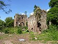 St Marys Church (Remains of), Avenbury (geograph 2042326).jpg 640 × 480; 127 KB
-
 Avenue of trees at Colwall Green - geograph.org.uk - 1552808.jpg 640 × 426; 124 KB
-
 Avenue of trees near Perrystone - geograph.org.uk - 694312.jpg 640 × 480; 199 KB
-
 Avenue, Canon Frome Court - geograph.org.uk - 1276316.jpg 640 × 412; 326 KB
-
 Bank of spring flowers - geograph.org.uk - 486496.jpg 640 × 480; 131 KB
-
 BartestreeConvent.jpg 640 × 426; 106 KB
-
 Beech boughs - geograph.org.uk - 1036554.jpg 640 × 480; 194 KB
-
 Beech branches 1 - geograph.org.uk - 1156927.jpg 640 × 482; 240 KB
-
 Beech, detail - geograph.org.uk - 3221700.jpg 1,200 × 900; 620 KB
-
 All Saints Church, Bishopswood - geograph.org.uk - 993196.jpg 640 × 394; 106 KB
-
 All Saints' church, Bishopswood - geograph.org.uk - 1419633.jpg 640 × 480; 247 KB
-

-
 Riverside path, Bodenham - geograph.org.uk - 1247501.jpg 640 × 480; 140 KB
-
 St Michael and All Angels, Bodenham - geograph.org.uk - 1764597.jpg 3,439 × 2,227; 4.68 MB
-
 St Michael and All Angels, Bodenham - geograph.org.uk - 1764603.jpg 3,300 × 2,233; 5.08 MB
-
 St Michael's Church at Bodenham - geograph.org.uk - 457393.jpg 640 × 480; 142 KB
-
 St Michael's Church at Bodenham - geograph.org.uk - 457403.jpg 640 × 480; 142 KB
-
-
 St. Michael and All Angels, Bodenham - geograph.org.uk - 1248928.jpg 479 × 640; 138 KB
-
 Bollitree Farm sign - geograph.org.uk - 1558489.jpg 640 × 480; 250 KB
-
 St Barnabas church, Brampton Bryan (1295136).jpg 1,000 × 715; 118 KB
-
 Bricklands, near Cusop - geograph.org.uk - 1741661.jpg 3,008 × 2,000; 1.47 MB
-
 Bridge Lane, Wellington - geograph.org.uk - 1059962.jpg 479 × 640; 223 KB
-
 St Bridget's Church, Bridstow - geograph.org.uk - 808856.jpg 640 × 426; 92 KB
-
 St Bridgets - geograph.org.uk - 79286.jpg 640 × 480; 73 KB
-
 St. Bridget's church, Bridstow - geograph.org.uk - 1145529.jpg 640 × 480; 200 KB
-
 St. Bridget's Church, south facade - geograph.org.uk - 520214.jpg 640 × 480; 424 KB
-
 St Michael, Brimfield (geograph 3224247).jpg 3,456 × 2,592; 1.51 MB
-
 St. Mary's Catholic church, Broad Oak - geograph.org.uk - 373479.jpg 640 × 480; 91 KB
-

-
 St Peter's Church from the Southeast - geograph.org.uk - 1161784.jpg 640 × 457; 80 KB
-
 St Peter's Church, Bullinghope - geograph.org.uk - 1583104.jpg 640 × 448; 94 KB
-
 Verge trimming, Grafton Lane - geograph.org.uk - 919985.jpg 640 × 480; 79 KB
-
 In a country churchyard - geograph.org.uk - 1131231.jpg 480 × 640; 167 KB
-

-
 Leaving the church - geograph.org.uk - 992129.jpg 480 × 640; 81 KB
-
 Burrington church (1293466).jpg 1,000 × 719; 111 KB
-

-
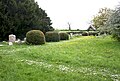
 Burrington churchyard - geograph.org.uk - 1320975.jpg 640 × 480; 61 KB
-
 St. Mary's Church Callow, Hereford. - geograph.org.uk - 1558284.jpg 640 × 431; 78 KB
-
 St. Mary's Church, Callow - geograph.org.uk - 605242.jpg 640 × 480; 176 KB
-
 Approach to Canon Frome Court - geograph.org.uk - 1274274.jpg 640 × 427; 276 KB
-
-
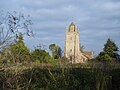
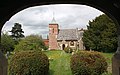 Canon Frome church - geograph.org.uk - 1274297.jpg 640 × 399; 261 KB
-
 Church at Checkley - geograph.org.uk - 1206935.jpg 640 × 480; 135 KB
-
 Chestnut turning colour - geograph.org.uk - 972543.jpg 640 × 590; 185 KB
-
 Church of St Mary Magdalene, Willersley, Herefordshire (1293486).jpg 2,847 × 2,001; 2.61 MB
-

-
 Churchyard, Welsh Bicknor Church - geograph.org.uk - 1658467.jpg 640 × 426; 143 KB
-
 All Saints Church and churchyard - geograph.org.uk - 888344.jpg 640 × 480; 176 KB
-
 All Saints Church, Clehonger - geograph.org.uk - 149666.jpg 640 × 426; 124 KB
-
 All Saints' church, Clehonger - geograph.org.uk - 905280.jpg 640 × 480; 86 KB
-
 Clump of trees at Croft Castle - geograph.org.uk - 454230.jpg 640 × 480; 156 KB
-
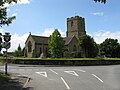
 Coddington church tower - geograph.org.uk - 947500.jpg 480 × 640; 82 KB
-
 College Road, Hereford - geograph.org.uk - 576566.jpg 640 × 480; 183 KB
-
 The gate at St Mary's church Collington - geograph.org.uk - 539878.jpg 480 × 640; 137 KB
-
 Colours on the turn - geograph.org.uk - 1558370.jpg 640 × 480; 139 KB
-
 Church of St. James The Great, Colwall - geograph.org.uk - 485939.jpg 640 × 481; 116 KB
-
 Colwall Church - geograph.org.uk - 636716.jpg 640 × 480; 81 KB
-
 Colwall Church - geograph.org.uk - 963621.jpg 426 × 640; 71 KB
-
 Colwall Church - geograph.org.uk - 963637.jpg 426 × 640; 72 KB
-
 Colwall church and graveyard - geograph.org.uk - 636702.jpg 480 × 640; 71 KB
-
 Coppet Hill - geograph.org.uk - 1100704.jpg 640 × 481; 101 KB
-
 Coppet Hill - geograph.org.uk - 1100795.jpg 640 × 481; 241 KB
-
 Coppet Hill - geograph.org.uk - 1100806.jpg 640 × 466; 168 KB
-

-
 Cross in Tyberton churchyard (geograph 1994999).jpg 480 × 640; 101 KB
-
 Dazzling acer - geograph.org.uk - 1280686.jpg 640 × 640; 324 KB
-
 Dead ash tree, Linton Hill - geograph.org.uk - 1594605.jpg 480 × 640; 120 KB
-
 Dead tree at Underley Farm - geograph.org.uk - 492376 (cropped).jpg 511 × 428; 122 KB
-
 Dead tree at Underley Farm - geograph.org.uk - 492376.jpg 640 × 480; 156 KB
-
 Death throes - geograph.org.uk - 1048487.jpg 480 × 640; 249 KB
-
 Deposition on the River Lugg - geograph.org.uk - 1219159.jpg 640 × 480; 180 KB
-
 View south towards Dewsall - geograph.org.uk - 905213.jpg 640 × 480; 69 KB
-
 St Mary's Church, Dilwyn - geograph.org.uk - 1764156.jpg 3,424 × 2,153; 5.78 MB
-
 St Giles church at Downton Estate - geograph.org.uk - 586744.jpg 480 × 640; 73 KB
-

-
 Felled beech at Dinedor Camp - geograph.org.uk - 640585.jpg 640 × 480; 221 KB
-

-
 Field edge east of Bromsash - geograph.org.uk - 869386.jpg 640 × 480; 134 KB
-
 Final Fling^ - geograph.org.uk - 1560252.jpg 640 × 481; 346 KB
-
 Frosted tree on the Cat's Back - geograph.org.uk - 1107619.jpg 640 × 426; 79 KB
-
 Frosty Holly - geograph.org.uk - 1100701.jpg 640 × 427; 359 KB
-
 Frosty trees on Coppet Hill - geograph.org.uk - 1100920.jpg 640 × 481; 161 KB
-
 Frosty trees on Coppet Hill - geograph.org.uk - 1100949.jpg 640 × 481; 168 KB
-
 Going out in a blaze of colour - geograph.org.uk - 1559537.jpg 480 × 640; 203 KB
-
 St Giles Church, Goodrich - geograph.org.uk - 1445908.jpg 640 × 426; 47 KB
-
 Grove of poplars near Great Marston - geograph.org.uk - 1520085.jpg 640 × 480; 108 KB
-
 Hazel and bracken - geograph.org.uk - 1181760.jpg 640 × 480; 207 KB
-
 Healthy crop of potatoes - geograph.org.uk - 482331.jpg 640 × 480; 436 KB
-
 Henry Street Evangelical Church - geograph.org.uk - 754288.jpg 640 × 480; 170 KB
-
 Hereford Cathedral from across the River Wye.jpg 4,326 × 3,232; 1.91 MB
-
 St. Giles's Chapel, St. Owen's Street - geograph.org.uk - 738878.jpg 640 × 480; 139 KB
-
 St. Nicholas' Church, Hereford - geograph.org.uk - 556215.jpg 640 × 465; 65 KB
-
 Hillside west of Croft Ambrey - 2 - geograph.org.uk - 1179727.jpg 640 × 480; 130 KB
-
 Hoar Frost covered trees - geograph.org.uk - 1100790.jpg 640 × 427; 265 KB
-
 Churchyard, St Cuthbert's - geograph.org.uk - 891321.jpg 640 × 480; 161 KB
-
 Hom Green Chapel - geograph.org.uk - 479366.jpg 640 × 480; 361 KB
-
 Humber Church - geograph.org.uk - 146700.jpg 640 × 480; 91 KB
-
 St Thomas of Canterbury, Huntington - geograph.org.uk - 909336.jpg 640 × 480; 91 KB
-
 Huntington Church - geograph.org.uk - 1164955.jpg 640 × 480; 71 KB
-
 Jubilee commemorations at Much Marcle - geograph.org.uk - 767484.jpg 426 × 640; 111 KB
-
 A variety of crosses - geograph.org.uk - 600648.jpg 480 × 640; 121 KB
-

-
 St Mary's, King's Pyon - geograph.org.uk - 666765.jpg 640 × 480; 82 KB
-
 Kingsland church - geograph.org.uk - 363616.jpg 426 × 640; 144 KB
-
 Kingsland church - geograph.org.uk - 363627.jpg 640 × 426; 103 KB
-
 Kingstone Church - geograph.org.uk - 149269.jpg 640 × 426; 112 KB
-
 Lych Gate St Marys Church Kington - geograph.org.uk - 11317.jpg 600 × 557; 413 KB
-
 Kinnersley church and War Memorial - geograph.org.uk - 319620.jpg 640 × 426; 144 KB
-
 St Michaels Church Knill (geograph 4373462).jpg 1,574 × 1,050; 2.23 MB
-
 Larch needles 1 - geograph.org.uk - 1047504.jpg 640 × 480; 154 KB
-
 Larch needles 2 - geograph.org.uk - 1047515.jpg 640 × 480; 162 KB
-
 Church of St John the Baptist, Lea - geograph.org.uk - 1651621.jpg 640 × 480; 117 KB
-

-
 Ledbury Church (7822492200).jpg 3,056 × 4,592; 4.82 MB
-
 Ledbury Road, Ross-on-Wye - geograph.org.uk - 888656.jpg 640 × 411; 67 KB
-
 Line of Pollards - Croft - Feb 2012 - panoramio.jpg 4,000 × 3,000; 3.83 MB
-
 Line of willow trees by the River Wye - geograph.org.uk - 558204.jpg 640 × 480; 139 KB
-
 Lingen is a place.... - geograph.org.uk - 315073.jpg 480 × 640; 132 KB
-
-
 Linton Wood in Autumn 2 - geograph.org.uk - 1043921.jpg 640 × 493; 168 KB
-
 Little Cowarne church and graveyard - geograph.org.uk - 1005928.jpg 640 × 480; 115 KB
-
 St Mary Magdalene, Little Hereford. - geograph.org.uk - 88662.jpg 640 × 480; 70 KB
-
 Little Hereford Church - geograph.org.uk - 1746194.jpg 640 × 480; 176 KB
-
 Llandinabo Farm - geograph.org.uk - 129008.jpg 426 × 640; 134 KB
-
 Lofty - geograph.org.uk - 866702.jpg 480 × 640; 136 KB
-
 Lone golfer slips through the trees - geograph.org.uk - 1042501.jpg 442 × 640; 178 KB
-
 Lone tree at Hole-in-the-Wall - geograph.org.uk - 483519.jpg 480 × 640; 399 KB
-
 Long November shadows - geograph.org.uk - 1585156.jpg 640 × 480; 131 KB
-
 Long shot of the bench (OpenBenches 9375-3).jpg 3,024 × 4,032; 2.75 MB
-
 Longworth Hall - geograph.org.uk - 722647.jpg 640 × 449; 162 KB
-
 Low afternoon sun - geograph.org.uk - 1558377.jpg 480 × 640; 152 KB
-
 Tree Cover - geograph.org.uk - 653174.jpg 640 × 427; 90 KB
-
 Converted church, Lower Broxwood - geograph.org.uk - 327845.jpg 640 × 426; 147 KB
-
 Lugwardine - Church From Lumber Lane - geograph.org.uk - 1355879.jpg 640 × 480; 163 KB
-

-
 St Michael and All Angels, Lyonshall - geograph.org.uk - 785211.jpg 640 × 363; 75 KB
-
 Lyonshall Church - geograph.org.uk - 442679.jpg 640 × 426; 149 KB
-
 Lyonshall church - geograph.org.uk - 957999.jpg 640 × 480; 79 KB
-
 Lyonshall church - geograph.org.uk - 958000.jpg 640 × 480; 90 KB
-
 Lyonshall church - geograph.org.uk - 958001.jpg 640 × 480; 77 KB
-

-
 Magnificent beech, Southbank, Withington - geograph.org.uk - 1028747.jpg 640 × 480; 184 KB
-

-
 Mistletoe infestation - geograph.org.uk - 1619102.jpg 640 × 480; 126 KB
-
 Mistletoe riddled Hawthorn - geograph.org.uk - 652974.jpg 640 × 427; 292 KB
-
 Church, Moccas - geograph.org.uk - 148854.jpg 640 × 473; 258 KB
-
 St Michael, Moccas - geograph.org.uk - 639790.jpg 640 × 412; 57 KB
-
 Monkey Trees - panoramio.jpg 9,025 × 2,887; 17.61 MB
-

-
 All Saints, Monkland - geograph.org.uk - 1741867.jpg 2,505 × 1,739; 4.11 MB
-
 Monkland church - geograph.org.uk - 360747.jpg 640 × 426; 103 KB
-
 Moorcourt Church - geograph.org.uk - 439538.jpg 640 × 426; 130 KB
-
 Shaft of Churchyard Cross, Much Cowarne - geograph.org.uk - 97977.jpg 640 × 479; 126 KB
-

-

-
 Much Dewchurch Church - geograph.org.uk - 149086.jpg 640 × 426; 105 KB
-
 Next year's leaves - geograph.org.uk - 620031.jpg 640 × 481; 70 KB
-

-
 Oak and oats - geograph.org.uk - 908651.jpg 640 × 380; 44 KB
-
 Oak trees on Snails Bank - geograph.org.uk - 1109870.jpg 640 × 426; 61 KB
-
 Ocle Pychard Church - geograph.org.uk - 1355963 (cropped).jpg 542 × 305; 121 KB
-
 Ocle Pychard Church - geograph.org.uk - 1355963.jpg 640 × 480; 222 KB
-
 Old orchard at Holling's Hill Farm - geograph.org.uk - 760502.jpg 640 × 480; 100 KB
-
 On the turn - geograph.org.uk - 1496569.jpg 480 × 640; 130 KB
-

-
 Eastern approach to Pencombe - geograph.org.uk - 1006019.jpg 640 × 480; 88 KB
-
 Pencombe Church - geograph.org.uk - 113360.jpg 640 × 479; 129 KB
-
 Gates to a country churchyard - geograph.org.uk - 1008484.jpg 640 × 480; 249 KB
-
 Plantation near Sidnall Farm - geograph.org.uk - 1005956.jpg 640 × 480; 85 KB
-
 Poplar-lined driveway, Strangford - geograph.org.uk - 963371.jpg 640 × 430; 170 KB
-
 Potato crop at Kynaston 3 - geograph.org.uk - 894970.jpg 640 × 368; 65 KB
-
 Preaching cross, Madley (geograph 2024789).jpg 480 × 640; 121 KB
-
 St Lawrence Church, Preston on Wye - geograph.org.uk - 148864.jpg 640 × 480; 304 KB
-
 Queenswood Country Park - geograph.org.uk - 286934.jpg 640 × 426; 209 KB
-
 Richards Castle - The Old Church - geograph.org.uk - 1759103.jpg 640 × 480; 192 KB
-
 Road junction, Garway Common - geograph.org.uk - 1181114.jpg 480 × 640; 492 KB
-
 Roadside copse - geograph.org.uk - 1077748.jpg 640 × 480; 355 KB


.jpg)

.jpg)


,_Avenbury_(geograph_2042326).jpg)


.jpg)


.jpg)


.jpg)


.jpg)


.jpg)


.jpg)


.jpg)


.jpg)


.jpg)


.jpg)


.jpg)


