Category:Travel maps of the Australian Capital Territory
Jump to navigation
Jump to search
States of Australia: New South Wales · Queensland · South Australia · Tasmania · Victoria · Western Australia
Internal territories of Australia: Australian Capital Territory · Northern Territory
External territories of Australia: Christmas Island · Cocos (Keeling) Islands · Norfolk Island
Internal territories of Australia: Australian Capital Territory · Northern Territory
External territories of Australia: Christmas Island · Cocos (Keeling) Islands · Norfolk Island
Travel maps of the Australian Capital Territory.
Media in category "Travel maps of the Australian Capital Territory"
The following 13 files are in this category, out of 13 total.
-
Central Canberra static map.png 1,624 × 1,352; 717 KB
-
Central Canberra static map.svg 750 × 625; 93 KB
-
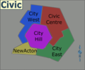
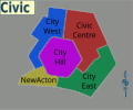
Civic regions map.png 1,684 × 1,070; 943 KB
-
Civic regions map.svg 750 × 625; 6.09 MB
-
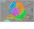
Civic static map.png 1,148 × 956; 497 KB
-
Civic static map.svg 750 × 625; 39 KB
-
Gold Creek Village to Hall, ACT walking directions.png 998 × 1,270; 1.29 MB
-
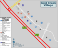
Gold Creek Village.png 1,899 × 1,582; 354 KB
-
Gold Creek Village.svg 750 × 625; 4.3 MB
-
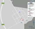
Hall map.png 1,185 × 983; 361 KB
-
Hall map.svg 750 × 625; 4.65 MB
-
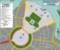
Parliamentary Triangle.png 1,899 × 1,553; 797 KB
-
Parliamentary Triangle.svg 750 × 625; 4.19 MB


