Category:Transport maps of Iran
Jump to navigation
Jump to search
Subcategories
This category has the following 5 subcategories, out of 5 total.
P
R
Media in category "Transport maps of Iran"
The following 18 files are in this category, out of 18 total.
-
1925 Air Routes of Persia.jpg 1,246 × 855; 284 KB
-
Air Routes from TEH2.PNG 1,532 × 643; 102 KB
-
ARAK airport Map Route Between 1939 and 1979.png 3,642 × 2,458; 176 KB
-
Arak Airport Network Map.png 1,761 × 1,007; 136 KB
-
Distance Khorramabad.jpg 895 × 823; 285 KB
-
DistanceKhorram.PNG 895 × 823; 51 KB
-
IKA Destinations.svg 512 × 226; 1.48 MB
-
Important cities of Iran according to rain and air connections.png 1,608 × 1,013; 603 KB
-
India-Iran-Afghanistan transit corridor map.svg 84 × 69; 1.49 MB
-
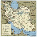
Iran 2001 CIA map.jpg 2,036 × 2,037; 1.84 MB
-
Iran Kolbar.png 300 × 276; 46 KB
-
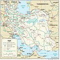
Iran Transportation.jpg 2,000 × 2,001; 1.41 MB
-
Kerman airport.png 3,642 × 2,458; 143 KB
-
Mashhad airport.png 3,642 × 2,458; 139 KB
-
Shiraz airport.png 3,642 × 2,458; 334 KB
-
SYZ Destinations.svg 1,410 × 715; 1.1 MB
-
Transport map of ardabil province نقشه حمل و نقل استان اردبیل.png 860 × 1,756; 131 KB
-
نقشه حمل و نقل استان بوشهر.png 7,200 × 10,794; 20.42 MB


