Category:Transport in Provo, Utah
Jump to navigation
Jump to search
Subcategories
This category has the following 28 subcategories, out of 28 total.
2
- 2230 North (UTA station) (13 F)
3
- 300 North (UTA station) (2 F)
4
- 400 South (UTA station) (2 F)
A
- Academy Square (UTA station) (3 F)
B
- BYU Stadium (UTA station) (3 F)
C
- Center Street (UTA station) (4 F)
E
- East Bay North (UTA station) (1 F)
- East Bay South (UTA station) (1 F)
J
- Joaquin (UTA station) (5 F)
L
- Lakeview Parkway Trail (4 F)
O
- Olmstead Bridge (Provo River) (19 F)
- Olmstead Junction (3 F)
P
- Provo Municipal Airport (28 F)
- Provo Yard (9 F)
R
- The Ryde (18 F)
S
T
U
Media in category "Transport in Provo, Utah"
The following 13 files are in this category, out of 13 total.
-
 Carterville Rd bridge, Provo, Utah, Aug 16.jpg 2,592 × 1,944; 2.35 MB
-
 Chilly Winter Morning - panoramio.jpg 3,264 × 2,448; 2.28 MB
-
 Cycling signal on US-89, Provo, Utah, Jan 17.jpg 2,592 × 1,944; 2.39 MB
-
 East at I-15 & SR-114 interchange, Provo, Utah, May 16.jpg 2,592 × 1,944; 2.33 MB
-
 East on E 700 N, Provo, Utah, Aug 16.jpg 2,592 × 1,944; 2.36 MB
-
 Frosted Trees - Jan. 17, 2009 - panoramio.jpg 3,264 × 2,448; 1.92 MB
-
 Frosty Winter Morning - panoramio.jpg 3,264 × 2,448; 1.97 MB
-
 Looking southeast on southbound I-15 ramp, Provo, Utah, May 16.jpg 2,592 × 1,944; 2.33 MB
-
 North across Carterville Rd bridge over SR-265, Provo, Utah, Jun 16.jpg 2,592 × 1,944; 2.38 MB
-
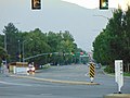
 Northeast across US-189 at Canyon Rd, Provo Utah, Jun 16.jpg 2,592 × 1,944; 2.37 MB
-
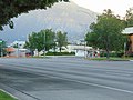
 Northwest along N State St (US-89), Provo, Utah, Jun 16.jpg 2,592 × 1,944; 2.34 MB
-
 South along N 500 W (US-89), Provo, Utah, Jun 16.jpg 2,592 × 1,944; 2.39 MB
-
 West on E 700 N, Provo, Utah, Aug 16.jpg 2,592 × 1,944; 2.44 MB


,_Provo,_Utah,_Jun_16.jpg)
,_Provo,_Utah,_Jun_16.jpg)
