Category:Topographic maps of Shizuoka prefecture
Jump to navigation
Jump to search
English: Category for the topographic maps of Shizuoka Prefecture, Japan
日本語: 日本・静岡県に関する地形図のカテゴリ
| Prefectures of Japan 地形図 (Topographic map) | |||
|---|---|---|---|
|

| ||
Media in category "Topographic maps of Shizuoka prefecture"
The following 23 files are in this category, out of 23 total.
-
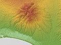
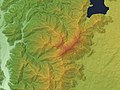
 Ashitaka Volcano Relief Map, SRTM-1 and Takkaosan kofun.jpg 800 × 600; 147 KB
-
 Ashitaka Volcano Relief Map, SRTM-1.jpg 800 × 600; 358 KB
-
 Daruma Volcano Relief Map, SRTM-1.jpg 1,200 × 900; 655 KB
-
 Hatchoike Relief Map, SRTM-1.jpg 800 × 600; 267 KB
-
 Irōzaki Fault Relief Map, SRTM-1.gif 800 × 600; 255 KB
-
 Izu Peninsula 3D 2012.jpg 2,400 × 2,800; 2.6 MB
-
 Izu Skyline, Map, SRTM-1.jpg 1,000 × 2,400; 1.71 MB
-
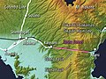
 Location IzuPeninsula.jpg 639 × 698; 61 KB
-
 Makinohara Relief Map, SRTM-1.jpg 1,200 × 1,800; 1.09 MB
-
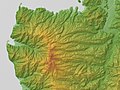
 Mikatahara & Iwatahara Relief Map, SRTM-1.jpg 1,200 × 900; 746 KB
-
 Mount Amagi Relief Map, SRTM-1.jpg 1,500 × 1,500; 1.24 MB
-
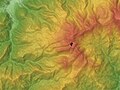
 Mount Fuji Relief Map, SRTM-1.jpg 2,500 × 2,500; 4.11 MB
-
 Mount Kenashi (Shizuoka Pref. & Yamanashi Pref.) Relief Map, SRTM-1.jpg 1,200 × 900; 657 KB
-

-
 Mount Ōmuro with Lava flow Relief Map, SRTM-1 (English).jpg 900 × 1,200; 565 KB
-
 Mount Ōmuro with Lava flow Relief Map, SRTM-1.jpg 900 × 1,200; 566 KB
-
 Shizuoka Plain Relief Map, SRTM-1.jpg 1,200 × 900; 640 KB
-
 Shizuoka Prefecture 3D 2012.jpg 4,500 × 3,500; 9.28 MB
-
 Shizuura Mountains Relief Map, SRTM-1 (Japanese).jpg 600 × 900; 356 KB
-
 Shizuura Mountains Relief Map, SRTM-1.jpg 600 × 900; 329 KB
-
 Tagata Plain Relief Map, SRTM-1.jpg 1,200 × 900; 791 KB
-
 Tanna Tunnel (Map 2017).jpg 800 × 600; 508 KB
-
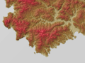
 Tenshi Mountains Relief Map, SRTM-1.jpg 600 × 1,200; 585 KB


_Relief_Map,_SRTM-1.jpg)

.jpg)


.jpg)


.jpg)
