Category:Topographic maps of Ishikawa prefecture
Jump to navigation
Jump to search
English: Category for the topographic maps of Ishikawa Prefecture, Japan
日本語: 日本・石川県に関する地形図のカテゴリ
| Prefectures of Japan 地形図 (Topographic map) | |||
|---|---|---|---|
|

| ||
Media in category "Topographic maps of Ishikawa prefecture"
The following 5 files are in this category, out of 5 total.
-
 Hakusan Volcano Relief Map, SRTM-1.jpg 1,200 × 900; 881 KB
-
 Kanazawa Plain Relief Map, SRTM-1.jpg 600 × 450; 197 KB
-
 Location NotoPeninsulaJp.jpg 647 × 702; 61 KB
-
 Nanatsushima map.jpg 370 × 178; 26 KB
-
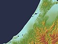
 Noto Peninsula Relief Map, SRTM-1.jpg 1,200 × 1,600; 845 KB


