Category:Topographic maps of Shimane prefecture
Jump to navigation
Jump to search
English: Category for the topographic maps of Shimane Prefecture, Japan
日本語:日本・島根県に関する地形図のカテゴリ
| Prefectures of Japan 地形図 (Topographic map) | |||
|---|---|---|---|
|
|||
Media in category "Topographic maps of Shimane prefecture"
The following 5 files are in this category, out of 5 total.
-
 Aonoyama Volcano Group Relief Map, SRTM-1 (marked).png 800 × 600; 741 KB
-
 Aonoyama Volcano Group Relief Map, SRTM-1.jpg 800 × 600; 391 KB
-
 Mount Sanbe Relief Map, SRTM-1.jpg 1,200 × 900; 596 KB
-
 Oki Islands Relief Map, SRTM.jpg 1,500 × 1,500; 556 KB
-
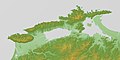 Shimane Peninsula Relief Map, SRTM-1.jpg 2,400 × 1,200; 1.23 MB
.png)


