Category:Topographic maps of Harz
Jump to navigation
Jump to search
Subcategories
This category has the following 3 subcategories, out of 3 total.
Media in category "Topographic maps of Harz"
The following 14 files are in this category, out of 14 total.
-
 Ausschnitt der Karte des Deutschen Reichs (Vogel) - Section 13 (2).png 1,621 × 1,645; 7.1 MB
-
 Eishockeystandorte-in-der-Region-Harz.jpg 1,144 × 763; 167 KB
-
 Fallstein-Huy-Karte.png 908 × 715; 527 KB
-
 Harz - Deutsche Mittelgebirge, Serie A-de.png 2,450 × 1,300; 4.46 MB
-
 Harz map-es.svg 10,084 × 5,973; 3.64 MB
-
 Harz map.png 2,529 × 1,523; 3.15 MB
-
 Harz map.svg 512 × 303; 2.97 MB
-
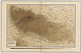 Höhenschichten Karte des Harzgebirges... - btv1b53020971k.jpg 13,619 × 8,760; 20.86 MB
-

-
 Karte des nordwestlichen Harzes... - bearbeitet von Karl Reuss... - btv1b530229250.jpg 9,849 × 7,169; 14.59 MB
-
 Lange-Diercke Volksschulatlas (Harz).jpg 2,823 × 2,106; 2.59 MB
-

-
 Sydow Mittelgruppe des Nord-deutschen Berglandes (Harz).jpg 3,188 × 2,314; 3.18 MB
-
 Sydow Wagners Methodischer Schulatlas 1904 Kopie (3).jpg 3,190 × 2,602; 2.58 MB
_-_Section_13_(2).png)


.jpg)
.jpg)
.jpg)
.jpg)