Category:Topographic maps of Lower Saxony
Jump to navigation
Jump to search
Federal states of Germany:
Subcategories
This category has the following 3 subcategories, out of 3 total.
T
Media in category "Topographic maps of Lower Saxony"
The following 51 files are in this category, out of 51 total.
-
 Deutschlandbearbeitet von E. von Sydow und Herm. Berghaus Teil Niedersachsen.jpg 1,204 × 734; 534 KB
-
 Einzugs- und Flussgebietskarte Bode.png 1,422 × 1,043; 1.49 MB
-
 Einzugs- und Flussgebietskarte Saale.png 2,103 × 3,002; 7.24 MB
-
 EisrandlagenNorddeutschland.jpg 474 × 405; 45 KB
-
 Elbe-Weser-Dreieck.png 692 × 534; 59 KB
-
 Binnenelbe Außenelbe.png 720 × 445; 38 KB
-
 Elm-Asse-Karte.png 739 × 591; 364 KB
-
 Emslauf.png 434 × 564; 128 KB
-
 Frieslande.png 2,599 × 1,423; 280 KB
-
 Gotischer Backstein um Nord- & südliche Ostsee.png 5,248 × 2,250; 11.33 MB
-
 GroßerGrabenSchiffgraben.png 1,274 × 957; 1.67 MB
-
 Hamme teufelsmoor.png 776 × 885; 103 KB
-
 Harz - Deutsche Mittelgebirge, Serie A-de.png 2,450 × 1,300; 4.46 MB
-
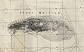
 Helgolaender Bucht.jpg 879 × 700; 52 KB
-
 IWF-Auslegung-17-4-2014.jpg 2,048 × 1,536; 573 KB
-
 Karte des Deutschen Reiches (5820360).jpg 11,272 × 14,111; 66.52 MB
-
 Karte des Deutschen Reiches (5820360c).jpg 11,197 × 9,270; 45.92 MB
-
 Karte des Deutschen Reiches (5820361c).jpg 11,313 × 9,244; 47.4 MB
-
 Karte des Deutschen Reichs (Vogel) - Section 07 - Hamburg.png 4,980 × 4,170; 11.55 MB
-
 Karte des Deutschen Reichs (Vogel) - Section 13 - Hannover.png 4,980 × 4,170; 13.6 MB
-
 Karte Niedersaechsisches Bergland.jpg 1,420 × 967; 964 KB
-
 Lange diercke sachsen deutsche landschaften moorlandschaft.jpg 1,255 × 1,016; 747 KB
-
 Map of pre World War II Germany TK25 Cloppenburg 3114 Cloppenburg City.jpg 1,843 × 1,611; 1.46 MB
-
 Map of pre World War II Germany TK25 Cloppenburg 3114.jpg 10,328 × 7,963; 22.34 MB
-
 Map of pre World War II Germany TK25 Hemelingen 2919.jpg 9,688 × 7,784; 20.5 MB
-
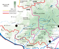
 Naturraumkarte Harz.png 1,410 × 1,033; 1.87 MB
-
 Karte Neßsand-Hahnöfersand.png 1,346 × 665; 545 KB
-
 Lower Saxony in Germany (relief) (shade).svg 1,073 × 1,272; 3.22 MB
-
 Lower Saxony in Germany (relief).svg 1,073 × 1,272; 6.53 MB
-
 Lower Saxony in Germany (relief) (shade) (special marker).svg 1,073 × 1,272; 3.24 MB
-
 Lange diercke sachsen deutsche landschaften wattenkueste.jpg 1,235 × 2,057; 1.14 MB
-
 Okereinzugsgebiet.png 1,200 × 1,597; 2.28 MB
-
 Verlauf der Oste.png 554 × 401; 35 KB
-
 Papenteich (geografisch).jpg 735 × 571; 96 KB
-
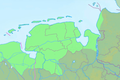
 Bremen Groningen blank.png 843 × 559; 105 KB
-
 Reliefkarte Alfeld Umgebung.png 900 × 900; 1.6 MB
-
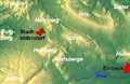 Reliefkarte Homburg, Elfas, Holzberg, Amtsberge.png 527 × 344; 394 KB
-
 Bremen Groningen Friesen.png 843 × 559; 205 KB
-
 Lower Saxony relief location map.jpg 1,786 × 1,509; 961 KB
-
 Niedersachsen Relief Friesen.png 1,786 × 1,509; 3.29 MB
-
 Schillig Forts.png 2,482 × 1,700; 1.56 MB
-
 Teutoburger Wald - Deutsche Mittelgebirge, Serie A-de.png 3,250 × 2,450; 12.42 MB
-
 TK 25000 1951 Ostende Langeoog 2211.jpg 10,312 × 7,955; 14.71 MB
-
 TK 25000 1954 Emden 2609 - Ausschnitt Stadtgebiet.jpg 3,420 × 4,653; 14.66 MB
-
 TK 25000 1954 Emden 2609.jpg 9,480 × 7,622; 11.45 MB
-
 TK 25000 1955 Baltrum 2210 (Ausschnitt).jpg 4,062 × 2,533; 2.7 MB
-
 TK 25000 1955 Baltrum 2210.jpg 9,400 × 7,727; 7.61 MB
-
 TK 25000 Langeoog 1955 1951.jpg 7,999 × 3,611; 11.91 MB
-
 Topo bremer schweiz.png 782 × 655; 281 KB
-
 Topomap lune.svg 600 × 300; 3.66 MB
-
 Wallburgen im Weserbogen.jpg 987 × 621; 105 KB


.jpg)
.jpg)
.jpg)
_-_Section_07_-_Hamburg.png)
_-_Section_13_-_Hannover.png)


_(shade).svg)
.svg)
_(shade)_(special_marker).svg)


.jpg)


.jpg)


