Category:Topographic maps of Baden-Württemberg
Jump to navigation
Jump to search
Federal states of Germany:
Subcategories
This category has the following 2 subcategories, out of 2 total.
E
Media in category "Topographic maps of Baden-Württemberg"
The following 35 files are in this category, out of 35 total.
-
Ausschnitt Karte Tübingen 1863 Maßstab 1 zu 50.000.jpg 3,600 × 2,700; 4.86 MB
-
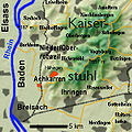
AchkarrenTopografic.jpg 268 × 268; 29 KB
-
AchkarrenTopographie.jpg 300 × 300; 34 KB
-
After Action Report - Reutlingen - NARA - 100384919.jpg 10,774 × 7,788; 22.27 MB
-
After Action Report - Strasbourg - NARA - 100384487 (page 1).jpg 10,562 × 8,852; 24.22 MB
-
Alpenrandrelief Nagelfluhschwelle.png 1,054 × 948; 2.01 MB
-
Alpenrelief Bregenzerwaldgebirge und Lechquellengebirge.png 948 × 994; 1.96 MB
-
Baden-Wuerttemberg relief location map.jpg 1,673 × 1,891; 1.32 MB
-
Baden-Württemberg in Germany (relief) (shade) (special marker).svg 1,073 × 1,272; 6.56 MB
-
Baden-Württemberg in Germany (relief) (shade).svg 1,073 × 1,272; 6.52 MB
-
Baden-Württemberg in Germany (relief).svg 1,073 × 1,272; 6.53 MB
-
BWphysisch.png 1,222 × 1,496; 743 KB
-
German wine regions.jpg 1,002 × 672; 211 KB
-
Haupteinheitengruppen Alpenvorland und Alpen.png 1,000 × 624; 1.09 MB
-
Haupteinheitengruppen westliches Schichtstufenland.png 1,000 × 1,020; 1.81 MB
-
Karte der naturräumlichen Untereinheiten der Donau-Iller-Lech-Platte.svg 1,909 × 1,525; 33.33 MB
-
Karte Region Hotzenwald.png 1,515 × 900; 1.34 MB
-
Karte Rems-Murr-Kreis.jpg 6,350 × 6,150; 25.67 MB
-
Karte Schluchsee.png 3,200 × 2,307; 2.62 MB
-
Karte Titisee.png 2,000 × 1,607; 1.51 MB
-
Land- und Hoehen-Karte von Würtemberg.jpg 5,085 × 6,543; 9.7 MB
-
MEGAL.png 805 × 547; 1.13 MB
-
Naturraeumliche Grossregionen Deutschlands, Schwarzwald.png 1,827 × 2,318; 5.87 MB
-
OberrotweilTopographie.jpg 300 × 300; 35 KB
-
Odenwald - Deutsche Mittelgebirge, Serie A-de.png 1,800 × 1,650; 4.36 MB
-
Pfullendorf-bodensee-1900.jpg 500 × 319; 42 KB
-
Relief Map of Germany, Black Forest.png 1,000 × 1,185; 1.48 MB
-
Schussental.png 475 × 400; 388 KB
-
Schwarzwald - Deutsche Mittelgebirge, Serie A-de.png 2,500 × 3,400; 12.29 MB
-
Schwäbisch-Fränkische Waldberge.png 1,497 × 950; 1.71 MB
-
Schwäbische Alb - Deutsche Mittelgebirge, Serie A-de.png 3,500 × 2,650; 13.05 MB
-
Spessart - Deutsche Mittelgebirge, Serie A-de.png 1,600 × 1,600; 3.67 MB
-
Südwestliche Mittelgebirge.jpg 513 × 476; 69 KB
-
The Linzgau, from Pfullendorf south to Lake Constance.jpg 896 × 578; 197 KB


