Category:Taw Estuary
Jump to navigation
Jump to search
Subcategories
This category has the following 3 subcategories, out of 3 total.
Media in category "Taw Estuary"
The following 147 files are in this category, out of 147 total.
-
 A boat at Pill's Mouth - geograph.org.uk - 1353201.jpg 640 × 480; 76 KB
-
 A riverside walkway, Barnstaple - geograph.org.uk - 1356179.jpg 480 × 640; 82 KB
-

-
 Abandoned Jetty on Yelland Marsh - geograph.org.uk - 33492.jpg 640 × 480; 81 KB
-

-
 Anchored on the Taw - geograph.org.uk - 42700.jpg 640 × 427; 57 KB
-

-
 Ashford, above the village - geograph.org.uk - 514209.jpg 640 × 427; 180 KB
-
 Bait digger and his dog, Taw Estuary - geograph.org.uk - 1323030.jpg 640 × 472; 92 KB
-
 Barnstaple and the river Taw - geograph.org.uk - 1532534.jpg 640 × 480; 37 KB
-
 Barnstaple banner Taw Bridge.JPG 2,625 × 376; 284 KB
-
 Barnstaple Long Bridge and surrounding buildings - geograph.org.uk - 1754403.jpg 1,024 × 683; 144 KB
-

-
 Barnstaple new bridge Taw.jpg 1,024 × 769; 281 KB
-
 Barnstaple new bridge under construction.jpg 800 × 600; 119 KB
-

-
 Barnstaple new road bridge - geograph.org.uk - 959817.jpg 640 × 427; 49 KB
-
 Barnstaple railway bridge (1970s).JPG 1,840 × 1,232; 627 KB
-
 Barnstaple Taw Bridge (A361) - geograph.org.uk - 1494394.jpg 640 × 480; 80 KB
-
 Barnstaple Taw Bridge and surrounds - geograph.org.uk - 1754409.jpg 1,024 × 683; 145 KB
-

-
 Barnstaple Western Bypass Bridge - geograph.org.uk - 627783.jpg 640 × 362; 178 KB
-

-

-
 BarnstapleQuay 19thCentury.jpg 460 × 261; 118 KB
-
 Barstaplequay.jpg 400 × 336; 18 KB
-
 Boats by the Taw - geograph.org.uk - 1346836.jpg 480 × 640; 103 KB
-
 Boats on the Taw at Chivenor - geograph.org.uk - 1477480.jpg 640 × 480; 112 KB
-
 Braunton Burrows from Instow - geograph.org.uk - 1420605.jpg 640 × 295; 53 KB
-
 Braunton Burrwos Crow Point 01.jpg 4,608 × 3,456; 5.89 MB
-
 Bridge across the River Taw - geograph.org.uk - 938910.jpg 640 × 480; 53 KB
-
 Bridge Buildings by the River Taw - geograph.org.uk - 1532532.jpg 640 × 480; 79 KB
-
 Broad Sands - geograph.org.uk - 1399476.jpg 640 × 480; 94 KB
-
 Broad Sands - geograph.org.uk - 817844.jpg 640 × 425; 58 KB
-
 Broad Sands, Crow Point - geograph.org.uk - 717265.jpg 640 × 367; 175 KB
-
 Building of Western Bypass Bridge - geograph.org.uk - 309572.jpg 640 × 360; 68 KB
-
 Coast path and Taw estuary - geograph.org.uk - 1397928.jpg 640 × 480; 92 KB
-
 Confluence of the Rivers Caen and Taw - geograph.org.uk - 1358559.jpg 640 × 480; 101 KB
-
 Crab boat on the Taw Estuary - geograph.org.uk - 4683987.jpg 1,024 × 783; 225 KB
-

-

-
 East Yelland Power Station Jetty - geograph.org.uk - 2137501.jpg 800 × 569; 417 KB
-
 Fremington Quay - geograph.org.uk - 1492728.jpg 640 × 427; 40 KB
-
 Fremington Quay - geograph.org.uk - 1492729.jpg 640 × 413; 40 KB
-
 Fremington Quay - geograph.org.uk - 1595914.jpg 640 × 480; 64 KB
-
 Fremington Quay - geograph.org.uk - 808752.jpg 640 × 373; 81 KB
-

-
 Gradient post on the Tarka Trail - geograph.org.uk - 1360709.jpg 640 × 480; 93 KB
-

-
 HeantonCourt HeantonPunchardon Devon.JPG 3,200 × 2,400; 3.24 MB
-
 HeantonCourt HeantonPunchardon ViewSeenBy JohnSwete.JPG 3,200 × 2,400; 3.48 MB
-
 HeantonCourtBySwete1796.jpg 2,080 × 1,444; 2.62 MB
-
 Lime kilns, Fremington - geograph.org.uk - 1595905.jpg 640 × 480; 55 KB
-

-

-

-
 Lower Yelland - geograph.org.uk - 790774.jpg 640 × 426; 109 KB
-
 Lower Yelland - geograph.org.uk - 790788.jpg 640 × 426; 61 KB
-

-
 Misty morning on the River Taw - geograph.org.uk - 336972.jpg 640 × 426; 100 KB
-
 Moored along the Taw - geograph.org.uk - 726115.jpg 640 × 474; 90 KB
-
 Mouth of Fremington Pill - geograph.org.uk - 1595881.jpg 640 × 480; 40 KB
-
 Mudflats by river Taw near Barnstaple - geograph.org.uk - 37959.jpg 640 × 512; 72 KB
-
 New Road Bridge over the Taw - geograph.org.uk - 140041.jpg 640 × 191; 41 KB
-
 North Devon - River Taw Estuary - geograph.org.uk - 3953995.jpg 4,288 × 2,848; 6.59 MB
-
 North Devon College - geograph.org.uk - 737449.jpg 640 × 426; 56 KB
-
 North Devon Leisure Centre - geograph.org.uk - 1578111.jpg 640 × 427; 51 KB
-

-
 Old Jetty on the Taw Estuary - geograph.org.uk - 315647.jpg 640 × 428; 65 KB
-

-
 On the Taw and Torridge estuary - geograph.org.uk - 4436568.jpg 800 × 531; 66 KB
-
 Ordnance Survey Sheet SS 43 53 Barnstaple, Published 1970.jpg 14,868 × 7,025; 38.71 MB
-
 Pastures by the Taw estuary - geograph.org.uk - 1321156.jpg 640 × 480; 84 KB
-
 Pill's Mouth - geograph.org.uk - 817827.jpg 640 × 425; 48 KB
-
 Pill's Mouth, River Taw - geograph.org.uk - 127166.jpg 640 × 480; 85 KB
-
 River Taw - geograph.org.uk - 1297498.jpg 640 × 480; 55 KB
-
 River Taw from Fremington Pill - geograph.org.uk - 1595902.jpg 640 × 480; 54 KB
-

-
 River Taw nr Barnstaple, Devon. - geograph.org.uk - 320717.jpg 640 × 420; 78 KB
-
 River Taw nr Barnstaple. - geograph.org.uk - 320711.jpg 640 × 480; 87 KB
-
 River Taw road bridge by Maurice Clements.jpg 640 × 480; 92 KB
-
 River Taw, Barnstaple - geograph.org.uk - 218223.jpg 640 × 480; 76 KB
-
 River Taw. Lower Yelland - geograph.org.uk - 790817.jpg 640 × 426; 81 KB
-
 Rivers Taw and Torridge meet - geograph.org.uk - 1323014.jpg 640 × 480; 134 KB
-
 Rowers in the Taw-Torridge estuary - geograph.org.uk - 4435591.jpg 800 × 531; 93 KB
-
 RumshamBridge OnRiverTaw BarnstapleDevon.JPG 4,608 × 3,456; 4.49 MB
-
 Saltmarsh in Taw Estuary.jpg 4,112 × 2,768; 5.51 MB
-
 Sands in the Taw estuary - geograph.org.uk - 1346858.jpg 640 × 480; 58 KB
-
 Sands in the Taw estuary - geograph.org.uk - 1346881.jpg 640 × 480; 65 KB
-
 South West Coast Path in the Taw estuary - geograph.org.uk - 1358567.jpg 640 × 480; 117 KB
-
-
 Sunset over the Taw estuary - geograph.org.uk - 959811.jpg 640 × 427; 41 KB
-
 Tarka Inn from Fremmington Quay - geograph.org.uk - 727509.jpg 640 × 480; 72 KB
-
 Tarka Inn Steps - geograph.org.uk - 1331515.jpg 480 × 640; 98 KB
-
 Tarka Trail - geograph.org.uk - 1349239.jpg 640 × 480; 97 KB
-
 Tarka Trail cycle path near Barnstaple - geograph.org.uk - 42701.jpg 640 × 427; 70 KB
-
 Taw and Torridge converge - geograph.org.uk - 1324076.jpg 640 × 418; 77 KB
-
 Taw and Torridge meeting at low tide - geograph.org.uk - 1377883.jpg 640 × 480; 168 KB
-
 Taw Bridge at dawn.jpg 3,944 × 2,728; 4.15 MB
-
 Taw Bridge.JPG 2,848 × 916; 698 KB
-
 Taw Estuary and South West Coastpath - geograph.org.uk - 104516.jpg 640 × 480; 43 KB
-
 Taw estuary below Barnstaple - geograph.org.uk - 1349312.jpg 640 × 480; 72 KB
-
 Taw estuary, Barnstaple - geograph.org.uk - 1742537.jpg 640 × 480; 61 KB
-
 The "Severn Sands" at Fremington - geograph.org.uk - 1595918.jpg 640 × 480; 62 KB
-
 The Aberdeen cargo ship - geograph.org.uk - 4436553.jpg 800 × 531; 70 KB
-
 The Civic Centre - geograph.org.uk - 761723.jpg 640 × 426; 68 KB
-
 The coast path beside Horsey Island - geograph.org.uk - 1397936.jpg 640 × 480; 130 KB
-
 The Deerhurst barge at Barnstaple - geograph.org.uk - 1357861.jpg 640 × 480; 104 KB
-

-

-

-
 The new Taw Bridge - geograph.org.uk - 1357932.jpg 640 × 480; 102 KB
-
-
 The old quay at Fremington - geograph.org.uk - 101567.jpg 568 × 425; 74 KB
-
 The River Taw at Barnstaple - geograph.org.uk - 1357887.jpg 640 × 480; 71 KB
-
 The river Taw at Barnstaple - geograph.org.uk - 1611937.jpg 640 × 407; 39 KB
-
 The River Taw from Ashford - geograph.org.uk - 1388918.jpg 640 × 427; 57 KB
-
 The River Taw from Fremington - geograph.org.uk - 43083.jpg 640 × 427; 46 KB
-
 The river Taw from Fremington Quay - geograph.org.uk - 1595907.jpg 640 × 450; 57 KB
-
 The setting sun - geograph.org.uk - 4435577.jpg 800 × 531; 88 KB
-
 The Severn Sands at Fremington Quay - geograph.org.uk - 1492726.jpg 640 × 427; 51 KB
-
-

-
 The Tarka Trail - geograph.org.uk - 1358002.jpg 640 × 480; 100 KB
-
 The Tarka Trail and River Taw - geograph.org.uk - 1357961.jpg 640 × 480; 119 KB
-
 The Tarka Trail and Taw estuary - geograph.org.uk - 1357992.jpg 640 × 480; 80 KB
-

-
 The Tarka Trail at Barnstaple - geograph.org.uk - 1388934.jpg 640 × 417; 62 KB
-

-
 The Tarka Trail near Barnstaple - geograph.org.uk - 43080.jpg 640 × 427; 68 KB
-

-
 The Taw Bridge at Barnstaple - geograph.org.uk - 1388929.jpg 640 × 427; 33 KB
-
 The Taw Bridge at Barnstaple - geograph.org.uk - 1388931.jpg 640 × 427; 36 KB
-
 The Taw estuary - geograph.org.uk - 1357977.jpg 640 × 480; 69 KB
-
 The Taw estuary - geograph.org.uk - 1358244.jpg 640 × 480; 62 KB
-
 The Taw estuary - geograph.org.uk - 1558153.jpg 640 × 480; 33 KB
-
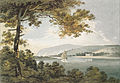
 Thomas Girtin - Estuary on the River Taw, Devon - Google Art Project.jpg 6,090 × 3,888; 5.64 MB
-

-
 View across the Taw estuary - geograph.org.uk - 1321669.jpg 640 × 418; 120 KB
-

-
 View towards Bideford Bar - geograph.org.uk - 4683928.jpg 1,024 × 754; 234 KB
-
 View towards Braunton Burrows - geograph.org.uk - 1324087.jpg 640 × 475; 65 KB
-
 Warehouses, Barnstaple.jpg 3,136 × 2,616; 3.29 MB
-
 Western By-pass Bridge, February 2007 - geograph.org.uk - 332930.jpg 640 × 427; 55 KB
-
 Western By-pass Bridge, February 2007 - geograph.org.uk - 332939.jpg 640 × 427; 105 KB
-
 Wheatfield south of the Taw estuary - geograph.org.uk - 1321183.jpg 640 × 480; 169 KB
-
 White House Yellow Boat - geograph.org.uk - 126122.jpg 640 × 480; 51 KB


.JPG)
_-_geograph.org.uk_-_1494394.jpg)


