Category:North coast of Devon
Jump to navigation
Jump to search
Media relating to the North coast of Devon
Subcategories
This category has the following 24 subcategories, out of 24 total.
B
- Baggy Point (85 F)
- Blackchurch Rock, Clovelly (11 F)
- Bull Point Lighthouse (24 F)
C
- Cliffs of Ilfracombe (19 F)
H
- Hangman Cliffs (12 F)
- Hartland Point Lighthouse (29 F)
- Holdstone Down (52 F)
I
L
- Lynmouth Foreland lighthouse (11 F)
M
R
- Rhenish Tower, Lynmouth Pier (13 F)
S
- St Catherine's Tor (13 F)
T
V
Media in category "North coast of Devon"
The following 200 files are in this category, out of 1,263 total.
(previous page) (next page)-

-
 .....and not a drop to drink^ - geograph.org.uk - 132651.jpg 640 × 480; 59 KB
-
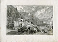 Coombe Martin, Devonshire early proof etched by W Miller after J M W Turner.jpg 4,679 × 3,394; 4.85 MB
-
 Coombe Martin, Devonshire proof for the curious engraved by W Miller after J M W Turner.jpg 4,679 × 3,394; 4.55 MB
-

-

-
 A view of Baggy Point - geograph.org.uk - 1325660.jpg 640 × 480; 50 KB
-
 A view to Lundy - geograph.org.uk - 1342359.jpg 483 × 640; 85 KB
-
 A view to Potter's Hill - geograph.org.uk - 1327033.jpg 640 × 480; 122 KB
-
 A39 descends to Lynmouth - geograph.org.uk - 477243.jpg 640 × 443; 252 KB
-
 Abbey River meets the sea at Blegberry Beach - Aug 2011 - panoramio.jpg 1,712 × 2,288; 1,000 KB
-
 Abbotsham Cliff - geograph.org.uk - 1302782.jpg 640 × 480; 66 KB
-
 Abbotsham Cliff - geograph.org.uk - 1302790.jpg 640 × 480; 234 KB
-
 Abbotsham Cliff - geograph.org.uk - 1302796.jpg 640 × 480; 123 KB
-
 Above Gawlish Cliff - geograph.org.uk - 1521909.jpg 640 × 480; 84 KB
-
 Above Great Burland Rocks - geograph.org.uk - 1603962.jpg 480 × 640; 86 KB
-

-
 Abseilers at Hartland Quay - geograph.org.uk - 375263.jpg 640 × 453; 125 KB
-
 Abseiling at Hartland Point - geograph.org.uk - 1461613.jpg 449 × 640; 55 KB
-
 Access road to Foreland Lighthouse - geograph.org.uk - 1460029.jpg 640 × 480; 82 KB
-
 Access to Combesgate Beach - geograph.org.uk - 1329745.jpg 640 × 480; 126 KB
-
 Across Barnstaple Bay - geograph.org.uk - 1342354.jpg 640 × 463; 72 KB
-
 Across Freshwater Bay - geograph.org.uk - 1756965.jpg 640 × 480; 234 KB
-
 Admiring the view - geograph.org.uk - 1327097.jpg 640 × 470; 126 KB
-
 Almost vertical - geograph.org.uk - 1327077.jpg 480 × 640; 157 KB
-
 Along the sea wall, Hartland Quay - geograph.org.uk - 1332154.jpg 640 × 480; 121 KB
-
 Amazing rock pool, Barricane Beach - geograph.org.uk - 1327506.jpg 480 × 640; 132 KB
-
 Ancient Fishing Weir - geograph.org.uk - 637068.jpg 480 × 640; 116 KB
-
 Anglers on the beach at Buck's Mills - geograph.org.uk - 1387028.jpg 640 × 427; 79 KB
-
 Appledore - geograph.org.uk - 1394268.jpg 640 × 416; 65 KB
-
 Approaching Baggy Point - geograph.org.uk - 819591.jpg 640 × 425; 59 KB
-
-
 At anchor - geograph.org.uk - 1318347.jpg 640 × 480; 89 KB
-
 Babbacombe Cliff - geograph.org.uk - 74256.jpg 640 × 480; 25 KB
-
 Baggy Hole - geograph.org.uk - 1304851.jpg 640 × 480; 87 KB
-
 Baggy Point - geograph.org.uk - 1354228.jpg 480 × 640; 99 KB
-
 Baggy Point - geograph.org.uk - 1354309.jpg 640 × 480; 89 KB
-
 Baggy Point - geograph.org.uk - 1366685.jpg 640 × 480; 91 KB
-
 Baggy Point - geograph.org.uk - 1473056.jpg 640 × 480; 101 KB
-
 Baggy Point - geograph.org.uk - 395175.jpg 640 × 480; 179 KB
-
 Baggy Point from Woolacombe Beach - geograph.org.uk - 648993.jpg 640 × 275; 22 KB
-
 Baggy Sandstone, Baggy Point - geograph.org.uk - 560065.jpg 640 × 480; 126 KB
-
 Barley Bay - geograph.org.uk - 1333704.jpg 640 × 480; 122 KB
-
 Barley Bay - geograph.org.uk - 1378440.jpg 640 × 359; 118 KB
-
 Barley Bay - geograph.org.uk - 1520216.jpg 480 × 640; 61 KB
-
 Barley Bay, Hartland - geograph.org.uk - 103602.jpg 318 × 425; 59 KB
-
 Barnstaple Bay - geograph.org.uk - 42694.jpg 640 × 427; 38 KB
-
 Barnstaple Bay from Babbacombe Cliff - geograph.org.uk - 1442491.jpg 640 × 480; 87 KB
-
 Barricane Beach - geograph.org.uk - 1327448.jpg 640 × 480; 118 KB
-
 Barricane Beach - geograph.org.uk - 207128.jpg 640 × 480; 96 KB
-
 Barricane Beach - geograph.org.uk - 348249.jpg 640 × 512; 105 KB
-
 Barricane Beach - geograph.org.uk - 818289.jpg 640 × 425; 67 KB
-
 Barricane Beach Cafe - geograph.org.uk - 1329714.jpg 640 × 480; 134 KB
-
 Barricane Beach near Woolacombe - geograph.org.uk - 1495688.jpg 640 × 415; 41 KB
-
 Barricane Shell Beach, Mortehoe, England-LCCN2002697096.jpg 3,700 × 2,716; 3.15 MB
-
 Base of Abbotsham Cliff - geograph.org.uk - 1302743.jpg 640 × 480; 102 KB
-
 Base of Lester Cliff, Combe Martin - geograph.org.uk - 218879.jpg 640 × 480; 129 KB
-
 Be Aware Pedestrians^ - geograph.org.uk - 1366709.jpg 640 × 480; 68 KB
-
 Beach access at Speke's Mill Mouth - geograph.org.uk - 506871.jpg 640 × 480; 157 KB
-
 Beach access, Croyde Bay - geograph.org.uk - 1325520.jpg 640 × 430; 68 KB
-
 Beach at Hartland Quay - geograph.org.uk - 1416234.jpg 640 × 415; 49 KB
-
 Beach at Hartland Quay - geograph.org.uk - 1416235.jpg 640 × 427; 79 KB
-
 Beach at Hartland Quay - geograph.org.uk - 1416250.jpg 640 × 427; 72 KB
-
 Beach at Ilfracombe - geograph.org.uk - 1430477.jpg 480 × 640; 94 KB
-
 Beach at Lee Bay - geograph.org.uk - 1421688.jpg 640 × 480; 106 KB
-
 Beach at Westward Ho^ - geograph.org.uk - 1358239.jpg 640 × 480; 84 KB
-

-
 Beach Cafe at Putsborough Sands - geograph.org.uk - 31823.jpg 640 × 461; 86 KB
-
 Beach clean at Rockham beach in the sea mist.jpg 2,448 × 3,264; 2.2 MB
-

-
 Beach to the north of Westward Ho^ - geograph.org.uk - 1367770.jpg 640 × 480; 82 KB
-
 Beached boats in Lynmouth Harbour - geograph.org.uk - 938552.jpg 640 × 480; 116 KB
-
-
 Bench and telescope, Capstone Point - geograph.org.uk - 1420705.jpg 640 × 480; 83 KB
-
 Bench on Knap Head - geograph.org.uk - 1555085.jpg 640 × 480; 122 KB
-
 Bench with a view - geograph.org.uk - 1419522.jpg 640 × 480; 89 KB
-
 Bennett's Mouth - geograph.org.uk - 880229.jpg 640 × 427; 75 KB
-
 Bennett's Mouth - geograph.org.uk - 880233.jpg 640 × 427; 91 KB
-
 Bennett's Mouth - geograph.org.uk - 880238.jpg 640 × 427; 70 KB
-
 Berry Lawn Linhay - geograph.org.uk - 1307142.jpg 640 × 480; 66 KB
-

-
 Bideford Bay Clovelly.jpg 640 × 427; 69 KB
-
 Bideford Bay from Clovelly Quay - geograph.org.uk - 1611795.jpg 640 × 480; 75 KB
-
 Big wave cheney.JPG 1,280 × 960; 325 KB
-
 Bight a Doubleyou - geograph.org.uk - 875397.jpg 640 × 427; 83 KB
-
 Black Pit - geograph.org.uk - 880375.jpg 640 × 427; 100 KB
-
 Blackchurch Rock - geograph.org.uk - 1989.jpg 640 × 395; 44 KB
-
 Blackchurch Rock from Brownsham Cliff - geograph.org.uk - 73238.jpg 640 × 480; 54 KB
-

-

-
 Blackpool Beach - geograph.org.uk - 506196.jpg 640 × 480; 120 KB
-
 Blegberry Cliffs - August 2011 - panoramio.jpg 2,288 × 1,712; 796 KB
-
 Boat in the Taw estuary - geograph.org.uk - 1354709.jpg 640 × 480; 59 KB
-
 Boats beached at low tide - geograph.org.uk - 1354848.jpg 480 × 640; 57 KB
-
 Brandy Cove Point - geograph.org.uk - 1322977.jpg 640 × 480; 86 KB
-
 Braunton Burrows from Instow - geograph.org.uk - 1420605.jpg 640 × 295; 53 KB
-
 Braunton, Saunton Sands - geograph.org.uk - 514169.jpg 640 × 427; 152 KB
-
 Braunton, Saunton Sands - geograph.org.uk - 72136.jpg 640 × 423; 63 KB
-
 Breakers at Barricane Beach - geograph.org.uk - 1327476.jpg 480 × 640; 109 KB
-

-
 Bristol Channel at Lynmouth unedited.jpg 4,272 × 2,848; 9.36 MB
-
 Bristol channel covered in fog, Near Lynton and Lynmouth (2545085053).jpg 2,518 × 2,750; 1.53 MB
-
 Bristol channel covered in fog, Near Lynton and Lynmouth (2545911334).jpg 2,412 × 2,503; 1.23 MB
-
 Bristol.channel.ilfracombe.arp.750pix.jpg 750 × 536; 93 KB
-
 Broad Sands - geograph.org.uk - 1399476.jpg 640 × 480; 94 KB
-
 Broad Sands - geograph.org.uk - 817844.jpg 640 × 425; 58 KB
-
 Broadsands - geograph.org.uk - 71354.jpg 640 × 480; 91 KB
-

-
 Broadstrand Beach at Ilfracombe - geograph.org.uk - 1494235.jpg 640 × 434; 93 KB
-

-
 Bucks Mills as seen from Clovelly - geograph.org.uk - 843064.jpg 640 × 426; 78 KB
-
 Bucks Mills Gut.JPG 3,264 × 2,448; 1.56 MB
-
 Bull Point - geograph.org.uk - 873152.jpg 640 × 427; 81 KB
-
 Campsite above Watermouth. - geograph.org.uk - 295888.jpg 640 × 426; 91 KB
-
 Canoeists in Lee Bay - geograph.org.uk - 884747.jpg 640 × 427; 92 KB
-
 Capstone from the arcade Ilfracombe England.jpg 1,073 × 832; 164 KB
-
 Capstone Parade, Ilfracombe - geograph.org.uk - 1420703.jpg 480 × 640; 53 KB
-
 Capstone Point, Ilfracombe - geograph.org.uk - 1430482.jpg 640 × 480; 101 KB
-
 Capstone steps Ilfracombe England.jpg 829 × 1,073; 163 KB
-
 Capstone steps, Ilfracombe, England-LCCN2002696824.jpg 2,716 × 3,690; 2.96 MB
-
 Capstone, from the arcade, Ilfracombe, England-LCCN2002696822.jpg 3,691 × 2,727; 3.12 MB
-
 Car park at Hartland Quay - geograph.org.uk - 506300.jpg 640 × 480; 128 KB
-
 Caravans above Hele Bay - geograph.org.uk - 1421681.jpg 640 × 480; 73 KB
-
 Castle Bungalow, Peppercombe - geograph.org.uk - 1430948.jpg 640 × 480; 93 KB
-
 Castle Rock and Rugged Jack - geograph.org.uk - 73912.jpg 480 × 640; 33 KB
-
 Castle Rock from the East - geograph.org.uk - 60055.jpg 640 × 480; 113 KB
-
 Caves on Rillage Point - geograph.org.uk - 819523.jpg 640 × 425; 72 KB
-
 Cemetery, Mortehoe - geograph.org.uk - 1474762.jpg 640 × 480; 137 KB
-
 Cemetery, Mortehoe - geograph.org.uk - 632422.jpg 640 × 480; 78 KB
-
 Chalets at Lee Bay - geograph.org.uk - 739498.jpg 640 × 498; 95 KB
-
 Challacombe Hill and Potters Hill - geograph.org.uk - 118403.jpg 640 × 416; 113 KB
-
 Cheyne Beach sea wall - geograph.org.uk - 873491.jpg 640 × 427; 67 KB
-
 Cliff above Barricane Beach - geograph.org.uk - 1327510.jpg 640 × 480; 123 KB
-
 Cliff at Glenthorne Beach.jpg 4,000 × 3,000; 2.81 MB
-
 Cliff base, Clovelly - geograph.org.uk - 985159.jpg 640 × 480; 119 KB
-
 Cliff east of the slipway, Hartland Quay - geograph.org.uk - 1332884.jpg 480 × 640; 115 KB
-
 Cliff path at Torrs Park - geograph.org.uk - 480086.jpg 640 × 418; 71 KB
-
-

-
 Cliffs above Speke's Mill Beach - geograph.org.uk - 506856.jpg 640 × 478; 109 KB
-
 Cliffs above Speke's Mill Mouth - geograph.org.uk - 1524934.jpg 640 × 480; 100 KB
-
 Cliffs at Combe Martin - geograph.org.uk - 191016.jpg 640 × 426; 137 KB
-
 Cliffs at East Cleave - geograph.org.uk - 747889.jpg 480 × 640; 67 KB
-
 Cliffs at Shag Point - geograph.org.uk - 1756966.jpg 640 × 480; 215 KB
-
 Cliffs below Galantry Gower - geograph.org.uk - 420648.jpg 640 × 426; 123 KB
-

-
 Cliffs Clovelly Coast West.JPG 2,934 × 2,112; 6.58 MB
-
 Cliffs from Hartland Quays - geograph.org.uk - 1149944.jpg 640 × 480; 66 KB
-
 Cliffs near Flat Point - geograph.org.uk - 565178.jpg 640 × 480; 61 KB
-

-
 Cliffs, Hazel Bushes Bay - geograph.org.uk - 1322985.jpg 640 × 480; 89 KB
-
 Climbing out of Bennett's Mouth - geograph.org.uk - 722247.jpg 425 × 640; 94 KB
-
 Clinging on to Lester Cliff - geograph.org.uk - 1318189.jpg 472 × 640; 145 KB
-
 Clovelly 08.jpg 4,140 × 3,105; 3.42 MB
-
 Clovelly 22.jpg 3,854 × 2,891; 2.8 MB
-
 Clovelly Bay - geograph.org.uk - 875320.jpg 640 × 427; 102 KB
-
 Clovelly Bay engraving by William Miller after Turner.jpg 2,310 × 1,860; 1.02 MB
-
 Clovelly bay.jpg 896 × 600; 323 KB
-
 Clovelly Beach west - geograph.org.uk - 875922.jpg 640 × 427; 77 KB
-
 Clovelly from the Hobby Drive - geograph.org.uk - 80206.jpg 480 × 640; 40 KB
-
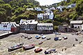
 Clovelly Harbour - geograph.org.uk - 29619.jpg 480 × 640; 93 KB
-
 Clovelly Harbour - geograph.org.uk - 342241.jpg 640 × 436; 75 KB
-
 Clovelly Harbour at low tide - geograph.org.uk - 238635.jpg 640 × 421; 87 KB
-
 Clovelly Harbour entrance at low tide - geograph.org.uk - 238618.jpg 640 × 423; 61 KB
-
 Clovelly smt.jpg 1,280 × 854; 411 KB
-
 Clovelly strata - geograph.org.uk - 18503.jpg 640 × 425; 160 KB
-
 Clovelly Waterfall - geograph.org.uk - 1563289.jpg 480 × 640; 98 KB
-
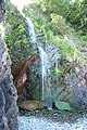 Clovelly Waterfall - geograph.org.uk - 875394.jpg 427 × 640; 113 KB
-
 Clovelly, Seascape - geograph.org.uk - 207092.jpg 640 × 480; 105 KB
-
 Clovelly, view from the sea - geograph.org.uk - 495267.jpg 640 × 429; 64 KB
-
 Coast above Countisbury Cove - geograph.org.uk - 1470917.jpg 640 × 480; 84 KB
-
 Coast at Hollow Brook Combe - geograph.org.uk - 1286940.jpg 640 × 480; 87 KB
-
 Coast below Torrs Park - geograph.org.uk - 1430446.jpg 480 × 640; 110 KB
-
 Coast east of Great Burland Rocks - geograph.org.uk - 1286045.jpg 640 × 472; 75 KB
-
 Coast east of Highveer Point - geograph.org.uk - 1286995.jpg 480 × 640; 88 KB
-
 Coast north of Hartland Quay - geograph.org.uk - 702214.jpg 640 × 607; 121 KB
-
 Coast North of Mortehoe - geograph.org.uk - 1302769.jpg 640 × 479; 115 KB
-
 Coast north of the Warren - geograph.org.uk - 506251.jpg 640 × 473; 112 KB
-
 Coast north of Woolacombe - geograph.org.uk - 609121.jpg 640 × 428; 118 KB
-
 Coast path above Exmansworthy Cliff - geograph.org.uk - 507041.jpg 640 × 430; 118 KB
-
 Coast path above Highveer Point - geograph.org.uk - 1287012.jpg 640 × 459; 95 KB
-
 Coast path above Peppercombe - geograph.org.uk - 1430956.jpg 640 × 480; 154 KB
-
 Coast path at North Cleave - geograph.org.uk - 1596960.jpg 640 × 480; 92 KB
-
 Coast path at North Cleave - geograph.org.uk - 1596961.jpg 640 × 480; 97 KB
-
 Coast path at Woody Bay - geograph.org.uk - 480424.jpg 640 × 625; 111 KB
-
 Coast path below Old Burrow Hill - geograph.org.uk - 1419526.jpg 640 × 480; 104 KB
-
 Coast path east of Lynmouth - geograph.org.uk - 1306760.jpg 640 × 480; 100 KB
-
 Coast path east of Lynmouth - geograph.org.uk - 890829.jpg 640 × 512; 60 KB
-

-
 Coast path in Sloo Wood - geograph.org.uk - 1430969.jpg 640 × 480; 152 KB
-
 Coast path near Lynton - geograph.org.uk - 559183.jpg 640 × 480; 131 KB
-
 Coast path on Hollerday Hill - geograph.org.uk - 560562.jpg 640 × 480; 137 KB
-
 Coast path through Barton Wood - geograph.org.uk - 1431404.jpg 480 × 640; 137 KB
-
 Coast path to Baggy Point - geograph.org.uk - 1366694.jpg 640 × 480; 97 KB
-
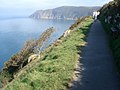
 Coast path to Foreland Point - geograph.org.uk - 1306881.jpg 640 × 480; 83 KB
-
 Coast path west of Woody Bay - geograph.org.uk - 480408.jpg 640 × 625; 79 KB
-
 Coastal Farm (7338288354).jpg 2,716 × 1,227; 1.11 MB
-
 Coastal habitat, Woolacombe - geograph.org.uk - 1327030.jpg 640 × 480; 174 KB
-
 Coastal path looking west - geograph.org.uk - 689074.jpg 1,600 × 1,200; 1.59 MB
-
 Coastal path near Heddon's mouth - geograph.org.uk - 691769.jpg 640 × 480; 96 KB


.jpg)
.jpg)


.jpg)


