Category:Streams in North Yorkshire
Jump to navigation
Jump to search
Ceremonial counties of England: Bedfordshire · Berkshire · Buckinghamshire · Cambridgeshire · Cheshire · Cornwall · Cumbria · Derbyshire · Devon · Dorset · Durham · East Riding of Yorkshire · East Sussex · Essex · Gloucestershire · Greater London · Greater Manchester · Hampshire · Herefordshire · Hertfordshire · Kent · Lancashire · Leicestershire · Lincolnshire · Merseyside · Norfolk · North Yorkshire · Northamptonshire · Northumberland · Nottinghamshire · Oxfordshire · Rutland · Shropshire · Somerset · South Yorkshire · Staffordshire · Suffolk · Surrey · Tyne and Wear · Warwickshire · West Midlands · West Sussex · West Yorkshire · Wiltshire · Worcestershire
City-counties: Bristol ·
Former historic counties:
Other former counties:
City-counties: Bristol ·
Former historic counties:
Other former counties:

Subcategories
This category has the following 73 subcategories, out of 73 total.
A
- Ashfold Side Beck (24 F)
B
- Bilton Beck (1 F)
- Borough Beck, Helmsley (5 F)
C
- Cam Beck, North Yorkshire (6 F)
- Carlesmoor Beck (4 F)
- Clapham Beck (30 F)
- Cock Beck (River Wharfe) (27 F)
- Cod Beck (36 F)
- Coppy Gill (10 F)
- Coul Beck (1 F)
- Crabdale Beck (3 F)
- Crimple Beck (9 F)
D
E
- East Beck, North Yorkshire (2 F)
- Eller Beck, Craven (64 F)
F
- Fangdale Beck (14 F)
- Foss Dike, Upper Poppleton (2 F)
G
- Gayle Beck (River Ure) (20 F)
- Germany Beck (32 F)
- Great Hograh Beck (5 F)
- Green Field Beck (4 F)
- Gunnerside Beck (16 F)
H
- Hardraw Beck (12 F)
- Hawkhills Beck (2 F)
- Hayburn beck (10 F)
- Hebden Beck (16 F)
- Hodge Beck (12 F)
- Holgate Beck (3 F)
- How Beck, North Yorkshire (9 F)
- Howl Beck (3 F)
K
L
- Little Hograh Beck (1 F)
M
- Markington Beck (3 F)
- Mirk Fell Gill (1 F)
N
- North Gill Beck (4 F)
O
- Oak Beck (12 F)
- Osbaldwick Beck (24 F)
P
- Posforth Gill (2 F)
R
- Rigg Mill Beck (1 F)
- River Hertford (18 F)
S
- Scugdale Beck (6 F)
- Selby Dam (1 F)
- Spinkburn Beck (2 F)
- Stock Beck, Yorkshire (4 F)
- Swinner Gill (48 F)
T
- Tang Hall Beck (12 F)
W
- Westfield Beck (7 F)
- Winterscales Beck (17 F)
Media in category "Streams in North Yorkshire"
The following 200 files are in this category, out of 837 total.
(previous page) (next page)-

-
 A view from Knoutberry Hill - geograph.org.uk - 1153884.jpg 640 × 480; 152 KB
-
 Agill Beck - geograph.org.uk - 279935.jpg 640 × 480; 88 KB
-
 All Roads Lead To Romanby - geograph.org.uk - 358242.jpg 600 × 450; 135 KB
-
 Angram Reservoir - geograph.org.uk - 25968.jpg 640 × 480; 95 KB
-
 Ash Spring Wood, Drax - geograph.org.uk - 584449.jpg 480 × 640; 101 KB
-
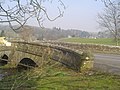 Austwick Bridge - geograph.org.uk - 409268.jpg 640 × 480; 101 KB
-
 Aygill Beck - geograph.org.uk - 461137.jpg 640 × 480; 101 KB
-
 Back Gill. - geograph.org.uk - 292935.jpg 640 × 480; 215 KB
-
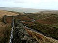
 Barnley Beck - geograph.org.uk - 497602.jpg 427 × 640; 240 KB
-
 Beck - geograph.org.uk - 796745.jpg 640 × 480; 82 KB
-
 Beck - Main Street, Pannal - geograph.org.uk - 859235.jpg 640 × 577; 386 KB
-
 Beck - Main Street, Pannal - geograph.org.uk - 859236.jpg 640 × 554; 346 KB
-
 Beck draining off Scale Gill Foot Moss - geograph.org.uk - 430992.jpg 640 × 480; 114 KB
-
 Beck east of York Bridge - geograph.org.uk - 2488644.jpg 1,600 × 1,200; 965 KB
-
 Beck Isle - geograph.org.uk - 440349.jpg 640 × 359; 95 KB
-
 Beck off Moor Lane - geograph.org.uk - 2384437.jpg 1,600 × 1,200; 565 KB
-
 Beldin Gill on Steel House Moor - geograph.org.uk - 344537.jpg 640 × 480; 144 KB
-
 Between Long Marston and Rufforth - geograph.org.uk - 184536.jpg 640 × 479; 61 KB
-
 Birchwath Slack - geograph.org.uk - 193465.jpg 640 × 384; 98 KB
-
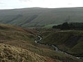
 Birkdale Beck - geograph.org.uk - 777534.jpg 640 × 480; 63 KB
-
 Birks Gill - geograph.org.uk - 1752853.jpg 2,592 × 1,944; 1.08 MB
-
 Bishop Monkton - geograph.org.uk - 384322.jpg 464 × 640; 91 KB
-
 Bishopdale Beck - geograph.org.uk - 159118.jpg 640 × 480; 150 KB
-
 Black Dike in low flow conditions - geograph.org.uk - 549427.jpg 640 × 480; 150 KB
-
 Blakethwaite smelt mill.jpg 503 × 640; 88 KB
-
 Blayshaw Gill. - geograph.org.uk - 303836.jpg 640 × 480; 101 KB
-
 Blue Beck Outfall - geograph.org.uk - 431738.jpg 640 × 480; 156 KB
-
 Blytham Beck - geograph.org.uk - 543579.jpg 480 × 640; 159 KB
-
 Bogs Dike - geograph.org.uk - 286638.jpg 640 × 480; 93 KB
-
 Bonfield Gill Bridge - geograph.org.uk - 45168.jpg 640 × 480; 158 KB
-
 Bordley Beck - geograph.org.uk - 1480316.jpg 640 × 480; 131 KB
-
 Boundary - geograph.org.uk - 184509.jpg 359 × 480; 31 KB
-
 Brewsdale Beck - geograph.org.uk - 145662.jpg 640 × 480; 87 KB
-
 Brewsdale Beck - geograph.org.uk - 630785.jpg 640 × 427; 110 KB
-
 Bridge (353145855).jpg 3,456 × 2,304; 3.38 MB
-
 Bridge or Culvert^ - geograph.org.uk - 712220.jpg 480 × 640; 134 KB
-
 Bridge over Marsett Beck - geograph.org.uk - 813221.jpg 640 × 480; 121 KB
-
 Brow Gill Beck at God's Bridge - geograph.org.uk - 846423.jpg 429 × 640; 94 KB
-
 Brow Gill Beck joining Cam Beck - geograph.org.uk - 398348.jpg 640 × 359; 91 KB
-
 Brown House Beck - geograph.org.uk - 521320.jpg 640 × 480; 127 KB
-
 Buckden Beck - geograph.org.uk - 730774.jpg 2,687 × 1,496; 2.25 MB
-
 Burn Bridge 20090613 005.jpg 3,580 × 2,536; 1.99 MB
-
 Burn Gill passing under the Nidd Aqueduct - geograph.org.uk - 583389.jpg 640 × 480; 138 KB
-
 Burton Bridge - geograph.org.uk - 824831.jpg 640 × 480; 148 KB
-
 Bydale Howle - geograph.org.uk - 795352.jpg 640 × 480; 133 KB
-
 Byerbeck Gill - geograph.org.uk - 634349.jpg 640 × 480; 144 KB
-
 Byerbeck Gill looking upstream - geograph.org.uk - 634331.jpg 640 × 480; 142 KB
-
 Calf Hole - geograph.org.uk - 319962.jpg 640 × 480; 73 KB
-
 Calf Hole above High Birkwith - geograph.org.uk - 960215.jpg 640 × 424; 136 KB
-
 Cam Beck - geograph.org.uk - 30345.jpg 640 × 480; 144 KB
-
 Cam Beck - geograph.org.uk - 398313.jpg 640 × 480; 80 KB
-
 Cam Beck enters Cam Woodlands - geograph.org.uk - 403790.jpg 640 × 480; 150 KB
-
 Cam Beck, with fallen tree - geograph.org.uk - 398345.jpg 640 × 511; 162 KB
-
 Canal from Canal Street - geograph.org.uk - 968333.jpg 640 × 480; 127 KB
-
 Carlesmoor Beck - geograph.org.uk - 634727.jpg 529 × 640; 99 KB
-
 Carlesmoor Beck from Swetton Bridge - geograph.org.uk - 312487.jpg 640 × 495; 167 KB
-
 Carleton Beck - geograph.org.uk - 862973.jpg 640 × 480; 102 KB
-

-
 Catterton Beck - geograph.org.uk - 319159.jpg 640 × 480; 173 KB
-
 Catterton Beck from Catterton lane - geograph.org.uk - 320735.jpg 640 × 480; 160 KB
-
 Cawder Gill - geograph.org.uk - 308119.jpg 640 × 480; 111 KB
-
 Chapel Beck - geograph.org.uk - 468717.jpg 427 × 640; 303 KB
-
 Clapdale Drive and Clapham Beck - geograph.org.uk - 271947.jpg 640 × 480; 132 KB
-
 Clapham Beck - geograph.org.uk - 283501.jpg 640 × 480; 304 KB
-
 Clapham Beck - geograph.org.uk - 283502.jpg 640 × 480; 321 KB
-
 Cliff Beck - geograph.org.uk - 814743.jpg 640 × 480; 125 KB
-
 Cliff Beck. - geograph.org.uk - 410392.jpg 640 × 427; 91 KB
-
 Cliff Force Waterfall - geograph.org.uk - 103137.jpg 640 × 480; 128 KB
-
 Cogden Gill Above Grinton.jpg 2,400 × 1,600; 2.82 MB
-
 Colber Beck - geograph.org.uk - 712002.jpg 480 × 640; 72 KB
-
 Colt House Gill - geograph.org.uk - 583403.jpg 640 × 480; 123 KB
-

-
 Cononley Beck - panoramio (2).jpg 1,537 × 1,447; 600 KB
-
 Cononley Beck and bridge - panoramio (1).jpg 1,145 × 1,178; 321 KB
-
 Cowesby Beck - geograph.org.uk - 89945.jpg 640 × 480; 91 KB
-
 Crook Beck near Clapham - geograph.org.uk - 283130.jpg 640 × 480; 245 KB
-
 Dauber Gill - geograph.org.uk - 1505872.jpg 640 × 480; 143 KB
-
 Downstream - geograph.org.uk - 287695.jpg 640 × 480; 102 KB
-
 Dried Up Stream Bed, Wheeldale Moor - geograph.org.uk - 1393108.jpg 427 × 640; 67 KB
-
 Dry stone wall Malham 07.JPG 1,786 × 1,729; 1.05 MB
-
 Dry Stream Bed - geograph.org.uk - 817225.jpg 640 × 620; 144 KB
-
 Ducks in Bishop Monkton - geograph.org.uk - 384331.jpg 640 × 479; 68 KB
-
 East Gill Dyke - geograph.org.uk - 650757.jpg 640 × 480; 114 KB
-
 Eller Bottoms - geograph.org.uk - 1353979.jpg 640 × 480; 83 KB
-
 Entrance to Gaping Gill - geograph.org.uk - 935575.jpg 640 × 480; 112 KB
-

-
 Far Long Gill - geograph.org.uk - 513490.jpg 640 × 480; 154 KB
-
 Fell Beck - geograph.org.uk - 547084.jpg 640 × 480; 124 KB
-
 Field Edge Footpath between Bishopthorpe and Acaster Malbis - geograph.org.uk - 3383652.jpg 4,000 × 3,000; 3.01 MB
-
 Foot Bridge over Little Beck - geograph.org.uk - 4948173.jpg 932 × 1,024; 765 KB
-
 Footbridge in the Valley of Desolation - geograph.org.uk - 1050538.jpg 640 × 461; 136 KB
-
 Footbridge in the Valley of Desolation - geograph.org.uk - 625053.jpg 480 × 640; 108 KB
-
 Footbridge over Burtis Beck. - geograph.org.uk - 552437.jpg 480 × 640; 144 KB
-
 Footbridge Over Sheepshaw Beck - geograph.org.uk - 654260.jpg 427 × 640; 291 KB
-

-
 Footpath up beck at Hob Holes - geograph.org.uk - 439365.jpg 480 × 640; 120 KB
-
 Former course of Cam Beck - geograph.org.uk - 398304.jpg 640 × 480; 85 KB
-

-
 Fosse Gill looking towards Foulshaw Crags - geograph.org.uk - 564022.jpg 640 × 480; 132 KB
-
 Foston Bridge - geograph.org.uk - 1330140.jpg 640 × 480; 87 KB
-
 Gaping Gill - geograph.org.uk - 1386205.jpg 640 × 480; 121 KB
-
 Gaping Gill - geograph.org.uk - 1633782.jpg 640 × 480; 100 KB
-
 Gaping Gill - geograph.org.uk - 1755439.jpg 640 × 481; 113 KB
-
 Gaping Gill Entrance - geograph.org.uk - 286705.jpg 640 × 480; 145 KB
-
 Gaping Gill. - geograph.org.uk - 369812.jpg 640 × 480; 278 KB
-
 GapingGillSurface.jpg 1,152 × 864; 229 KB
-
 Garriston Beck, near Hunton - geograph.org.uk - 139375.jpg 640 × 480; 90 KB
-
 Gill Beck - geograph.org.uk - 1562320.jpg 480 × 640; 171 KB
-
 Grain Beck in Dalby Forest - geograph.org.uk - 1318006.jpg 473 × 640; 186 KB
-
 Great Ash Gill - geograph.org.uk - 651581.jpg 640 × 480; 132 KB
-
 Great Ash Gill - geograph.org.uk - 651582.jpg 640 × 480; 115 KB
-
 Great Bank Gill. - geograph.org.uk - 162913.jpg 640 × 480; 81 KB
-
 Great Blake Beck - geograph.org.uk - 431018.jpg 480 × 640; 102 KB
-
 Great Blake Beck - geograph.org.uk - 431058.jpg 640 × 480; 132 KB
-
 Great Blowing Gill Beck - geograph.org.uk - 495202.jpg 640 × 480; 120 KB
-

-
 Great Gill and Bow Bridge - geograph.org.uk - 472041.jpg 640 × 480; 123 KB
-
 Green Grooves Gill. - geograph.org.uk - 303825.jpg 640 × 480; 71 KB
-
 Greystone Beck - geograph.org.uk - 1058030.jpg 640 × 480; 142 KB
-
 Greystone Beck in Lindley Wood - geograph.org.uk - 176466.jpg 480 × 640; 230 KB
-
 Greystone Beck in Lindley Wood - geograph.org.uk - 176468.jpg 640 × 480; 245 KB
-
 Gurtof Beck and Bridge - geograph.org.uk - 2098421.jpg 4,000 × 3,000; 4.21 MB
-
 Hag Dike Gill and Providence pot. - geograph.org.uk - 144928.jpg 480 × 640; 146 KB
-
 Hambleton Dike - geograph.org.uk - 266148.jpg 640 × 458; 122 KB
-
 Harlow Carr - geograph.org.uk - 331077.jpg 570 × 418; 111 KB
-
 Healaugh Beck - geograph.org.uk - 248177.jpg 479 × 640; 128 KB
-
 Helmsley IMG 2232 - panoramio.jpg 1,200 × 800; 771 KB
-
 High Street and Scugdale Beck, Swainby (geograph 6564528).jpg 2,000 × 1,500; 1.44 MB
-
 HLH snow.JPG 1,600 × 1,200; 766 KB
-
 Holborn Beck - geograph.org.uk - 282861.jpg 640 × 480; 165 KB
-
 Hornington Bridge - geograph.org.uk - 319167.jpg 640 × 480; 208 KB
-
 Hull Pot Beck - geograph.org.uk - 1633713.jpg 640 × 480; 128 KB
-
 Hundwith Beck - geograph.org.uk - 251400.jpg 640 × 480; 142 KB
-
 Hungate Bridge - geograph.org.uk - 1717013.jpg 2,048 × 1,536; 1.45 MB
-
 Hutton Beck - geograph.org.uk - 2351978.jpg 1,600 × 1,200; 642 KB
-

-

-
-
 Kex Beck - geograph.org.uk - 185796.jpg 640 × 480; 103 KB
-
 Kex Beck - geograph.org.uk - 415068.jpg 640 × 480; 90 KB
-
 Kex Beck from the footbridge - geograph.org.uk - 414765.jpg 640 × 480; 110 KB
-
 Kex Beck from the footbridge - geograph.org.uk - 476929.jpg 640 × 480; 100 KB
-
 Kex Beck from the Footbridge - geograph.org.uk - 476932.jpg 640 × 480; 109 KB
-
 Kex Beck, Beamsley - geograph.org.uk - 402045.jpg 480 × 640; 176 KB
-
 Kexwith Beck - geograph.org.uk - 583380.jpg 640 × 480; 84 KB
-
 King's Beck - geograph.org.uk - 339448.jpg 427 × 640; 114 KB
-
 Leadmill Beck.jpg 2,100 × 1,500; 2.09 MB
-
 Ling Gill Bridge on the Pennine Way - geograph.org.uk - 6522621.jpg 1,024 × 669; 199 KB
-
 Linton in Craven - geograph.org.uk - 16731.jpg 640 × 480; 141 KB
-
 Little Beck Nr Falling Foss - geograph.org.uk - 4948164.jpg 768 × 1,024; 517 KB
-
 Little Dale Beck - geograph.org.uk - 1152885.jpg 640 × 480; 197 KB
-
 Little Marsh - geograph.org.uk - 481024.jpg 640 × 480; 164 KB
-

-
 Looking up Roe Beck - geograph.org.uk - 769900.jpg 640 × 480; 75 KB
-
 Loskey Beck - geograph.org.uk - 1308311.jpg 640 × 426; 85 KB
-
 Lower Waterfall, Posforth Gill - geograph.org.uk - 426841.jpg 640 × 501; 161 KB
-
 Malton Gate - geograph.org.uk - 443041.jpg 640 × 359; 90 KB
-
 Marsett Beck - geograph.org.uk - 1257280.jpg 640 × 480; 113 KB
-
 Marsett Beck - geograph.org.uk - 1260712.jpg 640 × 480; 93 KB
-
 Marske Beck - geograph.org.uk - 676840.jpg 640 × 425; 268 KB
-
 Masons Arms - geograph.org.uk - 1204014.jpg 640 × 480; 100 KB
-
 May Beck - geograph.org.uk - 4948113.jpg 858 × 1,024; 620 KB
-
 May Beck - geograph.org.uk - 612009.jpg 640 × 480; 112 KB
-
 May Beck at Midge Hall - Falling Foss Tea Room - geograph.org.uk - 4948145.jpg 857 × 1,024; 548 KB
-
 May Beck flowing towards Falling Foss - geograph.org.uk - 4948138.jpg 711 × 1,024; 378 KB
-
 Middle Beck - geograph.org.uk - 309615.jpg 426 × 640; 81 KB
-
 Mill Bridge - geograph.org.uk - 1330633.jpg 480 × 640; 126 KB
-
 Mill Race, Woodfield Mill - geograph.org.uk - 712381.jpg 480 × 640; 123 KB
-
 Mouth of Staithes Beck - geograph.org.uk - 1754902.jpg 1,600 × 1,067; 231 KB
-
 Nell Beck - geograph.org.uk - 388849.jpg 478 × 640; 322 KB
-
 Nell Beck, Ellenthorpe Lane - geograph.org.uk - 320623.jpg 480 × 640; 143 KB
-
 New Hill Gill Brotton - geograph.org.uk - 1714809.jpg 2,048 × 1,365; 561 KB
-

-
 New Spital Bridge - geograph.org.uk - 1330171.jpg 640 × 480; 125 KB
-
 Newbiggin Beck (geograph 1790617).jpg 2,048 × 1,536; 1.05 MB
-
 North Beck at Goose Eye - geograph.org.uk - 57363.jpg 640 × 480; 247 KB
-
 North Gill Beck - geograph.org.uk - 112531.jpg 640 × 480; 121 KB
-
 North Gill Beck - geograph.org.uk - 266159.jpg 640 × 480; 112 KB
-
 North Gill Beck - geograph.org.uk - 473216.jpg 480 × 640; 206 KB
-
 Norton Beck - geograph.org.uk - 312446.jpg 640 × 480; 152 KB
-
 Norton Beck from the minor road - geograph.org.uk - 312452.jpg 640 × 480; 161 KB
-
 Old Bridge Abutment, Loftus Wood - geograph.org.uk - 716892.jpg 640 × 427; 100 KB
-
 Old Foss Beck at Cow Moor Bridge - geograph.org.uk - 4087115.jpg 1,600 × 1,064; 813 KB
-
 Old mill stream, Gargrave, Yorkshire - geograph.org.uk - 879274.jpg 640 × 446; 166 KB
-
 Orms Gill - geograph.org.uk - 373453.jpg 640 × 480; 121 KB
-
 Otterburn Beck - geograph.org.uk - 543213.jpg 640 × 480; 223 KB
-
 Otterburn Beck.jpg 640 × 480; 70 KB
-
 Ouse Gill Beck - geograph.org.uk - 360099.jpg 640 × 480; 146 KB
-
 Pace Gate Beck - geograph.org.uk - 1209411.jpg 640 × 480; 115 KB
-
 Pickhill Beck - geograph.org.uk - 1355956.jpg 640 × 442; 125 KB
-
 Piker Thorn Beck - geograph.org.uk - 131626.jpg 479 × 640; 119 KB
-
 Posforth Gill beck - geograph.org.uk - 517322.jpg 640 × 480; 180 KB
-
 Purple orchids (Orchis mascula) below Scala Falls, Hebden, North Yorkshire.jpg 2,505 × 1,804; 2.31 MB
-
 Rake Beck - geograph.org.uk - 1762828.jpg 2,880 × 2,160; 1.4 MB
-
 Raydale Beck. - geograph.org.uk - 284082.jpg 640 × 480; 251 KB
-
 Reaps Dike. - geograph.org.uk - 291706.jpg 640 × 480; 201 KB
-
 Ripley Beck - geograph.org.uk - 410650.jpg 640 × 480; 106 KB
-
 Robert Beck near Copgrove - geograph.org.uk - 377676.jpg 480 × 640; 196 KB
-
 Robin Hood's Bay 11.jpg 1,920 × 2,560; 2.46 MB


.jpg)


.jpg)
.jpg)


.jpg)


.jpg)


_below_Scala_Falls,_Hebden,_North_Yorkshire.jpg)


