Category:Streams in Northamptonshire
Jump to navigation
Jump to search
Ceremonial counties of England: Bedfordshire · Berkshire · Buckinghamshire · Cambridgeshire · Cheshire · Cornwall · Cumbria · Derbyshire · Devon · Dorset · Durham · East Riding of Yorkshire · East Sussex · Essex · Gloucestershire · Greater London · Greater Manchester · Hampshire · Herefordshire · Hertfordshire · Kent · Lancashire · Leicestershire · Lincolnshire · Merseyside · Norfolk · North Yorkshire · Northamptonshire · Northumberland · Nottinghamshire · Oxfordshire · Rutland · Shropshire · Somerset · South Yorkshire · Staffordshire · Suffolk · Surrey · Tyne and Wear · Warwickshire · West Midlands · West Sussex · West Yorkshire · Wiltshire · Worcestershire
City-counties: Bristol ·
Former historic counties:
Other former counties:
City-counties: Bristol ·
Former historic counties:
Other former counties:
Media in category "Streams in Northamptonshire"
The following 45 files are in this category, out of 45 total.
-
 Brook near Pitsford Water - geograph.org.uk - 61019.jpg 480 × 640; 119 KB
-
 Creaton - geograph.org.uk - 324835.jpg 640 × 480; 135 KB
-
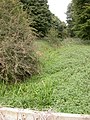
 Stream - geograph.org.uk - 442870.jpg 480 × 640; 139 KB
-
 Jurassic Way south west to Wilbarston - geograph.org.uk - 301000.jpg 640 × 480; 68 KB
-
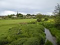 Kingsthorpe meadow - geograph.org.uk - 762717.jpg 640 × 480; 79 KB
-
 Mill at Woodnewton - geograph.org.uk - 256002.jpg 640 × 480; 120 KB
-
 Stream from Althorp - geograph.org.uk - 530772.jpg 480 × 640; 155 KB
-
 Stream through Grafton Underwood - geograph.org.uk - 92858.jpg 480 × 640; 104 KB
-
 Watering Hole. - geograph.org.uk - 466054.jpg 640 × 480; 161 KB
-
 Willow Brook - geograph.org.uk - 1258704.jpg 640 × 480; 70 KB
-
 Adstone - geograph.org.uk - 308399.jpg 640 × 480; 181 KB
-
 Babbling brook - geograph.org.uk - 398542.jpg 640 × 480; 152 KB
-
 Black Ouse - geograph.org.uk - 328623.jpg 640 × 480; 98 KB
-

-
 Bridge Over Brook - geograph.org.uk - 388603.jpg 640 × 480; 95 KB
-
 Brook near Creaton - geograph.org.uk - 446671.jpg 640 × 477; 125 KB
-
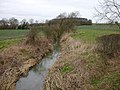
 Brook running west to Sulby reservoir. - geograph.org.uk - 294590.jpg 640 × 480; 192 KB
-

-
 Climate Change^ - geograph.org.uk - 428730.jpg 640 × 480; 173 KB
-
 Farthinghoe Stream - geograph.org.uk - 331591.jpg 480 × 640; 146 KB
-
 Harper's Brook - geograph.org.uk - 323662.jpg 640 × 480; 87 KB
-
 Harpers Brook - geograph.org.uk - 323600.jpg 640 × 426; 240 KB
-
 Home for a bit - geograph.org.uk - 91411.jpg 442 × 640; 119 KB
-
 Lamport - geograph.org.uk - 325067.jpg 640 × 480; 117 KB
-
 Lilbourne - geograph.org.uk - 112736.jpg 640 × 480; 154 KB
-
 Maidford - geograph.org.uk - 308378.jpg 640 × 480; 101 KB
-
 More rape across the stream - geograph.org.uk - 446663.jpg 640 × 477; 127 KB
-
 Parish Boundary Brook - geograph.org.uk - 82183.jpg 480 × 640; 131 KB
-
 Polebrook Brook - geograph.org.uk - 108266.jpg 640 × 480; 92 KB
-
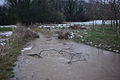
 Road over a stream - geograph.org.uk - 397365.jpg 640 × 427; 189 KB
-
 Rugby - Hillmorton - geograph.org.uk - 63786.jpg 640 × 480; 98 KB
-
 Small stream - geograph.org.uk - 458400.jpg 480 × 640; 156 KB
-

-
 Small Stream. - geograph.org.uk - 437010.jpg 640 × 480; 176 KB
-
 Stream and hedge near Yardley Hastings - geograph.org.uk - 531704.jpg 480 × 640; 238 KB
-
 Stream near Biddlesden Park - geograph.org.uk - 464890.jpg 480 × 640; 155 KB
-
 Stream near Hanging Houghton - geograph.org.uk - 336249.jpg 640 × 428; 97 KB
-
 Stream off Watling Street, Towcester - geograph.org.uk - 454904.jpg 640 × 480; 105 KB
-
 Stream passing under a bridleway - geograph.org.uk - 444318.jpg 640 × 640; 209 KB
-

-
 The brook at Newbottle Bridge - geograph.org.uk - 396534.jpg 640 × 480; 159 KB
-
 The entrance to Corby Golf Course - geograph.org.uk - 488266.jpg 640 × 480; 105 KB
-
 Thorpe Brook - geograph.org.uk - 111599.jpg 640 × 480; 69 KB
-
 Tributary of the Nene - geograph.org.uk - 388905.jpg 640 × 480; 139 KB
-


