Category:Stone walls in South Yorkshire
Jump to navigation
Jump to search
Ceremonial counties of England: Berkshire · Buckinghamshire · Cambridgeshire · Cheshire · Cornwall · Cumbria · Derbyshire · Devon · Dorset · Durham · East Sussex · Essex · Gloucestershire · Greater London · Hampshire · Herefordshire · Kent · Lancashire · Leicestershire · Lincolnshire · Merseyside · Norfolk · North Yorkshire · Northamptonshire · Northumberland · Nottinghamshire · Oxfordshire · Rutland · Shropshire · Somerset · South Yorkshire · Staffordshire · Surrey · West Sussex · West Yorkshire · Wiltshire · Worcestershire
City-counties:
Former historic counties:
Other former counties:
City-counties:
Former historic counties:
Other former counties:
Subcategories
This category has only the following subcategory.
D
Media in category "Stone walls in South Yorkshire"
The following 45 files are in this category, out of 45 total.
-
 All Saints' church, Aston - geograph.org.uk - 146514.jpg 640 × 427; 120 KB
-

-
 Beech House Road Hemingfield - geograph.org.uk - 993804.jpg 640 × 427; 87 KB
-
 ChurchofStAndrewTheApostleinBoltonUponDearne - 04052015.jpg 640 × 480; 106 KB
-
 Brierley, St Paul's Church - geograph.org.uk - 226729.jpg 432 × 285; 18 KB
-
 Catcliffe Glass Cone - geograph.org.uk - 1602249.jpg 640 × 426; 51 KB
-
 Doncaster, St James's Church - geograph.org.uk - 234718.jpg 312 × 432; 16 KB
-
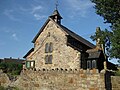
 St.Peter's church, Old Edlington - geograph.org.uk - 84029.jpg 640 × 427; 108 KB
-
 Farm on Flight Hill, Scholes - geograph.org.uk - 1251883.jpg 640 × 436; 75 KB
-
 Fields and Boundary Walls Hill Side - geograph.org.uk - 480230.jpg 640 × 480; 101 KB
-
 Footpath to Brookhouse Bridge - geograph.org.uk - 852067.jpg 640 × 480; 108 KB
-
 Handsworth Sheffield EdwardVII.jpg 850 × 1,280; 667 KB
-
 Handsworth Sheffield WarMemorial.jpg 1,280 × 720; 622 KB
-
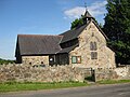
 Church, Hickleton - geograph.org.uk - 116865.jpg 640 × 480; 115 KB
-
 Hickleton Hall Doncaster.jpg 999 × 665; 348 KB
-
 Hickleton Hall south facade.jpg 615 × 407; 77 KB
-
 Hillsborough Barracks, SE tower and walls.jpg 2,449 × 1,843; 3.29 MB
-
 Lets clean it up^ - geograph.org.uk - 786539.jpg 640 × 518; 136 KB
-
 Looking down towards Darton - geograph.org.uk - 1211060.jpg 640 × 480; 52 KB
-
 Lower Coates Farm - geograph.org.uk - 938917.jpg 640 × 480; 95 KB
-
 Brunswick Methodist Church, Mexborough - geograph.org.uk - 341863.jpg 640 × 480; 105 KB
-

-
 Old stables,Gunthwaite Mill - geograph.org.uk - 1305546.jpg 640 × 480; 122 KB
-
 St Paul , Pilley.JPG 2,592 × 1,944; 1.5 MB
-
 St Pauls Church Pilley.JPG 3,264 × 2,448; 2.56 MB
-
 St.Mary's church, Rawmarsh - geograph.org.uk - 265567.jpg 640 × 427; 78 KB
-
 Dial House, Ben Lane, Wisewood.jpg 2,400 × 1,800; 431 KB
-
 St George, Portobello, Wall and Gate Piers.JPG 2,560 × 1,920; 3.27 MB
-
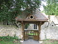 Hampole - Skelbrooke Lych Gate.jpg 640 × 480; 96 KB
-

-
 Stainton church from Lime Kiln Lane - geograph.org.uk - 637017.jpg 640 × 345; 73 KB
-
 Swinden Lane, Langsett - geograph.org.uk - 1274891.jpg 640 × 480; 136 KB
-

-
 Thorpe Salvin Church - geograph.org.uk - 1090197.jpg 480 × 640; 96 KB
-
 Ulley Lane - Footpath to the Reservoir - geograph.org.uk - 956785.jpg 640 × 480; 126 KB
-
-
-

-
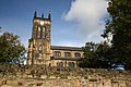
 Wadsley Parish Church.jpg 2,000 × 1,792; 225 KB
-
 Round House, Wentworth - geograph.org.uk - 391656.jpg 450 × 640; 135 KB
-

-

-

-

-
 Rural Houses at Fullshaw - geograph.org.uk - 109080.jpg 640 × 480; 129 KB


_-_View_from_Broom_Lane_Junction_-_geograph.org.uk_-_956827.jpg)
.jpg)
.jpg)

