Category:Dry stone walls in South Yorkshire
Jump to navigation
Jump to search
Media in category "Dry stone walls in South Yorkshire"
The following 21 files are in this category, out of 21 total.
-
 'Close up' of Dry Stone Walls on Lee Lane - geograph.org.uk - 720843.jpg 640 × 480; 138 KB
-
 Alongside the A629 Thurgoland - geograph.org.uk - 1194967.jpg 640 × 424; 69 KB
-

-
 Dry stone wall and gate to nowhere - geograph.org.uk - 1063159.jpg 640 × 391; 76 KB
-
 Entrance to Margery Wood - geograph.org.uk - 180453.jpg 640 × 480; 154 KB
-
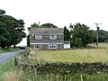 House on Salter Hill - geograph.org.uk - 922059.jpg 640 × 480; 82 KB
-
 Kirk Edge Convent, Boundary Wall.JPG 3,648 × 2,736; 2.78 MB
-
 Lee Lane, above Broomhead Reservoir - geograph.org.uk - 720840.jpg 640 × 427; 104 KB
-
 Mucky Lane, near Stocksbridge - geograph.org.uk - 720757.jpg 640 × 427; 79 KB
-
 Nabs Wood - geograph.org.uk - 380984.jpg 640 × 480; 63 KB
-
 Newchapel Farm - geograph.org.uk - 770889.jpg 640 × 480; 104 KB
-
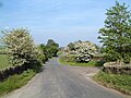
 Parallel lines - geograph.org.uk - 723934.jpg 640 × 566; 107 KB
-
 Parallel lines - geograph.org.uk - 995325.jpg 640 × 480; 139 KB
-

-
 Ruined wall on Hingcliff Common - geograph.org.uk - 188788.jpg 640 × 440; 101 KB
-

-
 Towards Flint Lane - geograph.org.uk - 138428.jpg 640 × 480; 99 KB
-
 View from Hartcliffe Road - geograph.org.uk - 748731.jpg 640 × 480; 83 KB
-
 View to Edge Mount from Penistone Road, Bradfield - geograph.org.uk - 1735689.jpg 2,608 × 1,952; 1.03 MB
-
 View up the Mickleden Beck - geograph.org.uk - 942001.jpg 640 × 378; 69 KB
-
 Water Trough - geograph.org.uk - 711356.jpg 640 × 427; 74 KB


