Category:Stone walls in Northumberland
Jump to navigation
Jump to search
Ceremonial counties of England: Berkshire · Buckinghamshire · Cambridgeshire · Cheshire · Cornwall · Cumbria · Derbyshire · Devon · Dorset · Durham · East Sussex · Essex · Gloucestershire · Greater London · Hampshire · Herefordshire · Kent · Lancashire · Leicestershire · Lincolnshire · Merseyside · Norfolk · North Yorkshire · Northamptonshire · Northumberland · Nottinghamshire · Oxfordshire · Rutland · Shropshire · Somerset · South Yorkshire · Staffordshire · Surrey · West Sussex · West Yorkshire · Wiltshire · Worcestershire
City-counties:
Former historic counties:
Other former counties:
City-counties:
Former historic counties:
Other former counties:
Subcategories
This category has only the following subcategory.
D
Media in category "Stone walls in Northumberland"
The following 21 files are in this category, out of 21 total.
-
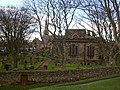
 Berwick-upon-Tweed walls (Church) - geograph.org.uk - 741426.jpg 640 × 480; 133 KB
-
 Berwick-upon-Tweed walls (two churches) - geograph.org.uk - 741427.jpg 640 × 480; 146 KB
-
 Two churches Berwick upon Tweed - geograph.org.uk - 29518.jpg 640 × 480; 157 KB
-
 St Cuthbert's Church, Elsdon - geograph.org.uk - 2197459.jpg 3,072 × 2,048; 576 KB
-
 United Reformed Church, Falstone - geograph.org.uk - 203725.jpg 640 × 480; 207 KB
-
 All Hallows Church, Henshaw - geograph.org.uk - 1772571.jpg 600 × 450; 311 KB
-
 Kirkheaton church - geograph.org.uk - 251577.jpg 640 × 480; 118 KB
-

-
 The St Cuthbert's Centre, Holy Island - geograph.org.uk - 412512.jpg 640 × 503; 89 KB
-
 The Church at Low Gate - geograph.org.uk - 38988.jpg 640 × 480; 250 KB
-

-
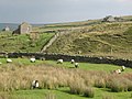
 Northumberland countryside - geograph.org.uk - 1362359.jpg 640 × 480; 73 KB
-
 Northumberland-Cumbria Boundary - geograph.org.uk - 413564.jpg 640 × 427; 123 KB
-
 Old field gate - geograph.org.uk - 628120.jpg 640 × 480; 104 KB
-
 St Mary's church, Ponteland - geograph.org.uk - 308026.jpg 485 × 640; 96 KB
-
-
 The Swin Hope valley (7) - geograph.org.uk - 1058008.jpg 640 × 480; 89 KB
-
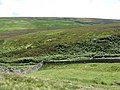 The valley of Henshaw Burn (2) - geograph.org.uk - 507469.jpg 640 × 480; 111 KB
-
 The valley of Henshaw Burn - geograph.org.uk - 508165.jpg 640 × 480; 87 KB
-
 Wall, Swinhoe - geograph.org.uk - 426869.jpg 640 × 427; 83 KB
-
 St. Oswin's Church.jpg 1,024 × 768; 130 KB
_-_geograph.org.uk_-_741426.jpg)
_-_geograph.org.uk_-_741427.jpg)


_-_geograph.org.uk_-_1058008.jpg)
_-_geograph.org.uk_-_507469.jpg)


