Category:Snow in West Sussex
Jump to navigation
Jump to search
Ceremonial counties of England: Bedfordshire · Berkshire · Buckinghamshire · Cambridgeshire · Cheshire · Cornwall · Cumbria · Derbyshire · Devon · Dorset · Durham · East Riding of Yorkshire · East Sussex · Essex · Gloucestershire · Greater London · Greater Manchester · Hampshire · Herefordshire · Hertfordshire · Kent · Lancashire · Leicestershire · Lincolnshire · Merseyside · Norfolk · North Yorkshire · Northamptonshire · Northumberland · Nottinghamshire · Oxfordshire · Rutland · Shropshire · Somerset · South Yorkshire · Staffordshire · Suffolk · Surrey · Tyne and Wear · Warwickshire · West Midlands · West Sussex · West Yorkshire · Wiltshire · Worcestershire
City-counties: Bristol · City of London
Former historic counties:
Other former counties:
City-counties: Bristol · City of London
Former historic counties:
Other former counties:

Subcategories
This category has only the following subcategory.
*
Media in category "Snow in West Sussex"
The following 200 files are in this category, out of 239 total.
(previous page) (next page)-
 700 bus in a snowy Emsworth Road - geograph.org.uk - 1669576.jpg 480 × 640; 104 KB
-
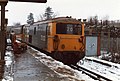 73132 at Gatwick Airport station - geograph.org.uk - 995189.jpg 640 × 433; 76 KB
-
 A shapely tree - geograph.org.uk - 1627062.jpg 428 × 640; 205 KB
-
 Ancient Flint Mines on Harrow Hill - geograph.org.uk - 1631001.jpg 640 × 480; 58 KB
-
 St Peter's church Ardingly in the snow - geograph.org.uk - 40005.jpg 480 × 640; 90 KB
-
 Bend on the A280 Long Furlong - geograph.org.uk - 1631623.jpg 640 × 480; 93 KB
-
 Bishop's Tree at Sunset, Chichester-6805828764.jpg 3,495 × 2,326; 4.52 MB
-
-
 Blockage on the Path - geograph.org.uk - 1148880.jpg 480 × 640; 91 KB
-
 Bluebell Restaurant - geograph.org.uk - 1692366.jpg 640 × 422; 56 KB
-
 Botany Cottage, Wyckham Dale Farm - geograph.org.uk - 322171.jpg 640 × 480; 93 KB
-
 Bridge Over the A23 - geograph.org.uk - 1629506.jpg 640 × 480; 84 KB
-
 Church of St John in the snow - geograph.org.uk - 382479.jpg 640 × 480; 60 KB
-
 Chantry Post on Chantry Hill - geograph.org.uk - 1631150.jpg 640 × 480; 90 KB
-
 A snowy A264 Cherry Tree layby - geograph.org.uk - 1626961.jpg 640 × 428; 108 KB
-
 Cathedral in the Snow - geograph.org.uk - 871011.jpg 640 × 480; 121 KB
-
 Former church of St. Peter the Great, West Street - geograph.org.uk - 1729731.jpg 3,072 × 2,304; 730 KB
-
 Church Bush Laine - geograph.org.uk - 1630904.jpg 640 × 480; 89 KB
-
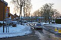
 Clayton Avenue, Hassocks snowscene - geograph.org.uk - 1149742.jpg 640 × 427; 50 KB
-
 Clayton Recreation Ground - geograph.org.uk - 1631099.jpg 640 × 480; 70 KB
-
 Closed until March - geograph.org.uk - 1660280.jpg 640 × 428; 148 KB
-
 Clubhouse, Pyecombe Golf Course - geograph.org.uk - 1630917.jpg 640 × 480; 73 KB
-

-

-
 Coldwaltham Church 4.JPG 3,168 × 2,314; 994 KB
-
 Coldwaltham Church lychgate.JPG 2,398 × 3,198; 1.33 MB
-
 Copthorne golf course in West Sussex under snow.jpg 640 × 428; 100 KB
-
 Cottage by the A264, Faygate - geograph.org.uk - 1626991.jpg 640 × 422; 143 KB
-
 Cuckfield Church from the north-east. - geograph.org.uk - 1653559.jpg 640 × 480; 105 KB
-
 Cuttinglye Lane - geograph.org.uk - 1658565.jpg 640 × 428; 148 KB
-
 Deep drifted snow on bridleway - geograph.org.uk - 1660620.jpg 640 × 480; 71 KB
-
 Deer seat, Bensonhill wood - geograph.org.uk - 1655139.jpg 640 × 428; 135 KB
-
-
 Denchy Field - geograph.org.uk - 1632115.jpg 640 × 480; 71 KB
-
 Derelict mobile farm building - geograph.org.uk - 1660790.jpg 640 × 480; 84 KB
-
 Devil's Dyke - geograph.org.uk - 1148798.jpg 640 × 480; 96 KB
-
 Digging up the golf course^ - geograph.org.uk - 1658527.jpg 640 × 428; 71 KB
-
 Disused chalk pit east of Lee Farm - geograph.org.uk - 1631233.jpg 640 × 480; 106 KB
-
 Down train approaching Balcombe - geograph.org.uk - 1660366.jpg 640 × 428; 113 KB
-
 Drainage Trenches - geograph.org.uk - 1651485.jpg 640 × 480; 72 KB
-

-
 Drifting Snow, South Downs Way - geograph.org.uk - 1630989.jpg 480 × 640; 59 KB
-
 Drive to a nursing home - geograph.org.uk - 335004.jpg 640 × 480; 130 KB
-
 Earthworks south of Chantry Post - geograph.org.uk - 1631162.jpg 640 × 480; 82 KB
-
 East Hill - geograph.org.uk - 1628611.jpg 640 × 480; 94 KB
-
-
 Eleventh Hole, Hassocks Golf Course - geograph.org.uk - 1632011.jpg 640 × 480; 70 KB
-
 Eleventh Hole, Pyecombe Golf Course - geograph.org.uk - 1631003.jpg 640 × 480; 67 KB
-
 Empty and Frozen - geograph.org.uk - 1629464.jpg 640 × 480; 91 KB
-
 Enigmatic premises - geograph.org.uk - 1626911.jpg 640 × 428; 162 KB
-

-

-
 Fifteenth Hole, Pyecombe Golf Club - geograph.org.uk - 1630962.jpg 640 × 480; 84 KB
-
 First Hole, Hassocks Golf Course - geograph.org.uk - 1632275.jpg 640 × 480; 49 KB
-

-
 Fourth Hole, Hassocks Golf Course - geograph.org.uk - 1632282.jpg 640 × 480; 59 KB
-
 Fulking - geograph.org.uk - 1148820.jpg 640 × 403; 109 KB
-
 Fulking Hill in the Snow - geograph.org.uk - 386016.jpg 640 × 480; 94 KB
-
 Furze Field - geograph.org.uk - 1632108.jpg 640 × 480; 63 KB
-

-
-
 Gotwick Farm entrance - geograph.org.uk - 1627605.jpg 640 × 428; 169 KB
-
 Grouse Road at Blackhouse Road junction - geograph.org.uk - 1660192.jpg 640 × 428; 137 KB
-
 Guildhall and Priory Park in the snow, January 2010 - geograph.org.uk - 1729703.jpg 3,072 × 2,304; 598 KB
-
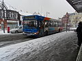 GX56 KWD (Route 6) at Station Approach, Worthing (8403387468).jpg 2,592 × 1,944; 1.74 MB
-
 GX56 KWD (Route 6) at Station Approach, Worthing (8403388368).jpg 1,944 × 2,592; 1.48 MB
-
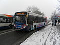 GX60 PCZ (PULSE Route) at Lyndhurst Road, Worthing (2) (8403385558).jpg 2,592 × 1,944; 1.62 MB
-
 Hammonds Mill Cottages - geograph.org.uk - 1632133.jpg 640 × 480; 83 KB
-
 Hares Dean - geograph.org.uk - 1630900.jpg 640 × 480; 55 KB
-
 Haresdean Farm - geograph.org.uk - 1629491.jpg 640 × 480; 82 KB
-
 Harrow Hill - geograph.org.uk - 1630959.jpg 640 × 480; 67 KB
-
 Bushy Field - geograph.org.uk - 1632118.jpg 640 × 480; 63 KB
-
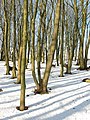
 Highbeeches Forest - geograph.org.uk - 1654479.jpg 640 × 428; 137 KB
-
 Hillybarn Road in a slippery state - geograph.org.uk - 1626717.jpg 640 × 428; 167 KB
-
 Hobbs Cottage - geograph.org.uk - 1629488.jpg 640 × 480; 101 KB
-
 Jack and Jill in the Snow - geograph.org.uk - 1631060.jpg 640 × 480; 113 KB
-
 Jack in the Snow - geograph.org.uk - 1631027.jpg 480 × 640; 103 KB
-
 Jill in the Snow - geograph.org.uk - 1631047.jpg 480 × 640; 69 KB
-
 Kelso Close, Crawley - geograph.org.uk - 1623900.jpg 640 × 428; 101 KB
-
 King's Gardens - geograph.org.uk - 752732.jpg 479 × 640; 76 KB
-
 Kings Way - geograph.org.uk - 1653141.jpg 640 × 480; 45 KB
-
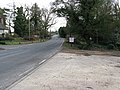
 Lane junction by "Mount Wood" - geograph.org.uk - 1626707.jpg 640 × 428; 148 KB
-
 Leaving Colgate, Blackhouse Road - geograph.org.uk - 1660166.jpg 640 × 428; 99 KB
-
 Little Four Acres - geograph.org.uk - 1631739.jpg 640 × 480; 78 KB
-
 Little Ridge - geograph.org.uk - 1631744.jpg 640 × 480; 83 KB
-
 Little Tree Field - geograph.org.uk - 1632120.jpg 640 × 480; 70 KB
-

-
 Lone walker striding up Great Down - geograph.org.uk - 1660817.jpg 640 × 480; 17 KB
-
-

-

-
 Looking south on the cinder track - geograph.org.uk - 1149740.jpg 640 × 427; 97 KB
-
 Lucky horse jump at Clapham Farm - geograph.org.uk - 1631998.jpg 640 × 480; 99 KB
-
 M23 across a snowy field - geograph.org.uk - 1623942.jpg 640 × 428; 120 KB
-
 Maplehurst Road, Chichester - geograph.org.uk - 1600045.jpg 640 × 480; 75 KB
-
 Marker or Boundary Stone - geograph.org.uk - 1631029.jpg 640 × 480; 101 KB
-

-
 Midhurst library in snow.jpg 2,816 × 2,112; 1.46 MB
-
 Mill Meadow - geograph.org.uk - 1632131.jpg 640 × 480; 121 KB
-
 Mill Piece - geograph.org.uk - 1631049.jpg 640 × 480; 75 KB
-
-
-
 Near Rowfant House - geograph.org.uk - 1653043.jpg 640 × 428; 101 KB
-
 New Buildings Farm - geograph.org.uk - 1654487.jpg 640 × 428; 117 KB
-

-
 New fencing and hedge plants - geograph.org.uk - 1629972.jpg 640 × 480; 60 KB
-
 Nore Wood - geograph.org.uk - 1660513.jpg 640 × 480; 100 KB
-
 North to the southern edge of West Chiltington Common - geograph.org.uk - 1670187.jpg 1,600 × 1,200; 488 KB
-
 Old Coppiced trees - geograph.org.uk - 1630077.jpg 640 × 480; 125 KB
-
 Old Gray's Wood - geograph.org.uk - 1630977.jpg 640 × 480; 97 KB
-
 Old London Road - geograph.org.uk - 1629510.jpg 480 × 640; 81 KB
-
 Old Mead - geograph.org.uk - 1632068.jpg 640 × 480; 103 KB
-
 Outbuildings at Lee Farm - geograph.org.uk - 1631237.jpg 640 × 480; 83 KB
-
 Paddocks near New Barn Farm - geograph.org.uk - 1631011.jpg 640 × 480; 65 KB
-

-
 Partly frozen duck pond - geograph.org.uk - 1660357.jpg 640 × 428; 144 KB
-
 Approach to Michelgrove - geograph.org.uk - 1629830.jpg 640 × 480; 76 KB
-

-
 Path between the Christmas trees - geograph.org.uk - 1627049.jpg 640 × 428; 191 KB
-
 Perimeter railings at Highways Depot - geograph.org.uk - 1632102.jpg 640 × 480; 114 KB
-
 Permissive Bridleway to Rockrose - geograph.org.uk - 1629534.jpg 480 × 640; 158 KB
-
 Pine in the snow - geograph.org.uk - 1627682.jpg 640 × 428; 149 KB
-
 Pound Gate - geograph.org.uk - 1631770.jpg 640 × 480; 75 KB
-
 Power line gap - geograph.org.uk - 1625263.jpg 640 × 428; 133 KB
-
 Practice Area, Hassocks Golf Course - geograph.org.uk - 1632279.jpg 640 × 480; 56 KB
-

-
 Prestwood Lane in the snow - geograph.org.uk - 1626660.jpg 640 × 428; 206 KB
-

-
 Private road, public footpath - geograph.org.uk - 1658464.jpg 640 × 428; 114 KB
-

-
 Pumping station at Longfurlong - geograph.org.uk - 1629748.jpg 640 × 480; 101 KB
-
 R706 DNJ (Route 6) at Station Approach, Worthing (8403386534).jpg 2,592 × 1,944; 1.49 MB
-
 R813 HCD (Route 9) at Lyndhurst Road, Worthing (1) (8402295769).jpg 2,592 × 1,944; 1.56 MB
-
 Railway radio mast - geograph.org.uk - 1625289.jpg 640 × 428; 170 KB
-

-

-
 Road Mead - geograph.org.uk - 1632057.jpg 640 × 480; 72 KB
-
 Rodstone and Wyndham House - geograph.org.uk - 1632288.jpg 476 × 640; 82 KB
-

-
 St Mary Magdalene's Church, Rusper - churchyard in snow.jpg 640 × 428; 170 KB
-
 Rusper cabins, Lambs Green - geograph.org.uk - 1626828.jpg 640 × 428; 114 KB
-
 Ruspers - geograph.org.uk - 1653123.jpg 640 × 480; 40 KB
-
 Rustic seat in the sunshine - geograph.org.uk - 1631647.jpg 640 × 480; 148 KB
-
 Salting the slope - geograph.org.uk - 1628261.jpg 640 × 428; 142 KB
-
 School Lane - geograph.org.uk - 1629530.jpg 640 × 480; 98 KB
-
 Second Hole, Hassocks Golf Course - geograph.org.uk - 1632273.jpg 640 × 480; 63 KB
-
 Seventh Hole, Hassocks Golf Course - geograph.org.uk - 1632280.jpg 640 × 480; 38 KB
-
 Shepherds Walk - geograph.org.uk - 1632291.jpg 640 × 480; 72 KB
-
 Shepherds Walk - geograph.org.uk - 1632293.jpg 640 × 469; 79 KB
-
 Single Barn Mead - geograph.org.uk - 1632076.jpg 640 × 480; 95 KB
-
 Sixteenth Hole, Hassocks Golf Course - geograph.org.uk - 1632051.jpg 640 × 480; 47 KB
-
 Sixteenth Hole, Pyecombe Golf Course - geograph.org.uk - 1630981.jpg 640 × 480; 56 KB
-
 Behind Tilgate Forest Row - geograph.org.uk - 1654470.jpg 640 × 428; 108 KB
-

-
 Small tree plantation NE of Lee Farm - geograph.org.uk - 1631229.jpg 640 × 457; 61 KB
-
 Snow bridge formation in drift - geograph.org.uk - 1658930.jpg 640 × 480; 35 KB
-
 Snow covered crop at Eastfield Farm - geograph.org.uk - 1627864.jpg 640 × 480; 98 KB
-
 Snow covered fields near North Wood - geograph.org.uk - 1660544.jpg 640 × 480; 26 KB
-

-

-
-
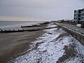
 Snow on the Beach - geograph.org.uk - 1626404.jpg 640 × 480; 55 KB
-
 Snow on the Beach - geograph.org.uk - 1626407.jpg 640 × 480; 85 KB
-
 Snow on the verge in Cot Lane - geograph.org.uk - 1627959.jpg 640 × 480; 91 KB
-
 Snow over Findon Village - geograph.org.uk - 356569.jpg 640 × 480; 111 KB
-

-
 Snowfield, Benson's Hill - geograph.org.uk - 1654928.jpg 640 × 428; 75 KB
-
 Snowy Benches - geograph.org.uk - 872429.jpg 640 × 480; 86 KB
-
 Snowy clearing, Spruce Hill - geograph.org.uk - 1627041.jpg 640 × 428; 167 KB
-
 Snowy cross roads, Colgate - geograph.org.uk - 1660119.jpg 640 × 428; 148 KB
-
 Snowy evening, Ashdown Drive Crawley - geograph.org.uk - 1624376.jpg 640 × 428; 135 KB
-
 Snowy woodland north of Wolstonbury Hill - geograph.org.uk - 1701805.jpg 2,560 × 1,920; 1.13 MB
-
 So Many Trees So Little Time - geograph.org.uk - 1148786.jpg 480 × 640; 160 KB
-
 South Downs Way - geograph.org.uk - 1628622.jpg 640 × 480; 87 KB
-
 South Downs Way - geograph.org.uk - 1629468.jpg 480 × 640; 82 KB
-
 South Downs Way - geograph.org.uk - 1629531.jpg 480 × 640; 155 KB
-
 South Downs Way - geograph.org.uk - 1630924.jpg 480 × 640; 88 KB
-
 South on Harbolets Lane at Broadford Bridge - geograph.org.uk - 1691343.jpg 1,600 × 1,200; 585 KB
-
 South Sands - geograph.org.uk - 1631750.jpg 640 × 480; 80 KB
-
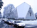
 Holy Innocents Southwater from south side in the snow.JPG 3,872 × 2,592; 2.34 MB
-
 Spillway, Douster Pond - geograph.org.uk - 1627029.jpg 640 × 428; 195 KB
-
 Stanford Avenue - geograph.org.uk - 1631789.jpg 480 × 640; 100 KB
-
 Stile at the corner of Nore Wood - geograph.org.uk - 1660495.jpg 640 × 480; 93 KB
-

-

-
 Swan Inn, Midhurst.jpg 2,112 × 2,816; 1.49 MB
-
 Talbot Field - geograph.org.uk - 1631763.jpg 640 × 480; 84 KB
-

-
 The mail gets through to Cowdray Close - geograph.org.uk - 1628229.jpg 640 × 428; 136 KB
-
 The Manor House in the snow - geograph.org.uk - 1650641.jpg 640 × 428; 141 KB
-
 The Street Clapham - geograph.org.uk - 1632013.jpg 640 × 480; 101 KB
-

-
 Through the scrap yard fence - geograph.org.uk - 1654945.jpg 640 × 428; 93 KB
-
 Tilgate golf course in the snow - geograph.org.uk - 1625256.jpg 640 × 428; 100 KB
-
 Tilgate Park, Nature Centre.jpg 640 × 480; 69 KB
-
 Tollgate Hill, Crawley - geograph.org.uk - 1625310.jpg 640 × 428; 164 KB
-
 Tough time for cattle - geograph.org.uk - 1660212.jpg 640 × 428; 141 KB
-
-

-


_at_Station_Approach,_Worthing_(8403387468).jpg)
_at_Station_Approach,_Worthing_(8403388368).jpg)
_at_Lyndhurst_Road,_Worthing_(2)_(8403385558).jpg)


_at_Station_Approach,_Worthing_(8403386534).jpg)
_at_Lyndhurst_Road,_Worthing_(1)_(8402295769).jpg)


