Category:Snow in Surrey
Jump to navigation
Jump to search
Ceremonial counties of England: Bedfordshire · Berkshire · Buckinghamshire · Cambridgeshire · Cheshire · Cornwall · Cumbria · Derbyshire · Devon · Dorset · Durham · East Riding of Yorkshire · East Sussex · Essex · Gloucestershire · Greater London · Greater Manchester · Hampshire · Herefordshire · Hertfordshire · Kent · Lancashire · Leicestershire · Lincolnshire · Merseyside · Norfolk · North Yorkshire · Northamptonshire · Northumberland · Nottinghamshire · Oxfordshire · Rutland · Shropshire · Somerset · South Yorkshire · Staffordshire · Suffolk · Surrey · Tyne and Wear · Warwickshire · West Midlands · West Sussex · West Yorkshire · Wiltshire · Worcestershire
City-counties: Bristol · City of London
Former historic counties:
Other former counties:
City-counties: Bristol · City of London
Former historic counties:
Other former counties:
Subcategories
This category has only the following subcategory.
Media in category "Snow in Surrey"
The following 200 files are in this category, out of 256 total.
(previous page) (next page)-
 Tilford Barley Mow.JPG 800 × 600; 415 KB
-

-
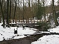
 A frozen Basingstoke Canal, Brookwood - geograph.org.uk - 1717772.jpg 2,816 × 1,880; 4.11 MB
-
 A Snow Event^ - geograph.org.uk - 1147707.jpg 640 × 480; 119 KB
-
 A snowy Alresford Road - geograph.org.uk - 1154100.jpg 640 × 480; 63 KB
-

-

-
 A snowy descent at Stag Hill - geograph.org.uk - 1153958.jpg 640 × 480; 81 KB
-
 A snowy pavement in Mareschal Road - geograph.org.uk - 1156680.jpg 480 × 640; 86 KB
-
 A snowy pavement in Ridgemount - geograph.org.uk - 1153595.jpg 480 × 640; 78 KB
-
 A snowy Ridgemount - geograph.org.uk - 1153600.jpg 640 × 480; 75 KB
-
 A snowy scene behind Alresford Road - geograph.org.uk - 1154170.jpg 640 × 480; 80 KB
-

-
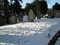
 A snowy scene in Guildford Cemetery - geograph.org.uk - 1158291.jpg 480 × 640; 90 KB
-
 A snowy Stag Hill - geograph.org.uk - 1153755.jpg 640 × 480; 81 KB
-
 A wintry view of Sydenham Road - geograph.org.uk - 2216013.jpg 1,024 × 768; 207 KB
-
 Albert Road North - geograph.org.uk - 1145331.jpg 640 × 426; 71 KB
-
 Ash Bridge - geograph.org.uk - 1153765.jpg 640 × 480; 112 KB
-
 At the End of Bowers Lane - geograph.org.uk - 1144338.jpg 640 × 480; 116 KB
-
 Banstead Heath - geograph.org.uk - 1152722.jpg 640 × 426; 43 KB
-
 Banstead Heath - geograph.org.uk - 1152726.jpg 640 × 426; 100 KB
-
 Banstead Heath - geograph.org.uk - 1152729.jpg 640 × 426; 80 KB
-
 Banstead Heath - geograph.org.uk - 1152732.jpg 640 × 426; 68 KB
-
 Banstead Heath - geograph.org.uk - 1152740.jpg 640 × 426; 40 KB
-
 Banstead Heath - geograph.org.uk - 1152741.jpg 640 × 426; 85 KB
-
 Banstead Heath - geograph.org.uk - 1152742.jpg 640 × 426; 68 KB
-
 Beacon Hill Playground - geograph.org.uk - 1152815.jpg 640 × 480; 71 KB
-
 Beacon Hill Recreation Ground - geograph.org.uk - 1152817.jpg 640 × 480; 79 KB
-
 Beaufort Close - geograph.org.uk - 1164193.jpg 640 × 426; 56 KB
-
 Beaufort Close - geograph.org.uk - 1164195.jpg 640 × 426; 66 KB
-
 Beaufort Road - geograph.org.uk - 1145329.jpg 640 × 426; 82 KB
-
 Bonnys Road (4262773143).jpg 3,072 × 2,304; 3.97 MB
-
 BP Filling Station, Burpham - geograph.org.uk - 1144374.jpg 640 × 376; 60 KB
-
 Bridleway Near Merstham, Surrey - geograph.org.uk - 1656669.jpg 3,872 × 2,592; 6.36 MB
-
 Bridleway Near Merstham, Surrey - geograph.org.uk - 1656723.jpg 3,872 × 2,592; 6.58 MB
-
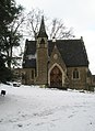
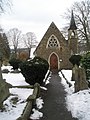
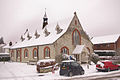
 St. Saviour's church, Brookwood - geograph.org.uk - 1717815.jpg 2,816 × 1,880; 2.65 MB
-
 Burnet Avenue - geograph.org.uk - 1146037.jpg 640 × 480; 74 KB
-
 Burpham Parade - geograph.org.uk - 1144356.jpg 640 × 480; 75 KB
-

-
 Capel Church Surrey.jpg 2,000 × 3,008; 1.18 MB
-
 Car radiator grille under snow at Gatton, Surrey.jpg 3,872 × 2,592; 3.51 MB
-
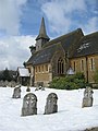
 Chaldon Church, Surrey - geograph.org.uk - 1652068.jpg 3,872 × 2,592; 4.14 MB
-
 Chaldon Church, Surrey - geograph.org.uk - 1652078.jpg 3,872 × 2,592; 5.34 MB
-
 Chaldon Church, Surrey - geograph.org.uk - 1652085.jpg 2,592 × 3,872; 2.76 MB
-
 Chalk Lane - geograph.org.uk - 2791644.jpg 2,592 × 1,936; 2.25 MB
-

-
 Churchfield Road - geograph.org.uk - 1145333.jpg 640 × 426; 61 KB
-
 Colley Hill in snow - geograph.org.uk - 1654220.jpg 640 × 426; 78 KB
-
 Colley Hill in snow - geograph.org.uk - 2803146.jpg 640 × 425; 289 KB
-
 Colley Hill in snow - geograph.org.uk - 2803164.jpg 640 × 425; 336 KB
-
 Colley Hill in snow - geograph.org.uk - 2803169.jpg 640 × 425; 300 KB
-
 Colley Hill in snow - geograph.org.uk - 2803198.jpg 640 × 425; 300 KB
-
 Colley Hill in snow - geograph.org.uk - 2803202.jpg 640 × 425; 287 KB
-
 Colley Hill in snow - geograph.org.uk - 2803204.jpg 426 × 640; 320 KB
-
 Connaught Crescent, Brookwood - geograph.org.uk - 1717845.jpg 2,816 × 1,880; 2.4 MB
-
 Coppice Lane - geograph.org.uk - 1656139.jpg 640 × 443; 86 KB
-
 Coppice Lane - geograph.org.uk - 1656140.jpg 640 × 426; 103 KB
-
 Cottage in Park Lane - geograph.org.uk - 1657312.jpg 640 × 426; 86 KB
-
 Crown Pub Badshot Lea - geograph.org.uk - 1632661.jpg 640 × 427; 44 KB
-

-
 Dalewod snow.jpg 400 × 286; 33 KB
-
 Dear little car on The Mount - geograph.org.uk - 1158247.jpg 640 × 480; 98 KB
-
 Dentists in Roke Lane - geograph.org.uk - 1626040.jpg 640 × 480; 100 KB
-
 Difficult driving conditions - geograph.org.uk - 1167824.jpg 640 × 425; 92 KB
-
 Distant hills (4262783505).jpg 3,072 × 2,304; 4.26 MB
-
 East Road - geograph.org.uk - 1164177.jpg 640 × 426; 76 KB
-
 Edge of Golden Valley - geograph.org.uk - 1144226.jpg 480 × 640; 68 KB
-
 Englefield Green Cemetery in Snow.jpg 3,264 × 2,448; 2.39 MB
-
 Epsom Road, Merrow - geograph.org.uk - 1146148.jpg 640 × 480; 99 KB
-
 St Martin of Tours, Epsom - geograph.org.uk - 1143885.jpg 640 × 427; 103 KB
-
 Evesham Close - geograph.org.uk - 1164184.jpg 640 × 426; 49 KB
-
 Evesham Road - geograph.org.uk - 1164188.jpg 640 × 426; 76 KB
-
 Evesham Road North - geograph.org.uk - 1164186.jpg 640 × 426; 75 KB
-
 Field near Betchworth in snow - geograph.org.uk - 1630243.jpg 447 × 640; 98 KB
-
 Flanchford Road - geograph.org.uk - 2186173.jpg 640 × 425; 59 KB
-
 Flanchford Road - geograph.org.uk - 2186910.jpg 640 × 425; 37 KB
-
 Flanchford Road - geograph.org.uk - 2188646.jpg 640 × 425; 40 KB
-

-
 Footbridge in Highcomb Bottom - geograph.org.uk - 1152842.jpg 640 × 480; 108 KB
-
 Footpath from Longdene Road in Haslemere - geograph.org.uk - 1671116.jpg 800 × 600; 129 KB
-

-
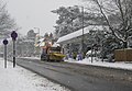 Gritter on the A3 - geograph.org.uk - 1144203.jpg 640 × 442; 55 KB
-
 Grove Road - geograph.org.uk - 1143902.jpg 640 × 427; 101 KB
-
 Guildford Bandstand - geograph.org.uk - 2205075.jpg 2,560 × 1,920; 1.69 MB
-

-
-
 Former chapel for Guildford Cemetery - geograph.org.uk - 1158327.jpg 480 × 640; 85 KB
-
-
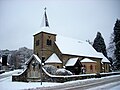
 Hambledon Church Surrey in the snow.JPG 3,264 × 2,448; 2.63 MB
-
 Hampton Court Motors In The Snow - geograph.org.uk - 1208840.jpg 480 × 640; 56 KB
-
 Hascombe Church - geograph.org.uk - 752642.jpg 480 × 640; 113 KB
-
 Hascombe Church - geograph.org.uk - 752648.jpg 640 × 480; 140 KB
-
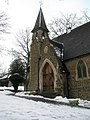
 St. Stephen's Church, Shottermill in snow.JPG 2,816 × 2,112; 1.1 MB
-
 Haslemere town centre - geograph.org.uk - 1852117.jpg 640 × 425; 59 KB
-
 Hindhead Common in the snow - geograph.org.uk - 1144209.jpg 640 × 480; 45 KB
-
 Hindhead Common in the snow - geograph.org.uk - 1144236.jpg 640 × 480; 45 KB
-
 Horse and Groom in Merrow - geograph.org.uk - 2201890.jpg 2,560 × 1,920; 1.72 MB
-

-

-
-

-
 Old chapel, Knaphill - geograph.org.uk - 1656071.jpg 640 × 480; 140 KB
-
 Lamppost in Roke Lane - geograph.org.uk - 1625958.jpg 640 × 480; 112 KB
-
 Lingering snow in Agraria Road - geograph.org.uk - 1154466.jpg 640 × 480; 67 KB
-
 Lingering snow in Roke Lane - geograph.org.uk - 1626027.jpg 640 × 480; 92 KB
-
 Liphook Road, Shottermill in snow 01.jpg 4,128 × 3,096; 5.93 MB
-
 Liphook Road, Shottermill in snow 02.jpg 4,128 × 3,096; 4.11 MB
-
 Liphook Road, Shottermill in snow 03.jpg 4,128 × 3,096; 5.37 MB
-
 Liphook Road, Shottermill in snow 04.jpg 4,128 × 3,096; 5.64 MB
-
 London Road Guildford Railway Station - geograph.org.uk - 2188772.jpg 1,024 × 762; 233 KB
-

-

-

-

-

-

-
 Looking up Mountside - geograph.org.uk - 1156685.jpg 640 × 480; 85 KB
-
 Ludlow Road - geograph.org.uk - 1153445.jpg 640 × 480; 107 KB
-
 Melting snow by the sluice bridge - geograph.org.uk - 1629775.jpg 480 × 640; 91 KB
-
 Melting snow in Agraria Road - geograph.org.uk - 1154474.jpg 480 × 640; 74 KB
-
 Melting snow in Alresford Road - geograph.org.uk - 1154103.jpg 640 × 480; 69 KB
-
 Melting snow in Beech Lane - geograph.org.uk - 1158441.jpg 640 × 480; 74 KB
-
 Melting snow on the Wey Path South - geograph.org.uk - 1629781.jpg 480 × 640; 120 KB
-
 St John's, Merrow - geograph.org.uk - 1146153.jpg 640 × 480; 130 KB
-
 Merrow, Horse and Groom - geograph.org.uk - 2201854.jpg 2,560 × 1,920; 1.9 MB
-
 Merstham Church from the east. - geograph.org.uk - 1653548.jpg 640 × 480; 106 KB
-
 Merstham Church, Surrey - geograph.org.uk - 1653036.jpg 2,592 × 3,872; 2.61 MB
-
 Merstham walk (6871074861).jpg 3,460 × 2,592; 5.57 MB
-
 My road seen from above,Merstham (6831240687).jpg 3,872 × 2,592; 5.19 MB
-
 Newlands Corner.jpg 790 × 528; 419 KB
-
 Nonsuch Park and Mansion (3).jpg 2,048 × 1,365; 1.89 MB
-
 Nonsuch Park, Surrey 6 December 2014.jpg 5,473 × 3,649; 12.25 MB
-
 Nutley Lane - geograph.org.uk - 1145323.jpg 640 × 426; 63 KB
-
 Ockley Mill 1909.jpg 800 × 490; 61 KB
-
 Old Merrow Street, Merrow. - geograph.org.uk - 108073.jpg 640 × 423; 157 KB
-
 Partridge Lane - geograph.org.uk - 1626773.jpg 640 × 428; 207 KB
-
 Petworth Road Haslemere - geograph.org.uk - 1852128.jpg 640 × 425; 54 KB
-
 Pines on Reigate Heath - geograph.org.uk - 2188656.jpg 640 × 425; 88 KB
-
 Pines on Reigate Heath - geograph.org.uk - 2188662.jpg 640 × 425; 121 KB
-

-
 Play area in a park in Haslemere - geograph.org.uk - 1654612.jpg 640 × 480; 103 KB
-
 Postbox in Poltimore Road - geograph.org.uk - 1154485.jpg 640 × 480; 65 KB
-
 Postbox on Mountside - geograph.org.uk - 1155617.jpg 640 × 480; 98 KB
-
 Priory Farm, South Nutfield - geograph.org.uk - 1652970.jpg 640 × 480; 72 KB
-
 Priory Park in snow - geograph.org.uk - 3303045.jpg 640 × 425; 240 KB
-
 Priory Park in snow - geograph.org.uk - 3303055.jpg 640 × 425; 320 KB
-
 Priory Park in snow - geograph.org.uk - 3303062.jpg 640 × 425; 308 KB
-
 Priory Park in snow - geograph.org.uk - 3303075.jpg 640 × 425; 213 KB
-
 Priory Park in snow - geograph.org.uk - 3303081.jpg 640 × 425; 248 KB
-
 Priory Park in snow - geograph.org.uk - 3303083.jpg 640 × 425; 192 KB
-
 Priory Park in snow - geograph.org.uk - 3303085.jpg 640 × 425; 238 KB
-
 Priory Park in snow - geograph.org.uk - 3303101.jpg 640 × 425; 249 KB
-
 Priory Park in snow - geograph.org.uk - 3303108.jpg 425 × 640; 255 KB
-
 Priory Park in snow - geograph.org.uk - 3303112.jpg 425 × 640; 354 KB
-
 Priory Park in snow - geograph.org.uk - 3303269.jpg 425 × 640; 242 KB
-
 Priory Park in snow - geograph.org.uk - 3303421.jpg 640 × 425; 417 KB
-
 Priory Park pavilion - geograph.org.uk - 2188637.jpg 640 × 425; 45 KB
-

-
 Reigate Heath in snow - geograph.org.uk - 2186193.jpg 640 × 425; 60 KB
-
 Reigate Heath in snow - geograph.org.uk - 2187059.jpg 640 × 425; 61 KB
-
 Reigate Heath in snow - geograph.org.uk - 2801649.jpg 640 × 426; 301 KB
-

-

-
 Reigate Priory - geograph.org.uk - 1626373.jpg 640 × 426; 112 KB
-
 Reigate Priory - geograph.org.uk - 1626378.jpg 640 × 426; 93 KB
-
 Reigate Priory - geograph.org.uk - 1626382.jpg 640 × 426; 121 KB
-
 Reigate Priory - geograph.org.uk - 2188627.jpg 640 × 425; 66 KB
-
 Reigate Priory in snow - geograph.org.uk - 3303094.jpg 640 × 425; 272 KB
-
 St Philips Church, Nutley Lane - geograph.org.uk - 1145321.jpg 640 × 426; 68 KB
-
 Roller, Reigate Heath - geograph.org.uk - 2186955.jpg 640 × 425; 55 KB
-
 Rose Cottage, Shottermill 01.jpg 5,152 × 3,864; 6.5 MB
-
 Rose Cottage, Shottermill 02.jpg 2,560 × 1,920; 2.32 MB
-
 Sainsbury's, Burpham - geograph.org.uk - 1144348.jpg 640 × 480; 55 KB
-
 Shottermill Junction Place after snow.jpg 2,816 × 2,112; 1.45 MB
-
 Sickle Mill in Snow 01.jpg 4,128 × 3,096; 6.08 MB
-
 Sickle Mill in Snow 02.jpg 4,128 × 3,096; 5.22 MB
-
 Sleepy Fox.jpg 1,249 × 921; 870 KB
-
 Snow (4196876539).jpg 3,072 × 2,304; 4.56 MB
-
 Snow clearing in Guildford Cemetery - geograph.org.uk - 1158300.jpg 480 × 640; 72 KB
-

-
 Snow covered homes in Rake Lane - geograph.org.uk - 1625535.jpg 640 × 480; 77 KB
-

-
 Snow in Surrey (2).jpg 1,746 × 1,393; 568 KB
-
 Snow in Surrey.jpg 1,660 × 1,198; 406 KB
-
-
-

-

-

-

-

-

-

-
 Snow in the High Street - geograph.org.uk - 2243107.jpg 1,024 × 760; 228 KB
-
 Snow in the Landscape - geograph.org.uk - 1655896.jpg 3,872 × 2,592; 5.24 MB
-
 Snow on Albury Downs - geograph.org.uk - 1146429.jpg 640 × 480; 102 KB
-
 Snow on the verge in Tilehouse Road - geograph.org.uk - 1631705.jpg 640 × 480; 122 KB
-
 Snow plus my van --) (4196873675).jpg 3,072 × 2,304; 4.66 MB
-
 SnowBikeClaygate.jpg 2,592 × 1,936; 1.93 MB
-


.jpg)


.jpg)


.jpg)


.jpg)


.jpg)
.jpg)

.jpg)


.jpg)


.jpg)

_-_geograph.org.uk_-_1626177.jpg)
_-_geograph.org.uk_-_1626179.jpg)
_-_geograph.org.uk_-_1626308.jpg)
_-_geograph.org.uk_-_1626309.jpg)
_-_geograph.org.uk_-_1626310.jpg)
_-_geograph.org.uk_-_1626314.jpg)
_-_geograph.org.uk_-_1626315.jpg)
_-_geograph.org.uk_-_1626323.jpg)


_(4196873675).jpg)

