Category:Snow in Lancashire
Jump to navigation
Jump to search
Ceremonial counties of England: Bedfordshire · Berkshire · Buckinghamshire · Cambridgeshire · Cheshire · Cornwall · Cumbria · Derbyshire · Devon · Dorset · Durham · East Riding of Yorkshire · East Sussex · Essex · Gloucestershire · Greater London · Greater Manchester · Hampshire · Herefordshire · Hertfordshire · Kent · Lancashire · Leicestershire · Lincolnshire · Merseyside · Norfolk · North Yorkshire · Northamptonshire · Northumberland · Nottinghamshire · Oxfordshire · Rutland · Shropshire · Somerset · South Yorkshire · Staffordshire · Suffolk · Surrey · Tyne and Wear · Warwickshire · West Midlands · West Sussex · West Yorkshire · Wiltshire · Worcestershire
City-counties: Bristol · City of London
Former historic counties:
Other former counties:
City-counties: Bristol · City of London
Former historic counties:
Other former counties:
Subcategories
This category has the following 3 subcategories, out of 3 total.
Media in category "Snow in Lancashire"
The following 143 files are in this category, out of 143 total.
-
 A meander on the River Keer - geograph.org.uk - 1657731.jpg 640 × 480; 85 KB
-
 Abandoned Allotment off Gas Street - geograph.org.uk - 1631491.jpg 640 × 480; 137 KB
-

-
 Approaching White House - geograph.org.uk - 1165825.jpg 640 × 480; 89 KB
-
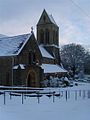
 Church of St John the Baptist, Arkholme.jpg 640 × 441; 151 KB
-
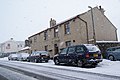
 Back street - geograph.org.uk - 1659612.jpg 480 × 640; 59 KB
-
 Bamford Crescent, Accrington - geograph.org.uk - 1659602.jpg 640 × 480; 63 KB
-
 Bank Hall Park - geograph.org.uk - 675291.jpg 640 × 479; 186 KB
-
 Saint Eadmer SD5745 320.jpg 2,560 × 1,920; 1.06 MB
-
 Bridge Road - geograph.org.uk - 1632972.jpg 640 × 480; 65 KB
-

-
 Burnley Road From Deerplay Hill - geograph.org.uk - 1146265.jpg 640 × 427; 59 KB
-

-
 Burnley Road, Hapton - geograph.org.uk - 1146966.jpg 640 × 480; 72 KB
-
 Former Jireh Baptist Chapel - geograph.org.uk - 1652143.jpg 480 × 640; 68 KB
-
 Bury Road, Haslingden - geograph.org.uk - 1073450.jpg 640 × 480; 38 KB
-
 Canal moorings, icy conditions - geograph.org.uk - 1507364.jpg 640 × 480; 61 KB
-
 Cant Clough Reservoir - geograph.org.uk - 1144108.jpg 640 × 427; 43 KB
-
 Cleveleys under snow - geograph.org.uk - 190848.jpg 640 × 446; 111 KB
-

-
 Clitheroe Castle View.JPG 2,304 × 3,072; 4.44 MB
-
 Clitheroe View.JPG 3,072 × 2,304; 5.3 MB
-
 Conder Green picnic site - geograph.org.uk - 1628367.jpg 640 × 480; 109 KB
-
 Cottages at Flaxmoss - geograph.org.uk - 1069637.jpg 640 × 444; 87 KB
-
 Cotton Street, Burnley - geograph.org.uk - 1650371.jpg 640 × 480; 78 KB
-
 Dickie Pinks, Tunnel Street - geograph.org.uk - 1650376.jpg 640 × 480; 66 KB
-

-
 Extwistle Hall - geograph.org.uk - 1153837.jpg 640 × 427; 73 KB
-
 Extwistle Hall - geograph.org.uk - 675040.jpg 640 × 419; 63 KB
-
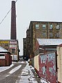
 Extwistle Mill - geograph.org.uk - 1153782.jpg 640 × 427; 132 KB
-
 Extwistle Road - geograph.org.uk - 1160713.jpg 640 × 427; 73 KB
-
 Farm Track off Haslingden Old Road - geograph.org.uk - 1721035.jpg 1,632 × 1,224; 412 KB
-
 Footbridge at Ward's Reservoir - geograph.org.uk - 131571.jpg 640 × 480; 213 KB
-
 Footpath up to Scout Moor - geograph.org.uk - 1075650.jpg 640 × 480; 32 KB
-
 Former Hapton Valley Coal Mine, Steps - geograph.org.uk - 1146971.jpg 480 × 640; 113 KB
-
 Frozen (50791816947).jpg 6,000 × 4,000; 8 MB
-
 Garages off Gas Street - geograph.org.uk - 1631487.jpg 640 × 480; 139 KB
-

-
 Grey Stone of Trough (Trough of Bowland, Lancashire, England).jpg 4,608 × 3,456; 8.93 MB
-
 Haverbreaks, Lancaster - geograph.org.uk - 1632975.jpg 640 × 480; 91 KB
-
 Haverbreaks, Lancaster - geograph.org.uk - 1632978.jpg 640 × 480; 44 KB
-
 Heasandford The Burnley Way - geograph.org.uk - 1183069.jpg 640 × 427; 117 KB
-
 Height End off Haslingden Old Road - geograph.org.uk - 1721044.jpg 1,630 × 966; 410 KB
-
 Helmshore Road - geograph.org.uk - 1146721.jpg 640 × 480; 84 KB
-
 High Halstead - geograph.org.uk - 1160702.jpg 640 × 427; 74 KB
-

-
 Hollins Lane, Accrington - geograph.org.uk - 1659651.jpg 480 × 640; 93 KB
-
 Hollins Lane, Accrington - geograph.org.uk - 1659653.jpg 480 × 640; 69 KB
-
 Houghton Hag Wood - geograph.org.uk - 1153646.jpg 640 × 426; 88 KB
-
 Hoyle Dean and Lumb in snow - geograph.org.uk - 2142526.jpg 640 × 406; 51 KB
-
 In Fields East of Foulridge - geograph.org.uk - 1165856.jpg 640 × 480; 92 KB
-
 In the grounds of Clitheroe Castle. - geograph.org.uk - 1650030.jpg 480 × 640; 44 KB
-
 Leafless tree in snow at Blackburn with Darwen, Lancashire 01.jpg 2,644 × 1,878; 1.49 MB
-
 Leafless tree in snow at Blackburn with Darwen, Lancashire 02.jpg 2,074 × 1,120; 773 KB
-
 Leafless tree in snow at Blackburn with Darwen, Lancashire 03.jpg 2,816 × 2,112; 1.85 MB
-
 Lee Green Farm - geograph.org.uk - 675060.jpg 640 × 427; 73 KB
-
 Lee Green Reservoir - geograph.org.uk - 1154001.jpg 640 × 426; 69 KB
-
 Lee Green Reservoir - geograph.org.uk - 1156471.jpg 640 × 427; 65 KB
-
 Lee Green Reservoir - geograph.org.uk - 1158004.jpg 640 × 427; 106 KB
-
 Lee Green Reservoir - geograph.org.uk - 1160666.jpg 640 × 426; 79 KB
-
 Lee Green Reservoir - geograph.org.uk - 675009.jpg 640 × 427; 48 KB
-
 Lister Well Road - geograph.org.uk - 154451.jpg 640 × 417; 56 KB
-
 Lonsdale Avenue, Ormskirk - geograph.org.uk - 1727636.jpg 3,648 × 2,736; 2.5 MB
-

-

-
 M65 - geograph.org.uk - 1650381.jpg 640 × 480; 68 KB
-

-
 Manchester Road - geograph.org.uk - 1109986.jpg 640 × 480; 63 KB
-
 Manchester Road, Accrington - geograph.org.uk - 1659681.jpg 640 × 480; 99 KB
-

-
 Market Street Edenfield - geograph.org.uk - 1127228.jpg 640 × 480; 74 KB
-
 Melville Street, Burnley - geograph.org.uk - 1652084.jpg 640 × 480; 90 KB
-
 Musbury Tor in the snow.jpg 1,263 × 943; 225 KB
-
 Near Salter Syke Farm - geograph.org.uk - 1163146.jpg 640 × 480; 77 KB
-
 Central Gospel Mission Hall - geograph.org.uk - 1068765.jpg 640 × 480; 53 KB
-
 Netherwood - geograph.org.uk - 1152984.jpg 640 × 427; 86 KB
-
 New ormskirk bus station (geograph 7477686).jpg 976 × 549; 177 KB
-
 Ogden Reservoir Dam - geograph.org.uk - 1157235.jpg 640 × 480; 103 KB
-
 Ogden Reservoirs 029.jpg 2,640 × 1,980; 888 KB
-
 Ormerod House snow in 1963.jpg 640 × 430; 71 KB
-
 Old farm at Overtown in deep snow in 1963.jpg 640 × 427; 76 KB
-
 Park Road, Padiham - geograph.org.uk - 1655582.jpg 640 × 480; 81 KB
-
 Parlick through the arch. - geograph.org.uk - 1650210.jpg 640 × 480; 43 KB
-
 Pendle from Clitheroe Castle. - geograph.org.uk - 1652812.jpg 480 × 640; 41 KB
-
 Pendle Hill - geograph.org.uk - 1171904.jpg 640 × 479; 42 KB
-
 Pendle Hill - geograph.org.uk - 348932.jpg 640 × 425; 220 KB
-
 Pendle Hill from Burnley - geograph.org.uk - 1092515.jpg 640 × 480; 84 KB
-
 Pendle Hill View.JPG 3,072 × 2,304; 5.01 MB
-
 Philomachus pugnax -Martin Mere -England -snow-31Jan2009.jpg 3,872 × 2,592; 1.68 MB
-
 Pond at Whittingham Hospital - geograph.org.uk - 1052983.jpg 640 × 480; 95 KB
-

-
 Ram in the snow, on Rossendale Way, Lancashire.jpg 640 × 480; 89 KB
-
 Ribble Valley - geograph.org.uk - 742188.jpg 640 × 480; 249 KB
-
 River Brock Woods and Ayla - geograph.org.uk - 696633.jpg 472 × 640; 93 KB
-
 River Brun - geograph.org.uk - 1230578.jpg 640 × 427; 132 KB
-
 River Calder, west of Whalley - geograph.org.uk - 1632654.jpg 640 × 480; 63 KB
-
 River Calder, west of Whalley - geograph.org.uk - 1632657.jpg 640 × 480; 66 KB
-
 Roggerham Gate Inn - geograph.org.uk - 1154065.jpg 640 × 427; 79 KB
-
 Rossendale Way Footpath - geograph.org.uk - 1075652.jpg 640 × 480; 66 KB
-
 Rowley Farmland - geograph.org.uk - 1152938.jpg 640 × 426; 86 KB
-
 Rowley Hall - geograph.org.uk - 1152929.jpg 640 × 426; 122 KB
-
 St. Paul's Scotforth - geograph.org.uk - 1632967.jpg 450 × 600; 38 KB
-
 Sheep at Roughlee Booth, Lancashire, England 1.jpg 2,640 × 1,980; 870 KB
-
 Sheep at Roughlee Booth, Lancashire, England 2.jpg 2,640 × 1,980; 1.08 MB
-
 Slaidburn Road - geograph.org.uk - 742190.jpg 640 × 480; 174 KB
-
 Slaidburn Road - geograph.org.uk - 742194.jpg 640 × 480; 238 KB
-
 Snow on Big end - geograph.org.uk - 768640.jpg 640 × 480; 50 KB
-
 Snow on the Accrington bypass - geograph.org.uk - 1654309.jpg 640 × 428; 28 KB
-
 Snowstorm over Clowbridge Reservoir - geograph.org.uk - 1748545.jpg 2,272 × 1,712; 1.06 MB
-
 St Anne's Parish Church - geograph.org.uk - 171202.jpg 640 × 473; 76 KB
-

-
 Stile on Pendle Hill - geograph.org.uk - 603050.jpg 640 × 480; 31 KB
-
 Sunderland point signs in snow.jpg 4,000 × 3,000; 1.99 MB
-
 Susan Mill - geograph.org.uk - 1650357.jpg 480 × 640; 48 KB
-
 Swinden Water - geograph.org.uk - 1152972.jpg 640 × 427; 145 KB
-
 Swinden Water - geograph.org.uk - 1152995.jpg 640 × 426; 116 KB
-
 Swinden Water - geograph.org.uk - 1153006.jpg 640 × 426; 107 KB
-
 The highest point of Cribden Hill - geograph.org.uk - 1717953.jpg 3,872 × 2,592; 3.1 MB
-
 The Hour Glass - geograph.org.uk - 1068640.jpg 640 × 480; 54 KB
-
 The Malt Shovel, Hargrove Avenue - geograph.org.uk - 1650350.jpg 640 × 480; 86 KB
-

-
 The Pack Horse, Belthorn - geograph.org.uk - 1719079.jpg 3,872 × 2,592; 4.21 MB
-
 The Water Witch pub, Lancaster Canal - geograph.org.uk - 1650834.jpg 640 × 480; 68 KB
-
 Thursden Valley picnic area - geograph.org.uk - 675111.jpg 640 × 427; 58 KB
-
 Thursden Valley picnic area - geograph.org.uk - 675128.jpg 640 × 418; 89 KB
-
 Todmorden Road Briercliffe - geograph.org.uk - 1157866.jpg 640 × 427; 43 KB
-
 Todmorden Road Briercliffe - geograph.org.uk - 1157905.jpg 640 × 427; 70 KB
-
 Track to Holden Farm - geograph.org.uk - 1154379.jpg 640 × 426; 74 KB
-

-
 View of Clitheroe.JPG 3,072 × 2,304; 5.06 MB
-

-
 Vine Mill, Oswaldtwistle (geograph 3288292).jpg 480 × 640; 78 KB
-

-
 Waterside, Darwen - geograph.org.uk - 12633.jpg 640 × 480; 118 KB
-
 Weir Close, Padiham - geograph.org.uk - 1655589.jpg 640 × 480; 60 KB
-
 Whalley Cricket Club ground, Lancashire.jpg 640 × 480; 194 KB
-
 Whalley Tennis Club - geograph.org.uk - 678970.jpg 640 × 480; 173 KB
-
 Whittingham Hospital - geograph.org.uk - 131839.jpg 640 × 480; 167 KB
-
 A sheep on Winter Hill, Lancashire.jpg 640 × 480; 116 KB
-
 Winter snow blanket - geograph.org.uk - 190844.jpg 640 × 429; 95 KB
-
 Wintery Grane Road - geograph.org.uk - 190849.jpg 640 × 424; 96 KB
-
 Eastern Avenue and Queen Victoria Road - geograph.org.uk - 657035.jpg 640 × 479; 119 KB
-
 Over Bickerstaffe Moss - geograph.org.uk - 131633.jpg 640 × 480; 122 KB


.jpg)


.jpg)


_-_geograph.org.uk_-_1150275.jpg)


.jpg)


.jpg)


