Category:Signs in Dorset
Jump to navigation
Jump to search
Ceremonial counties of England: Bedfordshire · Berkshire · Buckinghamshire · Cambridgeshire · Cheshire · Cornwall · Cumbria · Derbyshire · Devon · Dorset · Durham · East Riding of Yorkshire · East Sussex · Essex · Gloucestershire · Greater London · Greater Manchester · Hampshire · Herefordshire · Hertfordshire · Kent · Lancashire · Leicestershire · Lincolnshire · Merseyside · Norfolk · North Yorkshire · Northamptonshire · Northumberland · Nottinghamshire · Oxfordshire · Rutland · Shropshire · Somerset · South Yorkshire · Staffordshire · Suffolk · Surrey · Tyne and Wear · Warwickshire · West Midlands · West Sussex · West Yorkshire · Wiltshire · Worcestershire
City-counties: Bristol · City of London
Former historic counties:
Other former counties:
City-counties: Bristol · City of London
Former historic counties:
Other former counties:
Subcategories
This category has the following 11 subcategories, out of 11 total.
Media in category "Signs in Dorset"
The following 200 files are in this category, out of 312 total.
(previous page) (next page)-
 "No jogging" - geograph.org.uk - 1060762.jpg 640 × 480; 131 KB
-
 5 Tips Firing Point, Povington - geograph.org.uk - 384791.jpg 640 × 480; 93 KB
-
 8-figure grid reference on bridge - geograph.org.uk - 550593.jpg 640 × 480; 81 KB
-
 A welcome break - West Bexington - geograph.org.uk - 1456500.jpg 473 × 640; 79 KB
-
 Abbotsbury, waymarker - geograph.org.uk - 1529334.jpg 640 × 480; 106 KB
-
 Access Gate to Durdle Door - geograph.org.uk - 844198.jpg 640 × 480; 76 KB
-
 Access land above Combe Bottom - geograph.org.uk - 623033.jpg 640 × 480; 103 KB
-
 Any disagreements^ - geograph.org.uk - 763078.jpg 640 × 430; 111 KB
-
 Athelhampton, postbox № DT2 87 - geograph.org.uk - 983913.jpg 640 × 480; 129 KB
-
 Badbury Rings point to point course - geograph.org.uk - 1205199.jpg 640 × 480; 69 KB
-
 Ballard Down , Footpath Sign and Hillside - geograph.org.uk - 1712268.jpg 3,264 × 2,448; 3.57 MB
-
 Ballard Down , Signpost and Public Footpath - geograph.org.uk - 1712380.jpg 3,264 × 2,448; 2.88 MB
-
 Ballard Down , Signpost, Public Footpath and Coast - geograph.org.uk - 1712426.jpg 3,264 × 2,448; 3.06 MB
-
 Beach and warning sign, Studland - geograph.org.uk - 718071.jpg 640 × 480; 42 KB
-
 Bear Mead Reserve - geograph.org.uk - 1187102.jpg 640 × 480; 96 KB
-
 Beech Avenue, Kingston Lacy.jpg 6,000 × 4,000; 11.04 MB
-

-
 Bere Regis, waymarks - geograph.org.uk - 1268818.jpg 640 × 480; 85 KB
-
 Bestwell Nature Reserve. - geograph.org.uk - 762845.jpg 640 × 430; 92 KB
-
 Beware , falling cliffs - geograph.org.uk - 1444237.jpg 640 × 427; 82 KB
-
 Beware. Dangerous Cliff Face. - geograph.org.uk - 1447318.jpg 640 × 480; 85 KB
-
 Blandford Forum town plan - geograph.org.uk - 1501768.jpg 640 × 427; 93 KB
-

-

-
 Bournemouth , BP Petrol Station - geograph.org.uk - 1119800.jpg 640 × 480; 68 KB
-
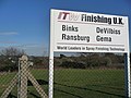 Bournemouth , ITW Finishing UK Sign - geograph.org.uk - 1747190.jpg 3,264 × 2,448; 3.49 MB
-
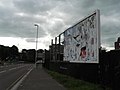
 Bournemouth , Moordown - Malvern Road Hoardings - geograph.org.uk - 1704420.jpg 3,264 × 2,448; 2.85 MB
-
 Bournemouth , Slades Farm Open Space - geograph.org.uk - 1119510.jpg 640 × 480; 91 KB
-
 Bournemouth , Stour Valley Local Nature Reserve - geograph.org.uk - 1704333.jpg 3,264 × 2,448; 3.97 MB
-
-
 Bournemouth , Welcome to Poole - geograph.org.uk - 1120106.jpg 640 × 480; 57 KB
-
 Bournemouth beach, Welcome to Poole - geograph.org.uk - 620002.jpg 640 × 480; 43 KB
-
 Bournemouth Gardens, Prince of Wales Road - geograph.org.uk - 669466.jpg 480 × 640; 110 KB
-

-

-
-

-

-

-
 Bournemouth, The Square plaque - geograph.org.uk - 670330.jpg 640 × 480; 54 KB
-
-
-
 Bridleway sign at Dorey's Farm - geograph.org.uk - 1167961.jpg 640 × 480; 249 KB
-
 Bumpers Lane, Portland, Dorset - geograph.org.uk - 1288725.jpg 640 × 480; 105 KB
-
 But is it Art^ - geograph.org.uk - 675424.jpg 640 × 480; 99 KB
-

-
 Centenary Sign, Colehill - geograph.org.uk - 1779180.jpg 600 × 800; 179 KB
-
 Chesil Beach road. - geograph.org.uk - 758101.jpg 640 × 480; 83 KB
-
 Cliff top above Durdle Door - geograph.org.uk - 755048.jpg 640 × 454; 56 KB
-
 Cloggs Off - geograph.org.uk - 477338.jpg 640 × 480; 63 KB
-
 Coombe Keynes - geograph.org.uk - 1565883.jpg 640 × 480; 112 KB
-
 Coombe Keynes - geograph.org.uk - 1565891.jpg 640 × 480; 122 KB
-
 Cordoned-off area of Chesil Beach - geograph.org.uk - 1325704.jpg 640 × 480; 258 KB
-
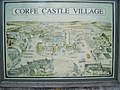 Corfe Castle - Village map - geograph.org.uk - 886623.jpg 640 × 480; 86 KB
-

-

-
 Creech Hill Viewpoint - geograph.org.uk - 1477781.jpg 640 × 480; 129 KB
-
 Cycle route sign - geograph.org.uk - 1366391.jpg 640 × 480; 314 KB
-
 Cycle Trail - geograph.org.uk - 390496.jpg 640 × 480; 24 KB
-
 DANGER UNSTABLE CLIFFS - geograph.org.uk - 909834.jpg 640 × 480; 134 KB
-
 Descending Golden Cap to Morecombelake - geograph.org.uk - 1708597.jpg 640 × 480; 103 KB
-

-
 Diversion sign - geograph.org.uk - 763257.jpg 640 × 430; 130 KB
-
 Dorchester Borough Coat of Arms - geograph.org.uk - 912510.jpg 640 × 480; 91 KB
-
 Dorchester Town Football Club - geograph.org.uk - 695619.jpg 640 × 480; 78 KB
-
 Dorset Sturminster Newton Bridge notice.jpg 314 × 222; 70 KB
-
 Dorset.jpg 1,175 × 794; 218 KB
-
 Durdle Door , Directions on a Rock - geograph.org.uk - 1119714.jpg 640 × 480; 65 KB
-

-
 Durdle Door, Coast path stone signpost - geograph.org.uk - 1749322.jpg 800 × 535; 468 KB
-
 Enterprise Business Park - geograph.org.uk - 491306.jpg 640 × 480; 89 KB
-
 Entrance - Hooke Park - geograph.org.uk - 1247768.jpg 640 × 480; 131 KB
-
 Entrance sign to Chideock Manor - geograph.org.uk - 406222.jpg 480 × 640; 58 KB
-
 Entrance to Holton Lee - geograph.org.uk - 453342.jpg 640 × 480; 115 KB
-
 Falcon Barn - geograph.org.uk - 854178.jpg 640 × 480; 88 KB
-
 Farmland and barn, Forston - geograph.org.uk - 545435.jpg 640 × 480; 157 KB
-
-
 Finger Post Eype Down - geograph.org.uk - 413734.jpg 640 × 480; 222 KB
-
 Flowers Barrow Hill Fort - geograph.org.uk - 1521406.jpg 640 × 455; 83 KB
-
 Follow the beer pot^^ - geograph.org.uk - 764815.jpg 640 × 430; 87 KB
-
 Footpath and bridleway signs - geograph.org.uk - 1460019.jpg 640 × 426; 140 KB
-
 Footpath Diverted - geograph.org.uk - 385887.jpg 480 × 640; 102 KB
-
 Footpath near Fleet village - geograph.org.uk - 539486.jpg 640 × 474; 71 KB
-
 Footpath sign - geograph.org.uk - 436353.jpg 640 × 480; 70 KB
-
 Frome Valley Way signpost - geograph.org.uk - 437535.jpg 477 × 640; 132 KB
-
 Gillingham railway station - geograph.org.uk - 1404134.jpg 640 × 480; 248 KB
-
-

-
 Godmanstone, postbox No. DT2 51 - geograph.org.uk - 1344324.jpg 477 × 640; 54 KB
-

-
 Hardy Way waymarker - geograph.org.uk - 1034034.jpg 640 × 640; 159 KB
-

-
 Hartland Moor, signpost - geograph.org.uk - 1201512.jpg 480 × 640; 41 KB
-
 Hidden path marker on Godlingston Heath - geograph.org.uk - 431860.jpg 430 × 640; 444 KB
-
 High Security Nature Reserve - geograph.org.uk - 1482613.jpg 640 × 480; 115 KB
-
 Houns-tout from the east - geograph.org.uk - 899869.jpg 480 × 640; 89 KB
-
 Houses in Poole (8801).jpg 4,288 × 2,848; 4.53 MB
-
 Houses on Bell Street, Shaftesbury - geograph.org.uk - 1606225.jpg 640 × 480; 106 KB
-
 Ibberton Hill Drive in Picnic Area - geograph.org.uk - 367822.jpg 640 × 480; 159 KB
-
 Iford Golf Centre, warning sign - geograph.org.uk - 1144280.jpg 640 × 480; 98 KB
-
 Junction for Osmington - geograph.org.uk - 618605.jpg 640 × 477; 87 KB
-
 Junction of paths to Corfe Castle - geograph.org.uk - 1026322.jpg 640 × 427; 89 KB
-

-
 Kimmeridge, footpath to the bay - geograph.org.uk - 836136.jpg 640 × 480; 66 KB
-
 Litton Cheney, thatched bus shelter - geograph.org.uk - 935067.jpg 640 × 480; 111 KB
-
 Living Trenches (7527771704).jpg 2,848 × 4,272; 5.09 MB
-
 Lodge at Athelhampton House - geograph.org.uk - 1177314.jpg 640 × 481; 129 KB
-

-
 Long Lane - geograph.org.uk - 476240.jpg 640 × 480; 101 KB
-

-
 Low Flying Warning Sign Kingston Russell - geograph.org.uk - 1123109.jpg 640 × 428; 115 KB
-

-
 Lulworth area - geograph.org.uk - 1564556.jpg 640 × 320; 57 KB
-
 Lulworth area - geograph.org.uk - 1564719.jpg 640 × 480; 138 KB
-
 Lyme Regis harbour 05.JPG 2,592 × 1,944; 1.4 MB
-
 Lyme Regis Harbour Pier Notices - geograph.org.uk - 803529.jpg 491 × 640; 105 KB
-

-

-

-
 Man of War or Durdle Door witch way - panoramio.jpg 1,944 × 2,592; 2.22 MB
-

-
 Military firing range warning sign - geograph.org.uk - 645525.jpg 427 × 640; 117 KB
-
 Milton Abbas ... post office sign. (3535765472) (2).jpg 2,945 × 1,025; 2.22 MB
-
 Monarch's Way and Coastal Path - geograph.org.uk - 709354.jpg 640 × 480; 233 KB
-
 Morcombelake, St. Wite's Well - geograph.org.uk - 519426.jpg 640 × 429; 118 KB
-
 Nature Reserve entrance - geograph.org.uk - 1365977.jpg 640 × 480; 92 KB
-
 No Bait Digging - geograph.org.uk - 1362051.jpg 640 × 480; 94 KB
-
 No Right of Way - geograph.org.uk - 798043.jpg 640 × 426; 125 KB
-
 No Right To Cycle - geograph.org.uk - 899827.jpg 480 × 640; 101 KB
-
-
 Notice to dog walkers - geograph.org.uk - 1625631.jpg 640 × 480; 87 KB
-
 Nudist Beach Warning, Studland - geograph.org.uk - 415106.jpg 640 × 480; 63 KB
-

-

-
 Old footpath sign - geograph.org.uk - 799803.jpg 640 × 426; 117 KB
-
 Old wall and Coast Path signs - geograph.org.uk - 1030097.jpg 480 × 640; 111 KB
-
 Overgrown path - geograph.org.uk - 569275.jpg 640 × 480; 175 KB
-
 Path to Scratchy Bottom - geograph.org.uk - 1529615.jpg 640 × 480; 109 KB
-

-

-
 Pharmacy sign - Cheap Street - geograph.org.uk - 1735925.jpg 640 × 480; 69 KB
-
 Portland Museum, Wakeham (geograph 3161790).jpg 1,024 × 683; 174 KB
-

-
 Postbox, Edmondsham - geograph.org.uk - 1160897.jpg 480 × 640; 181 KB
-
 Private, keep out - geograph.org.uk - 621353.jpg 640 × 477; 86 KB
-

-
 Puddletown Forest - geograph.org.uk - 1180790.jpg 640 × 481; 220 KB
-
 Puncknowle, old library sign - geograph.org.uk - 935111.jpg 480 × 640; 118 KB
-
 Purbeck Way marker, Brenscombe Hill - geograph.org.uk - 1025776.jpg 640 × 640; 133 KB
-
 Quarry track, Chalklands Quarries - geograph.org.uk - 1030146.jpg 640 × 480; 98 KB
-
 Range target, Lulworth ranges - geograph.org.uk - 764515.jpg 640 × 430; 67 KB
-
 Rates on the Cobb at Lyme Regis (2852).jpg 2,848 × 4,288; 6.29 MB
-
 Recycled sign, Broadmayne - geograph.org.uk - 847866.jpg 640 × 480; 189 KB
-
 Restricted Mooring, The Fleet - geograph.org.uk - 1297652.jpg 640 × 443; 106 KB
-
 Ringstead Bay, Coast Path - geograph.org.uk - 1705212.jpg 449 × 599; 185 KB
-
 Ringstead, beach notices - geograph.org.uk - 1416605.jpg 640 × 480; 104 KB
-

-
 River Piddle, Piddletrenthide - geograph.org.uk - 1065362.jpg 640 × 480; 123 KB
-
 Road to Higher Came Farmhouse - geograph.org.uk - 415172.jpg 640 × 427; 93 KB
-
 Rufus Castle - geograph.org.uk - 109876.jpg 480 × 640; 159 KB
-
 Rufus Castle from the coast path - geograph.org.uk - 1030791.jpg 480 × 640; 112 KB
-
 Safety equipment - geograph.org.uk - 529412.jpg 493 × 623; 80 KB
-
 Sea View Holiday Park - geograph.org.uk - 621149.jpg 640 × 477; 67 KB
-
 Seat on Flowers Barrow - geograph.org.uk - 1521417.jpg 640 × 455; 74 KB
-
 Seatown, coast path diversion sign - geograph.org.uk - 1353575.jpg 480 × 640; 85 KB
-
 Sheep Pens Car park Dorset - geograph.org.uk - 559688.jpg 640 × 427; 146 KB
-
 Shitterton - geograph.org.uk - 162264.jpg 600 × 450; 82 KB
-
 Sign - Man Of War-Durdle Door (6164252616).jpg 3,000 × 4,000; 4.54 MB
-
 Sign for Shroton cricket club - geograph.org.uk - 1624881.jpg 426 × 640; 64 KB
-

-
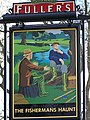 Sign for the Fishermans Haunt - geograph.org.uk - 1190689.jpg 481 × 640; 153 KB
-
 Sign for the Jubilee Trail - geograph.org.uk - 449314.jpg 640 × 480; 124 KB
-
 Sign heralding a new quarry - geograph.org.uk - 1558601.jpg 640 × 427; 79 KB
-
 Sign on Durweston Bridge - geograph.org.uk - 411898.jpg 640 × 480; 103 KB
-
-
 Sign on the Crown Hotel - geograph.org.uk - 1714613.jpg 480 × 640; 86 KB
-
 Sign posted farm track - geograph.org.uk - 421778.jpg 640 × 480; 186 KB
-
 Signpost by Norden railway station (2753).jpg 2,848 × 4,288; 6.67 MB
-
 Signpost near Corfe Castle - geograph.org.uk - 1366886.jpg 640 × 480; 135 KB
-
 Signpost near Upwey - geograph.org.uk - 1359555.jpg 480 × 640; 179 KB
-

-
 Signpost on the Purbeck Way - geograph.org.uk - 1025443.jpg 640 × 427; 68 KB
-

-
 South West Coast Path - inland route - geograph.org.uk - 617444.jpg 640 × 477; 67 KB
-
 South West Coast Path - inland route - geograph.org.uk - 617453.jpg 640 × 477; 111 KB
-
 South West Coast Path marker near West Lulworth (1788).jpg 4,288 × 2,848; 6.26 MB
-
 St Mary's Church entrance - geograph.org.uk - 426723.jpg 640 × 480; 131 KB
-
-
 St Nicholas Church, Durweston - geograph.org.uk - 163322.jpg 600 × 450; 70 KB
-
 St. Michaels Church (7672409936).jpg 3,395 × 2,542; 3.33 MB
-
 Stair Hole sign - geograph.org.uk - 436345.jpg 640 × 480; 92 KB
-
-

-

-
 Stone sign, Portland Coast Path - geograph.org.uk - 1032871.jpg 480 × 640; 105 KB
-
 Stour Provost, notice in Church Lane - geograph.org.uk - 1434109.jpg 640 × 480; 118 KB
-
 Studland Beach , Sand Dune and Beach Hut - geograph.org.uk - 1707172.jpg 3,264 × 2,448; 3.46 MB
-
 Studland Beach , Study Centre and Car Park - geograph.org.uk - 1706971.jpg 3,264 × 2,448; 3.69 MB
-
 Studland Beach , Study Centre and Car Park - geograph.org.uk - 1712592.jpg 3,264 × 2,448; 2.59 MB
-


_-_geograph.org.uk_-_1601497.jpg)


_-_geograph.org.uk_-_1749351.jpg)


.jpg)


.jpg)


.jpg)
.jpg)


.jpg)


.jpg)


.jpg)


.jpg)


.jpg)


.jpg)


_(2).jpg)