Category:Signs in Devon
Jump to navigation
Jump to search
Ceremonial counties of England: Bedfordshire · Berkshire · Buckinghamshire · Cambridgeshire · Cheshire · Cornwall · Cumbria · Derbyshire · Devon · Dorset · Durham · East Riding of Yorkshire · East Sussex · Essex · Gloucestershire · Greater London · Greater Manchester · Hampshire · Herefordshire · Hertfordshire · Kent · Lancashire · Leicestershire · Lincolnshire · Merseyside · Norfolk · North Yorkshire · Northamptonshire · Northumberland · Nottinghamshire · Oxfordshire · Rutland · Shropshire · Somerset · South Yorkshire · Staffordshire · Suffolk · Surrey · Tyne and Wear · Warwickshire · West Midlands · West Sussex · West Yorkshire · Wiltshire · Worcestershire
City-counties: Bristol · City of London
Former historic counties:
Other former counties:
City-counties: Bristol · City of London
Former historic counties:
Other former counties:
Subcategories
This category has the following 12 subcategories, out of 12 total.
B
I
- Information boards in Devon (8 F)
N
- National Trust signs in Devon (18 F)
P
R
- Railway station signs in Devon (37 F)
V
- Village signs in Devon (34 F)
W
- Welcome signs in Devon (16 F)
Media in category "Signs in Devon"
The following 200 files are in this category, out of 600 total.
(previous page) (next page)-
 "Stay on footpath or stay home" - geograph.org.uk - 1059577.jpg 640 × 574; 128 KB
-
 'The Dolphin' - Old Plymouth Breweries livery - geograph.org.uk - 1755538.jpg 1,200 × 1,600; 424 KB
-
 022 Buckfast Abbey (5930474182).jpg 1,022 × 684; 549 KB
-
 2013 at Totnes Littlehempstone - access path.jpg 1,024 × 768; 271 KB
-
 2014 at Sea Lawn Terrace 12.JPG 1,366 × 910; 649 KB
-
 2014 at Sea Lawn Terrace 35.JPG 1,366 × 910; 510 KB
-
 2016 at Dawlish - new gates on sea wall.JPG 1,366 × 910; 208 KB
-
 2016 at Plymouth Breton Side bus station - coach departure platform.JPG 1,024 × 1,366; 567 KB
-
 2016 at Plymouth Breton Side bus station - entrance signs.JPG 1,024 × 1,366; 526 KB
-
 2016 at Plymouth Bretonside - redirections.JPG 1,366 × 910; 440 KB
-
 2019 at Marine Parade (01).JPG 1,712 × 1,140; 778 KB
-
 2019 at Marine Parade (33).JPG 1,366 × 910; 657 KB
-
 2019 at Marine Parade (35) (GWR 802012).JPG 1,366 × 910; 352 KB
-
 2023 at Marsh Barton station - approach from the west.JPG 1,366 × 820; 435 KB
-
 A New Footpath^ - geograph.org.uk - 1397245.jpg 640 × 427; 115 KB
-

-

-
 A thatched notice board - geograph.org.uk - 1078249.jpg 640 × 429; 88 KB
-
 A39 passing Waytown farm - geograph.org.uk - 522434.jpg 640 × 425; 90 KB
-
 AA hotel sign, Dunsford - geograph.org.uk - 1491001.jpg 490 × 640; 87 KB
-
 Activity Trail at Wistlandpound - geograph.org.uk - 1501713.jpg 640 × 480; 114 KB
-
 Adders basking - geograph.org.uk - 1508218.jpg 640 × 412; 64 KB
-

-
 Approaching Stoney Cross from the west - geograph.org.uk - 1975455.jpg 1,024 × 680; 145 KB
-
 Approaching Stover Quarry - geograph.org.uk - 1730381.jpg 640 × 480; 673 KB
-
 Attention Climbers Sign, Berry Head.jpg 4,967 × 3,297; 2.26 MB
-
 Badlake Moor Cross - geograph.org.uk - 616421.jpg 640 × 427; 115 KB
-
 Bandstand, Dartmouth - geograph.org.uk - 1033643.jpg 640 × 521; 96 KB
-

-
 Beer and hymns - geograph.org.uk - 829944.jpg 480 × 640; 126 KB
-
 Beer beach, boats for hire - geograph.org.uk - 952349.jpg 640 × 480; 179 KB
-
 Beeson Pool - geograph.org.uk - 826277.jpg 640 × 430; 98 KB
-
 Before and after^ - geograph.org.uk - 1579305.jpg 480 × 640; 73 KB
-
 Berry Head National Nature Reserve.jpg 2,448 × 2,448; 2.77 MB
-
-
 Beware of Adders - geograph.org.uk - 1028780.jpg 480 × 640; 169 KB
-
 Beware of Trains - geograph.org.uk - 643478.jpg 640 × 480; 115 KB
-
 Beware of Trains Sign, Staverton Station.jpg 5,152 × 3,864; 7.06 MB
-
 Bideford cemetery - notice and plaque - geograph.org.uk - 1159479.jpg 469 × 640; 243 KB
-
 Bird migration records at Berry Head - geograph.org.uk - 956554.jpg 640 × 480; 81 KB
-
 Blackpool Cottages.jpg 5,152 × 3,864; 9.61 MB
-
 Blasted notice - geograph.org.uk - 828750.jpg 640 × 480; 117 KB
-
 Bonfire, Shaldon - geograph.org.uk - 1041923.jpg 640 × 480; 93 KB
-
 Boswell's Bungalow, North Tawton, Devon - geograph.org.uk - 448623.jpg 640 × 480; 151 KB
-
 Braunton Burrows - geograph.org.uk - 1399435.jpg 640 × 480; 104 KB
-
 Bridleway closed by badger holes - geograph.org.uk - 1266610.jpg 456 × 640; 111 KB
-
 Bridleway Crossroads - geograph.org.uk - 499425.jpg 640 × 426; 131 KB
-
 Bridleway Junction - geograph.org.uk - 763717.jpg 640 × 427; 159 KB
-
 Bridleway to Cherridge and beyond - geograph.org.uk - 751868.jpg 640 × 480; 170 KB
-
 Bridleway to Kingskerswell Road - geograph.org.uk - 1610145.jpg 640 × 480; 68 KB
-
 Bridleway towards Finlake - geograph.org.uk - 728633.jpg 480 × 640; 131 KB
-

-
 Brixham Trawler Race Sign.jpg 2,304 × 1,728; 520 KB
-
 Brixham, to toilets with accuracy - geograph.org.uk - 1464914.jpg 640 × 480; 86 KB
-

-

-

-
-

-

-
 Burgh Island, dangerous cliffs - geograph.org.uk - 1465429.jpg 640 × 480; 68 KB
-
 Burscombe lane, foot path - geograph.org.uk - 1490223.jpg 640 × 480; 120 KB
-
 Bus DSC00146 (16200754090).jpg 1,632 × 1,224; 415 KB
-
 Butterwalk, High Street, Totnes - geograph.org.uk - 986511.jpg 480 × 640; 74 KB
-
 Cafe fare - geograph.org.uk - 1329724.jpg 640 × 480; 128 KB
-

-
 Car wash signs, Torquay - geograph.org.uk - 1728688.jpg 640 × 457; 68 KB
-
 Carved wood panel by river Otter - geograph.org.uk - 1729810.jpg 640 × 480; 299 KB
-
 Cats Protection Centre, Clyst St Mary - geograph.org.uk - 1069248.jpg 640 × 480; 156 KB
-
 Caution - badger holes ahead - geograph.org.uk - 1271305.jpg 640 × 460; 120 KB
-
 Caution pheasants - geograph.org.uk - 1619483.jpg 640 × 480; 138 KB
-
 Chapel Hill Pleasure Grounds, Torquay - geograph.org.uk - 862606.jpg 430 × 640; 77 KB
-
 Chasse gardee, Wrigwell - geograph.org.uk - 816842.jpg 480 × 640; 102 KB
-
 Chawleigh goes digital - geograph.org.uk - 1278163.jpg 513 × 640; 117 KB
-
 Chivelstone, the path to East Prawle - geograph.org.uk - 951863.jpg 640 × 427; 254 KB
-
 Christmas for sale sign, Torquay - geograph.org.uk - 1627113.jpg 640 × 480; 95 KB
-
 Chucks Ford - geograph.org.uk - 1045307.jpg 480 × 640; 85 KB
-
 Chunky Monkey, Exwick Barton - geograph.org.uk - 1367234.jpg 640 × 453; 85 KB
-
 Church Hill, Marldon Gradient Sign.jpg 3,864 × 5,152; 12.39 MB
-
 Claypit road bridge detail - geograph.org.uk - 758053.jpg 640 × 480; 98 KB
-
 Close up of stone sign (3865307874).jpg 2,000 × 1,500; 1.46 MB
-
 Closed footpath, East Grove Road - geograph.org.uk - 1069232.jpg 480 × 640; 85 KB
-
 Closed promenade - geograph.org.uk - 820752.jpg 465 × 640; 71 KB
-
 Coast path above Babbacombe Cliff - geograph.org.uk - 1442469.jpg 640 × 480; 110 KB
-
 Coast path sign - geograph.org.uk - 771382.jpg 640 × 480; 72 KB
-
 Coast path sign Start Point.jpg 2,048 × 1,536; 1.4 MB
-
 Coast path signpost at Wembury - geograph.org.uk - 1564883.jpg 640 × 480; 103 KB
-
 Coast path signs near Branscombe mouth - geograph.org.uk - 952379.jpg 640 × 480; 145 KB
-
 Coastal path into Sidmouth - geograph.org.uk - 1138888.jpg 640 × 427; 198 KB
-

-
 Coastal path looking west - geograph.org.uk - 689074.jpg 1,600 × 1,200; 1.59 MB
-
 Coastal Path Signpost - geograph.org.uk - 1112713.jpg 640 × 430; 83 KB
-
 Coastal Paths, near Mortehoe - geograph.org.uk - 609381.jpg 640 × 428; 108 KB
-
 Colyford Tram Stop.JPG 2,048 × 1,536; 548 KB
-

-
 Communications centre, South Pool^^ - geograph.org.uk - 825882.jpg 640 × 430; 92 KB
-
 Company Sign - geograph.org.uk - 953694.jpg 640 × 428; 100 KB
-
 Cottage at Ladram Bay - geograph.org.uk - 1138808.jpg 640 × 426; 182 KB
-

-

-
 Cousins Cross Signpost, Blackawton.jpg 3,864 × 5,152; 8.49 MB
-
 Cowley Bridge - Colas DR75406.JPG 1,366 × 910; 577 KB
-
 Creacombe, East Batsworthy Farm - geograph.org.uk - 243721.jpg 640 × 427; 183 KB
-
 Crest Singer.JPG 3,648 × 2,736; 4.28 MB
-
 Croydehoe Farm - geograph.org.uk - 1758198.jpg 640 × 480; 208 KB
-
 Cut Hill - geograph.org.uk - 15223.jpg 640 × 425; 91 KB
-
 Daddyhole Road Signs, Torquay.jpg 5,312 × 2,988; 3.29 MB
-
 Damaged waymark post, Washwalk - geograph.org.uk - 1323619.jpg 480 × 640; 104 KB
-
 Danger - Loose Rocks Sign.jpg 5,152 × 3,864; 6.87 MB
-
 Dartmoor ranges - geograph.org.uk - 373629.jpg 413 × 640; 60 KB
-
 Dartmouth , Woodlands Theme Park - geograph.org.uk - 1217509.jpg 640 × 480; 133 KB
-
 Dartmouth Do Not Feed the Seagulls Sign.jpg 5,152 × 3,864; 3.5 MB
-

-
 David J. Penwell builders sign - geograph.org.uk - 887310.jpg 640 × 480; 57 KB
-
 Dawlish Warren , Beach Road - geograph.org.uk - 1235738.jpg 640 × 512; 43 KB
-

-

-
 Dawlish Warren , Nature Reserve - geograph.org.uk - 1155129.jpg 640 × 480; 87 KB
-
 Dawlish Warren , Nature Reserve sign - geograph.org.uk - 1155135.jpg 480 × 640; 79 KB
-

-

-
 Dawlish, to toilets and The Lawn - geograph.org.uk - 1468995.jpg 480 × 640; 98 KB
-
 Deep Water Sign, Cockington Mill Pond.jpg 3,864 × 5,152; 12.99 MB
-
 Denbury Athletic Football Club - geograph.org.uk - 1616078.jpg 640 × 480; 81 KB
-
 Derelict shed near Butterleigh - geograph.org.uk - 1621893.jpg 640 × 480; 152 KB
-
 Devon County.jpg 1,174 × 548; 125 KB
-
 Devon footpath (34390068336).jpg 2,854 × 3,806; 2.47 MB
-
 Devon signpost in the sun - geograph.org.uk - 1255150.jpg 427 × 640; 102 KB
-
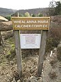 DGC Calciner Sign.jpg 3,864 × 5,152; 7.08 MB
-
 Direction of travel from Axminster station.jpg 1,600 × 1,200; 877 KB
-
 Distance markers, Wrigwell Bridge - geograph.org.uk - 816869.jpg 640 × 480; 128 KB
-

-
 DO NOT OBSTRUCT - geograph.org.uk - 1179388.jpg 640 × 480; 102 KB
-
 DodderidgianLibrary Barnstaple StoneTablet.JPG 3,113 × 1,286; 2.34 MB
-
 Dogs beware - geograph.org.uk - 380609.jpg 480 × 640; 52 KB
-
 Don't even think of parking here - geograph.org.uk - 1571311.jpg 480 × 640; 101 KB
-

-
 East Devon , Coast Path and Bushes - geograph.org.uk - 1476773.jpg 640 × 480; 152 KB
-
 East Devon , Coast Path and Hazard Sign - geograph.org.uk - 1477288.jpg 640 × 480; 143 KB
-
 East Devon , East Devon Golf Club - geograph.org.uk - 1477465.jpg 640 × 480; 116 KB
-
 East Ogwell Wishing Well.jpg 3,864 × 5,152; 11.39 MB
-
 2018 at Eggesford station - platform 1 entrance.JPG 1,366 × 910; 707 KB
-

-
 Entrance to Ashcombe Adventure Centre - geograph.org.uk - 1167686.jpg 640 × 480; 104 KB
-
 Entrance to Bickington Village Hall.jpg 3,864 × 5,152; 9.53 MB
-

-
 Entrance to the Coast Path - geograph.org.uk - 1324100.jpg 480 × 640; 129 KB
-
 Entrance to The Willows - geograph.org.uk - 336329.jpg 640 × 479; 139 KB
-
 Entrance to Waffapool Farm - geograph.org.uk - 1186550.jpg 640 × 480; 118 KB
-

-
 Entrance with horses - geograph.org.uk - 746107.jpg 640 × 484; 126 KB
-
 Entrance, Castle Drogo - geograph.org.uk - 1652376.jpg 640 × 347; 86 KB
-

-
 St Luke's church, Countess Wear - geograph.org.uk - 279315.jpg 640 × 480; 124 KB
-
 Exeter2.jpg 556 × 417; 62 KB
-
 Exmouth lifeguard by danger sign.JPG 1,366 × 820; 439 KB
-
 Exmouth SSSI sign.jpg 768 × 1,024; 489 KB
-
 Faded painted advertising - geograph.org.uk - 1638719.jpg 640 × 480; 97 KB
-
 Farm sign - geograph.org.uk - 570501.jpg 480 × 640; 137 KB
-
 Ferry information board - geograph.org.uk - 601778.jpg 640 × 480; 70 KB
-
 Field and Gate - geograph.org.uk - 1286018.jpg 640 × 480; 154 KB
-
 Field next to Langdon's Business Park - geograph.org.uk - 1069237.jpg 640 × 480; 184 KB
-
 Filling station sign - geograph.org.uk - 1076686.jpg 640 × 480; 85 KB
-
 Fish and chips Plymouth.jpeg 1,279 × 786; 103 KB
-
 Fish and chips, Torquay - geograph.org.uk - 1597945.jpg 640 × 543; 76 KB
-
 Fish River Otter Devon.jpg 1,181 × 785; 497 KB
-
 Food Kiosk at Paignton Beach.jpg 5,152 × 3,864; 7.47 MB
-
 Footpath across a field near Thorverton - geograph.org.uk - 971682.jpg 640 × 480; 186 KB
-

-
 Footpath down to the estuary - geograph.org.uk - 1092697.jpg 640 × 480; 139 KB
-

-

-
 Footpath near Whiteley - geograph.org.uk - 741149.jpg 480 × 640; 146 KB
-
 Footpath off Dudmoor Lane - geograph.org.uk - 722125.jpg 640 × 425; 90 KB
-
 Footpath Sign - geograph.org.uk - 326972.jpg 640 × 480; 158 KB
-
 Footpath Sign - geograph.org.uk - 826194.jpg 640 × 430; 130 KB
-
 Footpath sign above Folly Hill - geograph.org.uk - 1476989.jpg 640 × 480; 86 KB
-
 Footpath sign along the Heddon's Path - geograph.org.uk - 917612.jpg 640 × 480; 142 KB
-
 Footpath sign at Rew Cross - geograph.org.uk - 226486.jpg 640 × 480; 104 KB
-
 Footpath sign near Baggy Point - geograph.org.uk - 1365220.jpg 640 × 480; 91 KB
-
 Footpath sign near Marldon Road - geograph.org.uk - 1079946.jpg 640 × 480; 146 KB
-
 Footpath sign near Woodhuish - geograph.org.uk - 858847.jpg 640 × 480; 116 KB
-
 Footpath sign under the trees - geograph.org.uk - 1074715.jpg 480 × 640; 112 KB
-
 Footpath sign, Kingswear - geograph.org.uk - 1368077.jpg 640 × 480; 52 KB
-
 Footpath sign, near Morchard Road - geograph.org.uk - 810219.jpg 426 × 640; 124 KB
-
 Footpath sign, near South Wood Farm - geograph.org.uk - 1271819.jpg 640 × 480; 129 KB
-
 Footpath Sign, Prawle Point - geograph.org.uk - 423059.jpg 640 × 480; 77 KB
-
 Footpath sign, St Marychurch - geograph.org.uk - 370274.jpg 480 × 640; 119 KB
-
 Footpath sign, Watcombe Park - geograph.org.uk - 1635985.jpg 480 × 640; 124 KB
-

-
 Footpath to Buck's Mills - geograph.org.uk - 1595993.jpg 640 × 480; 152 KB
-
 Footpath to Cleave Farm - geograph.org.uk - 678745.jpg 640 × 480; 105 KB
-
 Footpath to Deer Bridge - geograph.org.uk - 1362746.jpg 640 × 480; 118 KB
-
 Footpath to Hembury Fort - geograph.org.uk - 35166.jpg 640 × 480; 101 KB
-
 Footpath to Ringmore - geograph.org.uk - 1473706.jpg 640 × 480; 115 KB
-
 Footpath to Welcombe Mouth - geograph.org.uk - 1555107.jpg 640 × 480; 121 KB
-
 For Sale signs by A38 - geograph.org.uk - 1626251.jpg 640 × 427; 309 KB
-
 Forches Cross - geograph.org.uk - 1745518.jpg 1,600 × 1,200; 403 KB
-
 Free drinks for all ladies, Honiton - geograph.org.uk - 903699.jpg 491 × 640; 59 KB
-
 Free range chickens and alpacas - geograph.org.uk - 1601348.jpg 640 × 480; 154 KB


.jpg)


.JPG)
.JPG)
_(GWR_802012).JPG)


_-_geograph.org.uk_-_1188476.jpg)


_Lifeboat_Station_information_board_-_geograph.org.uk_-_413632.jpg)


.jpg)


.jpg)


.jpg)


