Category:Signs in Buckinghamshire
Jump to navigation
Jump to search
Ceremonial counties of England: Bedfordshire · Berkshire · Buckinghamshire · Cambridgeshire · Cheshire · Cornwall · Cumbria · Derbyshire · Devon · Dorset · Durham · East Riding of Yorkshire · East Sussex · Essex · Gloucestershire · Greater London · Greater Manchester · Hampshire · Herefordshire · Hertfordshire · Kent · Lancashire · Leicestershire · Lincolnshire · Merseyside · Norfolk · North Yorkshire · Northamptonshire · Northumberland · Nottinghamshire · Oxfordshire · Rutland · Shropshire · Somerset · South Yorkshire · Staffordshire · Suffolk · Surrey · Tyne and Wear · Warwickshire · West Midlands · West Sussex · West Yorkshire · Wiltshire · Worcestershire
City-counties: Bristol · City of London
Former historic counties:
Other former counties:
City-counties: Bristol · City of London
Former historic counties:
Other former counties:
Subcategories
This category has the following 8 subcategories, out of 8 total.
Media in category "Signs in Buckinghamshire"
The following 93 files are in this category, out of 93 total.
-
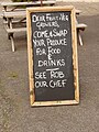 "Swap your produce for food and drinks" - geograph.org.uk - 957040.jpg 480 × 640; 113 KB
-

-
 Approaching Little Horwood village - geograph.org.uk - 256916.jpg 640 × 480; 118 KB
-
 Arts Centre sign, Great Linford - geograph.org.uk - 1157675.jpg 640 × 480; 72 KB
-
 BBOWT - geograph.org.uk - 259754.jpg 640 × 480; 132 KB
-
 Best kept village sign.JPG 2,800 × 2,128; 3.33 MB
-
 Brambles Nursery near Singleborough - geograph.org.uk - 256909.jpg 640 × 480; 130 KB
-
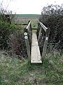 Bridge across a ditch - geograph.org.uk - 397620.jpg 480 × 640; 172 KB
-
 Bridleway to Hungary Hall - geograph.org.uk - 452913.jpg 640 × 428; 111 KB
-
 Buckinghamshire Best Kept Town sign, Manor Waste, Wendover, January 2024.jpg 3,024 × 4,032; 5.64 MB
-
 Buckinghamshire.jpg 1,175 × 796; 185 KB
-
 Bull in field - geograph.org.uk - 891045.jpg 640 × 480; 63 KB
-
 Burcott Lodge Farm Entrance - geograph.org.uk - 350830.jpg 640 × 508; 178 KB
-
 Burnham Beeches Sign - geograph.org.uk - 130100.jpg 457 × 640; 173 KB
-
 Business Signs in Longwick - geograph.org.uk - 1595712.jpg 640 × 426; 88 KB
-
 CCTV operates in this area - geograph.org.uk - 692636.jpg 479 × 640; 234 KB
-
 Chesham and around, May 2020 09.jpg 1,536 × 2,048; 1.35 MB
-
 Chesham Urban District sign, May 2020.jpg 1,536 × 2,048; 1.48 MB
-
 Danger ^ 2 - geograph.org.uk - 851076.jpg 640 × 455; 109 KB
-
 Detail of Buckinghamshire Best Kept Town sign, Manor Waste, Wendover, January 2024.jpg 4,032 × 3,024; 2.49 MB
-
 Directions to the Dinton Hermit - geograph.org.uk - 1495454.jpg 503 × 380; 70 KB
-

-
 Eton College rowing centre - no swimming - geograph.org.uk - 1309703.jpg 640 × 426; 174 KB
-
 EU Ref What would Jesus do? (27757808491).jpg 3,967 × 2,976; 3.82 MB
-
 Farm buildings at Sunnyhill - geograph.org.uk - 256911.jpg 640 × 480; 124 KB
-
 Farmland Track - geograph.org.uk - 267445.jpg 640 × 480; 124 KB
-
 Finemere Wood - geograph.org.uk - 408568.jpg 640 × 480; 183 KB
-
 Flying of Model Aircraft - geograph.org.uk - 1345965.jpg 640 × 480; 108 KB
-
 Footpath Waymarks, near Olney - geograph.org.uk - 454287.jpg 428 × 640; 71 KB
-
 Footpaths by Chesham Station - geograph.org.uk - 1462903.jpg 547 × 640; 79 KB
-
 Fragile roof sign.jpg 800 × 795; 159 KB
-
 General Information sign - geograph.org.uk - 895205.jpg 640 × 530; 178 KB
-

-
 Approach to Lodge Farm - geograph.org.uk - 276552.jpg 640 × 480; 96 KB
-
 Hedsor Water - geograph.org.uk - 1420657.jpg 640 × 480; 106 KB
-
 High Meadow Farm (Beware of the Dogs ^) - geograph.org.uk - 139550.jpg 640 × 480; 121 KB
-
 High Wycombe Cemetery - geograph.org.uk - 1504862.jpg 640 × 480; 57 KB
-
 Hollingdon Junction - geograph.org.uk - 211850.jpg 640 × 480; 162 KB
-
 Information board , Finemere Wood - geograph.org.uk - 480054.jpg 640 × 480; 141 KB
-
 Information board , Finemere Wood 2 - geograph.org.uk - 953692.jpg 640 × 449; 73 KB
-
 Informative post, Midshires Way - geograph.org.uk - 235271.jpg 480 × 640; 80 KB
-
 Ivinghoe Common - geograph.org.uk - 135830.jpg 640 × 480; 99 KB
-
 Jumble of signs, Asheridge - geograph.org.uk - 1185605.jpg 640 × 480; 183 KB
-
 Little Kimble Station - geograph.org.uk - 135430.jpg 640 × 480; 60 KB
-
 Low Scrubs - The National Trust - geograph.org.uk - 1345968.jpg 480 × 640; 121 KB
-
 Manor Farm, Hoggeston - geograph.org.uk - 235346.jpg 640 × 473; 155 KB
-
 Cycle racks at Marlow Station - geograph.org.uk - 1500453.jpg 640 × 427; 91 KB
-
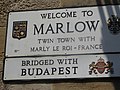 Marlow sign.JPG 4,896 × 3,672; 5.37 MB
-
 Marsworth Reservoir (Information) - geograph.org.uk - 1413841.jpg 638 × 480; 58 KB
-
 Mentmore Towers - side gate and notice (geograph 3996534).jpg 1,000 × 1,333; 1.27 MB
-
 Monks Risborough Station.jpg 640 × 491; 125 KB
-
 Mountain Bike Area Sign, Aston Hill - geograph.org.uk - 1542665.jpg 640 × 480; 86 KB
-
 New houses this way - geograph.org.uk - 1692238.jpg 640 × 563; 87 KB
-
 No fishing from this side - geograph.org.uk - 1759763.jpg 640 × 460; 79 KB
-
 No Parking - geograph.org.uk - 254781.jpg 640 × 480; 110 KB
-

-
 Path junction, Ashotts Lane - geograph.org.uk - 1185482.jpg 640 × 480; 191 KB
-
 Permissive footpath sign, Moorend Common - geograph.org.uk - 943420.jpg 480 × 640; 175 KB
-
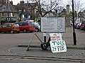 Preparing for Pancake day - geograph.org.uk - 1174994.jpg 640 × 480; 98 KB
-
 Princes Risborough Station - geograph.org.uk - 1458663.jpg 640 × 410; 64 KB
-
 Public footpath crossing a railway - geograph.org.uk - 209270.jpg 640 × 480; 176 KB
-
 River Wye at Bourne End - geograph.org.uk - 492027.jpg 640 × 480; 110 KB
-
 Sensible sign, the riverside,Olney - geograph.org.uk - 1223661.jpg 640 × 480; 109 KB
-

-
 Sign on a gate at Quainton - geograph.org.uk - 981736.jpg 640 × 480; 72 KB
-
 Sign on the common - geograph.org.uk - 1763498.jpg 640 × 480; 118 KB
-
-

-
 St Tiggywinkles nameboard - geograph.org.uk - 1460086.jpg 640 × 480; 80 KB
-
 Startopsend Reservoir (Information) - geograph.org.uk - 1413807.jpg 638 × 480; 74 KB
-
 Temporary sign ^ - geograph.org.uk - 318144.jpg 640 × 480; 162 KB
-
 The A41 leaves Aylesbury - geograph.org.uk - 1588864.jpg 640 × 385; 92 KB
-
 The Duck Pond, Cholesbury - geograph.org.uk - 106758.jpg 640 × 480; 122 KB
-
 The Entrance to Olney Park Farm - geograph.org.uk - 361853.jpg 640 × 480; 161 KB
-
 The Farmland Wildlife Project - geograph.org.uk - 1412559.jpg 640 × 405; 37 KB
-
 The River Thames, Mill End - geograph.org.uk - 510780.jpg 640 × 480; 155 KB
-
 The Working Watermill at Ford End - geograph.org.uk - 1250320.jpg 640 × 414; 107 KB
-
 Timeline viewpoint on Whiteleaf Hill - geograph.org.uk - 1458712.jpg 640 × 427; 75 KB
-
 Train Coming^ - geograph.org.uk - 258760.jpg 640 × 480; 119 KB
-

-
 Trust No-one - geograph.org.uk - 1345971.jpg 640 × 480; 127 KB
-
 Tylers Green Pond - geograph.org.uk - 1759774.jpg 640 × 457; 80 KB
-
 UK Olney (Pancake Sign).jpg 1,681 × 1,434; 432 KB
-

-
 Wendover Woods - Start of Walk - geograph.org.uk - 1180508.jpg 480 × 640; 177 KB
-
 Wendover Woods sign, Aston Hill - geograph.org.uk - 135455.jpg 640 × 480; 127 KB
-
 Wendover, Station Approach - geograph.org.uk - 135444.jpg 640 × 480; 111 KB
-
 Weston Turville Reservoir - geograph.org.uk - 1259380.jpg 640 × 480; 88 KB
-
 Willow Brook Farm Sign - geograph.org.uk - 1635921.jpg 640 × 480; 139 KB
-
 Icknield Way Logo - geograph.org.uk - 576917.jpg 640 × 480; 82 KB
-
 Sign on Bridle Path Westfield Lane - geograph.org.uk - 201239.jpg 640 × 427; 165 KB
-
 The End of the Road - geograph.org.uk - 363308.jpg 640 × 480; 91 KB
-
 West Park Entrance - geograph.org.uk - 296127.jpg 640 × 480; 152 KB


.jpg)


_-_geograph.org.uk_-_139550.jpg)


_-_geograph.org.uk_-_1413841.jpg)
.jpg)


_-_geograph.org.uk_-_1413807.jpg)


.jpg)


